To plan trans Himalayan traverses hikers require a good understanding of the topography (geography) of the region: major valleys (rivers) and in-between ridgelines which can be crossed through mountain passes. In recent months hundreds of rivers and 2100 mountain passes were mapped in the mid and high ranges (above the cultivated foothills) of Nepal enabling hikers to plan countless traverses across this topography. Passes were identified using legacy 1:50K and 1:25K scale topo sheets from pahar.in and accurately mapped in Open Street Maps.
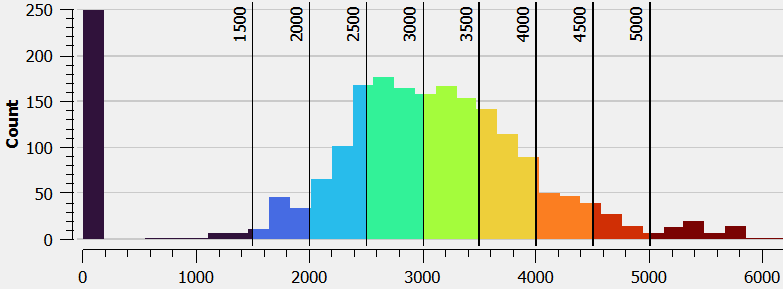
Hundreds of these topo sheets are geo-referenced and saved in a format suitable for offline navigation while exploring the trails on these legacy topo sheets. This posts presents an overview of the 50 major valleys and 1200 mountain passes using 1:300-400K scale maps for each of the 6 provinces of Nepal from West to East. Mountain passes are visualized as per altitude range (color) enabling hikers to identify the right season / month of the year to traverse a given altitude range. Altitude data is generated from Digital Elevation Model data downloaded from NASA SRTM.
Traverse Planning
To plan a Himalayan traverse simply show the OSM mapped passes on your basemap to easily identify possible entry / exit points for all major valleys (left). You can additionally overlay the Waymarked Hiking Trails to easily view OSM mapped hiking routes through these passes (right):
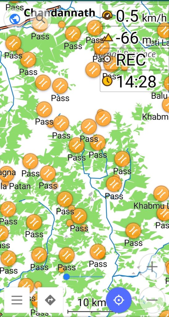
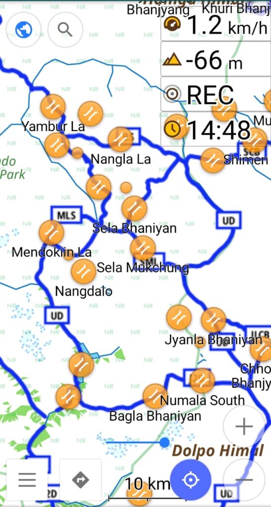
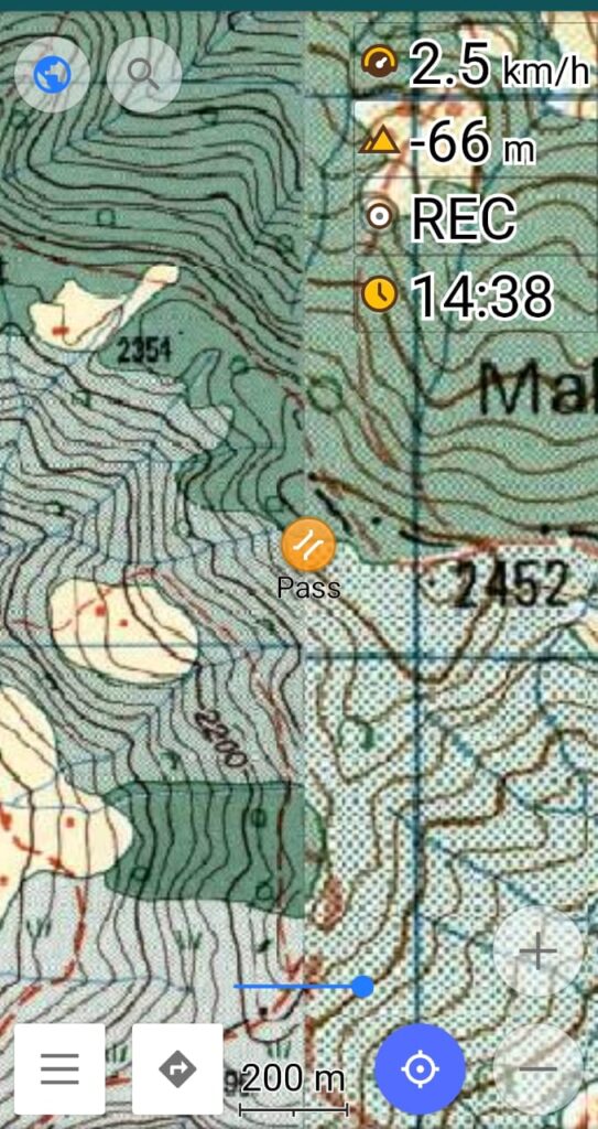
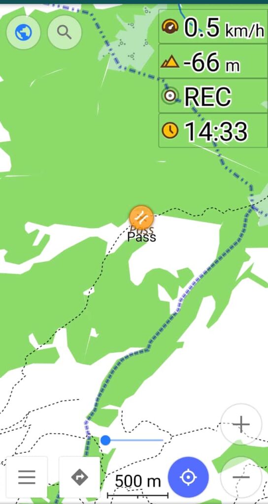
To navigate your way along the planned traverse simply follow the trails mapped in OSM (right) or geo-referenced offline 1:50K topo sheets of Nepal (left):
Let’s take a closer look at the geography of each of the 6 mountain provinces of Nepal including major rivers and mountain passes for various altitude ranges / seasons:
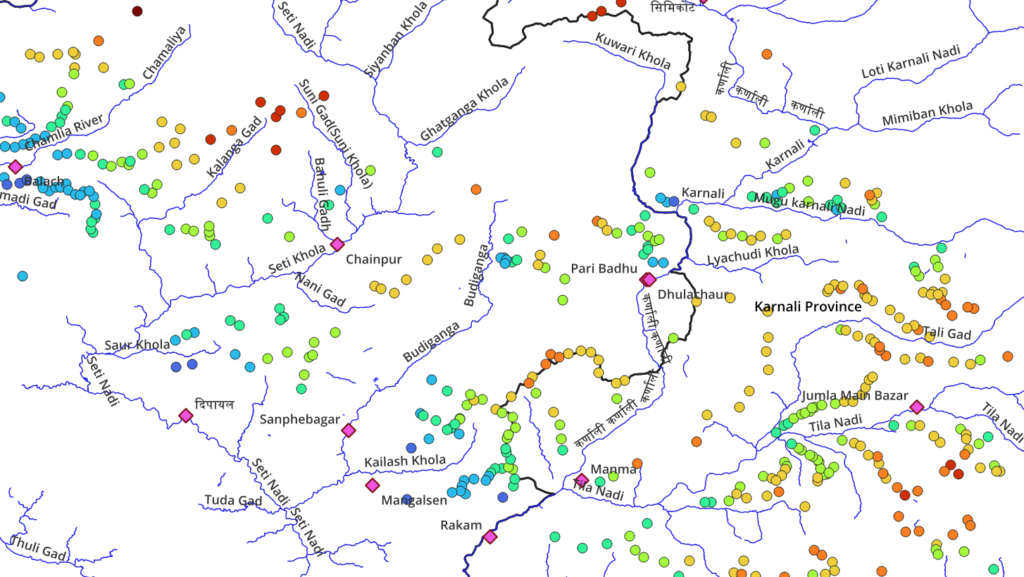
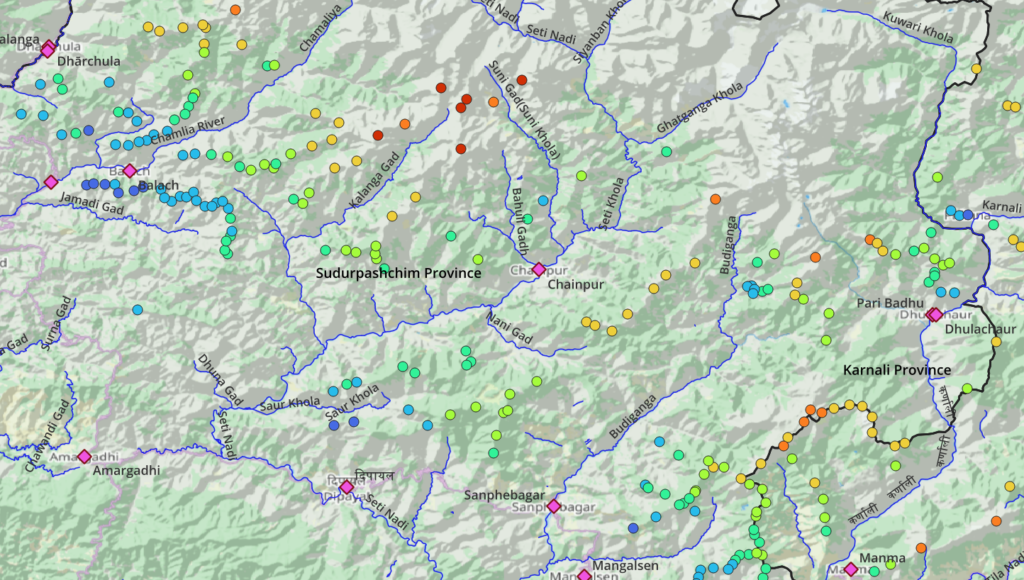
Sudurpashchim
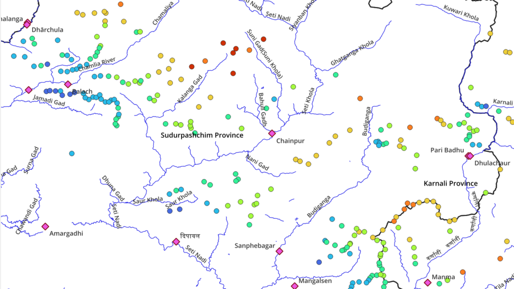
Topography / Major valleys from West 2 East:
- Sharda river – Darchula, Khalanga
- Naugarh gad
- Chamliya river – Balach, Gokuleshwar
- Jamadi gad
- Kalanga gad
- Bahuli gad
- Seti Khola – Chainpur
- Ghatganga Khola
- Budiganga – Sanphebagar, Mangalsen
- Kailash Khola
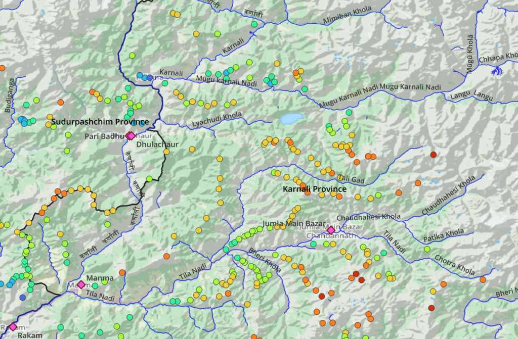
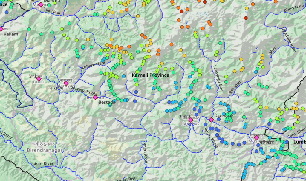
Karnali North
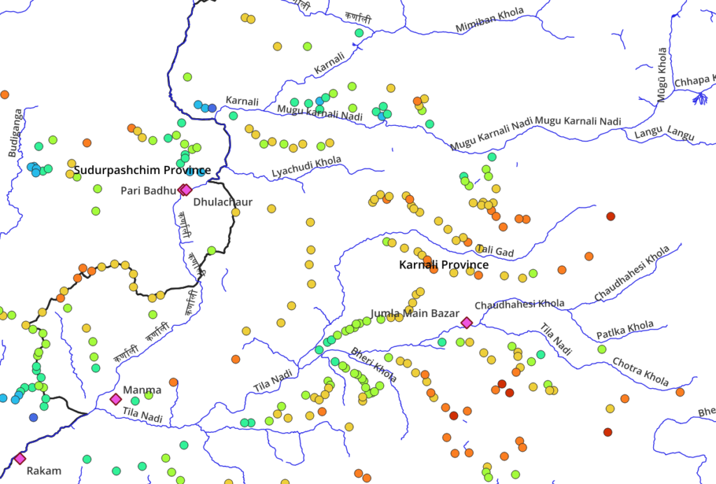
Topography / Major valleys from West 2 East:
- Kunwari Khola
- Loti Karnali Nadi
- Mimiban Khola
- Mugu Karnali Nadi
- Karnali river – Manma, Rakam
- Tali Gad
- Chaudhahesi Khola
- Tila Nadi – Manma, Jumla Bazar
Karnali South
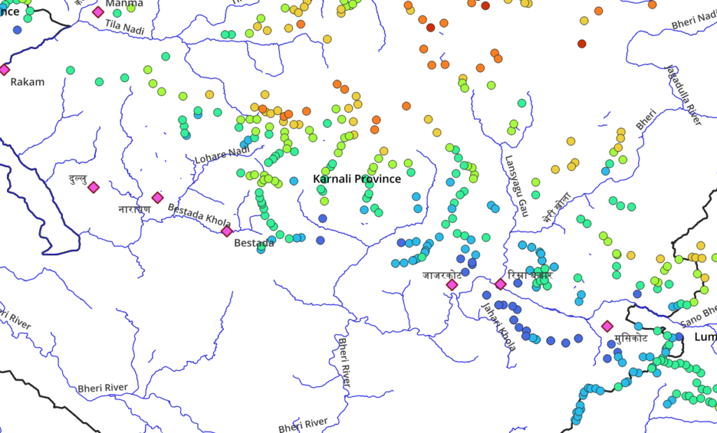
Topography / Major valleys from West 2 East:
- Tila Nadi
- Bestada Khola – Bestada
- Lansyagu Gau
- Jagadula river
- Thuli Bheri – Bhulbheri
- Bheri river
- Sano Bheri Nadi
Lumbini

Topography / Major valleys from West 2 East:
- Sano Bheri Nadi
- Gaur Gad
- Pelma Khola
- Ganga Nadi
- Lukum Khola
- Marim Khola
- Bagauna Khola
- Ghusban Khola
- Lungri river
- Jhimruk Khola

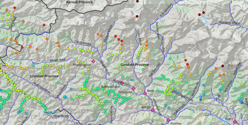
Gandaki West
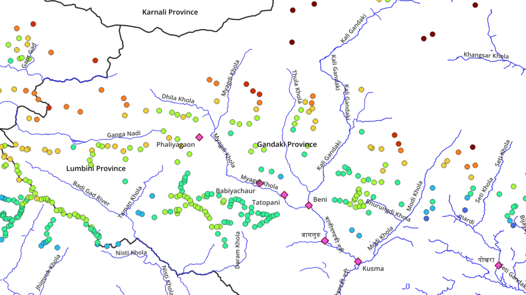
Topography / Major valleys from West 2 East:
- Ganga Nadi
- Badi Gad river
- Dhila Khola
- Myagdi Khola – Phaliyagaon, Baiyachaur, Tatopani
- Thula Khola
- Kali Gandaki – Beni
- Modi Khola – Kusma
- Seti Khola
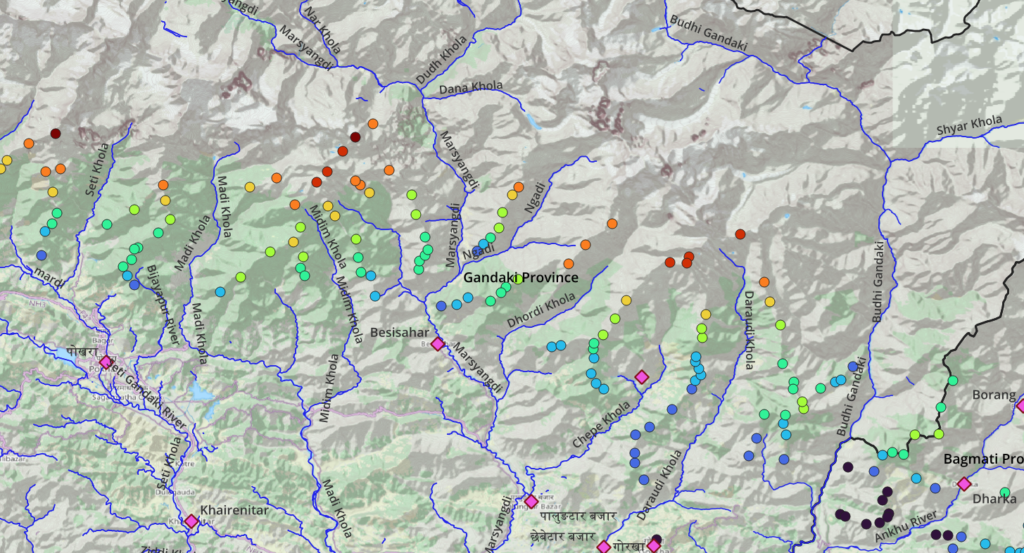
Gandaki East
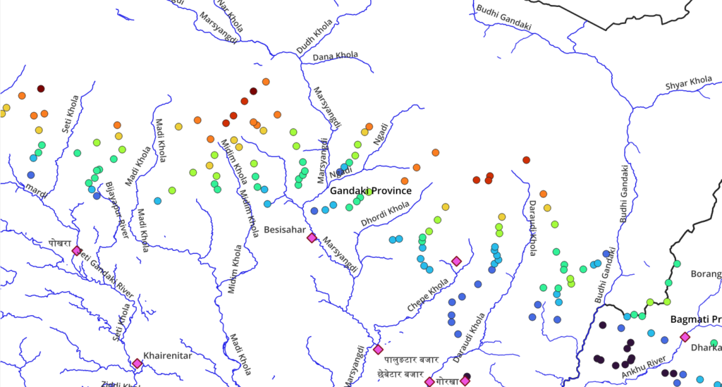
Topography / Major valleys from West 2 East:
- Seti Khola
- Madi Khola
- Midim Khola
- Marsyangdi – Besisahar
- Ngadi
- Dhodi Khola
- Chepe Khola
- Daraudi Khola
- Budhi Gandaki
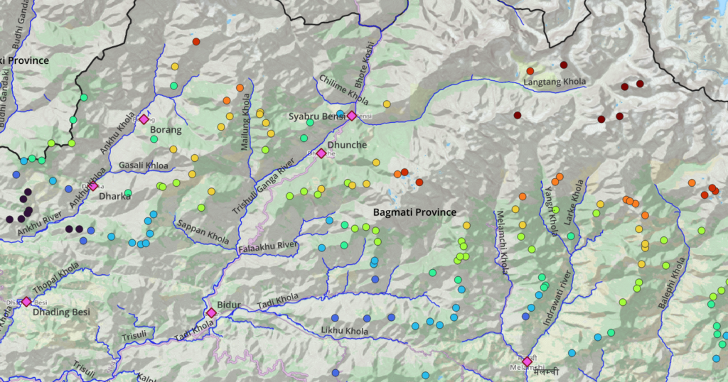
Bagmati West
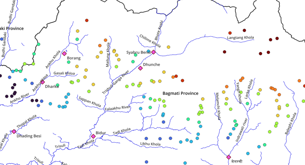
Topography / Major valleys from West 2 East:
- Ankhu River
- Mailung Khola
- Langtang Khola
- Trishuli Ganga River
- Tadi Khola
- Likhu Khola
- Melamchi Khola
- Indrawati River
- Balephi Khola
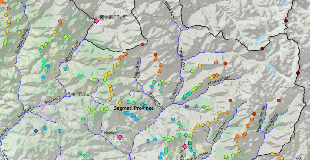
Bagmati East
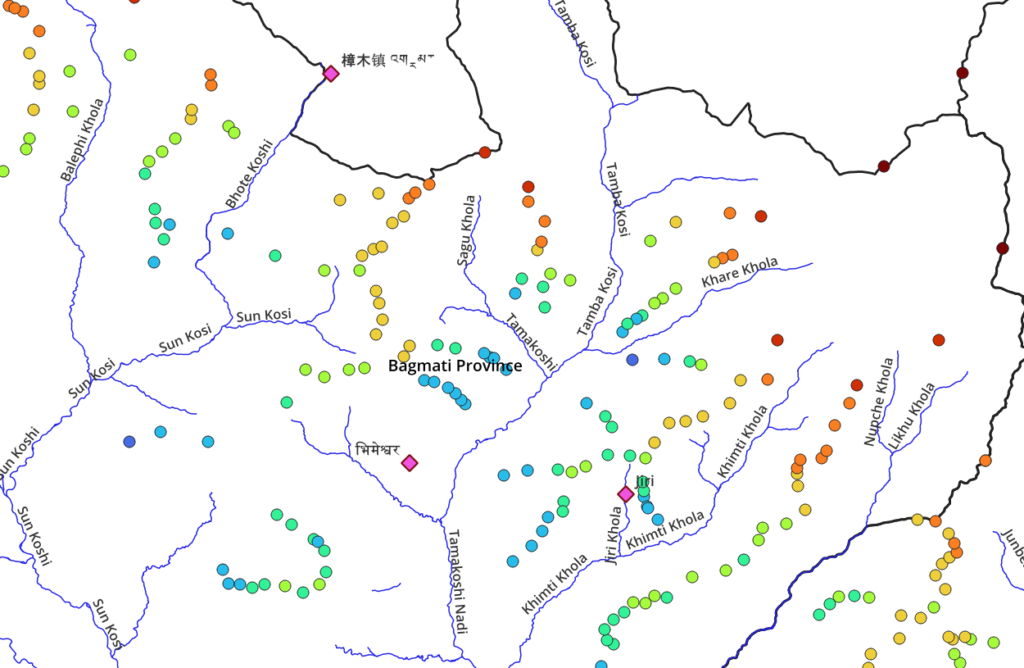
Topography / Major valleys from West 2 East:
- Bhote Koshi
- Sun Koshi
- Sagu Khola
- Tamba Koshi
- Khare Khola
- Tamakoshi Nadi
- Khimti Khola
- Likhu Khola
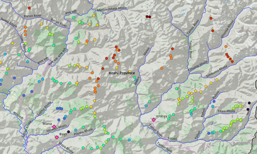
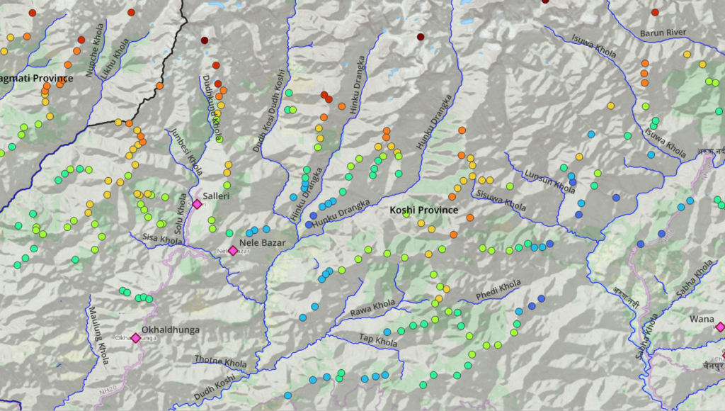
Koshi West
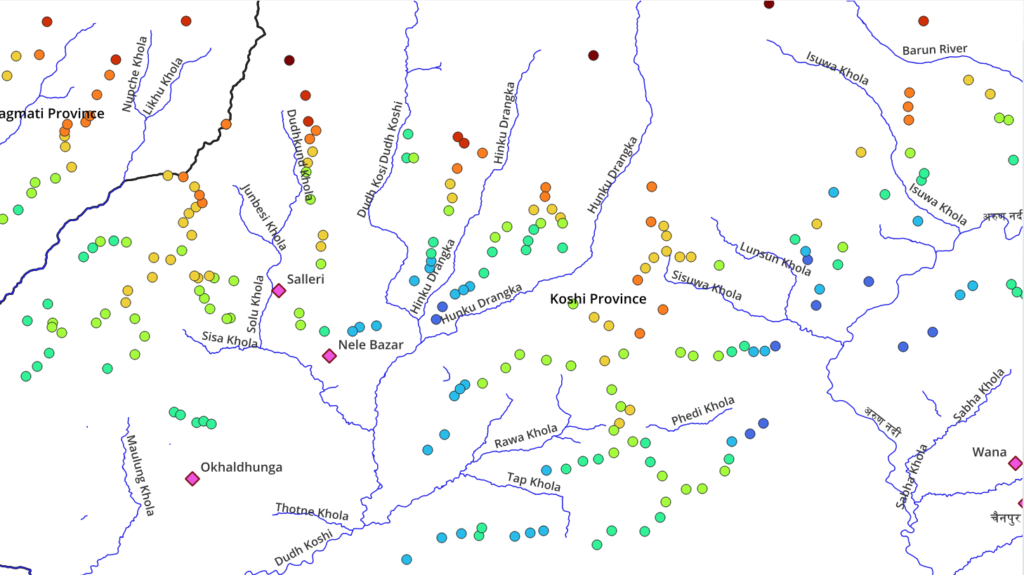
Topography / Major valleys from West 2 East:
- Likhu Khola
- Maulung Khola
- Solu Khola – Salleri, Nele Bazar
- Dudh Koshi – Okhaldunga
- Hinku Drangka
- Rawa Khola
- Dinkhuwa Khola
- Pikhua Khola
- Phedi Khola
- Sisuwa Khola
- Lunsun Khola
- Isuwa Khola
- Barun River
- Sabha Khola
Koshi East
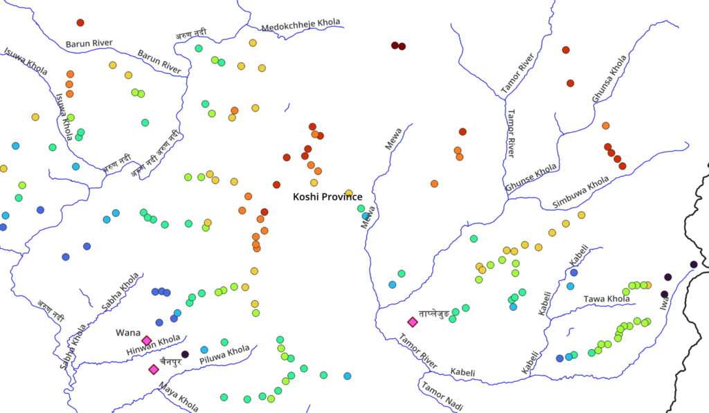
Topography / Major valleys from West 2 East:
- Barung River
- Hinwan Khola – Wanna
- Piluwa Khola
- Mewa
- Tamor River
- Ghunsa Khola
- Simbuwa Khola
- Kabeli
- Iwa