In this chapter we will be downloading & geo-referencing legacy maps like 1:50K Survey of India and 1:100K Soviet Army maps, digitize trails and export to mobile for offline navigation
Contents
- Survey of India Maps
- Download topo sheets
- Coordinate Reference System
- Geo-referencing topo sheets
- Digitizing map features
- Exporting trails for offline navigation
Survey Maps

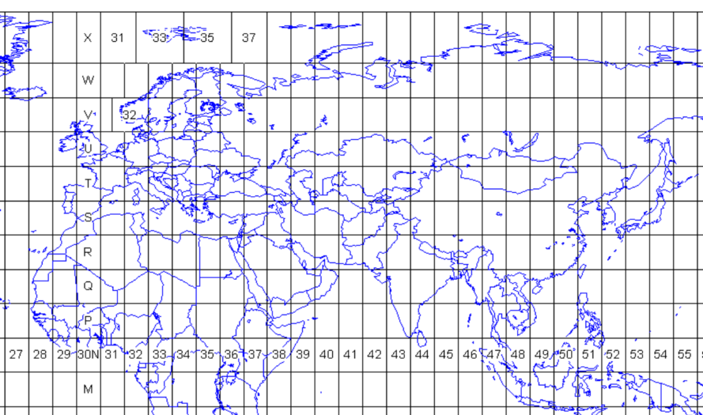
The Survey publishes the Open Map Series 1:50K toposheets to the general public. You can download individual 28x28km sheets from:
https://onlinemaps.surveyofindia.gov.in/FreeMapSpecification.aspx
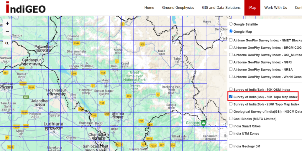
First step is to identify the topo sheet number which you can easily identify using:
https://www.indigeo.com/iMap.html
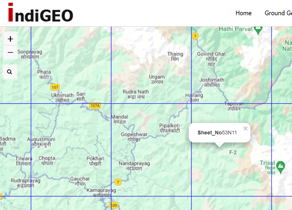
Click on the top right layers icon to overlay the “Survey of India 50K topo map” index. Search for the location you are interested to download and click on the cell to identify the toposheet ID
Downloading Maps
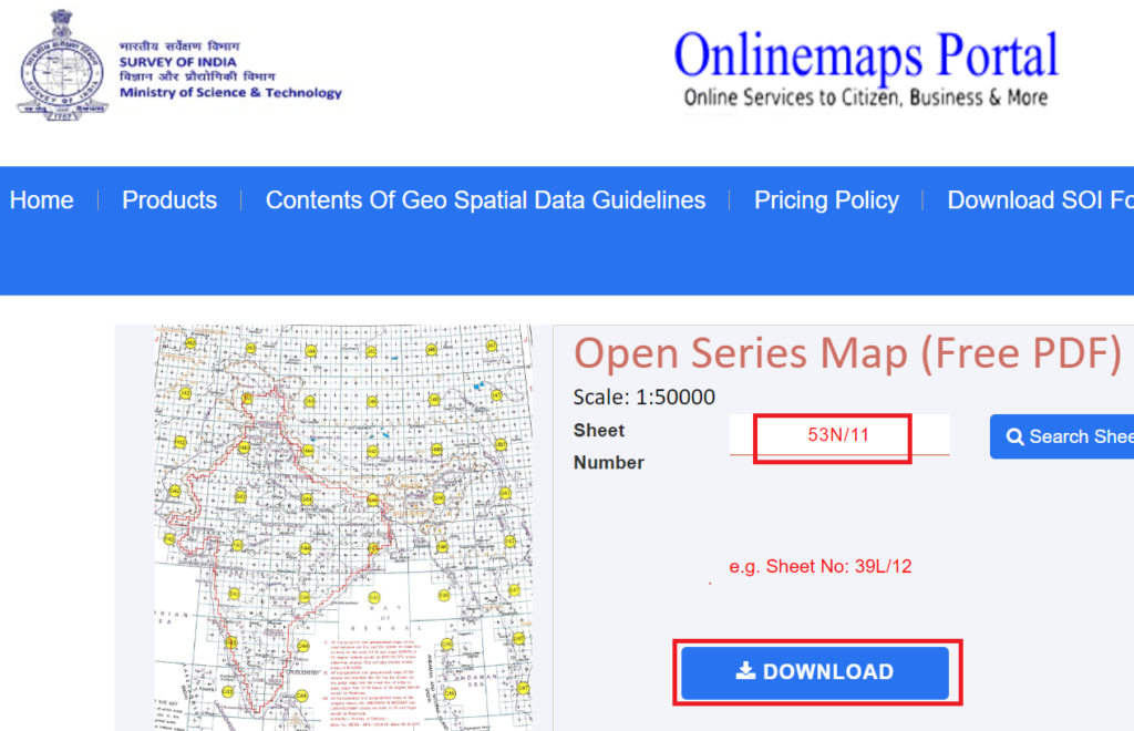
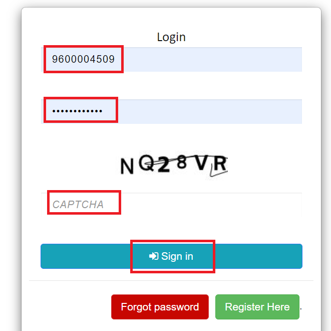
Enter the toposheet index with “/” in the Survey of India OSM download portal and click download. You ll have to create a login (phone, OTP) and for every sheet you download you ll have to give a captcha. There s a download limit of 5 toposheets every 24 hours
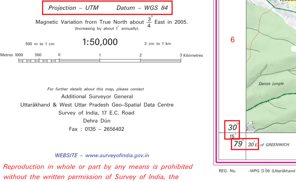
The corresponding toposheet will be downloaded as a PDF. Survey maps are fixed scale 1:50K (1 unit on the map equals 50 thousand units on the ground or 1cm on the map equals 500m on the ground). Zoom in 150% to clearly view the map details. The map has relief hill shades but no contours.
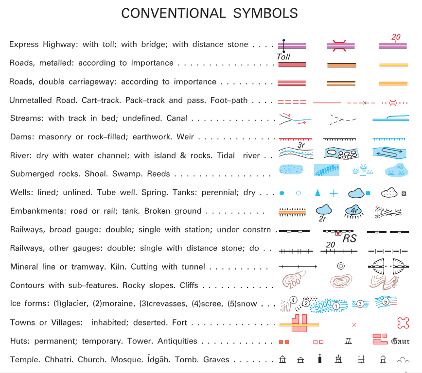
Check the legend for the meaning of each symbol used on the map
Coordinate Reference System
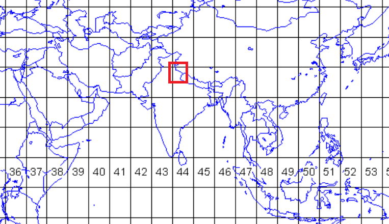
Survey maps use the UTM (Universal Transverse Mercator) and WGS-84 datum Coordinate Reference System. UTM coordinate system divides the world into sixty north-south zones, each 6 degrees of longitude wide. India is located in UTM-43 to 45 North.
WGS-84 Coordinates are listed for each of the 4 corners of the map. The bottom left corner below corresponds to 30.25 degrees North and 79.5 degrees East (1 degree = 60 minutes). The size of each Survey topo-sheet is 15 by 15 minutes (roughly 28x28km).
Geo-referencing maps
A georeferenced digital map or image has been tied to a known Earth coordinate system, so users can determine where every point on the map or aerial photo is located on the Earth’s surface.
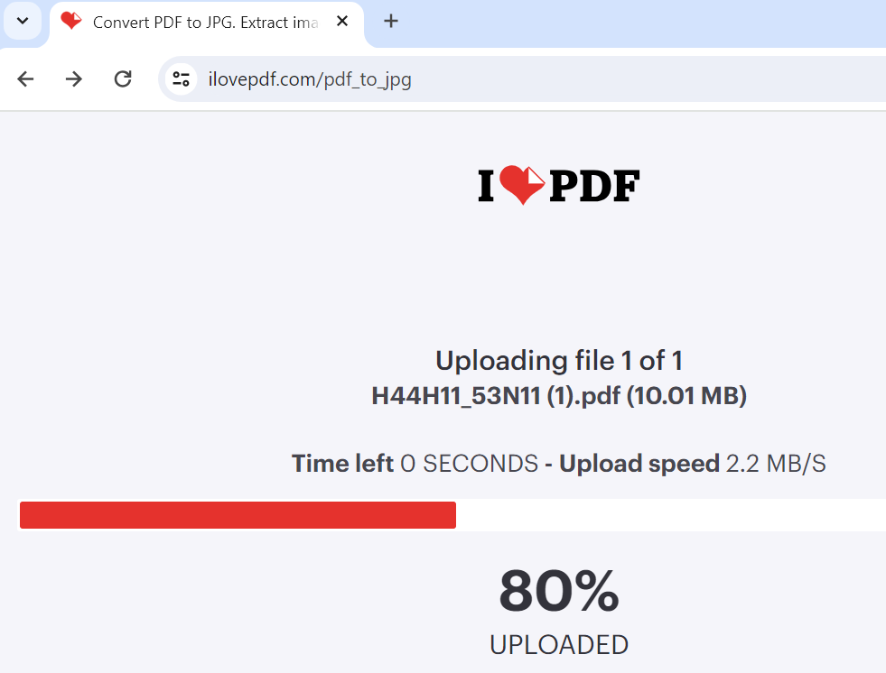
Let’s first convert the PDF file to standard JPG format using the ilovePDF website:
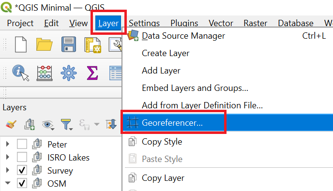
Open up the QGIS Georeferencer plugin from the Layer menu to geo-reference the Survey map
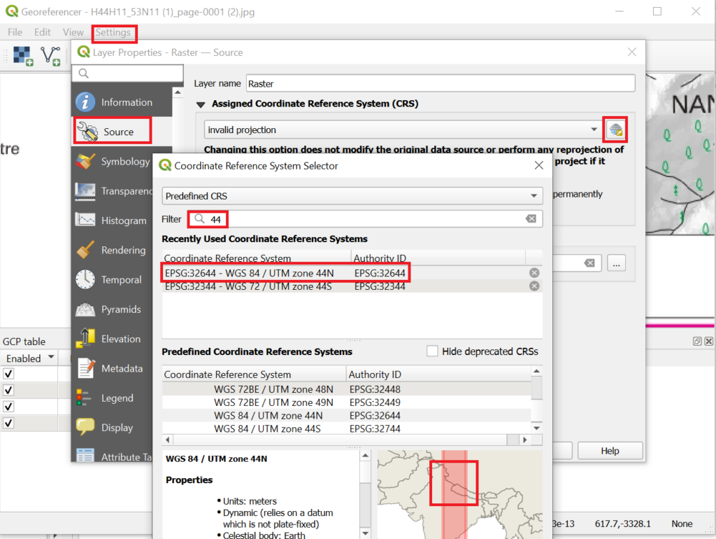
Load the JPG file in the QGIS Georeferencer and set the CRS for the Survey Map as UTM-44 North (Uttarakhand)
Open the Settings menu – Source Properties – Source – Assigned CRS – Click the globe icon and search for “44” to locate the correct CRS: EPSG:32644 WGS84 / UTM zone 44N
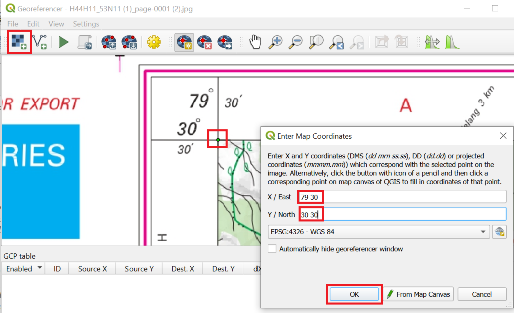
Now zoom and click on each of the 4 corners of the map to enter the corresponding WGS-84 coordinates
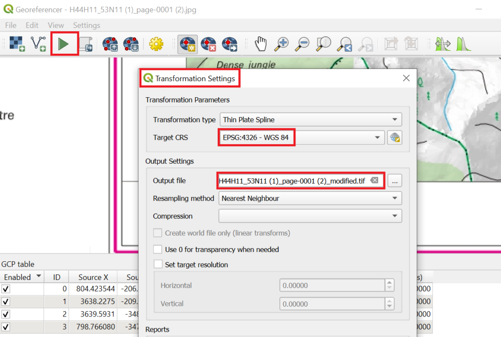
Click on the “Start Georeferencing” icon to bring up the Transformation Settings. Choose the target CRS as “EPSG:4326 WGS 84” (same as your project). Click the icon once again to georeference the Survey map (CRS UTM-44N) into your QGIS project (CRS EPSG:4326)
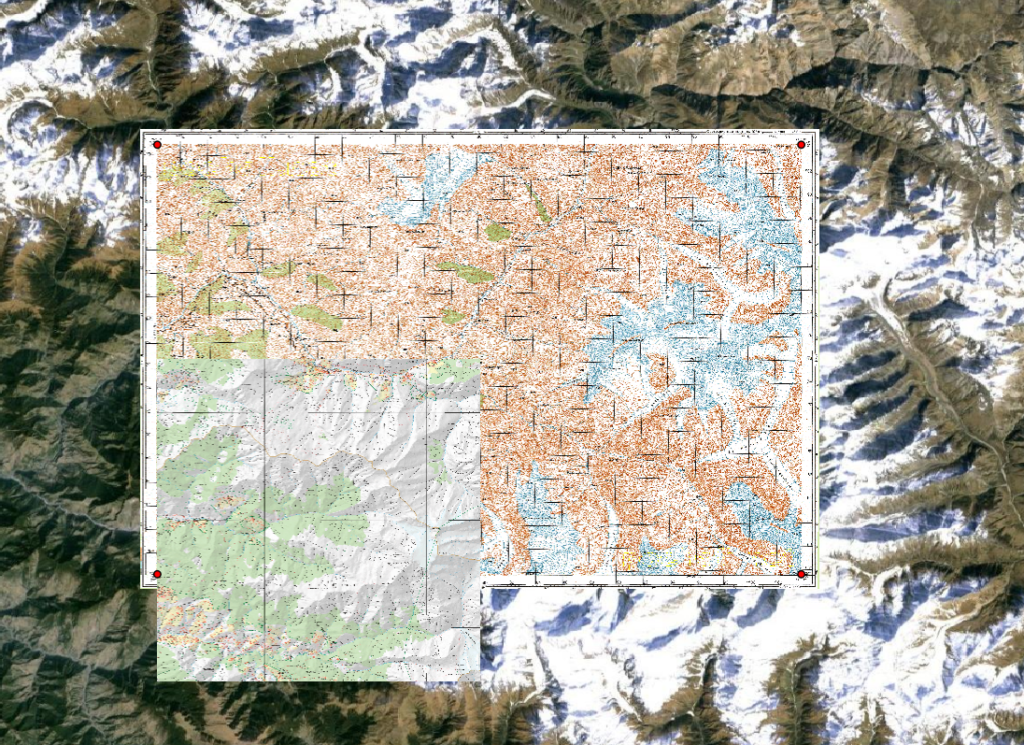
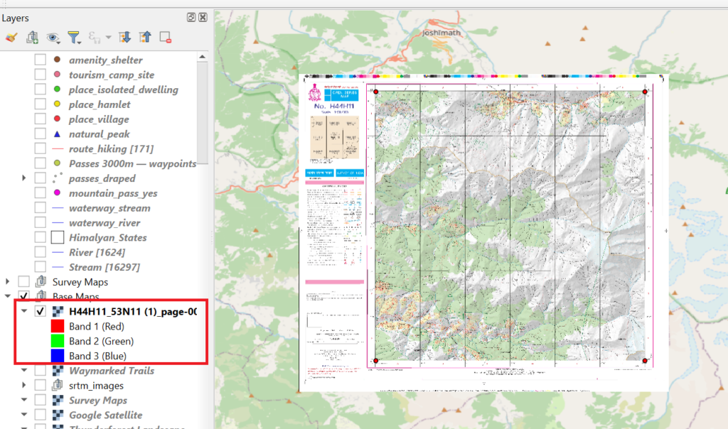
A new raster layer is created showing the Survey map correctly projected in our project and in sync with the other layers
Let’s remove the borders / legend of the map by clipping the raster layer exactly around the map corners
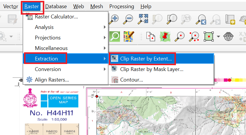
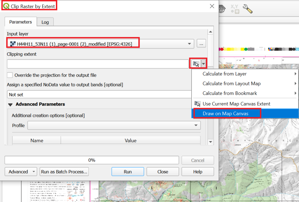
For “Clipping Extent” choose “Draw on Map Canvas” to draw the exact extent of the actual Survey map and click “Run” to clip the map
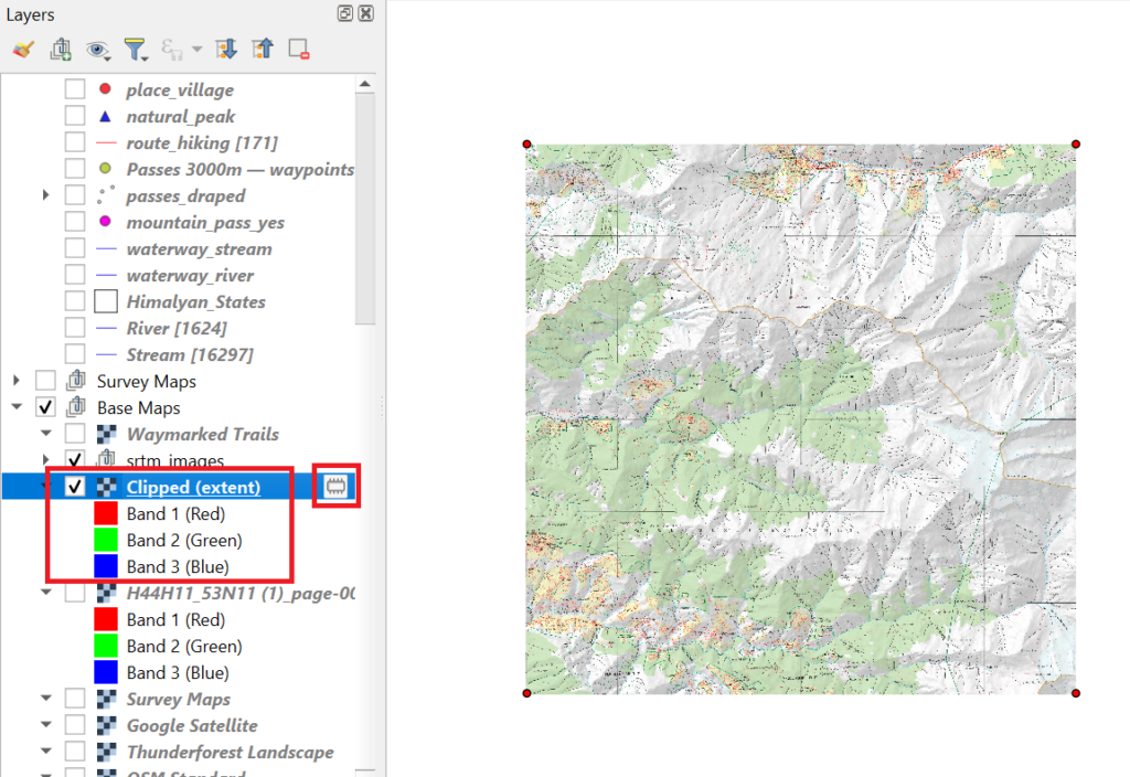
A new raster layer is created with the clipped Survey map. Remove the original layer and save the new clipped layer as a GeoTIFF file and give a proper name H44H11
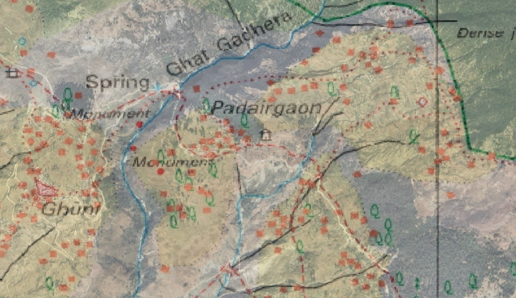
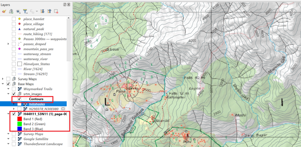
You can overlay the Survey map on other base maps and vector layers, zoom in and show/hide the Survey map to verify that the geographic features (rivers, topography) on the Survey map match with those of other layers
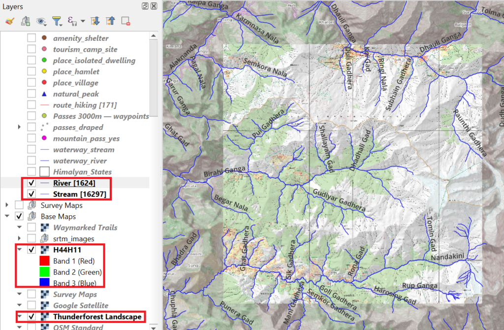
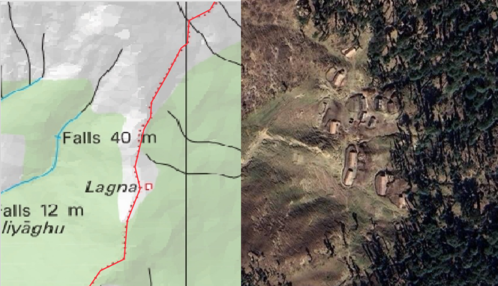
Overlay waymarked hiking to compare OSM hiking routes with Survey trails (red dotted / dashed lines)
Overlay the Survey Map with 50% transparency over a satellite map to match topography, human settlements and trails
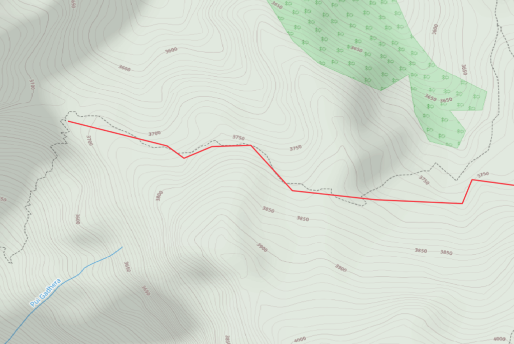
We can overlay contours to make the Survey map a proper topographic map
Digitizing Map Features
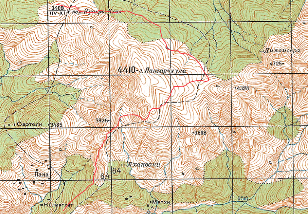
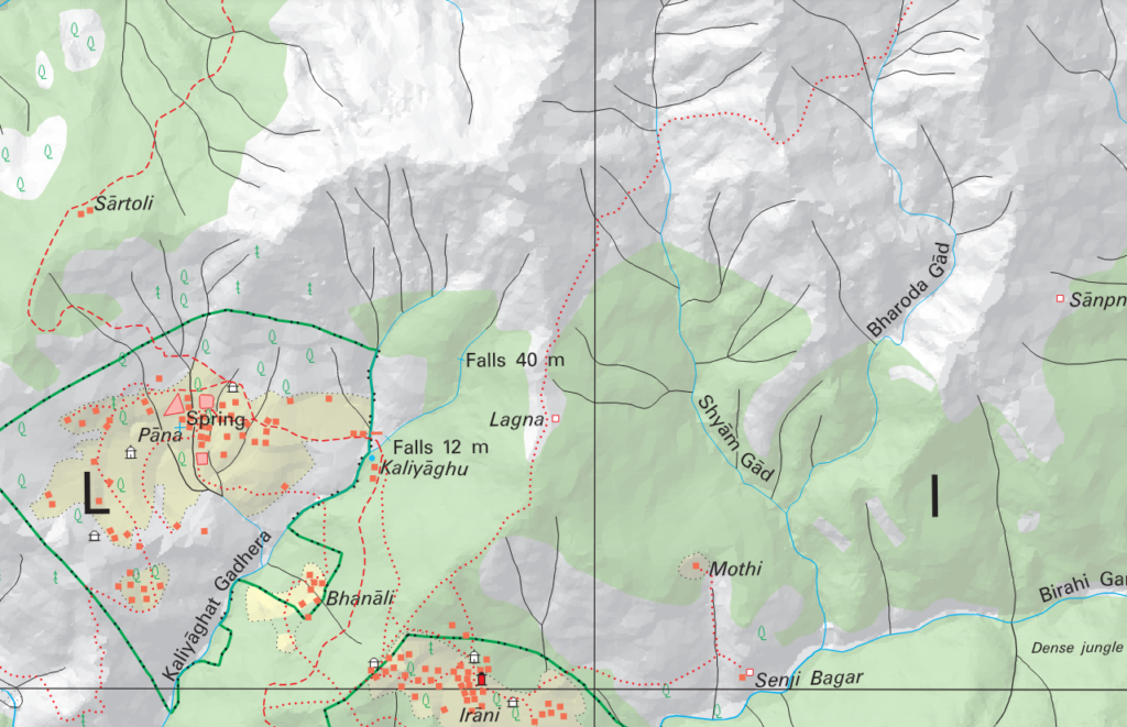
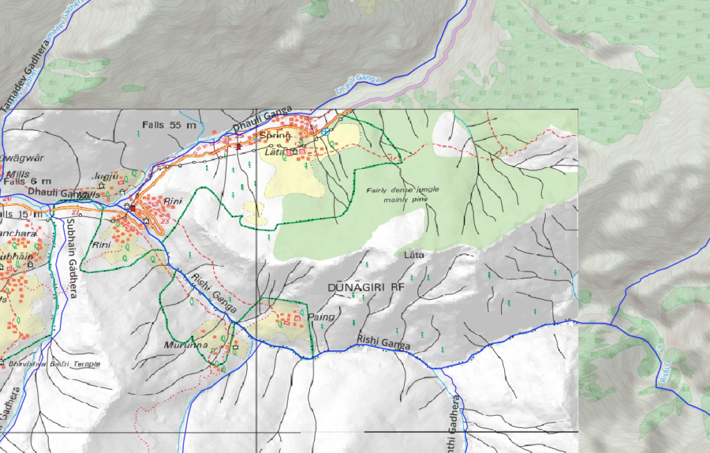
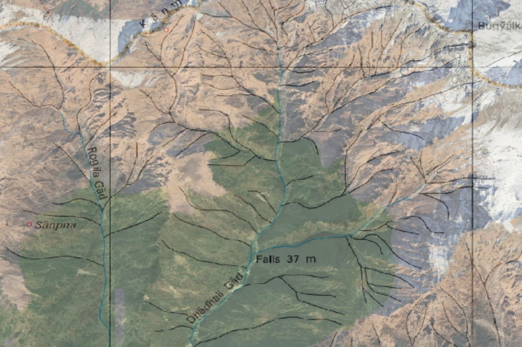
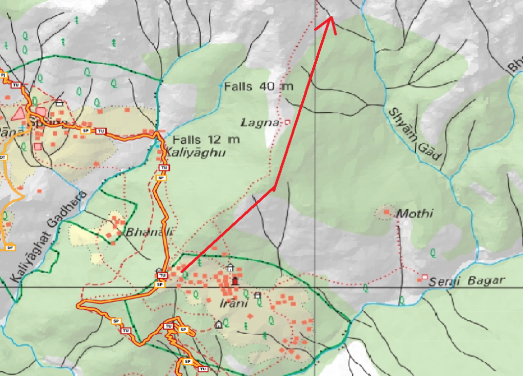
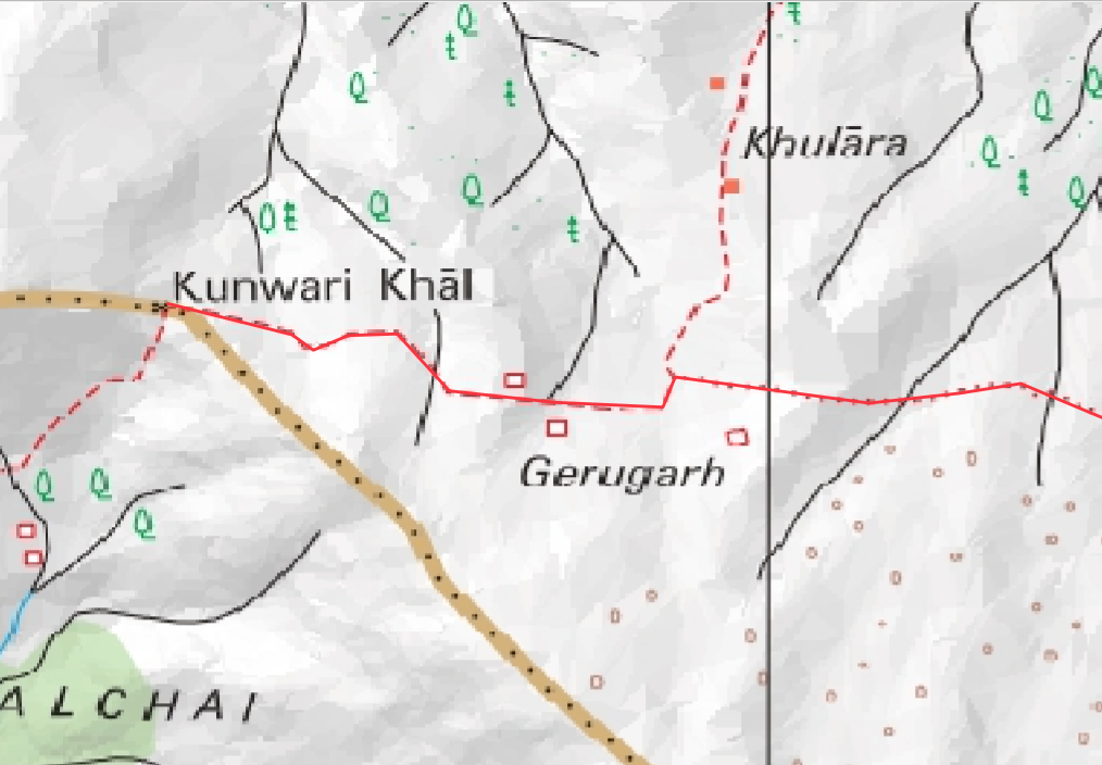
Once geo-referenced we can extract any features from the map. Let’s say we wish to explore a trail marked on the Survey map which is not yet mapped in OSM (waymarked hiking trails). Let’s digitize the trail going North from Irani village
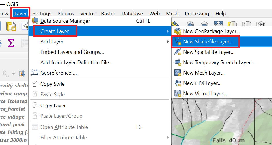
Let’s create a new Shapefile line layer to digitize this trail
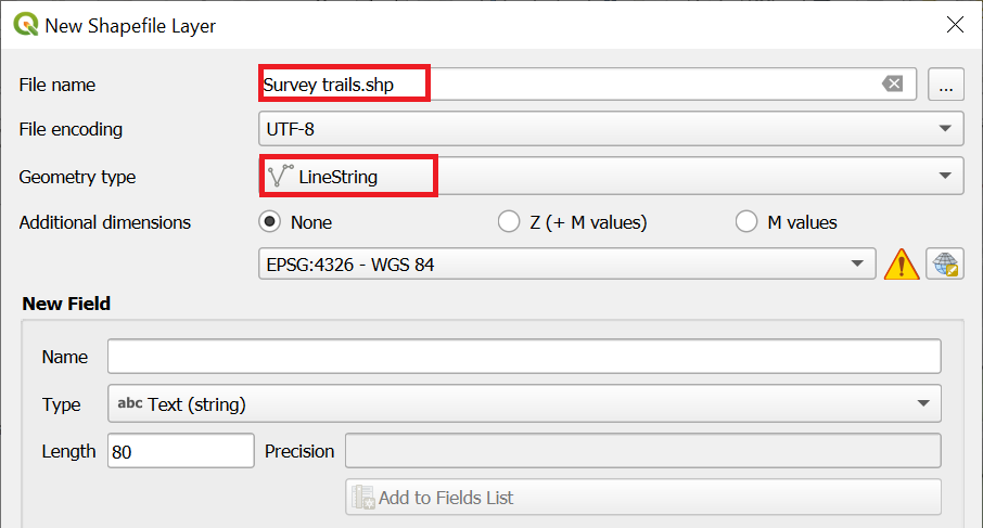
Select the new line vector layer, “Toggle Edit” icon, “Add Line Feature” icon and start tracing over the red dotted trail on the Survey map

Draw the trail all the way North towards the popular Kunwari Khal (Kuari) pass
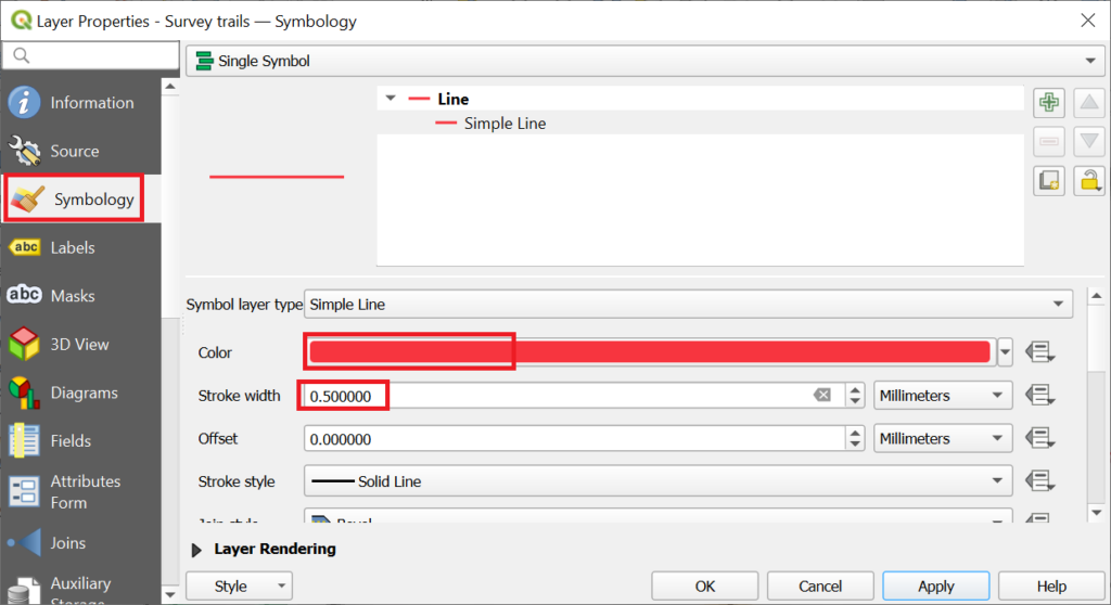
Bring up Properties of the “Survey Trails” line layer, “Symbology” and chose red color and 0.5 stroke width
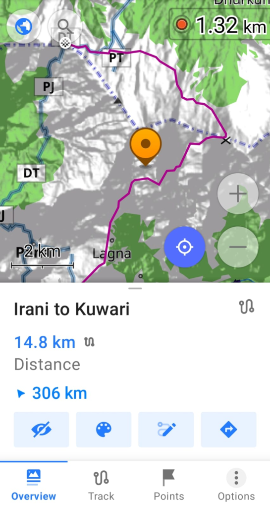
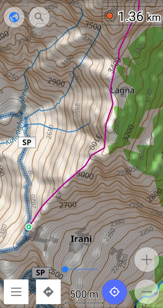
Congratulations! You have now digitized your first Survey trail from Irani up North around the Pangarchulla peak till the Kunwari Khal pass
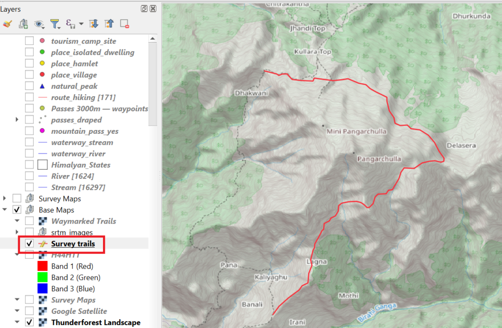
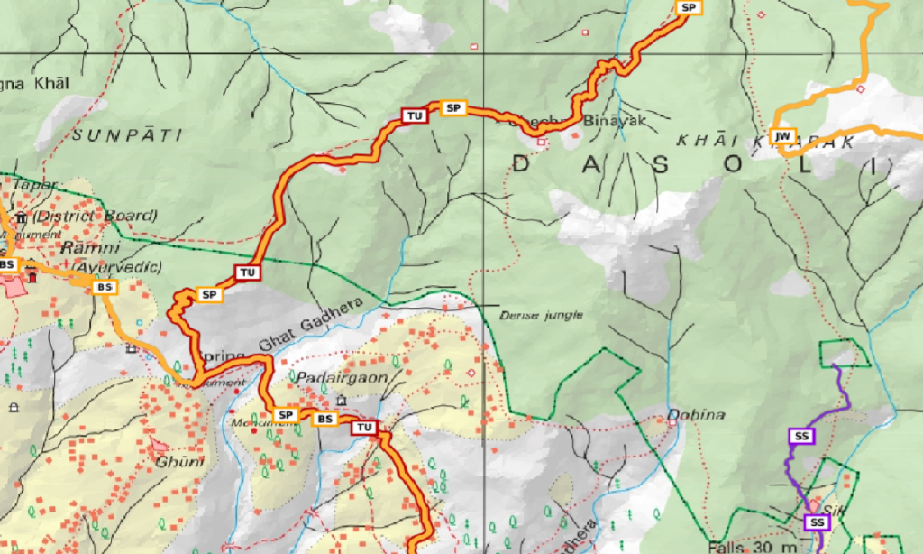
You can compare the Survey map trail and remote settlements with the same features on the Google Satellite map
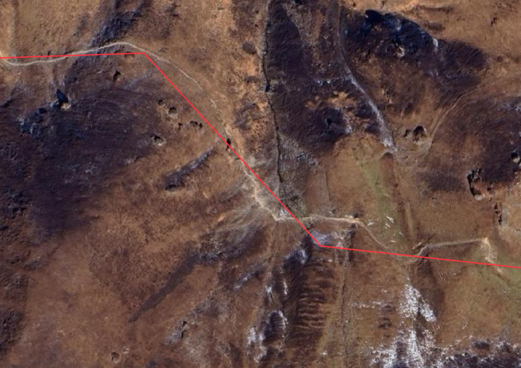
One section of the Survey trail has already been mapped in OSM
Exporting Features
Let’s now export the digitized Survey trail in GPX format which can be used for offline navigation
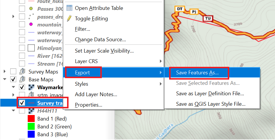
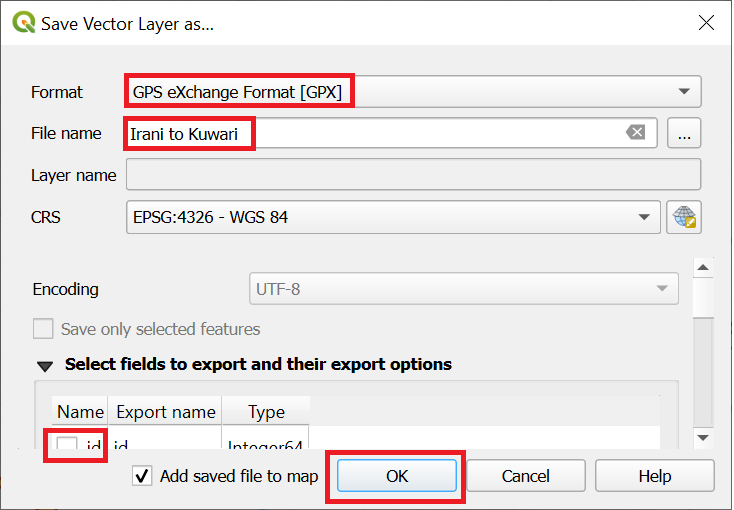
Download the GPX file in your phone and off you go!
Assignment
Geo-reference the Soviet 1:100K map (UTM-44N) in QGIS and compare features, trails with Survey and other base maps