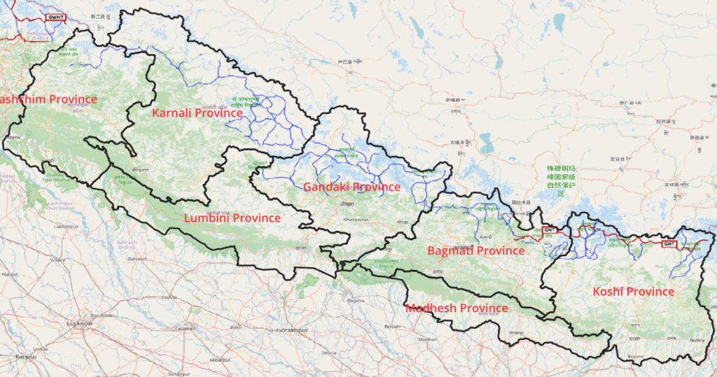
The Great Himalayan Trail runs East to West in Nepal extending further into India as the Great Western Himalayan Trail through Uttarakhand, Himachal, Ladakh and Kashmir. Recently the GHT was fully mapped in Open Street Maps.
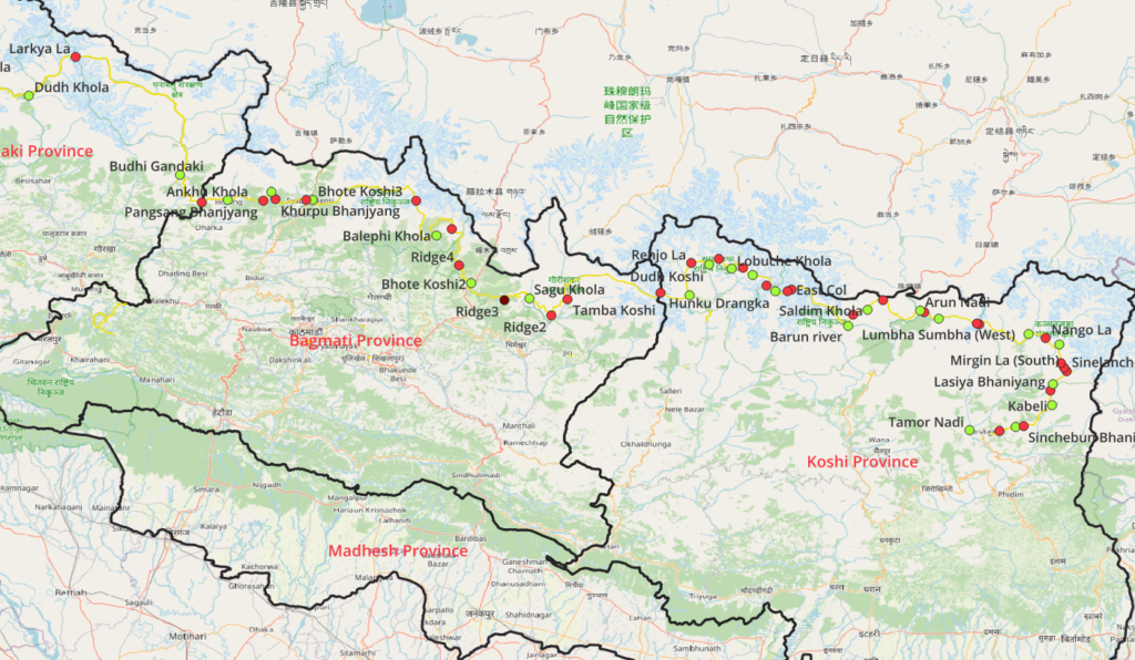
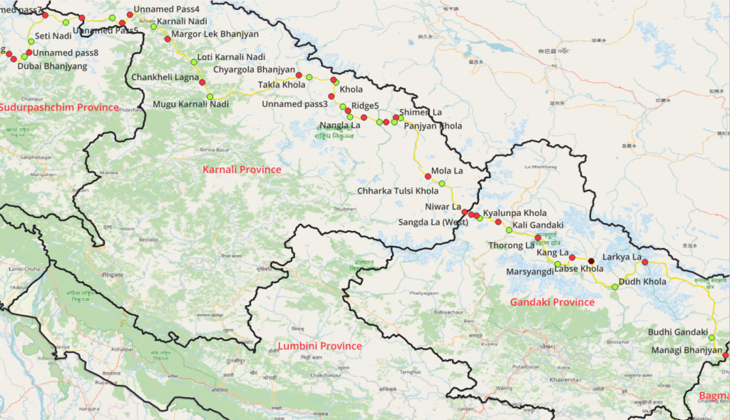
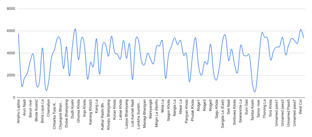
This blog presents an overview of the 24 individual OSM sections using 1:180K scale topo maps across 49 valleys (Khola-s) and 52 mountain passes (Bhanjyang-s) as it traverses through the Koshi, Bagmati, Gondaki, Karnali and Sudurpashchim provinces.
1:50K Topo sheets
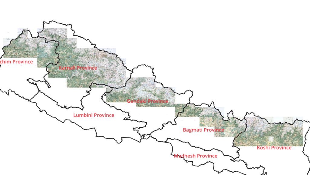
Some geographic details are taken from Nepal Toposheets.
Koshi province
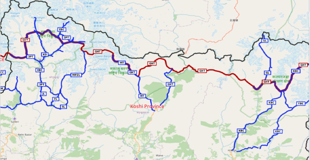
6 Sections across 11 valleys and 19 passes
- Kanchendjunga Base Camp (KBC)
- Ghang La (GL)
- Great Himalayan Trail (GHT)
- Makalu Basecamp Trek (MBT)
- Mera Peak trek via Zaztrw La (MPZL)
- 3 Passes Trail (3TP)
Bagmati province
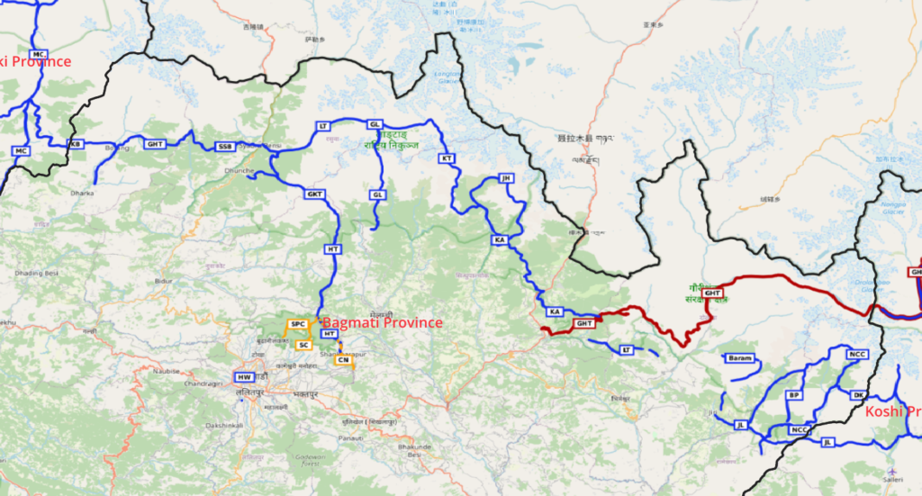
8 Sections across 11 valleys and 8 passes
- Great Himalaya Trail (GHT)
- Kyansing to Alamput (KA)
- Jugal Himal (JH)
- Kyanjin to Tempathang (KT)
- Langtang Trek (LT)
- Somdang to Syabru Bensi (SSB)
- Ganesh Himal Trail (GHT)
- Khorlabesi to Borang (KB)
Gandaki province
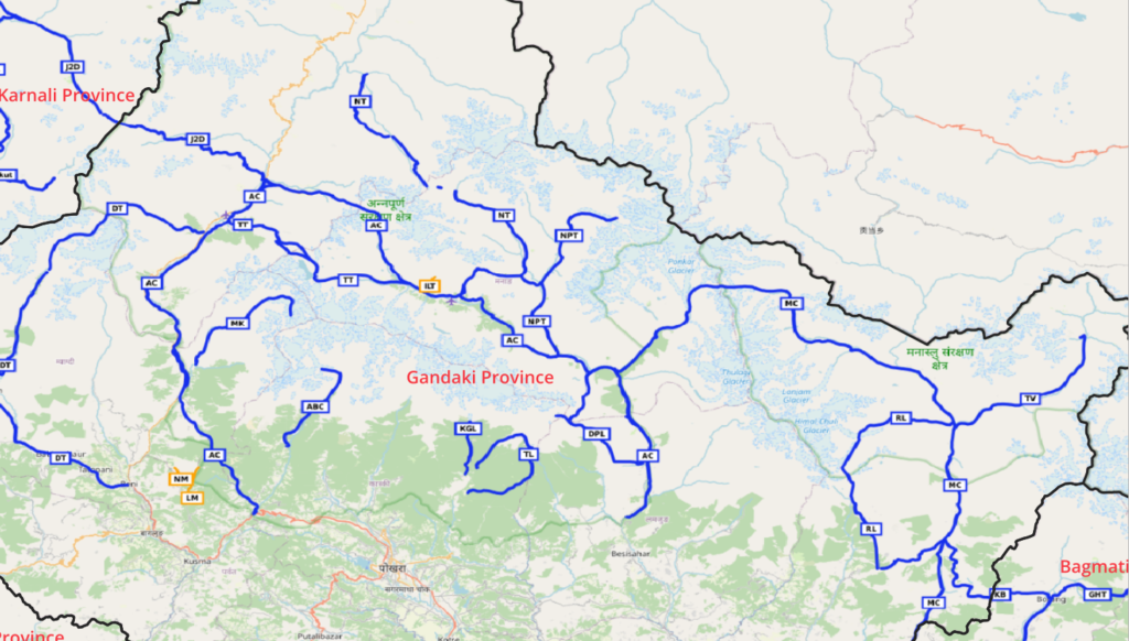
3 Sections across 6 valleys and 6 passes
Karnali province
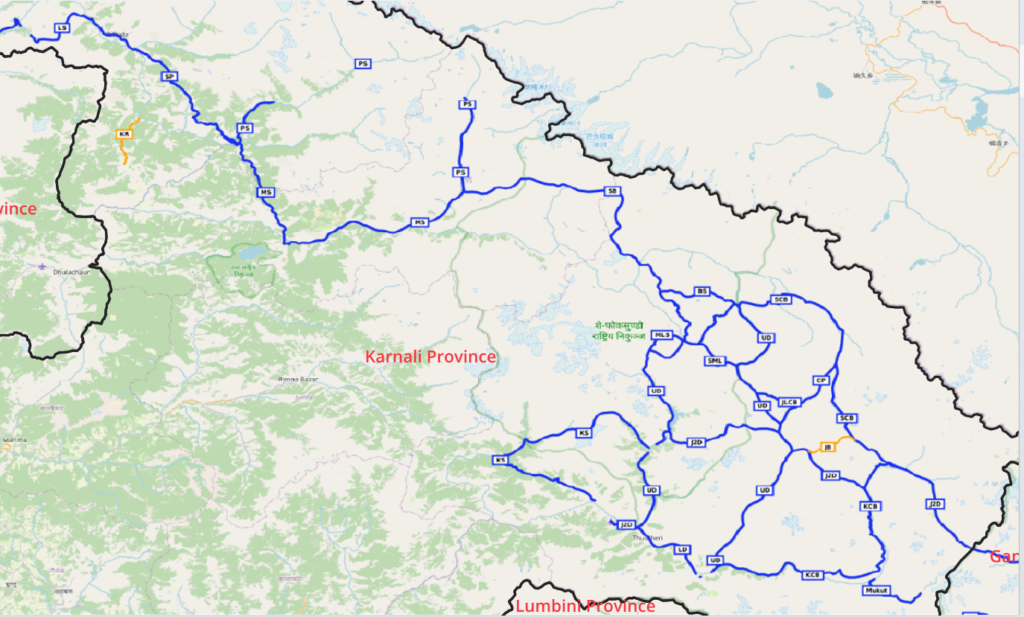
7 Sections across 13 valleys and 12 passes
- Saldang to Chharka Bhot (SCB)
- Bhijer to Saidang (BS)
- Siraanchaur to Bhijer (SB)
- Piplang to Siraanchaur (PS)
- Melchham to Siraanchaur (MS)
- Simikot to Piplang (SP)
- Lumthi to Simikot (LS)
Sudurpashchim province
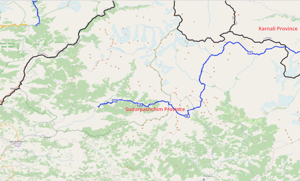
1 Section across 8 valleys and 7 passes
