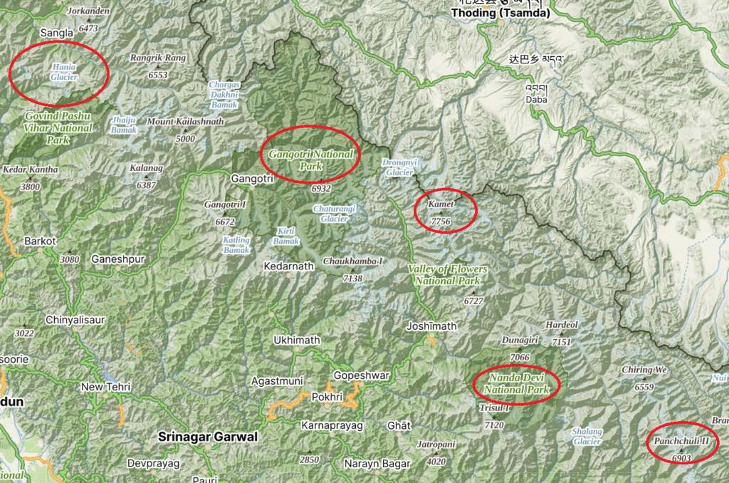
In this post we explore mesmerizing views on the Himalayas along any given hiking route. During my 4 months Trans Uttarakhand winter traverse I got treated on stunning views of the high ranges of Uttarakhand (East to West): Panchchuli, Nanda Devi, Kamet Group, Gangotri and Bandarpunch.
One evening I set up camp on Khalya Top (3710m) near Munsyari in Kumaon and got treated on beautiful sunset views of the Nanda Devi Range to the North and Panchchuli range to the East. Below we analyze the view on these Himalayan ranges using Open Street Maps and topographic models and maps. Waymarked Hiking Trails gives a birds eye view of the OSM mapped hiking route.

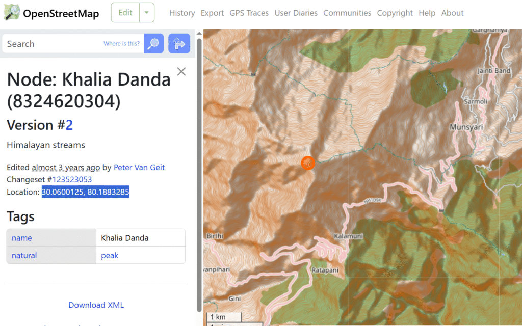
We locate the same peak known as “Khalia Danda” in Open Street Maps to identify its exact location / coordinates: 30.0600125, 80.1883285 (latitude, longitude).
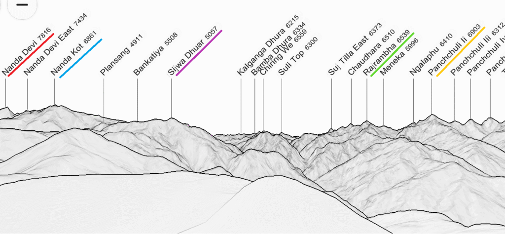
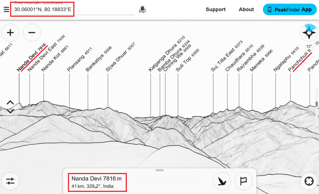
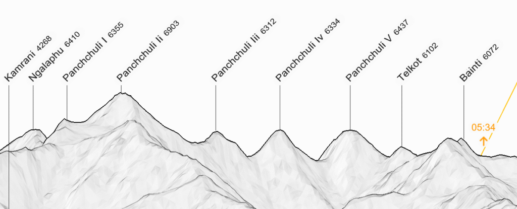
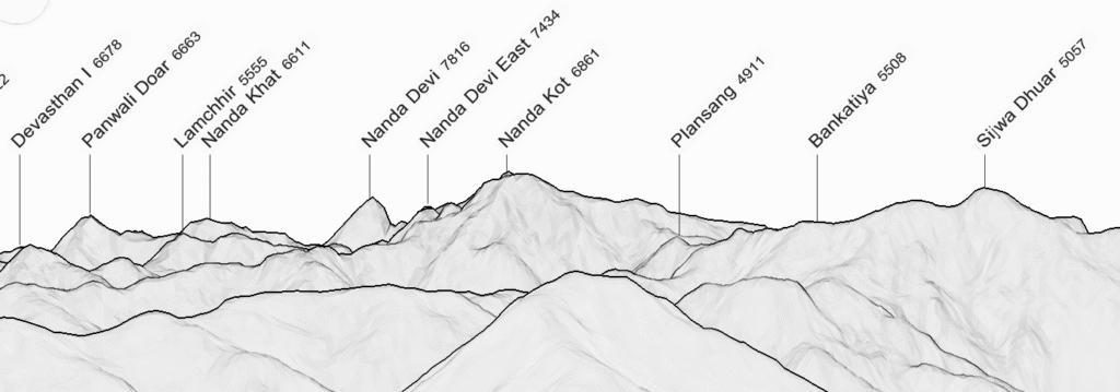
The Peakfinder website and mobile app uses DEM (Digital Elevation Model) data to generate 3D topography and overlay mountain peaks from OSM. Copy the coordinates of Khalia Danda in the search box to get a virtual view of the Himalayas from the peak. Use the mouse move your view 360 degrees and zoom in/out. To the North we see the Nanda Devi range including Nanda Devi (7816m) at 329 degrees / 41km. Towards the East we see the Panchchuli range including Panchchulli II (6903m) at 53 degrees / 29km.
Bring up nakarte.me (mapy.cz layer) to see a topographic map of the same Nanda Devi and Panchchuli ranges and mark the three above peaks using their respective coordinates: Khalia Danda, Nanda Devi and Panchchuli II.
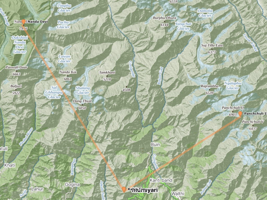
We can use a digital compass to draw the same bearings on the topographic map – Nanda Devi at 229 degrees Northwest and Panchchuli at 53 degrees Northeast.

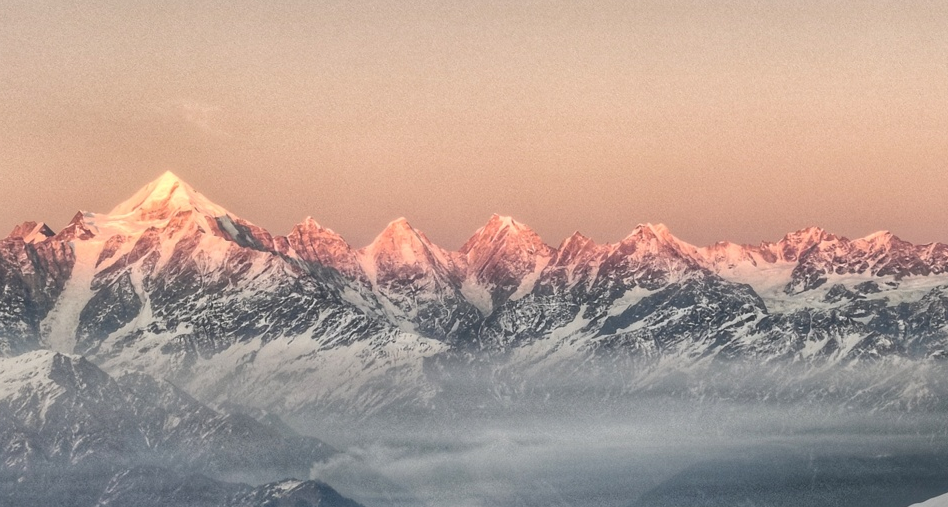
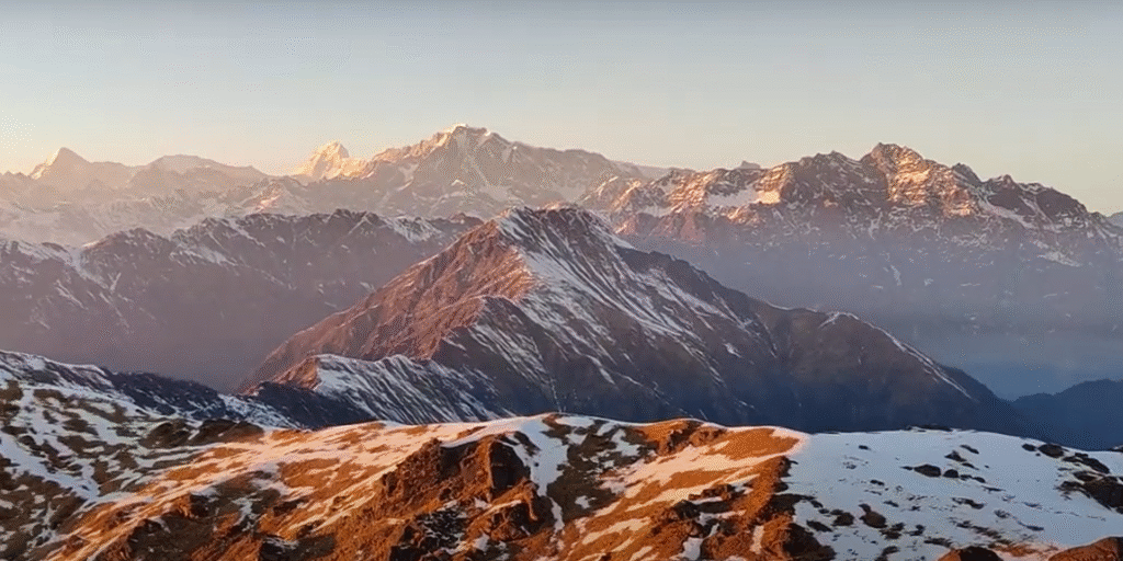
While camping on Khalya Top I took the above sunset video panning East to West revealing both high ranges. A snapshot of the Panchchuli range (5 fingers) in the East appears to match with the topographic sketch generated by peakfinder using DEM data.
Similar the view to the North of my campsite towards the Nanda Devi range apeears to match with the topographic sketch generated by Peakfinder:
Using Google Earth Web we can render a 3D satellite view on the Nanda Devi range (Left, North) and Panchchuli (Right, East) with Khalya top visible near the bottom.
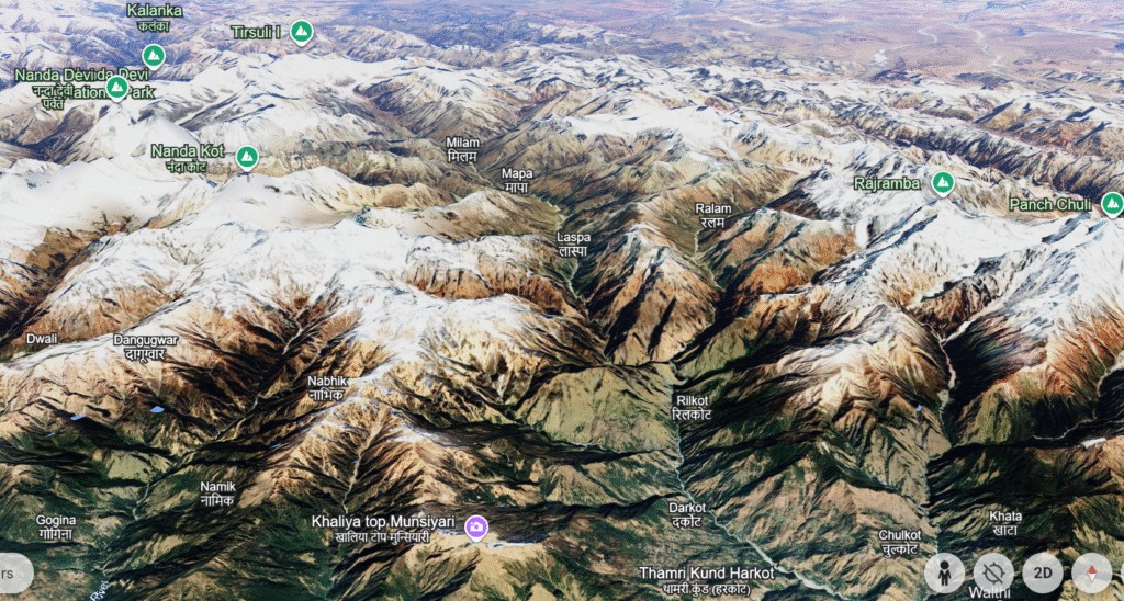
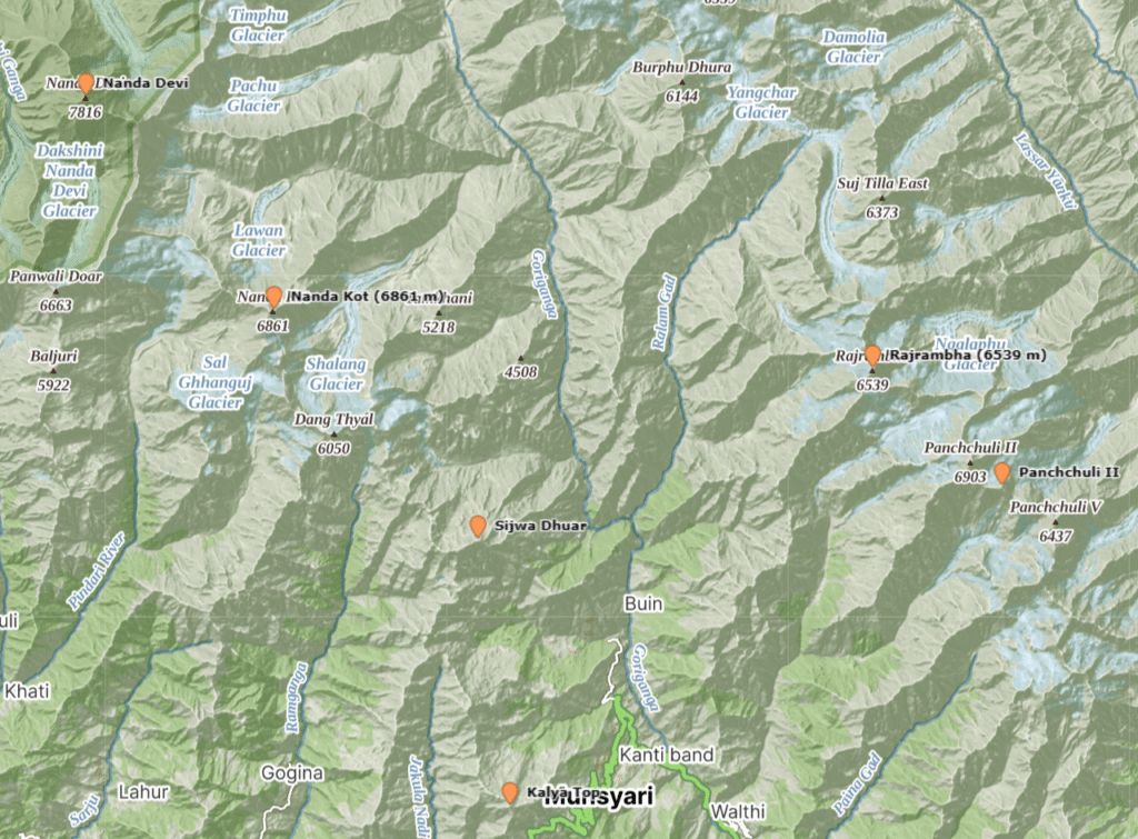
We can mark prominent peaks (Nanda Devi, Nanda Kot, Sijwa Dhuar, Rajrambha, Panchchuli II) in the OSMAnd app and nakarte.me to get a better spatial view on the location of these peaks and correlate them with the topographic view generated by Peakfinder: