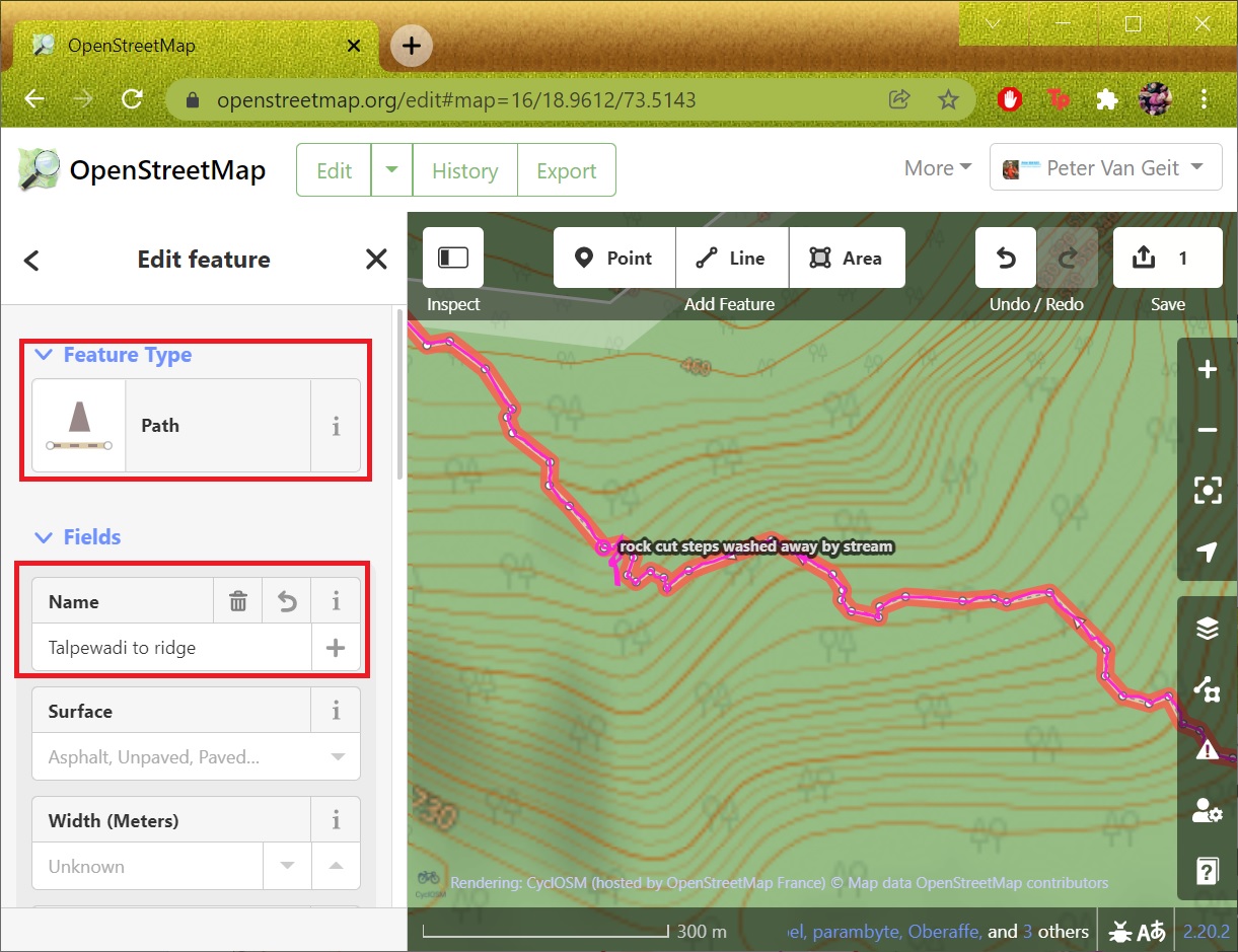
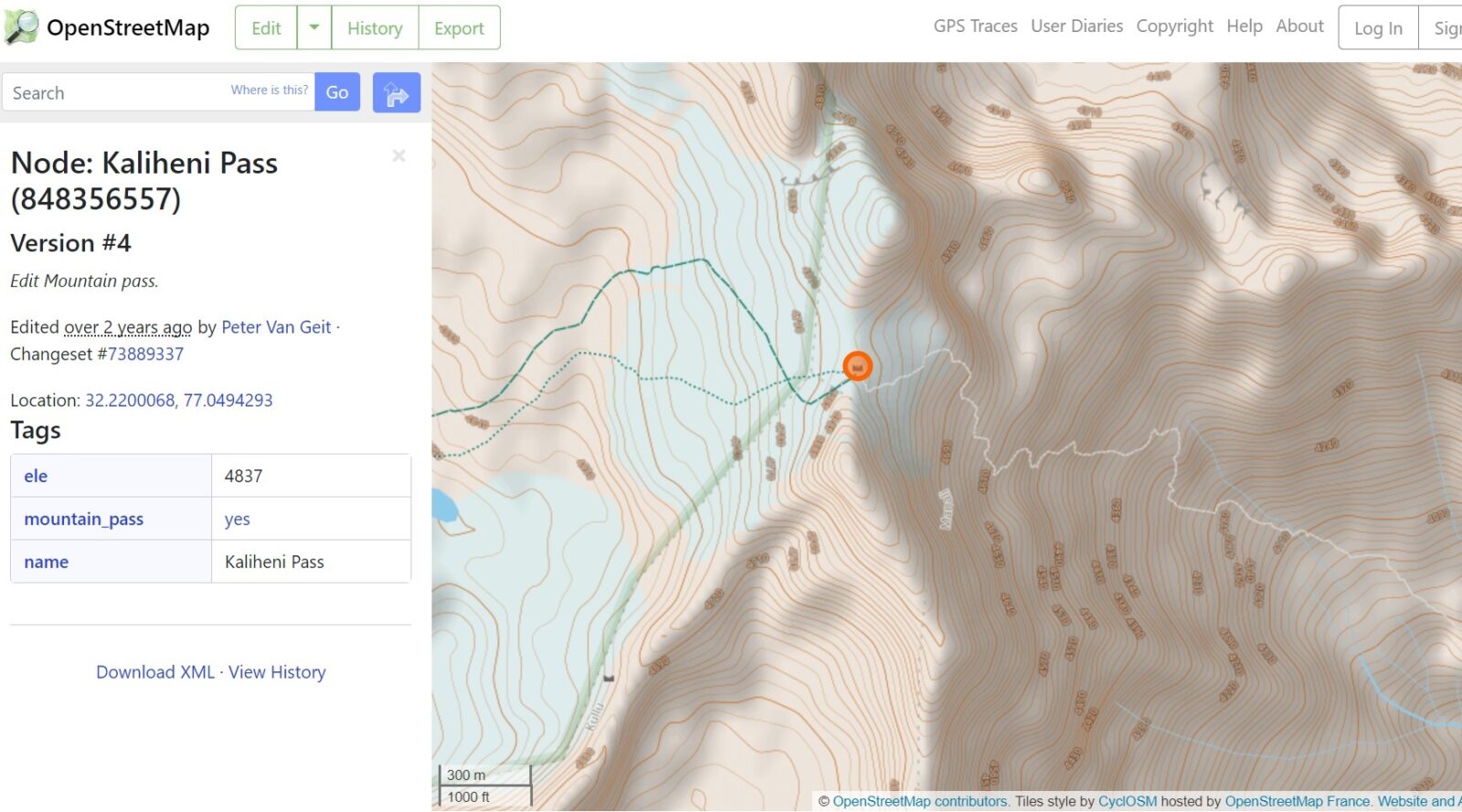
Congratulations in mapping your first trail in OSM! The trail is now shown in any OSM web client or mobile…

Congratulations in mapping your first trail in OSM! The trail is now shown in any OSM web client or mobile…
In the previous module we mapped human settlements based on an external geo-referenced data set. In this module we will…
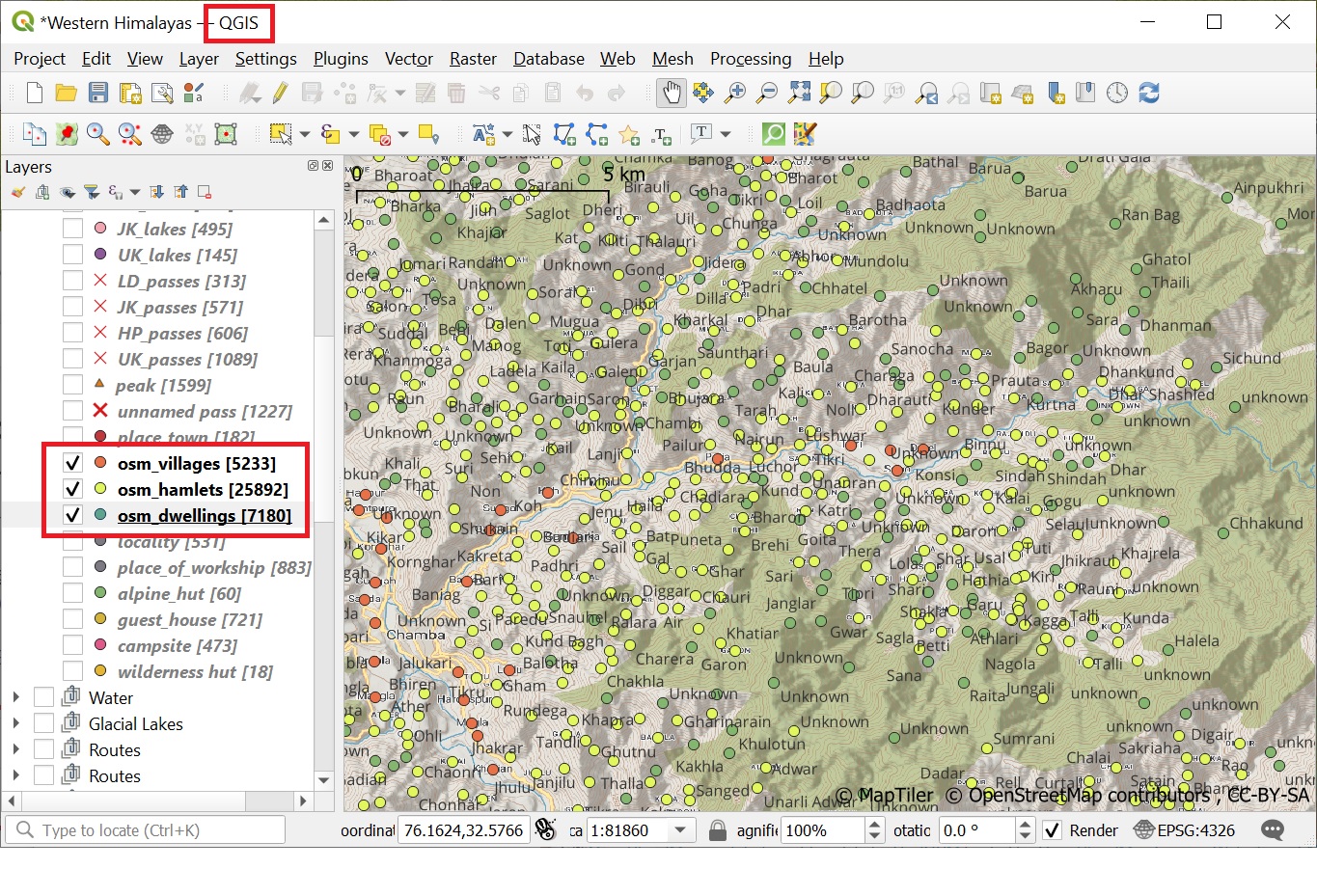
As mentioned in earlier chapters, human settlements are important base points for the alpine style hiker (food supply, night shelter,…
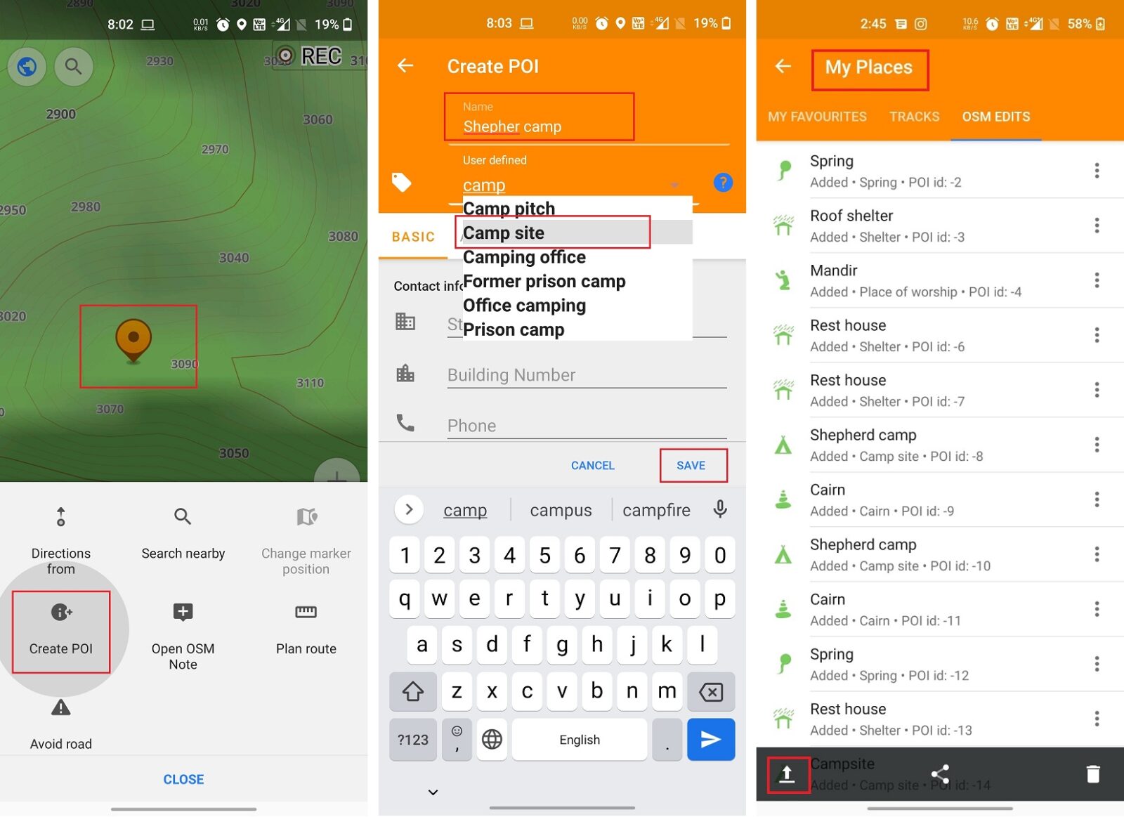
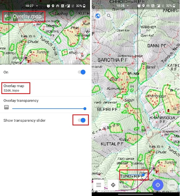
In module 2 we explore the various ways to contribute to Open Street Maps through the mobile app OSMAnd: Adding…
Congratulations on completing the first 6 chapters of the Alpine Hiking Bootcamp. You now mastered the basic concepts including planning…
In this module we will export the Survey map with contours in maptiles format which can be used for offline…

A Digital Elevation Model (DEM) is a representation of the bare ground (bare earth) topographic surface of the Earth excluding trees, buildings,…
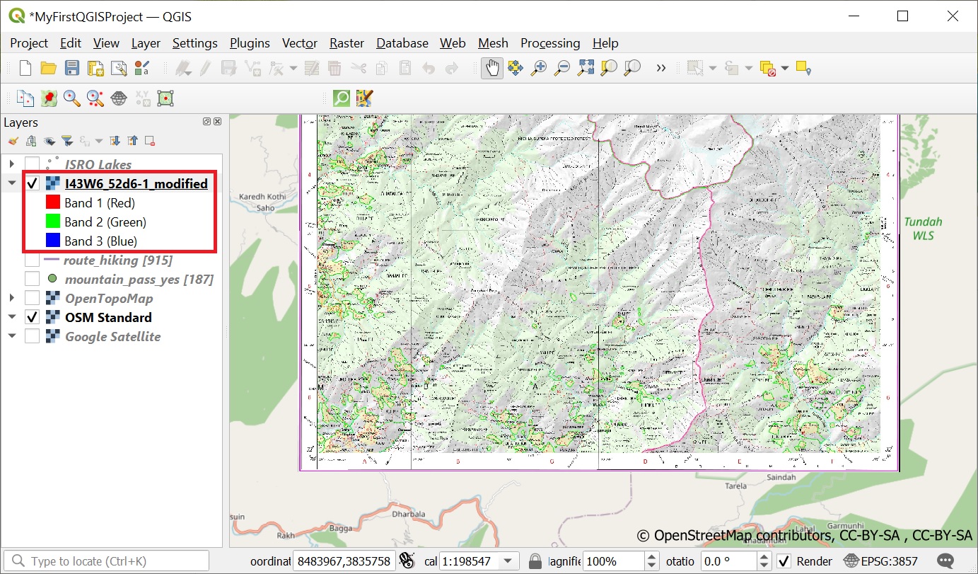
Geo-referencing is the process of taking a digital image and adding geographic information to it so that GIS software can…
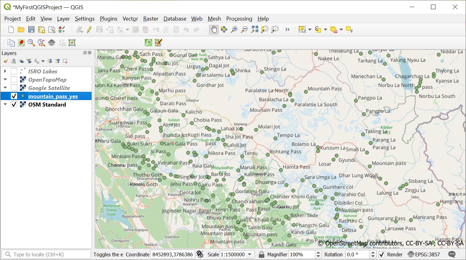
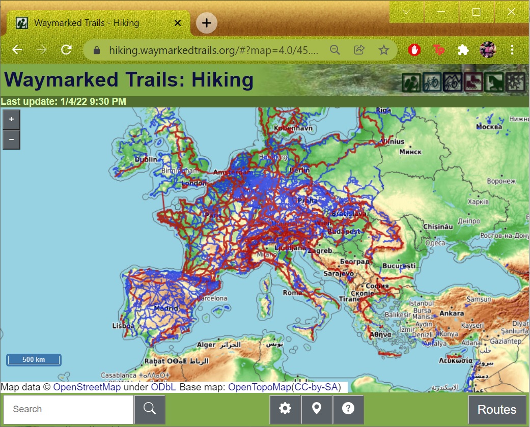
One of the most extensive public datasets of geographic data is Open Street Maps. Let’s play around with some interesting…
Now that we have QGIS up and running let’s start looking at some publicly available data sets for the Western…