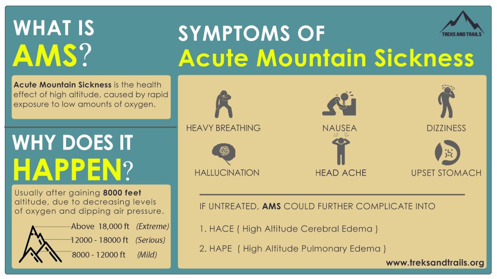
One important aspect of planning your hiking journey in the Himalayas is the (higher) altitude. As we go higher above…

One important aspect of planning your hiking journey in the Himalayas is the (higher) altitude. As we go higher above…
In Chapter 1 we learned about the Geography of the Western Himalayas, Topography (Contours) and various detailed maps like Open…
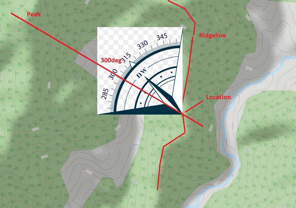
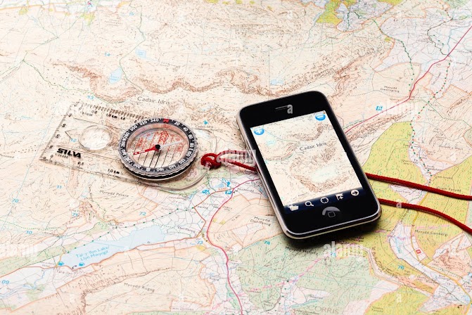
Yet another way to navigate across a mountainous terrain is by using a compass or altimeter. One can correlate his…
When you don’t have a map with trails or GPS log there’s another way to make your way across the…
When visiting Ladakh you’ll encounter many Europeans navigating with large size Olizane paper maps (scale 1:150K). Olizane maps have been…
Another popular way to navigate is using GPS recordings of hiking routes (GPX format). There are many web sites /…
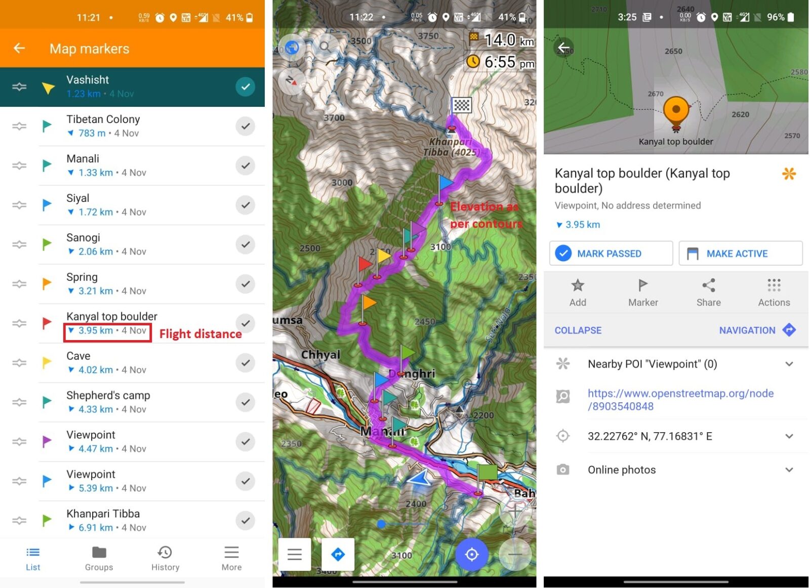
In this chapter we will familiarize ourselves with mobile navigation and route planning through OSMAnd using Open Street Maps (OSM)…
Congratulations for completion Chapter 1 where we learned about the Geography of the Western Himalayas, Topography (Contours) and various detailed…
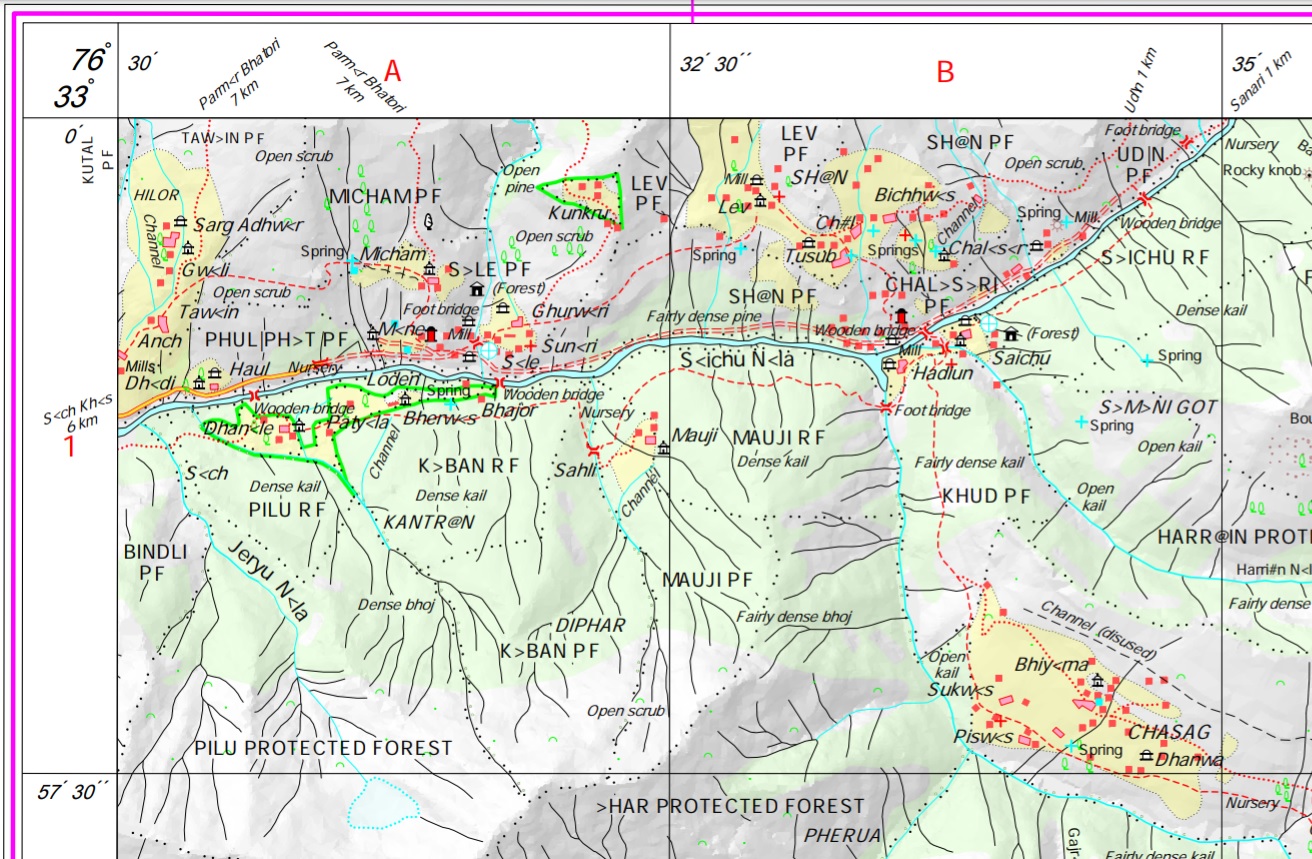
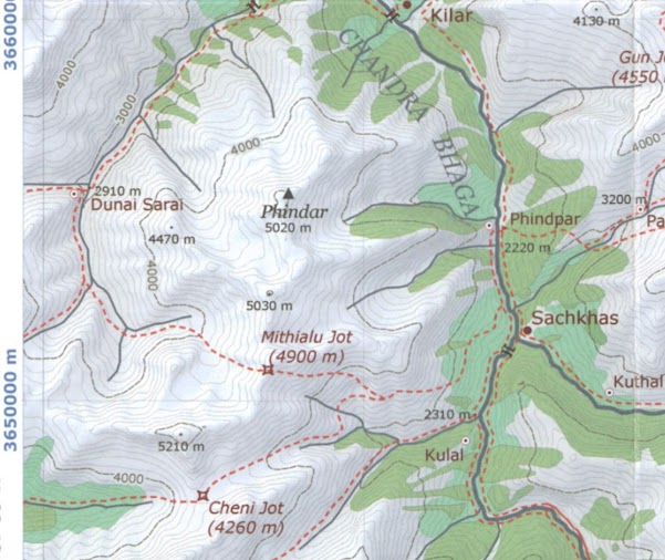
The most detailed and freely available maps of the Himalayas are those published by the Survey of India (SOI). Initially…
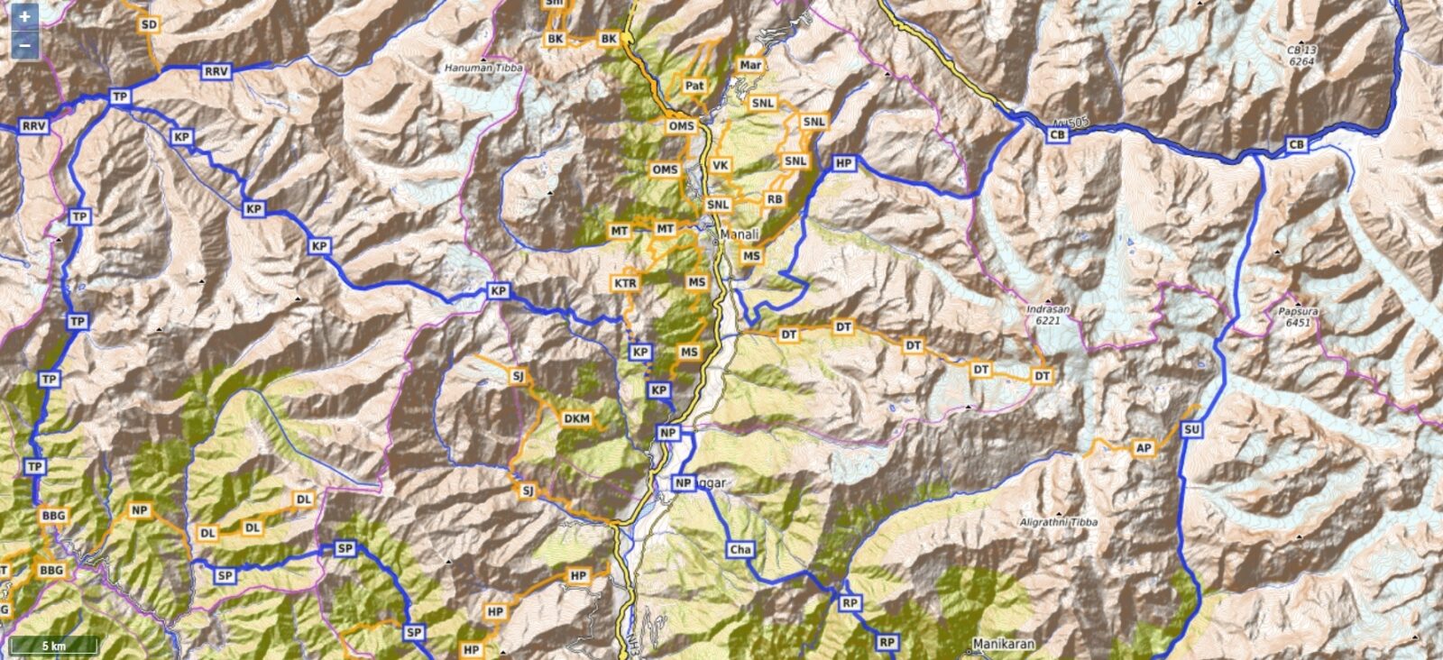
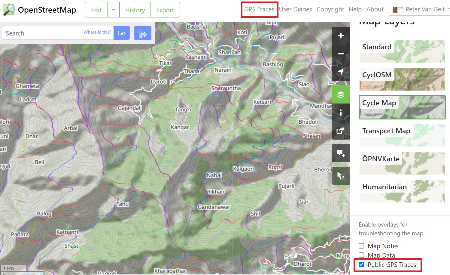
There are many Open Street Map viewers, both web based (planning on laptop) and mobile (offline navigation in mountains) based.…