Introduction
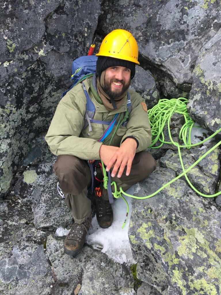
My name is Johan Solberg, and growing up in Norway, hiking was a natural part of my life. After moving part-time to India in 2020, I wanted to continue exploring nature as I did in Norway—just packing my bag and heading out. However, outside the realm of organized treks, finding information on where to go was challenging. Another mental challenge for me was the perception of solo trekking in India. Unlike in Norway, where people are encouraged to be outdoors by themselves, I was repeatedly warned about its dangers. I have previously done treks in India and Nepal with a guide and never felt satisfied with this arrangement.
Planning and executing the trek is an integral part of my enjoyment of the outdoors. Fortunately, I discovered the detailed Survey of India maps, allowing me to plan independently. In my online trek research I stumbled upon Peter Van Geit’s website. His journeys and pragmatic approach to nature resonated with me. His work with SOI maps, OpenStreetMap and much more aligned with my interests, so I reached out, and he generously suggested a route for my trek in early March.
I set my sights on Uttarkashi, using Peter’s outline to refine my plan with maps and satellite images. Wanting to keep my pack light, I aimed to stay in shepherds’ huts or sleep under the stars. I connected with a friend of a close friend of mine who was very interested in joining the trek and we decided to start from Uttarkashi town on the 5th of March. Leading up to the departure date I monitored the weather and kept an eye on the snow forecast.
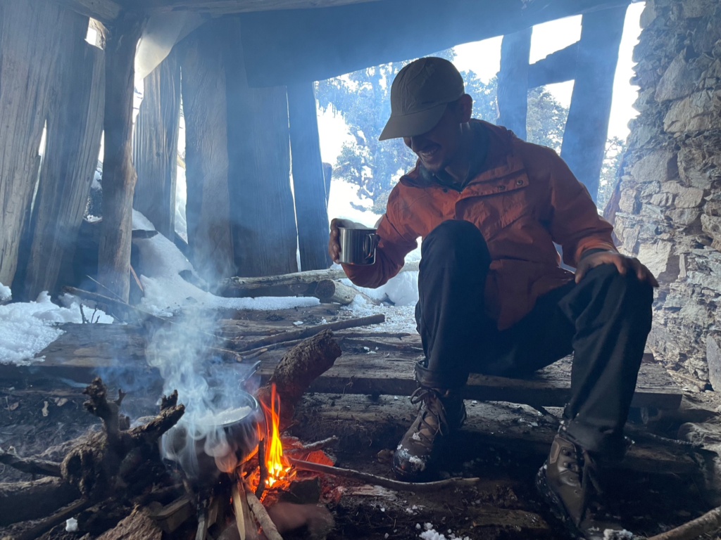
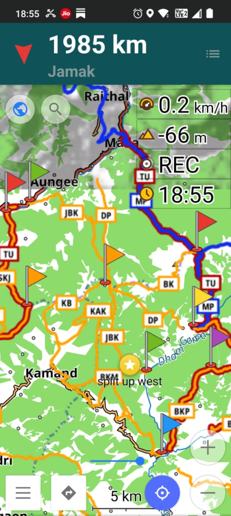
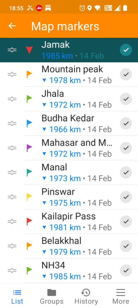
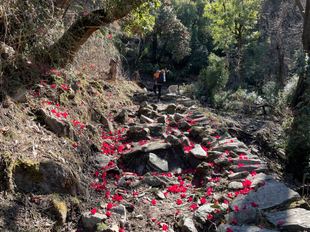
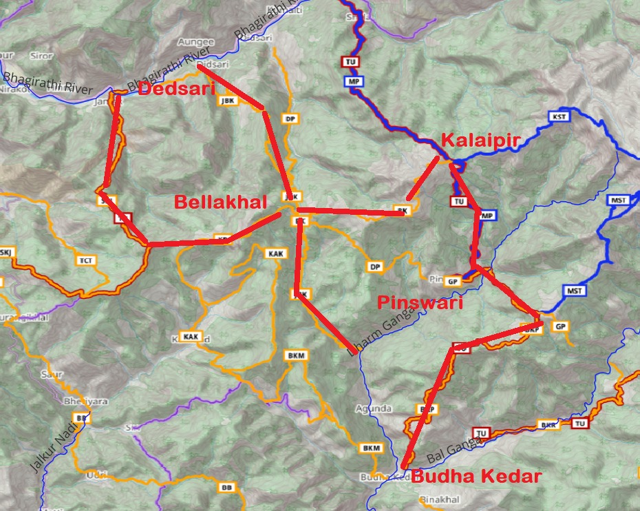
Starting in Delhi, I took a night bus to Dehradun. I met Mukesh Rana by the bus station and we took a government bus to Uttarkashi town. The next day, we took a shared taxi to Maneri, our trek’s starting point. Our goal was Belakkhal Pass, a seasonal settlement where we could find shelter. The transition from villages to wilderness was stunning, with large trees and dense forest. At 2600 m, we encountered light snow, which deepened to knee-high as we reached Belakkhal at 3000 m. After 16 km and a 1750 m ascent, we dried our gear by the bonfire, cooked, and settled in for the night.
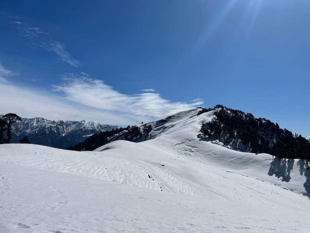
We rose early, hoping for a firm snow crust to traverse the ridge to Kalaipir Pass via Kushkalyan Peak at 3800 m. However, the snow was too soft, making progress impossible without skis or snowshoes. Having planned alternative routes, we descended to around 2500 m and followed a path towards Pinswar. On the way we encountered bear and leopard tracks which was one of many highlights of the trip. Upon reaching Pinswar we had lunch at a local dhaba. With daylight left, we continued toward Manal (3275 m). After crossing the Dharm Ganga, we struggled to find the intended path, eventually bushwhacking through open forest to reconnect with our planned route. As darkness fell, we pushed on, hoping to reach a possible shelter makered on my map. Finding only remnants of one, we camped on a small meadow under a star-filled sky. After a long day of 20 km in steep terrain I fell asleep almost immediately.
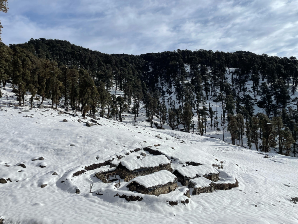
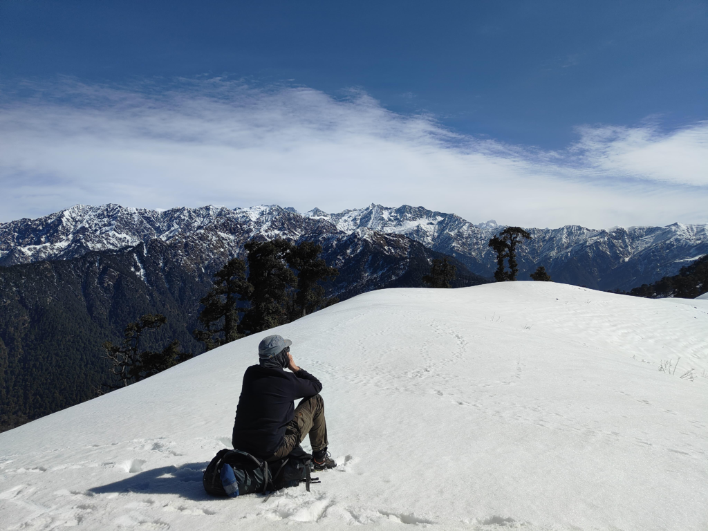
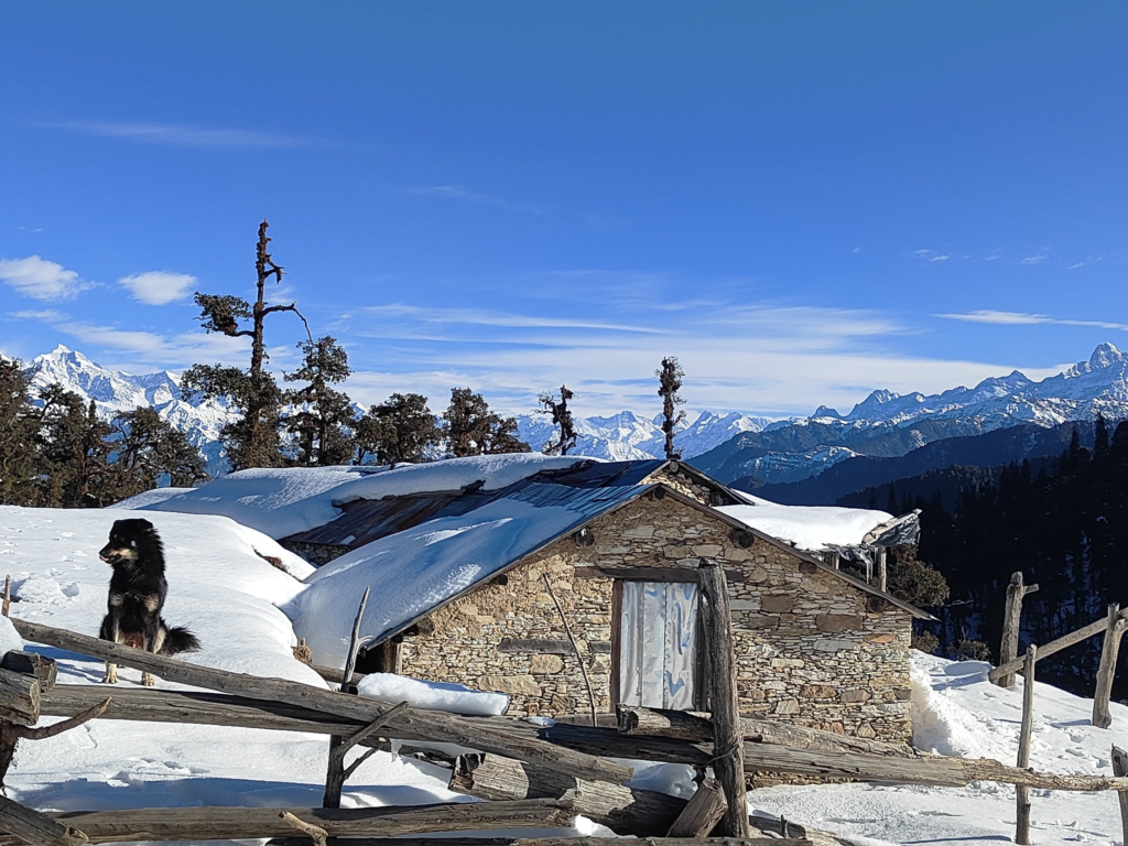
The next morning, we resumed our climb towards Manal. We quickly made progress up the steep terrain reaching the meadow just below Manal top. From there we enjoyed views of Bandarpunch and other peaks. With the sun rapidly softening the snow crust, we pressed on toward Mahasar Gad. The path, staying at around 3000m, was partially buried in deep snow, making progress slow. Eventually, the twin lakes of Mahasar Gad came into view, offering a well-earned break. Continuing on the trail through lush forests, we passed shepherds’ camps before reaching Titruna, where a newly built road ended. As darkness quickly approached, we took a shared taxi to Budha Kedar and stayed in a small hotel.
Originally, I had planned two more days of trekking back to Uttarkashi via a different route over Belakkhal. However, given the deep, wet snow, I decided to end the trek here. In hindsight, snowshoes would have made the journey significantly easier. In addition I should have packed vapour barrier socks or plastic bags to keep my boots dry in the snow. The next morning, we caught a bus to Rishikesh and then I returned to Delhi.
Planning
Travel:
Delhi – fligh/train to Haridwar
Share taxi to Uttarkashi
Share taxi to Maneri
Pack up 2 days of food
Bhagirati river valley
Day1:
Hike up to Bellakhal (3000m)
Deserted dwelling – stay in shelter
Day 2:
Ridgeline towards Kalaipir pass (3400m)
Kushkaliyan (3800m) peak in between
Snow might be ok on top of ridge
If too much snow then divert via Chataruna
Descend to Hariapu take diversion to Dulpe
Night stay at Pinswar / Dhaba / eat food + pack up 1 day food
Dharm Ganga river valley
Day 3
Climb up to Manal (3200m)
Descend South ridge to Masar Tal (3000m)
Descend to Budha Kedar
Camp in school / get a room
Eat food + pack up 1 day food
Day 4
Hitch a road ride to Jhala
Pangrana Gad stream
Climb up to Bellakhal (3000m)
Continue on West ridge – Pandra, Harunta
Descend to Manari
This gives you 1 day buffer. If you can stay on schedule then add:
Day 5
Pack up 2 days of food at Budha Kedar
Instead of descending to Manari proceed West along ridgeline
till Dunda
Possible night halt on Day 4 near Sankuara Khal
or at Nagni Tank you might find a yogi medidating
(not sure if he’s there during winter)
Hop onto share taxi back to Haridwar