Planning a contiguous long-distance traverse across a vast network of trails on raster maps can be challenging. Survey of India offers some of the lowest scale (1:25K, 1:50K) raster maps pan India offering rich terrain details including a vast network of trails. Planning a traverse using fixed scale raster maps requires frequent zooming and panning to identify a continuous set of trail segments spanning a wider region. Planning traverses using scalable maps (like OSM) or vector data (GPX) is much easier as the trail network can be viewed at different (especially larger) scales. In this post we analyze how to plan (pan India) traverses using vector data sets.
- Himalayan Trails
- Raster Maps
- Vector Data
- Traverse Planning
- Export
- Navigation
Himalayan Trails
To plan a traverse we can source trails from various sources:
- Open Street Maps (scalable): 750 hiking Routes mapped over 14 thousand kms
- Olizane Maps (1:150K): hundreds of hiking routes spanning Ladakh & Zanskar
- Survey Maps (1:50K, 1:25K): 63 thousand kms of trails in Western Himalayas alone
- Soviet Topomaps (1:100K): spanning the Northern Himalayas – India, Pakistan, Afganistan, Tajikistan, Uzbekistan
- Trail Repositories (scalable): web sites offering tens of thousands of downloadable GPS logs
Raster Maps
Planning long-distance traverses using low scale raster maps can be time consuming as one needs to frequently zoom and pan to identify a contiguous set of trails across a wider region. One solution is to digitize the trails – the resulting vector data set (GPX) can be viewed at larger scales making it easier to plan long distance traverses across this vast trail network. Digitizing vast trail networks for larger regions (district, state) is again a tireless manual process.
Survey Vector Data
The Survey of India has several vector data sets which are useful for traverse planning:
- Rivers: https://indianopenmaps.fly.dev/rivers/wris/{z}/{x}/{y}.pbf
- Passes: https://github.com/ramSeraph/indian_roads/releases/download/soi-roads/SOI_Passes.geojsonl.7z
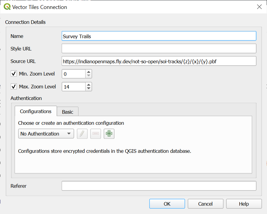
- Tracks: https://indianopenmaps.fly.dev/not-so-open/soi-tracks/{z}/{x}/{y}.pbf
- Glacial Routes: https://indianopenmaps.fly.dev/not-so-open/soi-glacial-routes/{z}/{x}/{y}.pbf
- Roads: https://indianopenmaps.fly.dev/not-so-open/soi-roads/{z}/{x}/{y}.pbf
You can access above vector tiles in OSM PBF (Protocolbufffer Binary Format) in QGIS by creating new Vector Tiles Connections:
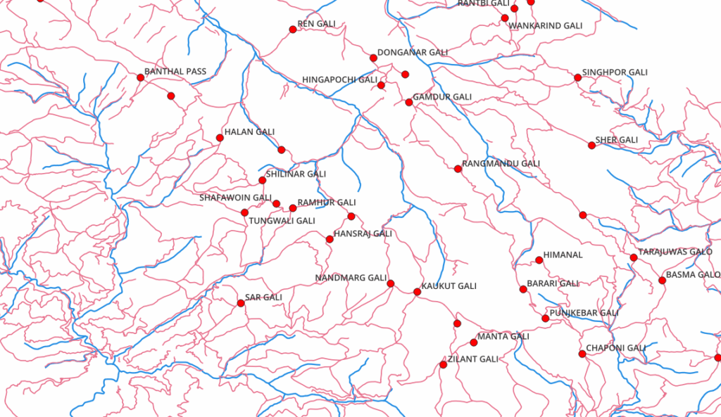
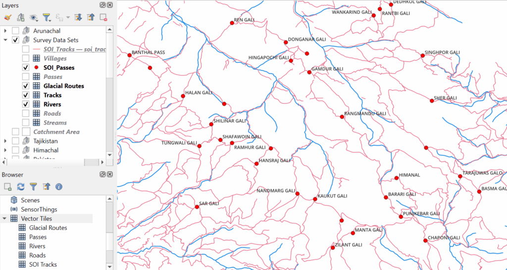
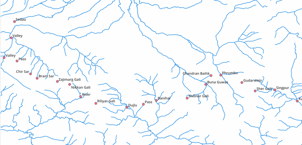
Below you can see a network of tracks (pink) which interconnect valleys (blue) through mountain passes (red):
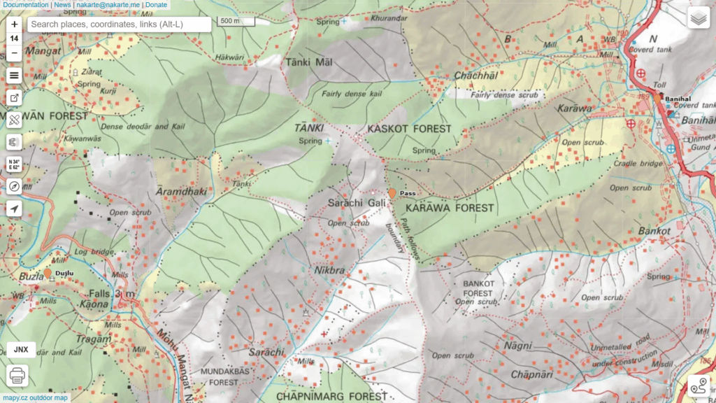
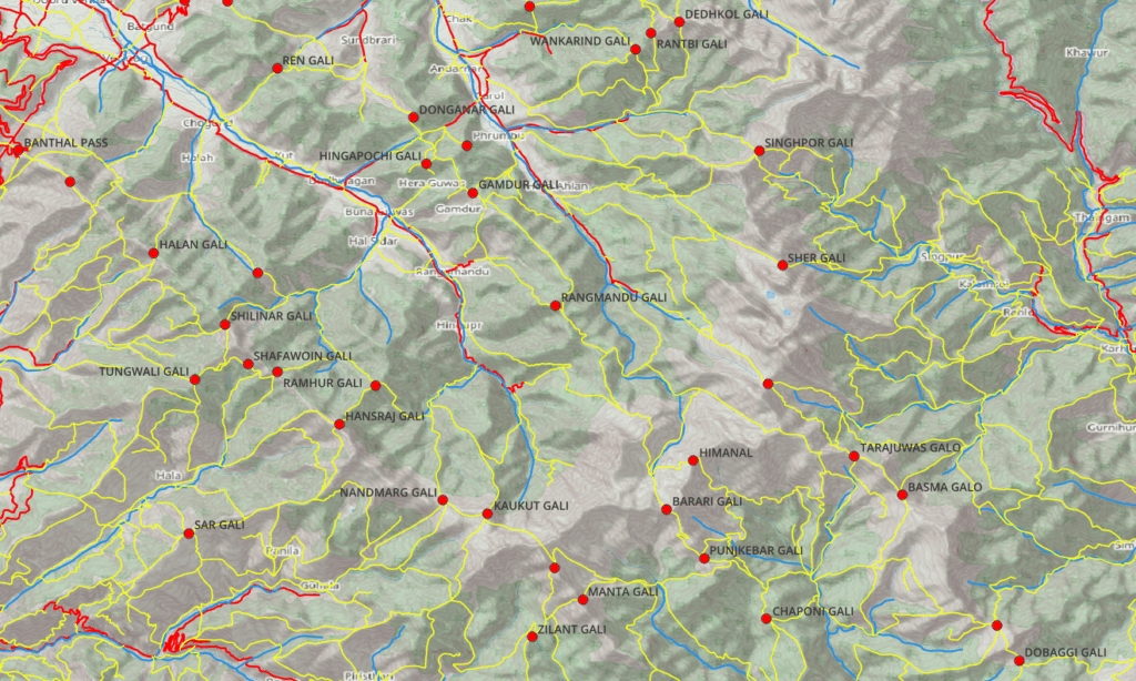
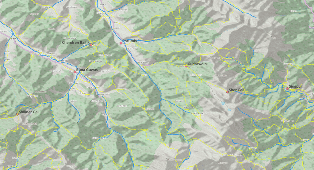
Viewing the same layers on a topographic base layer: roads (red), tracks (yellow), rivers (blue). We can create an infinite number of contiguous traverses across this vast track network hopping across passes through adjacent valleys connecting individual track segments.
Traverse Planning
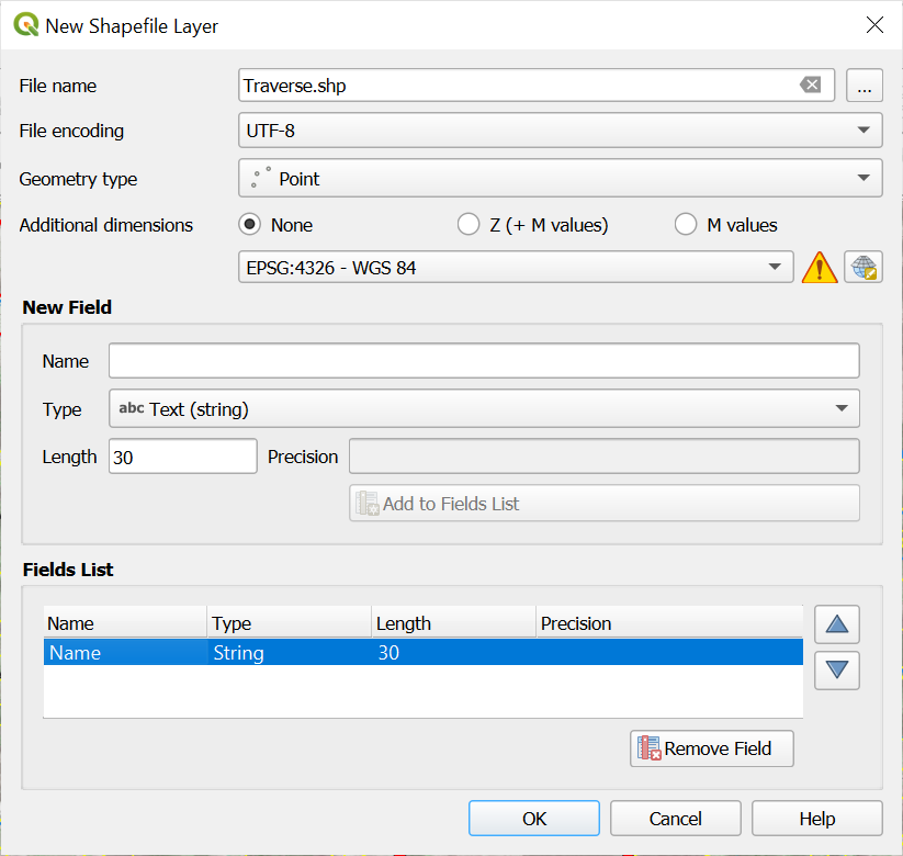
Add a new point shapefile in QGIS to mark periodic points along the traverse:
Plan a traverse by marking periodic points along a sequence of interconnected track segments connecting valleys through mountain passes:
The sample traverse below interconnects 7 major river valleys in Kashmir through 6 mountain passes and a few alpine lakes:
Export
Export the traverse from QGIS in GPX format and load in nakarte.me to view and refine:
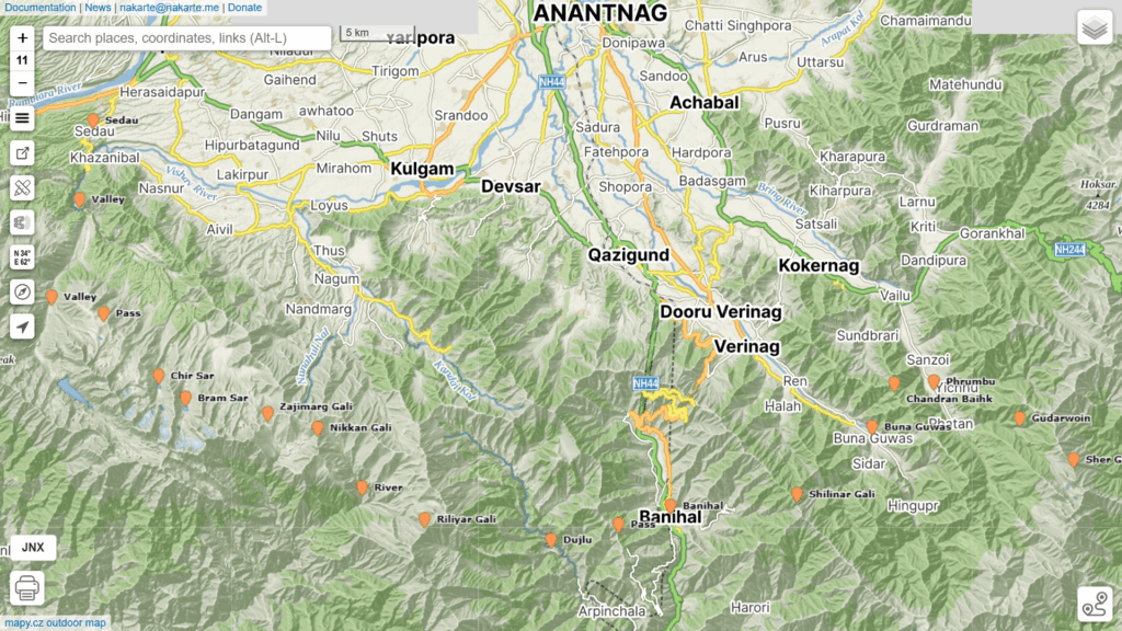
Use Survey 1:25K or 1:50K scale map layers to detail your traverse marking important POI (Points of Interest) along the way. Once complete you can export the traverse as a GPX from nakarte an load in your phone for field navigation.