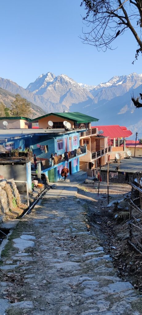
Woke up from a peaceful night near Thamri Kund at 2800m with beautiful views on the snow capped peaks of Panchchuli in the Eastern Kumaon range. Went out for a quick chuchu late night while capturing the night skies filled with stars above the twinkling city lights of Munsyari in the valley below. At 7:30am the sun rose above the Eastern horizon sun rays penetrating through the surrounding forest.

I packed up in a zippy and was on my way along the frozen rock path back to the road head. Had to watch out not to slip as the snow was hard and frozen due to many footsteps. From the road head immediately a nice cobbled path contours down 500m towards Munsyari short cutting the hair pin bends of the road. It took me to the bus / taxi stop where I dropped into a small dhaba to indulge in aloo paratha with dahi. Yumm! I did not find proper food the previous night.

I charged up my phone and power bank and packed up a few apples and snacks for the day ahead. At 10am I started off towards my next target: Khaliya Top, at 3700m a solid 1500m climb above Munsyari. From the peak you get 370 deg views on the ranges of Nanda Devi and East Kumaon. It took me some time to find the trail head towards the top. I started of from s nice rock path but soon lost it again as I followed the Survey of India map trail towards the hamlet of Balanti.

Lucky a few locals put me back on track and I was hair pinning up again on a nice cobbled rock path. At 2700m the path got partly covered by snow and was slippery in many places did to many footsteps. I soon came across a few local tourists heading up to Khalladnada at 3250m where a few buildings and platforms give a bird’s eye view on the East Kumaon high ranges above Munsyari. As usual shouting loudly and disturbing the peace I moved ahead of the group.

From Khalladnada the path was fully covered by compacted frozen snow so I took out my poles to get grip on the steep, slippery path that lead to the snow covered bugyals above. Once on top the ridgeline flattens and one can see Khaliya Top some 1.5km away completed covered in a thick snow blanket offering a stark contrast with the deep blue sky above At this point the views on the surrounding high ranges open up 270 degrees.

A one foot deep trail of footsteps runs through the white landscape towards the peak. The pre existing path makes it easy to move forward as compared to opening virgin snow. The trail of footsteps circles right around the base of the peak before climbing up steeply to the top. A Shiva tripod marks the peak which offers mesmerizing views on the high ranges of Eastern Uttarkhand. To the Northwest we can see the Southern Nanda Devi subsection while on the East Panchchuli rises up in the Eastern Kumaon range.

South we can see the endless lower ranges of Uttarakhand below a misty cover. Deep below we see Southeast the Ramganga river valley flowing from Namik glacier and Southeast the Goriganga flowing from the Milan and Ralam glaciers. Seeing both the snow covered upper high ranges to the North and the valleys deep below to the South carrying the snow meltwater to the foothills is a unique experience.

The sun shines brightly in the blue sky above radiating warmth while walking through the frozen snow blanket. There is absolute silence at the peak 2500m high above the raging rivers in the valleys below. I m the only one on top, no other hikers seemed to have passed beyond Khalladnada. Being alone on top of the world in absolute silence with mesmerizing views around instills a feeling of inner peacefulness.

After a short snack break I descend back down from the peak and proceed North along the ridgeline. I walk through virgin snow now sinking knee deep inside. No one has gone this far yet except for the foot prints of some animals. I continue for about 1km along the ridge sometimes sinking till the waist. Looking ahead I can see the Rur Khan pass at 3450m, gateway between the Jakula Nadi and Goriganga valleys. Still 2km away along a jagged snow covered ridge looks too intense to reach within a reasonable timeframe.

It s already later in the afternoon and I decide to head back to the Khaliya peak to camp on top and take in mesmerizing sunset views. I looks for a suitable flat location to pitch up my Bluebolt tent along the snow covered ridge with excellent views on both sunset and su rise. After clicking countless photos of the deep oranges colored skyline and high ranges I settle down under my -12C Bluebolt quilt. As I blog the happenings of the day under my warm cosy quilt I can hear a freezing wind blowing outside my tent.

Trans Hima 2020 – 46 Munsyari to Khaliya Top Woke up from a peaceful night near Thamri Kund at 2800m with beautiful…
Posted by Peter Van Geit on Monday, 25 January 2021

Indeed its an amazing place. I did this trek in December and was aw struck by its beauty ?. Best wishes to you ?
oh là là! what a breathtaking view from the top with various shades of red in the backdrop.
nice place, would like to visit here.