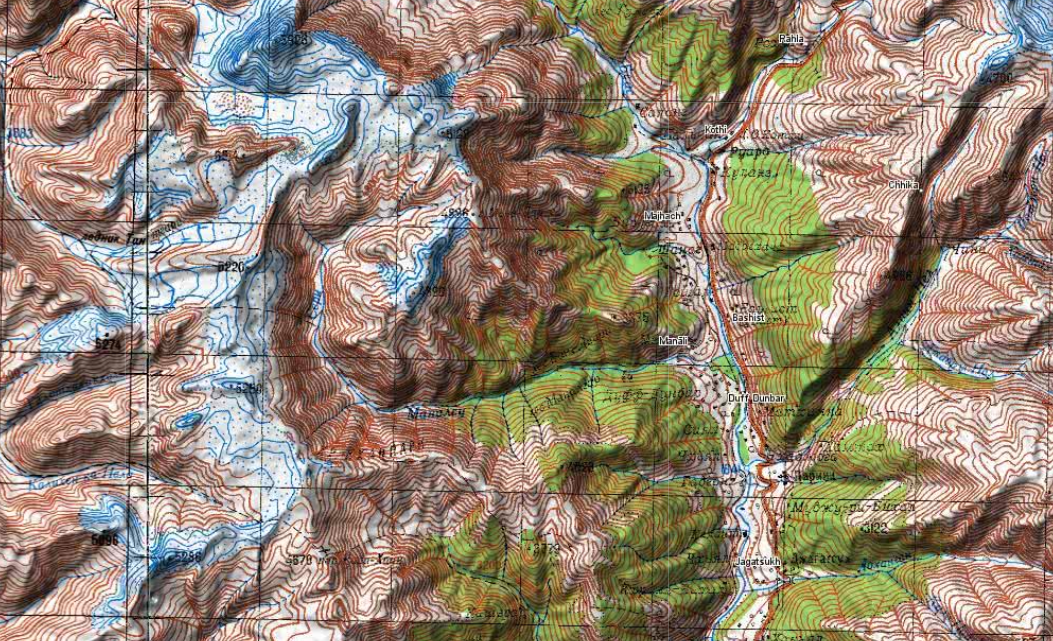
During the cold war the Soviet military secretly mapped the entire world using detailed topographic maps. Although the focus was…

During the cold war the Soviet military secretly mapped the entire world using detailed topographic maps. Although the focus was…
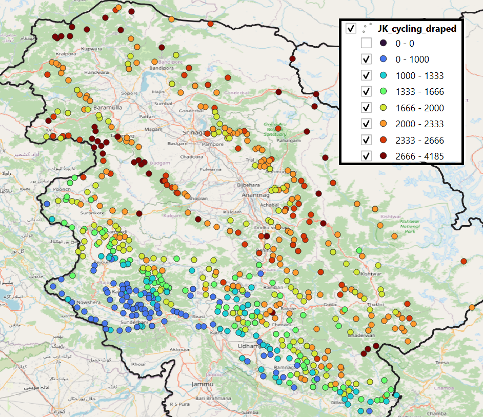
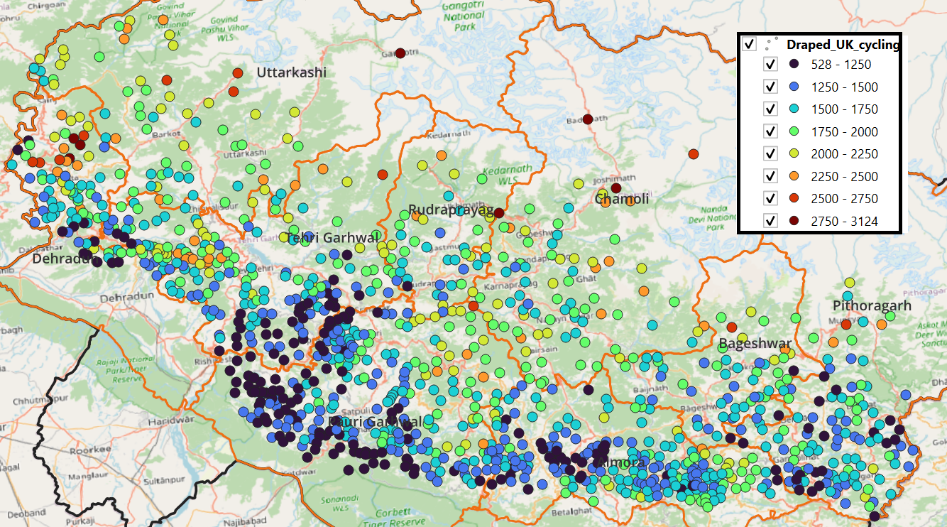
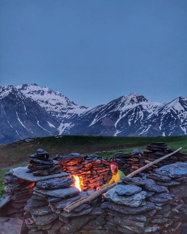
In this post we identify thousand+ km-s of scenic cycle / bike routes in the Himalayan alpine desert of Jammu…
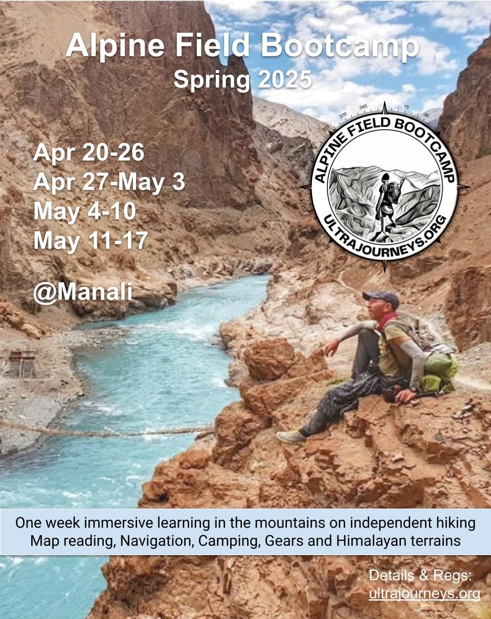
Spring dates for the Alpine Field Bootcamp are finalized as below: Alpine Field Bootcamp is a one week immersive learning in…
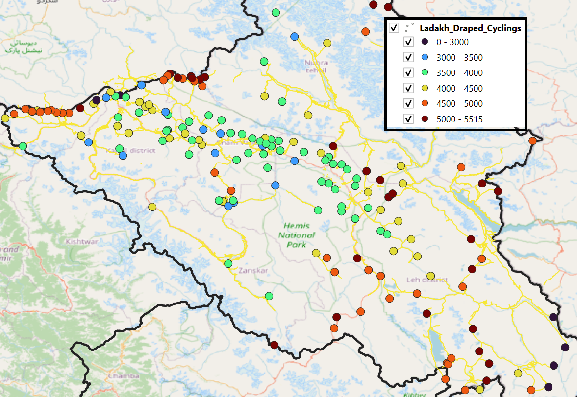
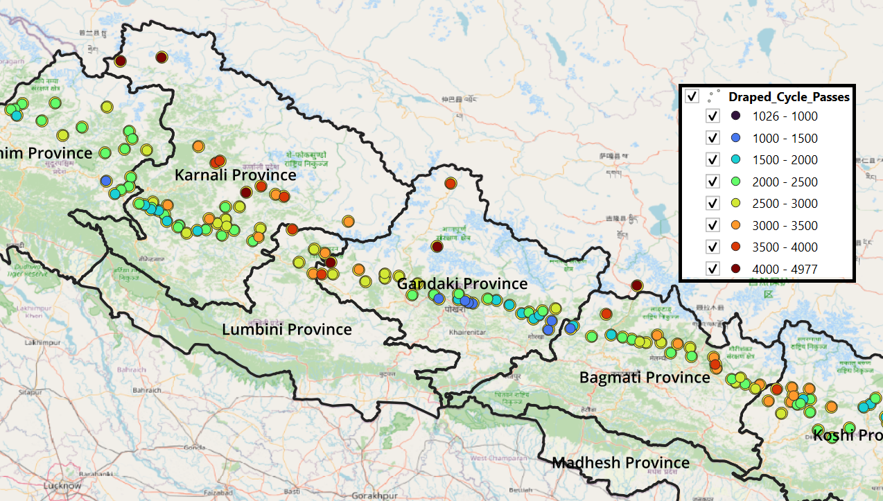
In this post we identify thousand+ km-s of scenic cycle / bike routes in the Himalayan alpine desert of Ladakh.…
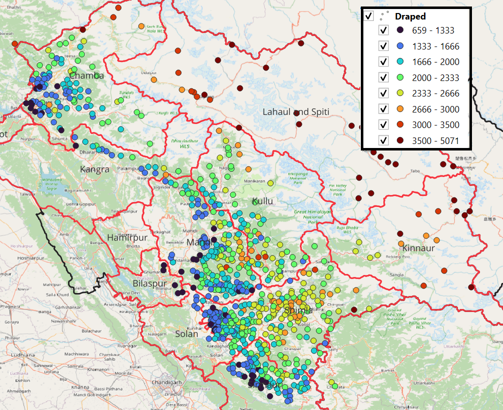
In this post we identify thousand+ km-s of scenic cycle / bike routes in the foothills of the Himalayas in…
In this post we identify thousand+ km-s of scenic cycle / bike routes in the foothills of the Himalayas in…
In this Video Adventurous Solo Traveller Peter Van Geit shared his Experiences with Munmozhi Talks. We welcome Peter Van Geit.…
Last couple of weeks I’ve been poring over Topographic maps, Satellite Imagery and Open Street Maps identifying thousands of kms…
There are several benefits associated with independent hiking vs. organized hikes: Alpine Style Hiking Organized Group Hiking Cost effective Expensive…
The course fees for the field camp are 28.5K INR including a 7-day packed course condensing decades of valuable field…