
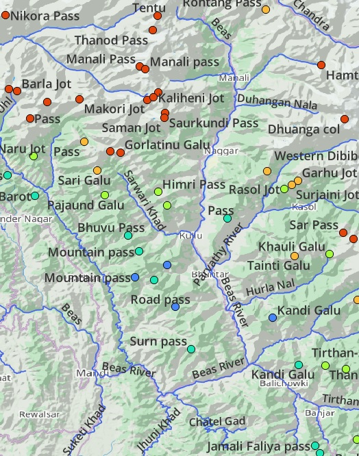
Mapping the Himalayas. Understanding the importance of detailed maps to explore the Indian Himalayas, I mapped thousands of mountain passes, hiking routes, prominent peaks, alpine lakes, major rivers and tens of thousands of human settlements in Open Street Maps enabling the international outdoor community to plan and navigate journeys through the Indian Himalayas.
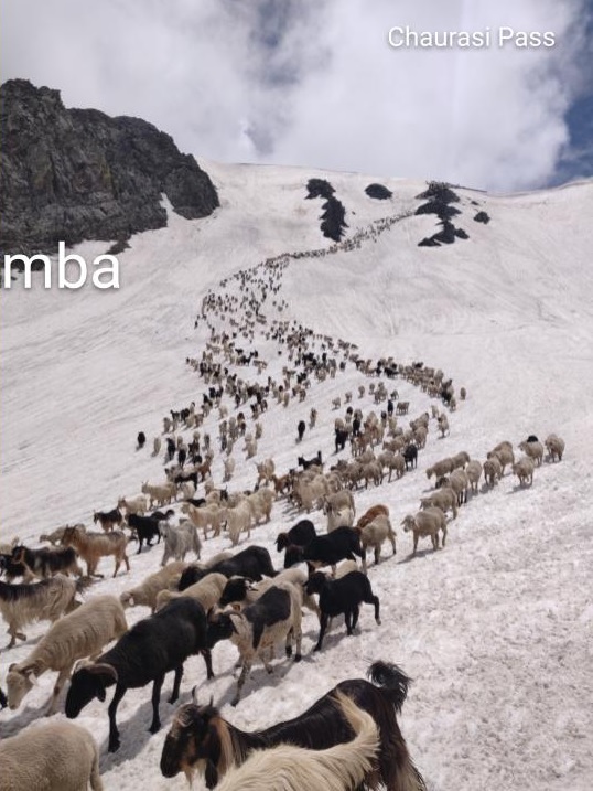
Himalayan Regions. This 17 module webinar takes you across as many regions throughout the Western Indian Himalayas including Garhwal & Kumaon, GHNP, Dhauladar, Pir Panjal, Pangi valley, Tsarap valley, Zanskar range, Spiti valley, Ladakah Spanging and Stok ranges, Baspa range, Parvathi valley, Manimahesh, Lug & Barot valleys and Chamba valley.
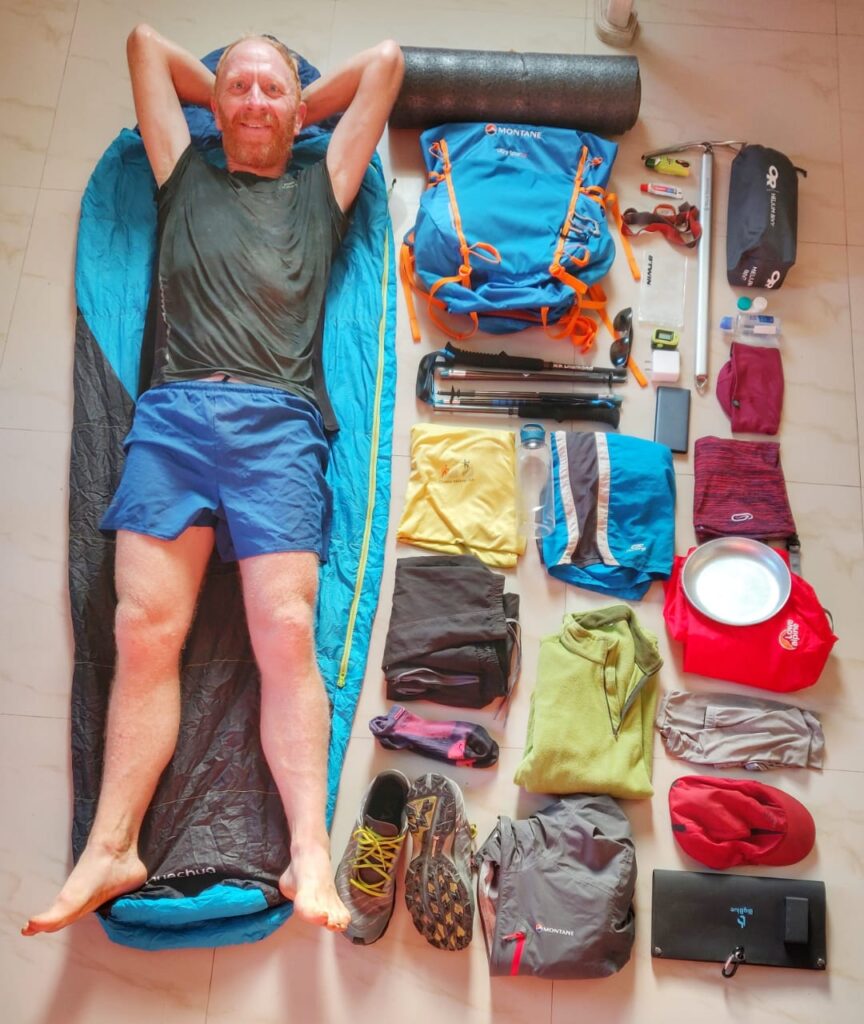
Gears. Minimalist fast-hiking the Himalayas using lightweight gears, optimizing food and shelter and proper traverse planning. Going lighter is going faster for the independent solo hiker. Going faster changes everything while hiking long-distance traverses in the steep Himalayan terrain.
Traverse Planning. Learn how to plan a Himalayan traverse taking into account seasons, food planning, hydration, night halt, topography, shelter. We use different types of maps to identify suitable long-distance traverses across major river valleys and mountain passes and plan as per seasonal snowline and changing weather conditions.
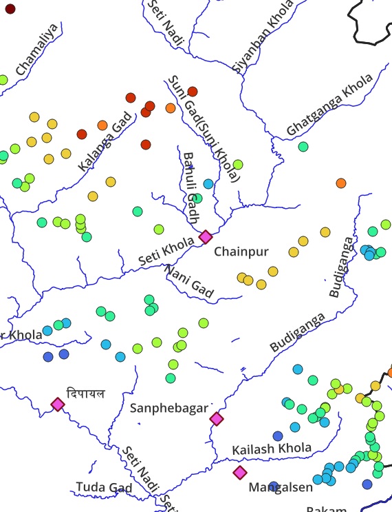
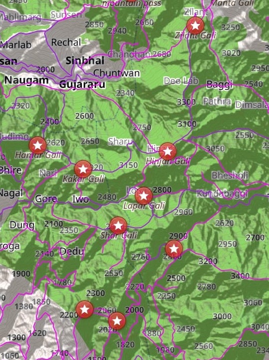
Nepal. To plan trans Himalayan traverses hikers require a good understanding of the topography of the region: major valleys and high ranges which can be crossed through mountain passes. Hundreds of rivers, thousands of mountain passes and hundreds of hiking routes were mapped in Nepal enabling hikers to plan countless traverses across this topography
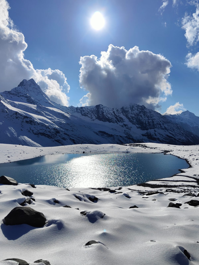
Lakes of the Himalayas. Thousands of mesmerizing alpine lakes spread across the Himalayas. These high altitude water bodies are mostly frozen and covered by winter snow to open up to the human eye only during the summer season. Plan your Himalayans traverse to these water sources considered holy by the local people.
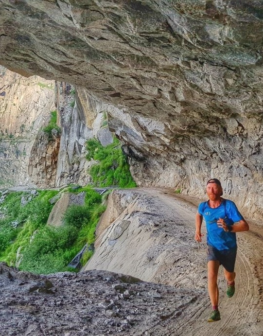
Ultra Running. Self-supported ultra runs across thousands of kilometers through beautiful remote valleys in the Himalayas. Running routes, planning long-distance running traverses, preparing for ultra races.
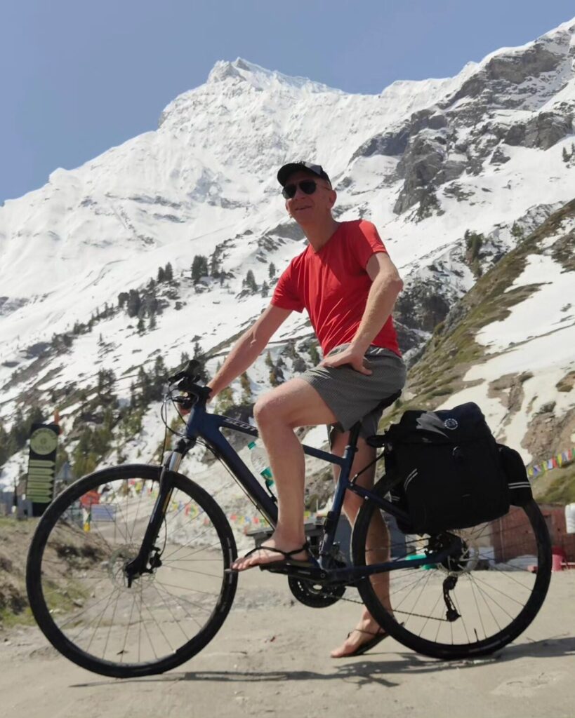
Cycle Touring. Thousands of beautiful cycle routes across mountain passes and end points in valleys across hundreds of major river valleys across the Indian and Nepal Himalayas. Various presentations on how to plan long-distance cycle tours through the mountains.