
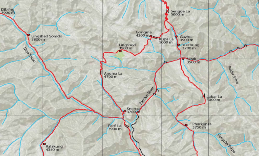
The first major effort to create public hiking maps for the Himalayas was done by Depi Chaudhry who explored the Western Himalayas extensively (using local guides) and accurately GPS recorded his routes. In 2015 he created a beautiful topographic map including 1000+ km of routes covered across 50+ high passes from Uttarakhand to Kashmir. He tried publishing his maps and hiking routes in both print format and through a mobile app but unfortunately his efforts did not realize. A 17×17 feet copy is displayed at the IMF (Indian Mountaineering Foundation) office in Delhi.
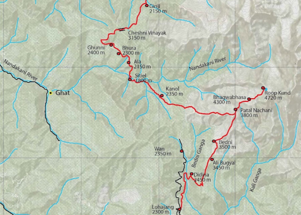
His topographic hiking maps can be downloaded over here. Unfortunately the maps are not geo-referenced and therefore not useful for accurate planning or navigation. Most of his GPS recorded trails however have been mapped in OSM by me.