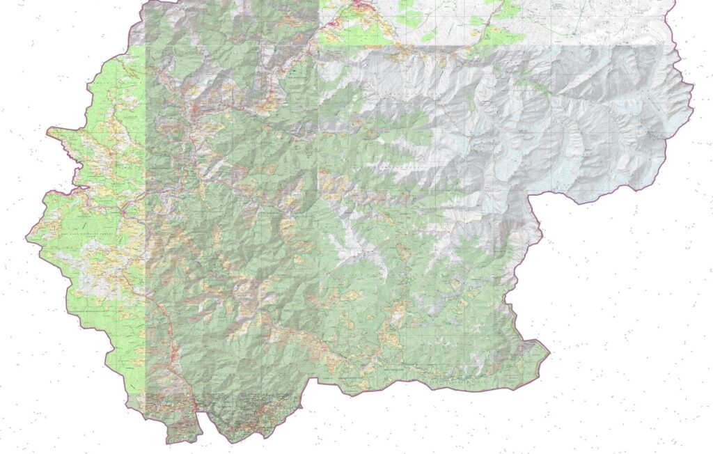
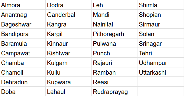
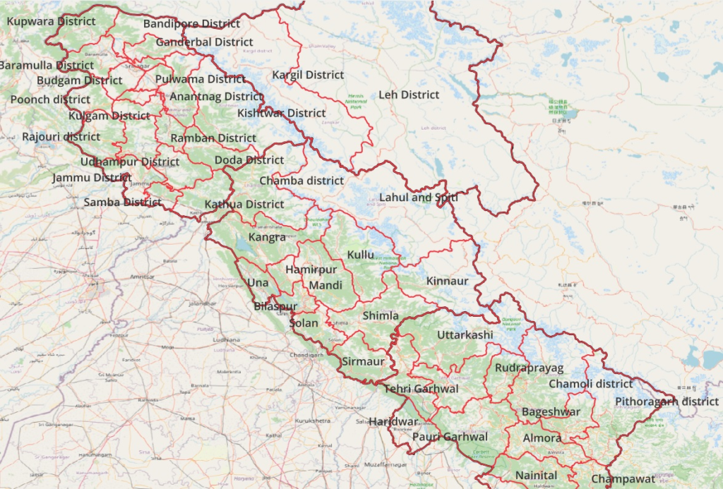
The Western Indian Himalayas consist of 4 states (Himachal, Ladakh, Uttarakhand, Jammu & Kashmir) and 40 districts:
Find here high resolution maps for each district which can be used for planning your Himalayan traverses. These maps contain a wealth of terrain details for the outdoor community:
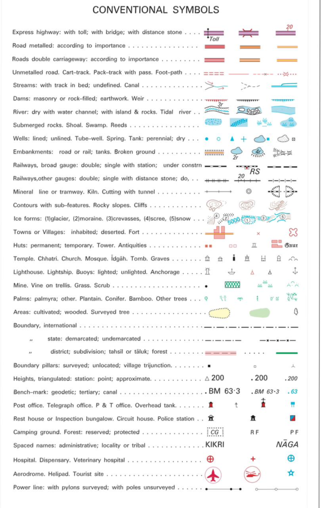
- Terrain: cultivations (yellow), forests (green), glaciers (light blue), lakes (blue), moraines (black dots), meadows (Thach, Bhugyal)
- Settlements (red squares), urban areas (red polygon)
- Rivers & streams (blue lines, Nala) and gullies (black lines)
- Trails (red dotted) and paths (red dashed lines)
- Ridgelines (black double dotted lines, Dhar)
- Springs (blue cross) and water falls (blue line)
- Boundaries (thick red, black dotted)
- Mountain passes (black X) + opening season
- Mountain peaks (Jot, Tibba)
- Bridges and ropeways
- Temples (white symbol)