
In this post we explore mesmerizing views on the Himalayas along any given hiking route. During my 4 months Trans…

In this post we explore mesmerizing views on the Himalayas along any given hiking route. During my 4 months Trans…
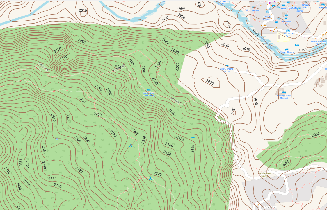
Topography is represented on topographic maps through contour lines. Most contours are generated from 30 meter (1 arc sec) DEM…
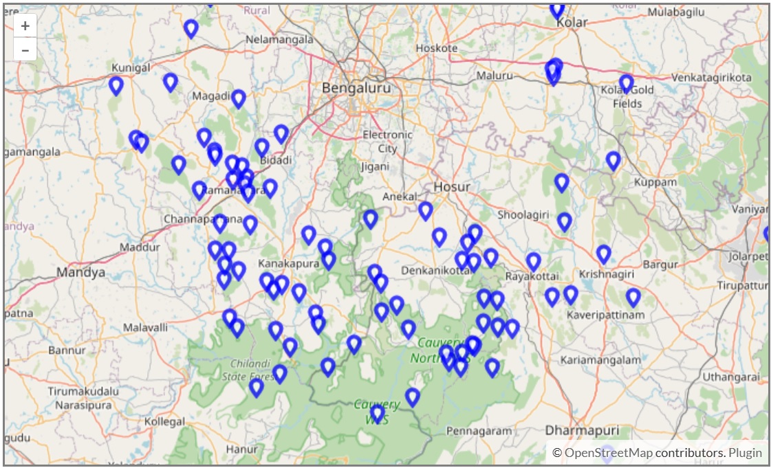
In the map below you can find some 100 hillocks in the outskirts of Bangalore which can be hiked with…
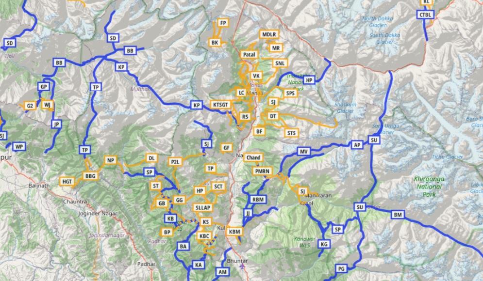
For the Alpine Field Bootcamp I generated a few high resolution topographic maps for the 4 states of the Western…
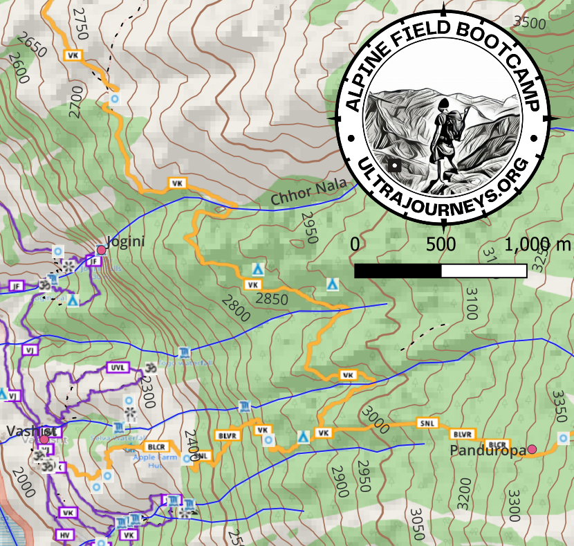
Click below to download a high resolution A3 sized 1:25K scale topographic map of the Manali region showing all hiking…
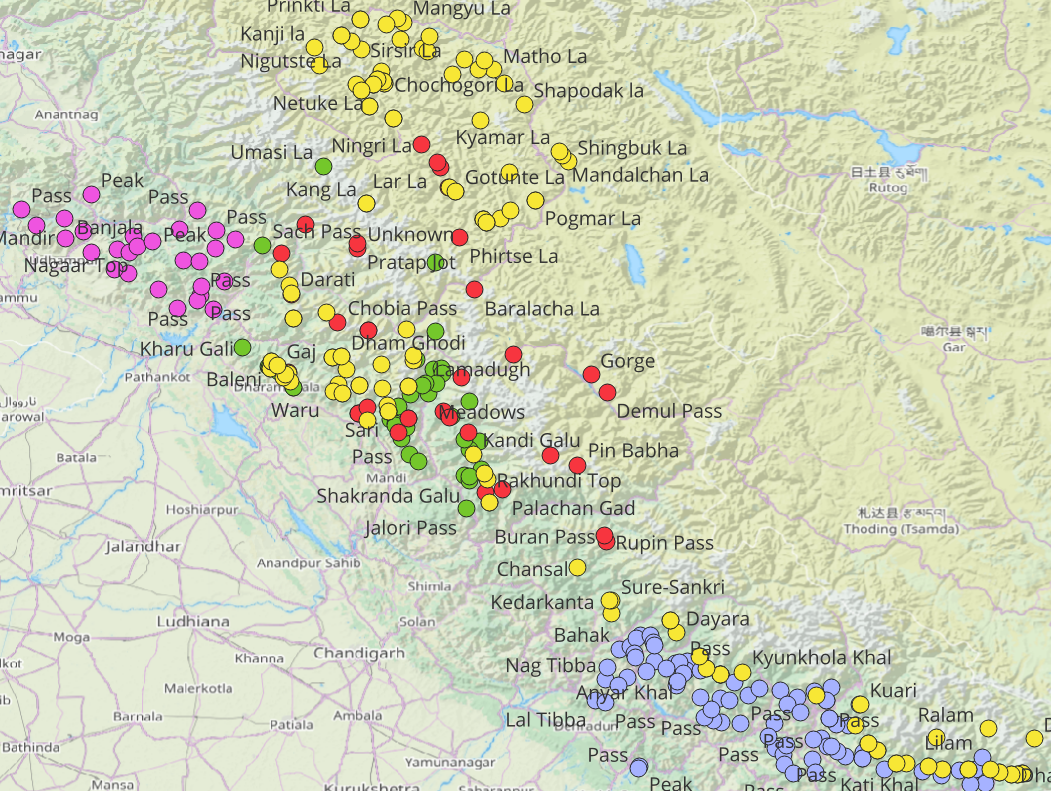
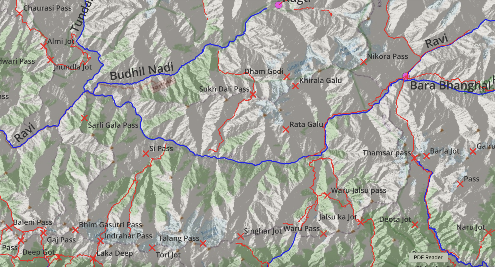
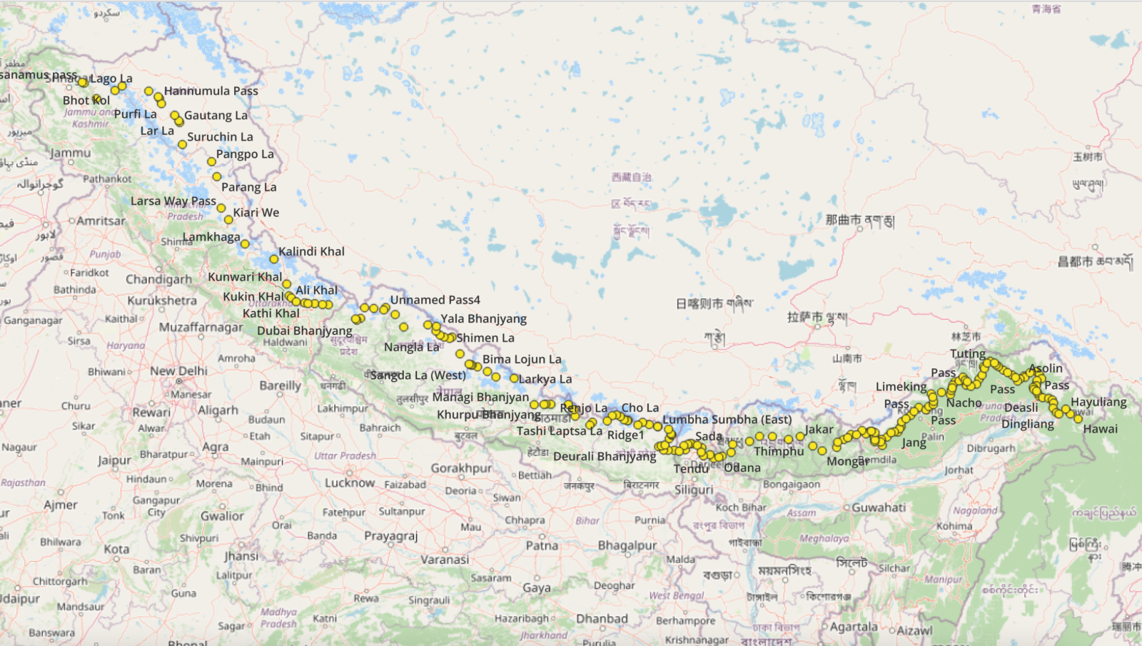
I explored more than 300 mountain passes across 10 thousand kilometers over 4 ultra journeys through the Western Indian Himalayas. Click on the…
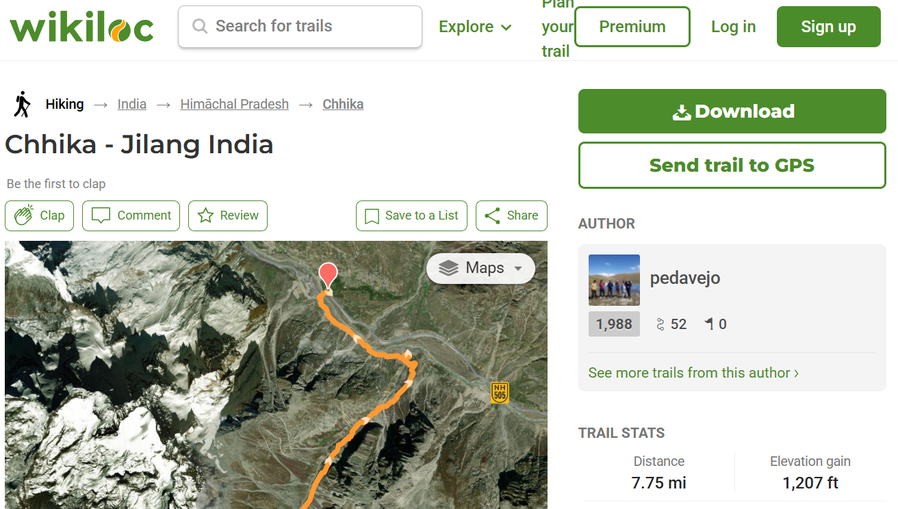
Introduction Traditionally the outdoor community shared popular hiking trails through a number of well known websites (WikiLoc, Ramblr, AllTrails, Strava…)…
Thousands of Himalayan hiking trails have been accurately mapped in Open Street Maps for the benefit of the independent hiking…
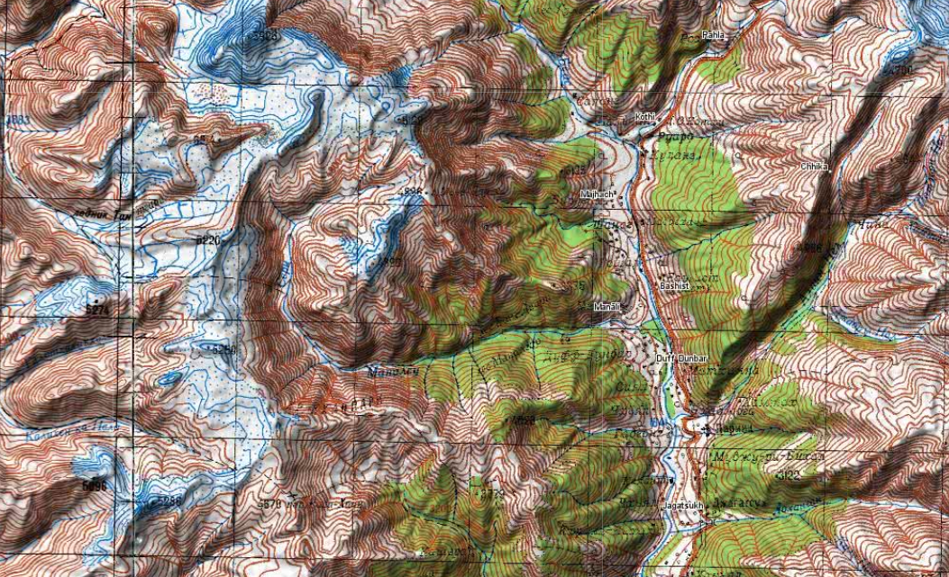
During the cold war the Soviet military secretly mapped the entire world using detailed topographic maps. Although the focus was…
This blog documents a Trans Himalayan East-West route across Arunachal, Bhutan, Sikkim, Nepal, Uttarakhand and Ladakh: Arunachal East Arunachal West…