
In this post we identify thousand+ km-s of scenic cycle / bike routes in the Himalayan alpine desert of Jammu & Kashmir. We go as deep as possible inside valleys (end points) and across ridgelines via mountain passes connecting neighboring valleys enabling us to create long distance traverses across 17 major river valleys spanning the entire state of J&JK.
- Valleys
- Road Network
- Target Points
- Elevation
- Settlements
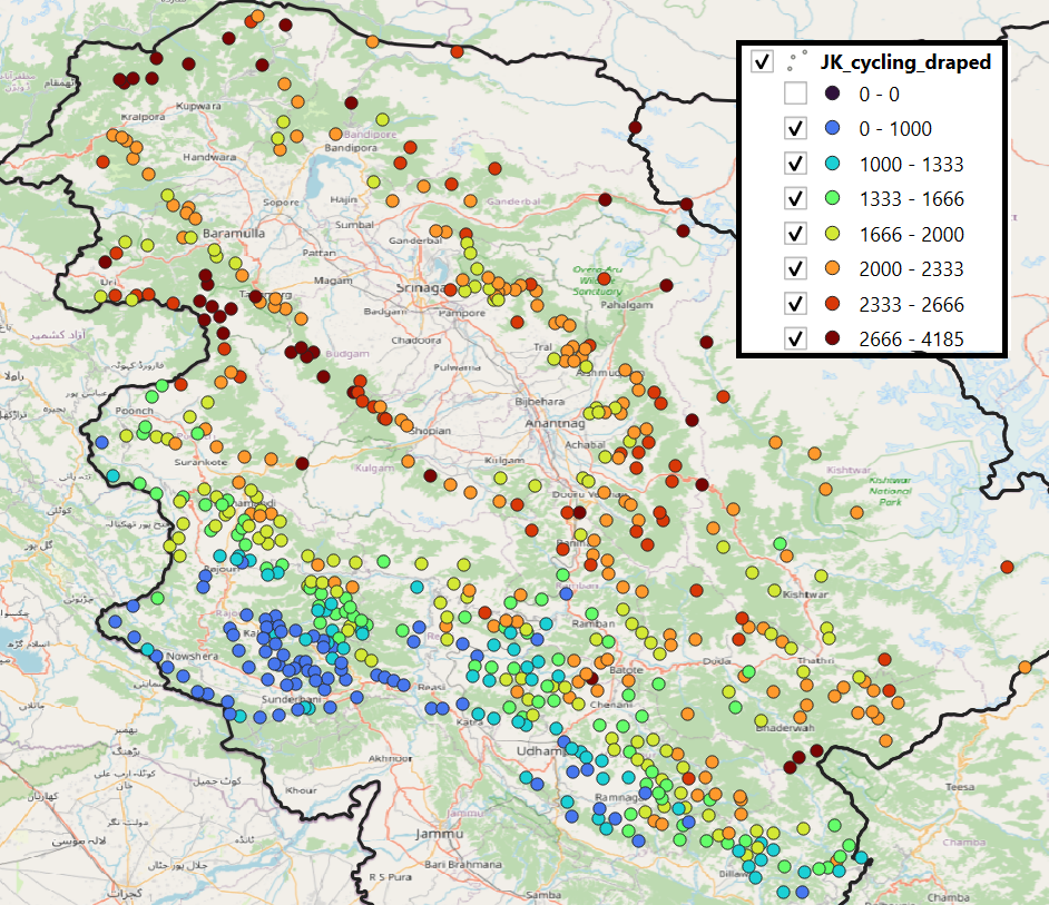
- Cycle & Bike points
Become a patreon to get access to thousands of kms of cycle routes for planning your next long-distance touring journey.
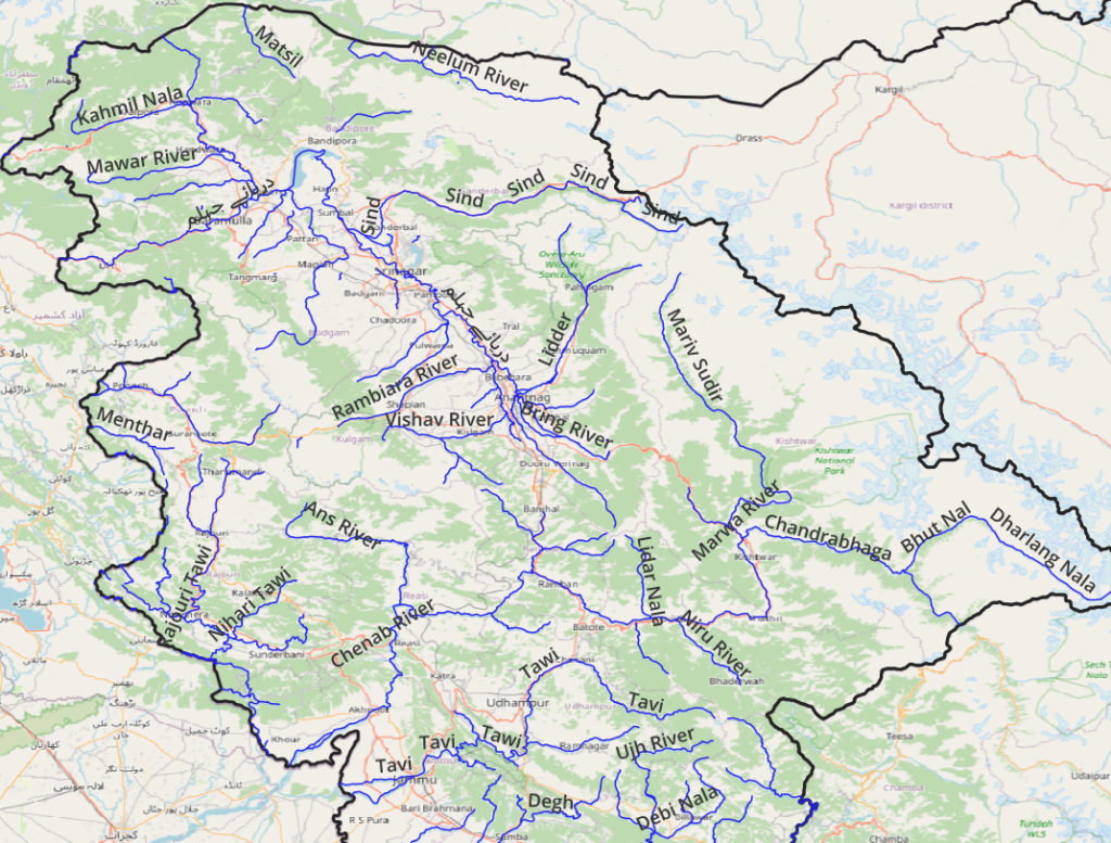
Valleys
Jammu and Kashmir consists of 30 major river valleys West to East – Neelum, Matsil, Manchar, Kahmil, Mawar, Madmatti, Sind, Godhar Nala, Rambiara, Lidder, Vishag, Bring, Pulast, Menthar, Rajouri Tawi, Nihari Tawi, Thandapani Wali Tawi, Manawar Tawi, Ansi, Bishari, Chenab, Marwa, Bhut Nal, Niru river, Tawi, Ujh, Debi Nala, Sewa river, Bhiyani Nadi, Ravi. We cycle / bike through these valleys as deep as possible as well as hop across mountain passes connecting neighboring valleys.
Road network
As a first step we identify the road network on which we can take the cycle or bike from Open Street Maps by querying on below key-value pairs:
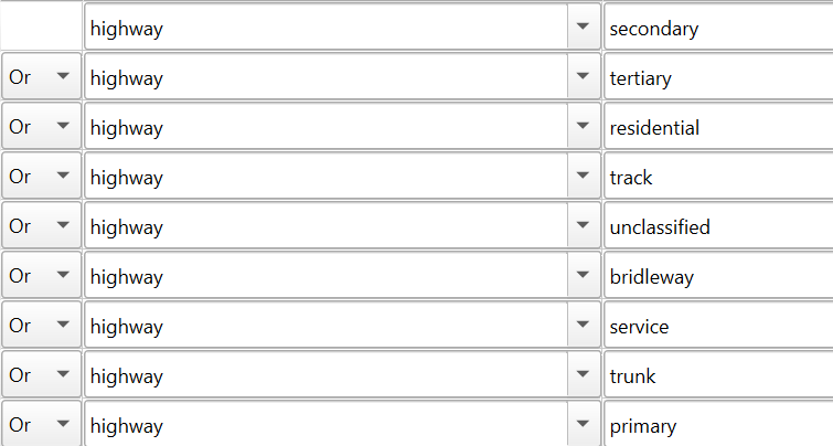
Using QGIS and the QuickOSM plug-in we can query above objects from OSM to quickly generate a road network including both tar roads and dirt tracks. This gives us a comprehensive overview how we can commute through valleys and across the mountains.
Target Points
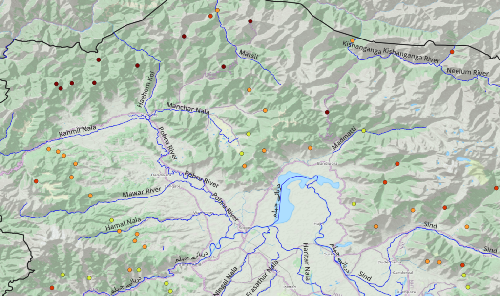
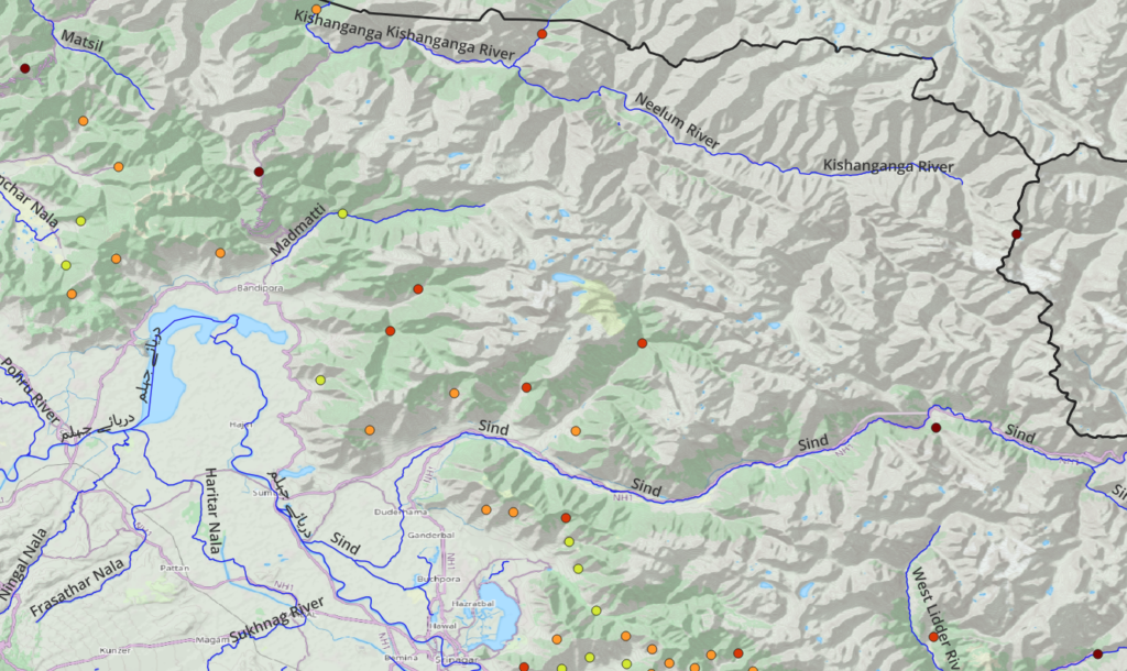
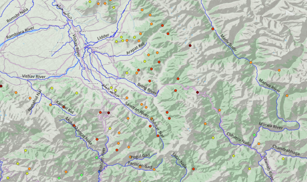
Overlaying this road network on a shaded relief map allows us to quickly identify mountain passes (where roads cross ridgelines) and end-points in valleys and slopes both which make scenic candidates for exploration. These target points provide the most remote and higher altitude points which provide scenic destinations on wheels across the most remote J&K hamlets.
After identifying all target points we get a beautiful overview map of scenic cycle and bike destinations both last points in the valleys as well as across mountain passes connecting neighboring valleys. Density of these points is higher in the foothills where the road network is more extensive.
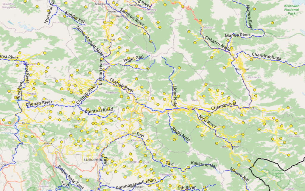
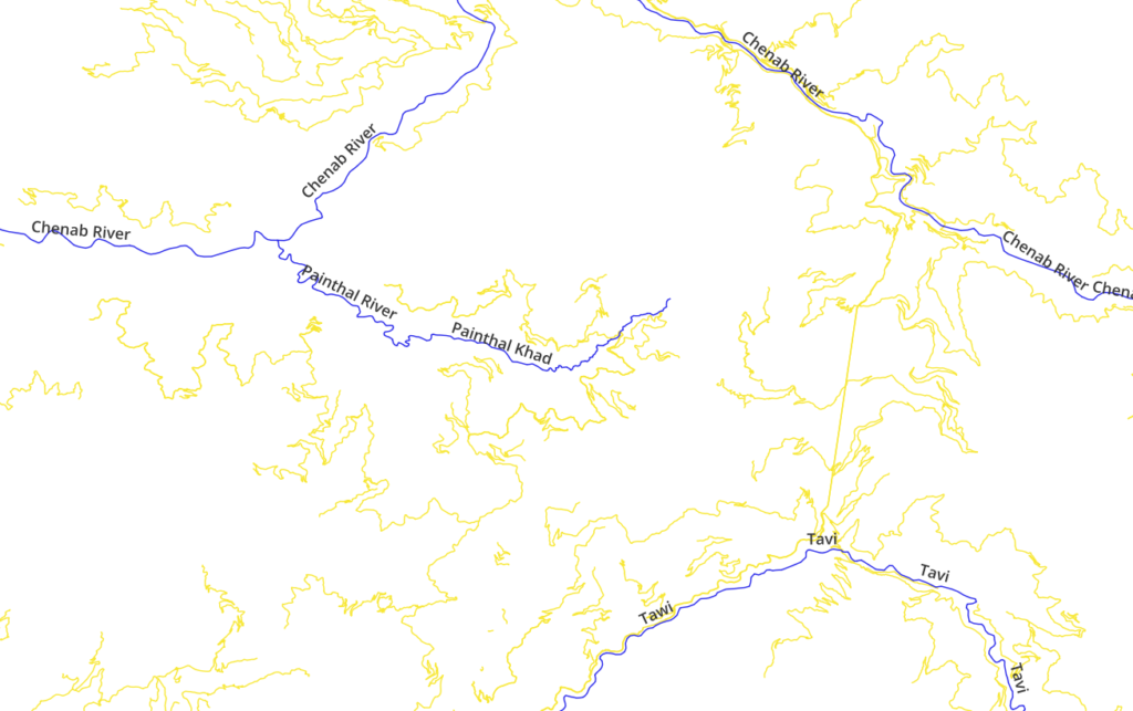
Not every possible road is mapped in Open Street Maps. We can identify additional roads by analyzing high res satellite imagery where additional roads can easily be identified in non forested regions.
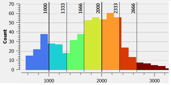
Elevation
We identified a total of 600 target points (mountain passes + end-points) across J&K which allow us to drive to the most interior regions of the Himalayas and across mid altitude passes. Below histogram shows the altitude range of these points ranging between mostly between 600m till 2600m offering excellent elevation range to explore.
Settlements
Zooming into Open Street Maps thousands of small villages, hamlets and isolated dwellings reveal themselves which form perfect pit-stops for night halt, food supply, guidance and charging electronics along your road trip.
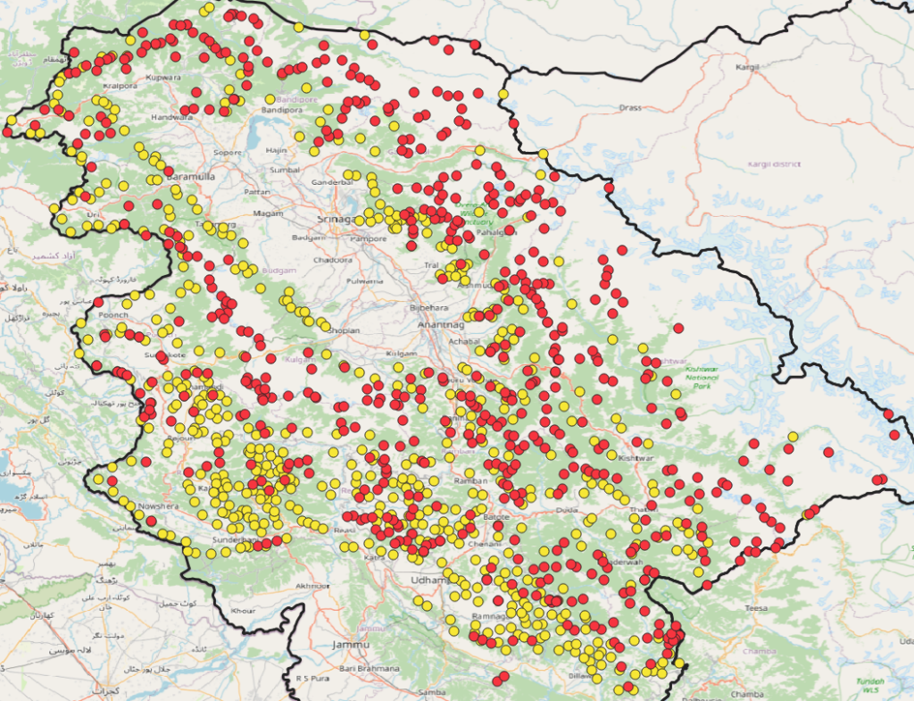
Biking vs Hiking
Comparing both bike points (yellow) and hiking mountain passes (red) we observe that there is a good overlap between both with steeper sections accessible only on foot.
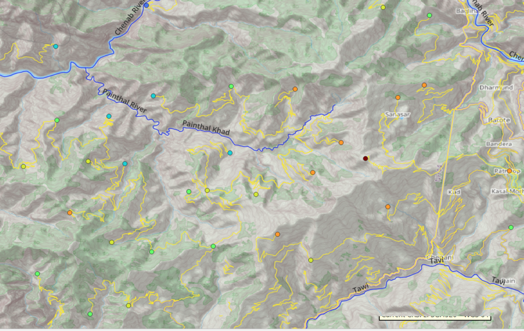
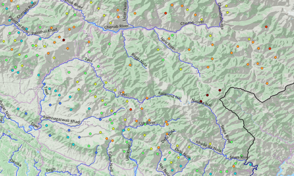
Cycle/Bike Points
Southeast
Southwest
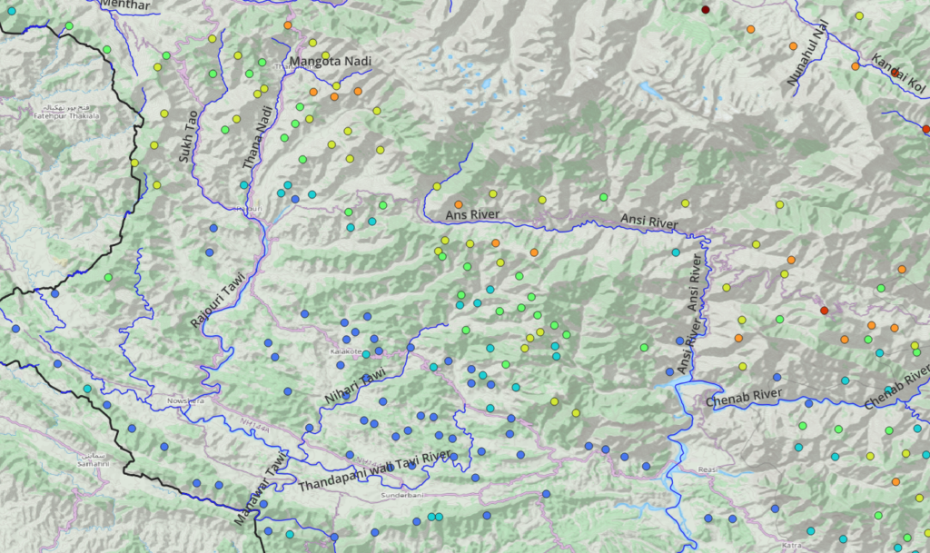
Midwest
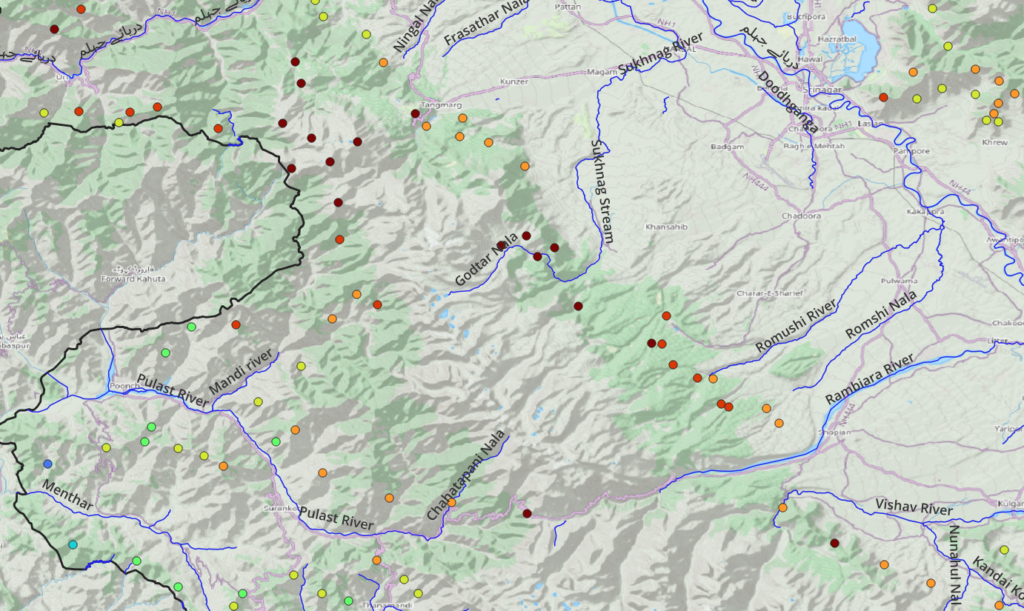
Northwest
Northeast
Mideast
Become a patreon to get access to thousands of kms of cycle routes for planning your next long-distance touring journey.