
Introduction Kosta from Australia, one of my Patreons, is on a solo 6 months mission through the Indian and Nepal Himalayas…

Introduction Kosta from Australia, one of my Patreons, is on a solo 6 months mission through the Indian and Nepal Himalayas…

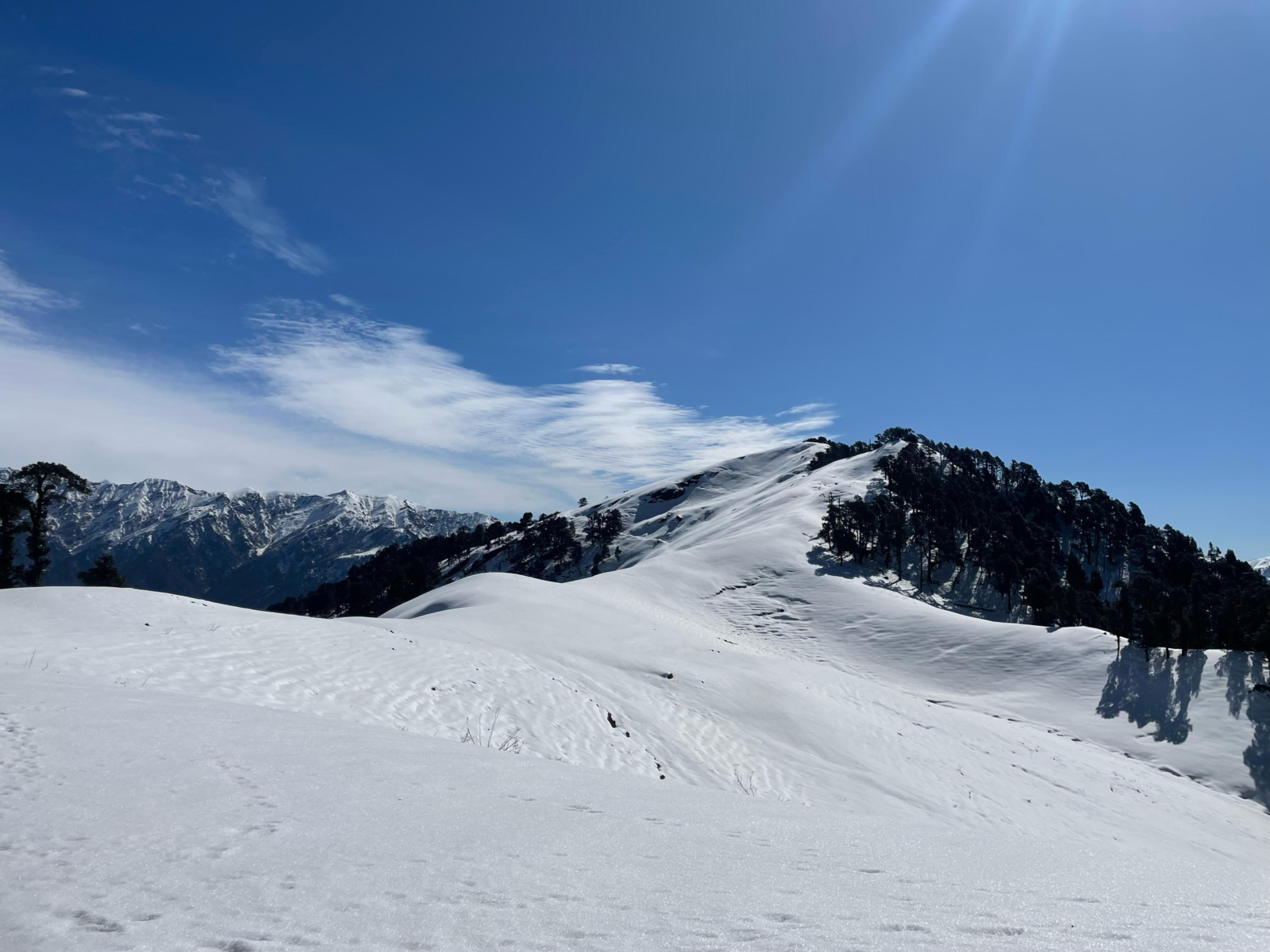
In this post we explore mesmerizing views on the Himalayas along any given hiking route. During my 4 months Trans…
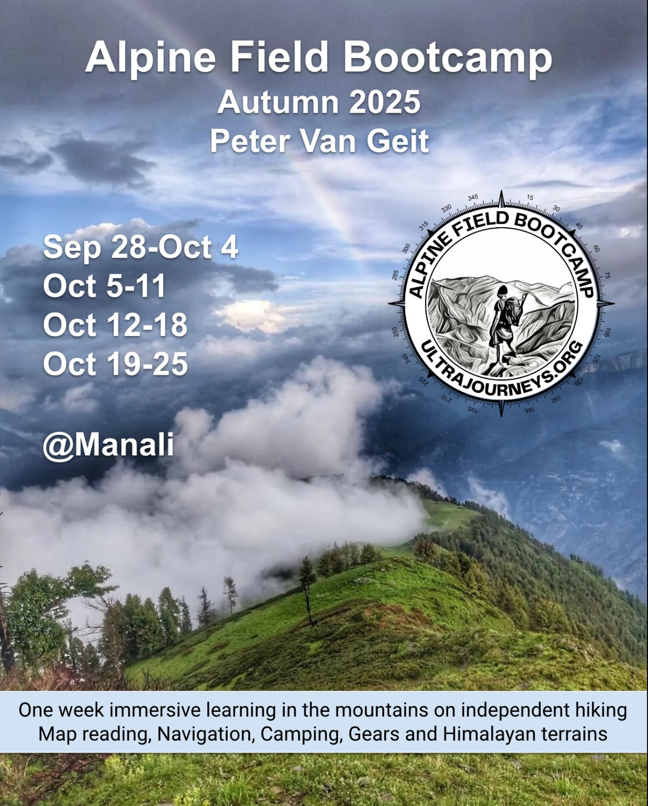
Summary Selim Baykara from Germany attended the Alpine Field Bootcamp in May 2025 and is planning a 6 months journey through the…
Introduction Adam Weifen from South Australia attended the Alpine Field Bootcamp in May 2025 and immediately planned a small 2…
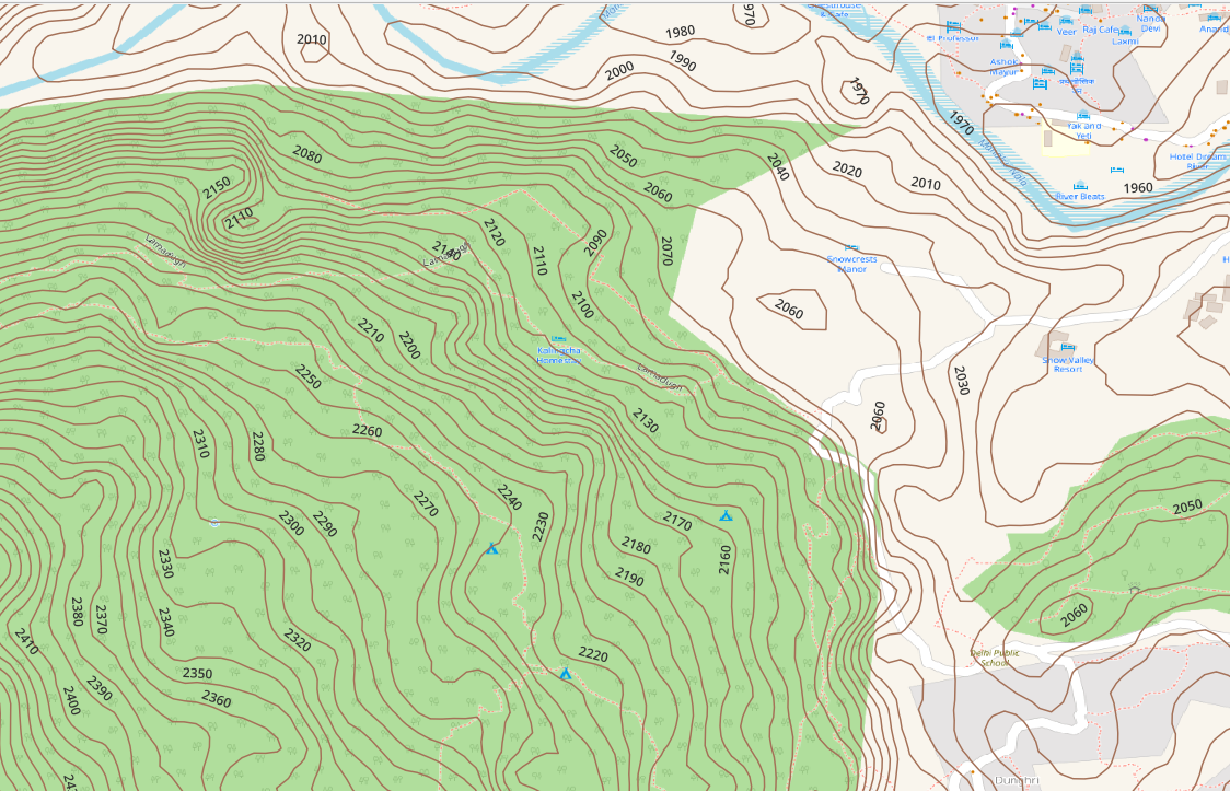
Topography is represented on topographic maps through contour lines. Most contours are generated from 30 meter (1 arc sec) DEM…
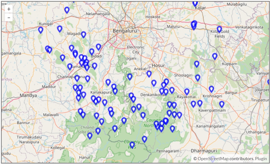
In the map below you can find some 100 hillocks in the outskirts of Bangalore which can be hiked with…
Stories over here Memories View this post on Instagram A post shared by Peter Van Geit (@petervangeit) View this post…
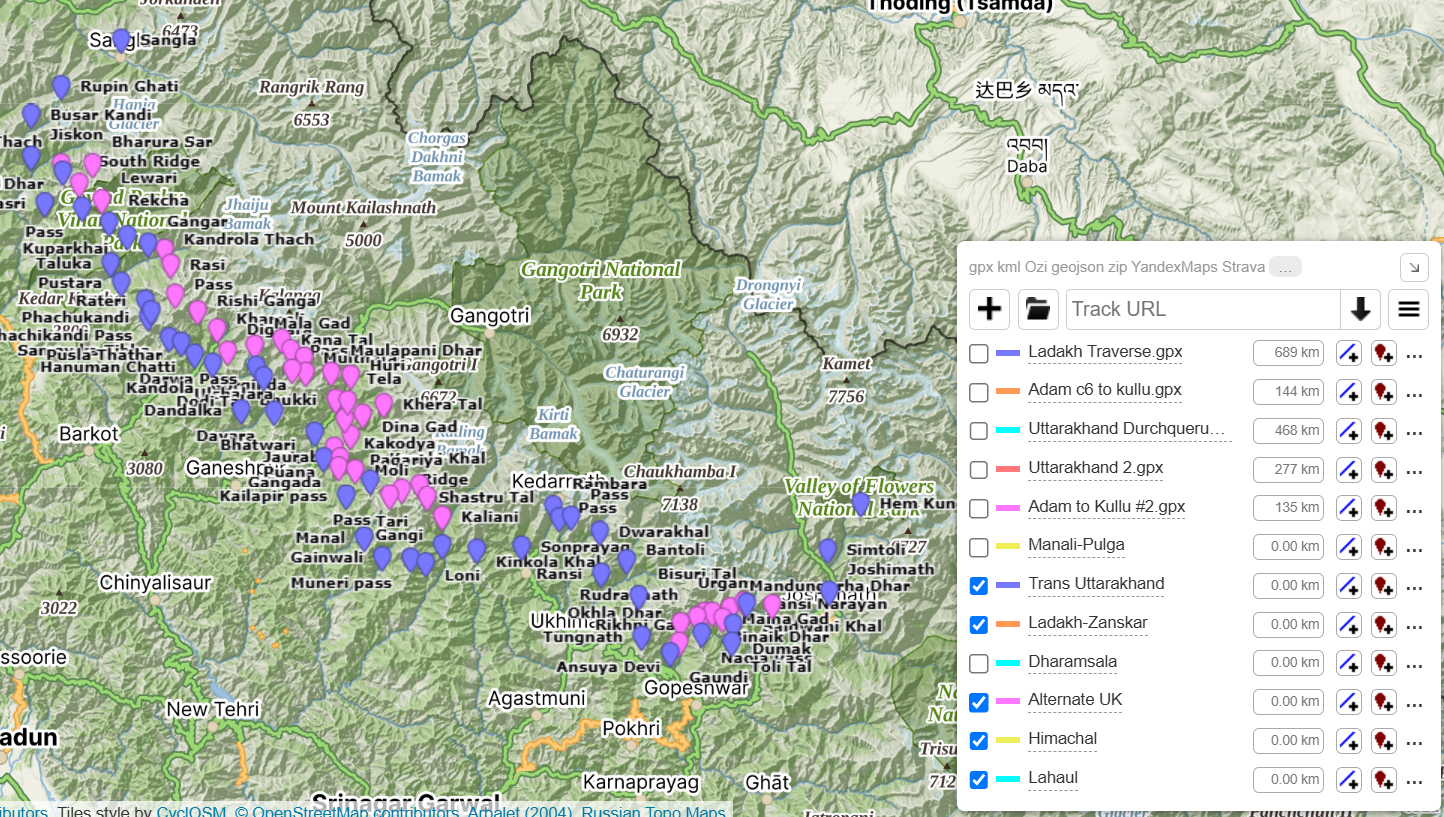
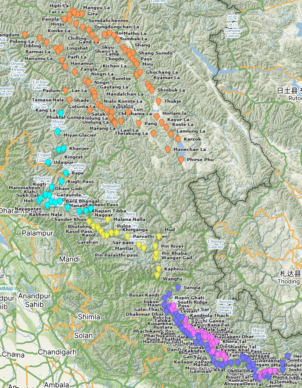
Open Street Maps has more than 750 hiking routes totaling 13 thousand kilometers of scenic trails across the Western Indian…
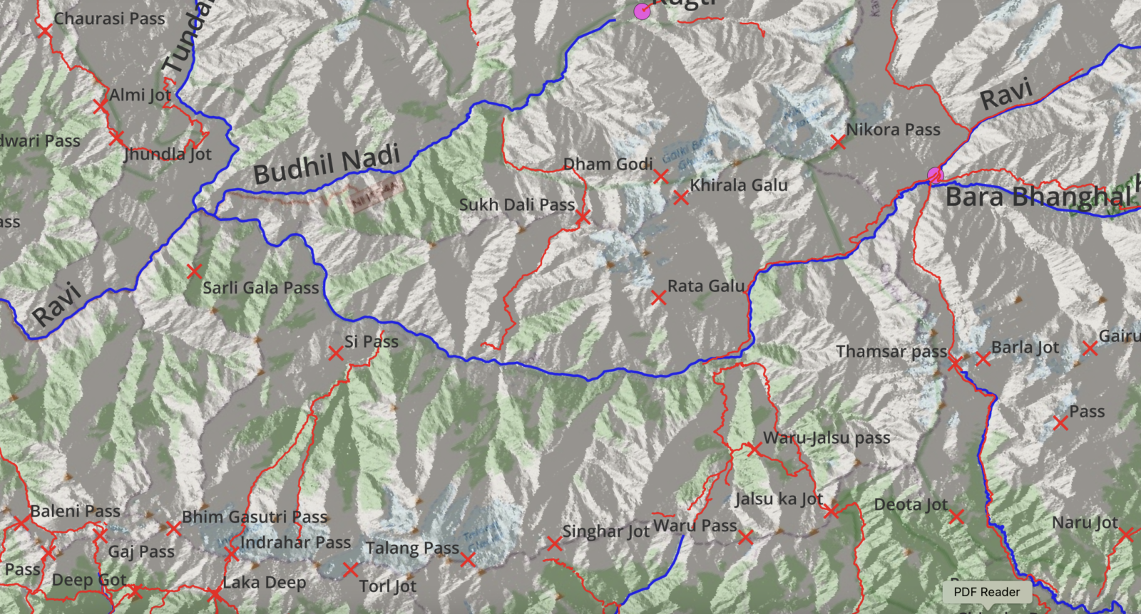
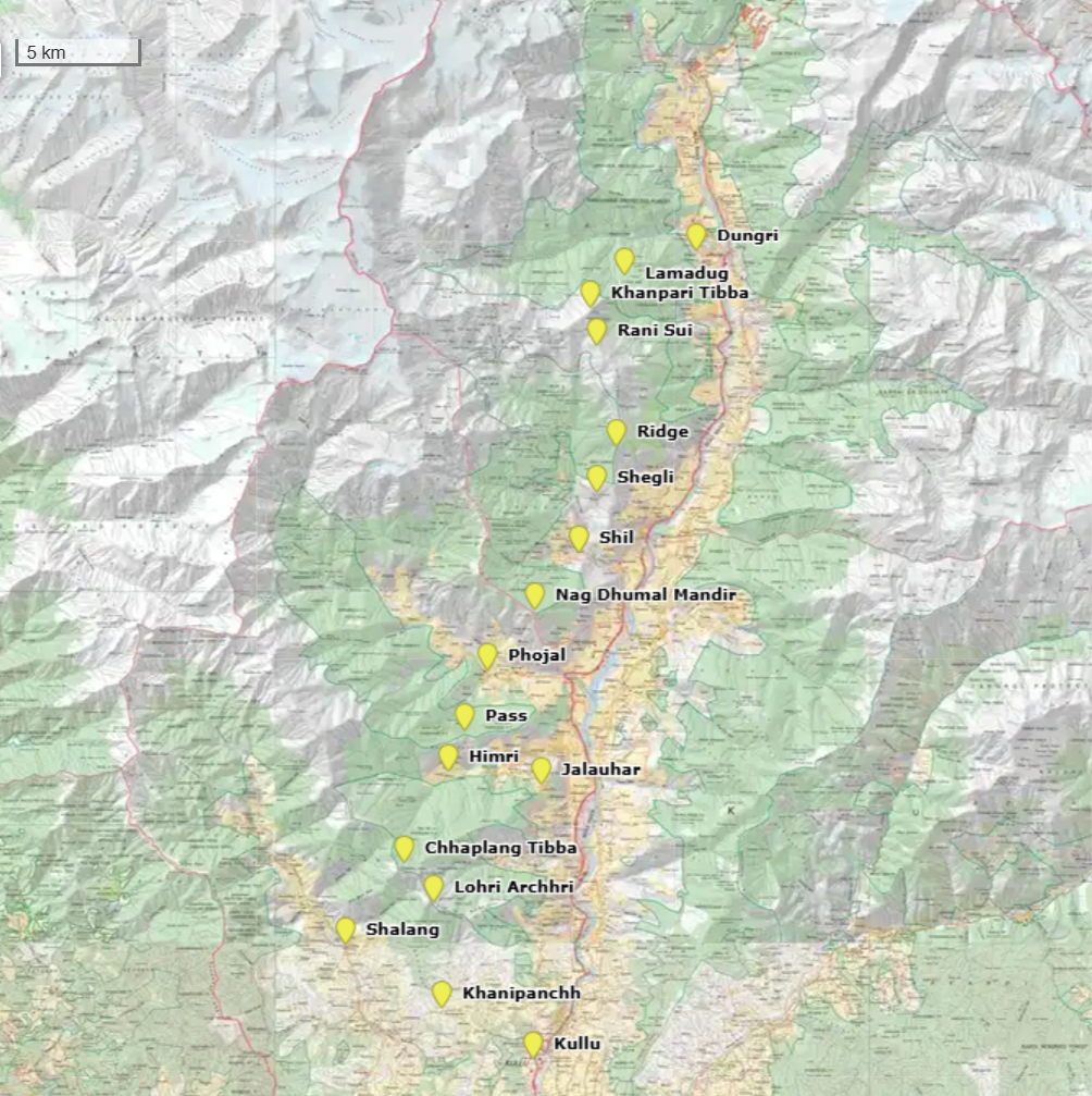
For the Alpine Field Bootcamp I generated a few high resolution topographic maps for the 4 states of the Western…
Introduction My name is Johan Solberg, and growing up in Norway, hiking was a natural part of my life. After…