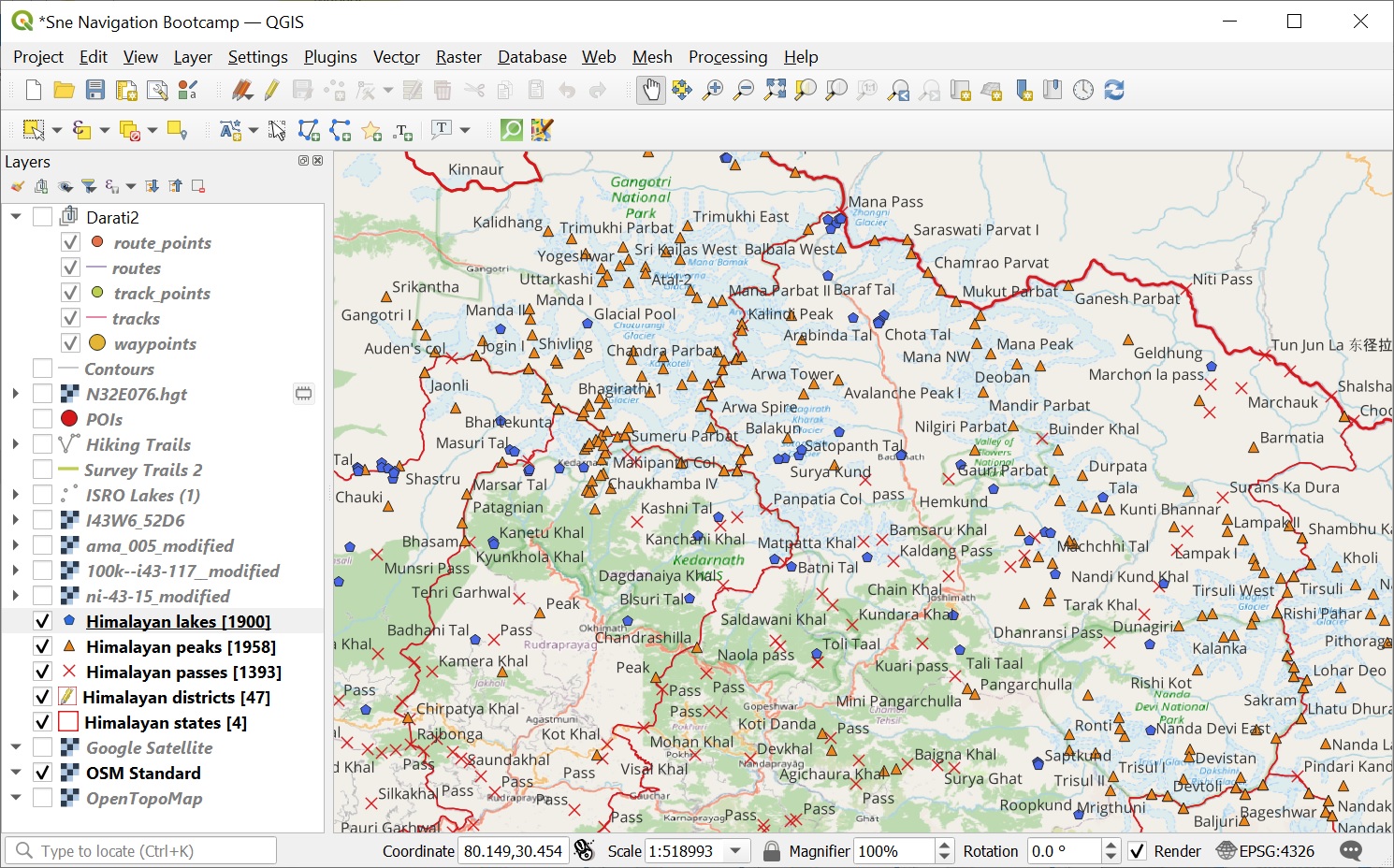
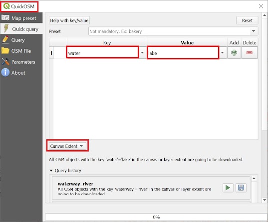
In this module we will query and visualize Alpine lakes from Open Street Maps in QGIS. Lakes are defined in OSM with tags “natural=water” and “water=lake”. Ensure the 4 Himalayan states are visible in the current QGIS map view. Open up QuickOSM and query for “water=lake” in the “Canvas Extent” to retrieve all lakes in current map view. See Images 1+2 below.
Unlike passes and peaks (point features), lakes are returned as polygon features in vector layer.
Visualization
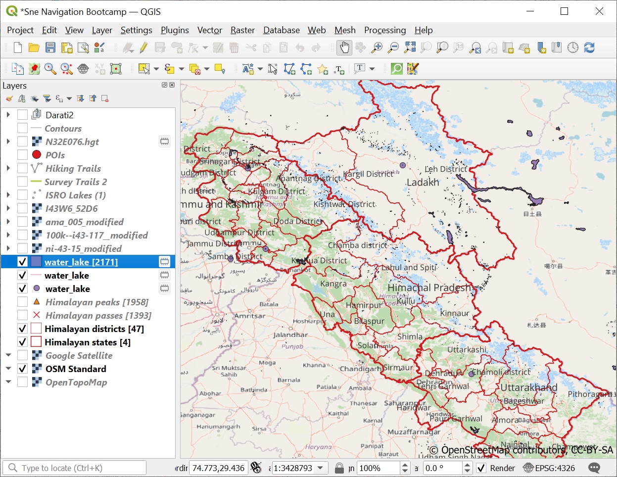
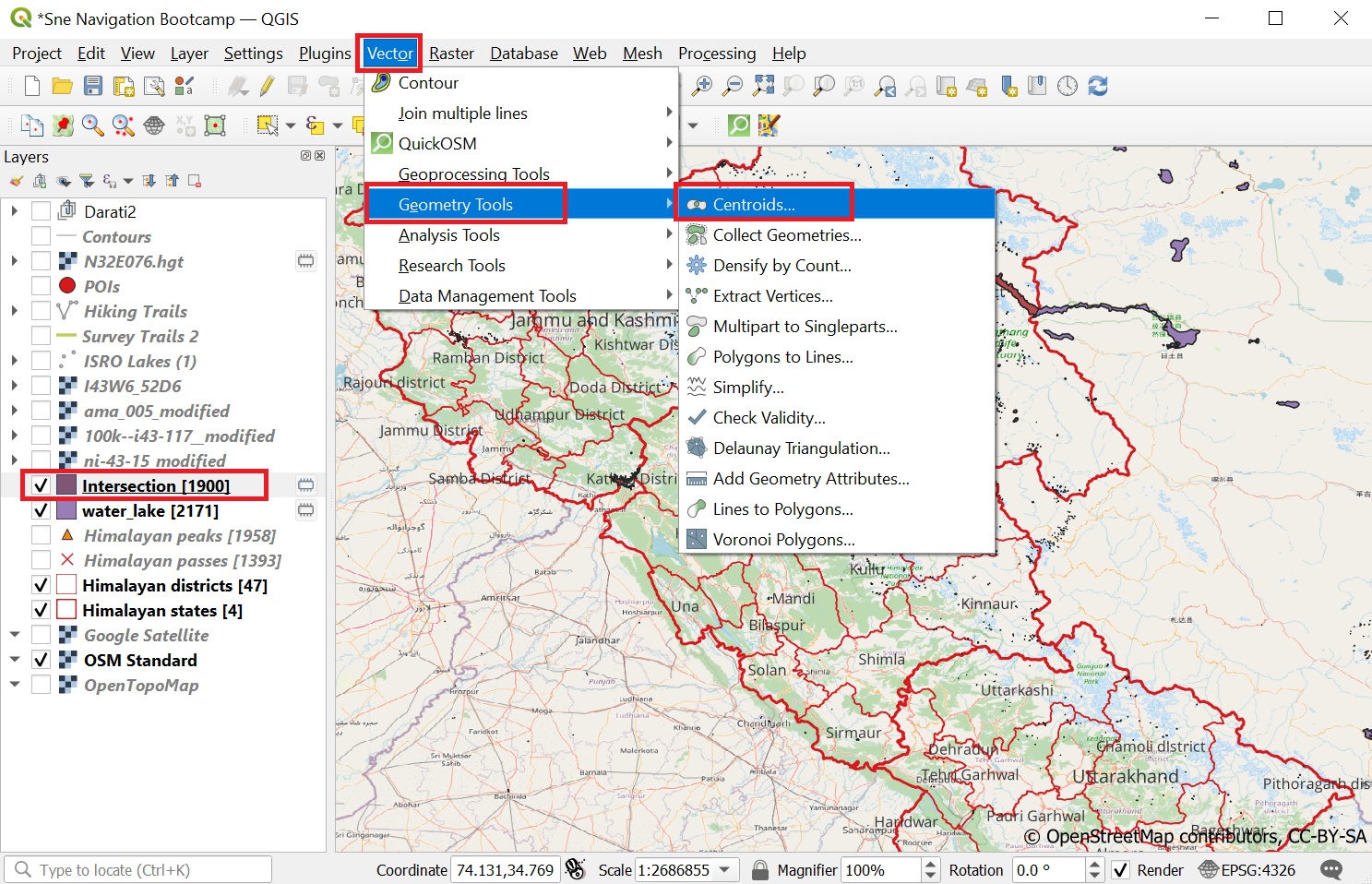
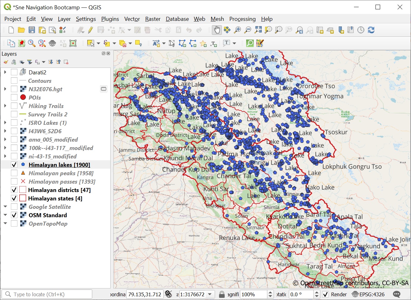
For a more comprehensive visualization of lakes we will use the “Centroids” Vector processing tool in the “Vector”, “Geometry Tools” menu. This will return the center of each polygon clearly showing the lakes at any zoom levels. See Image 1 below.
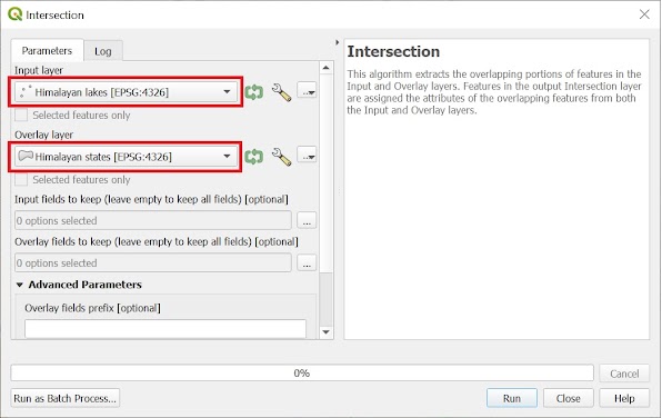
Similar to peaks and passes run the “Intersection” Geoprocessing tool on the centroids overlaid with the Himalayan States. This will result in some 1900 lakes located in the Western Himalayas. See Image 2 below.
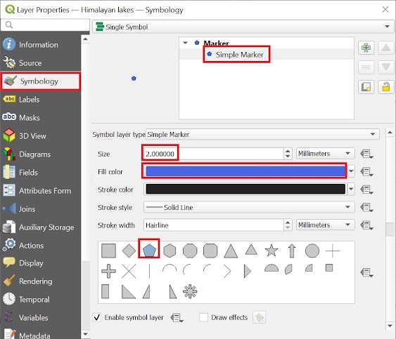
Open up the “Symbology” tab for the lakes vector layer and visualize lakes using a blue pentagon to distinguish from the peaks and passes. See Images 3+4 below.
Save the resulting lakes vector layer as an ESRI Shapefile and remove the earlier / temporary layers.
Assignment
Acknowledge your understanding of the concepts learned by submitting the assignment below