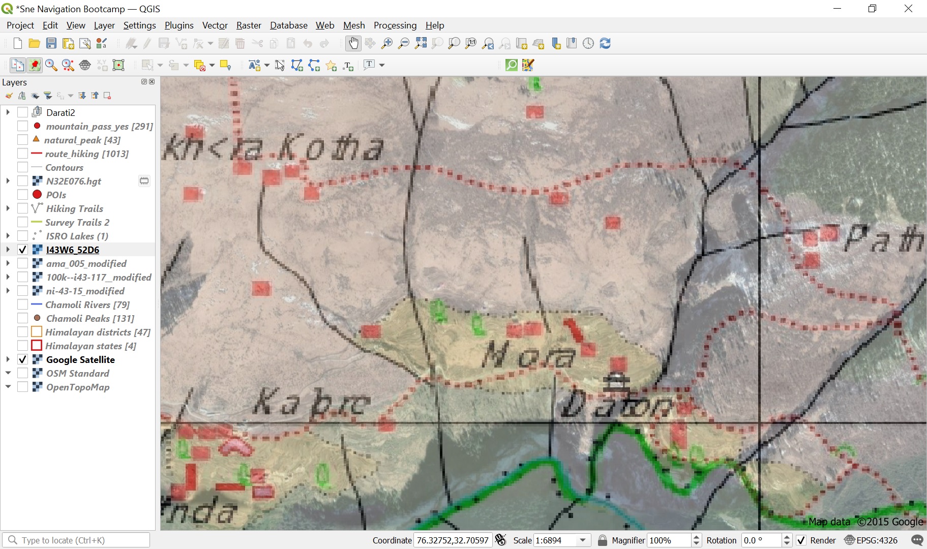
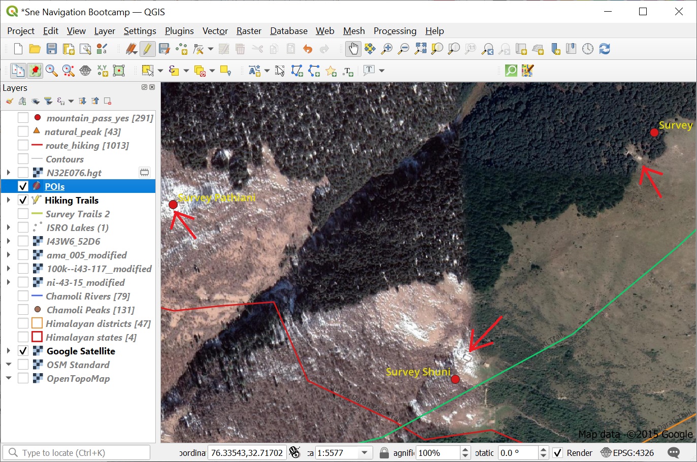
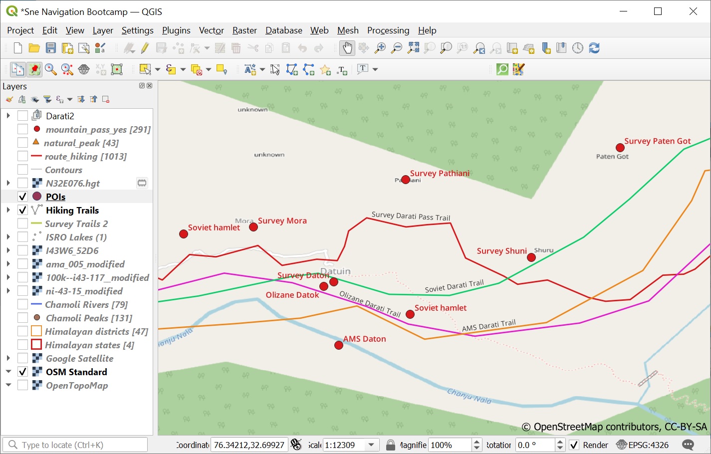
In this final module we ll be cross referencing the digitized features of Survey, Olizane, Soviet and US AMS maps with the actual features on the Satellite map to identify which maps are most accurate. Open up a Google Satellite base map from the Web – QuickMapServices – Google menu. See Image 1 below.
Analysis
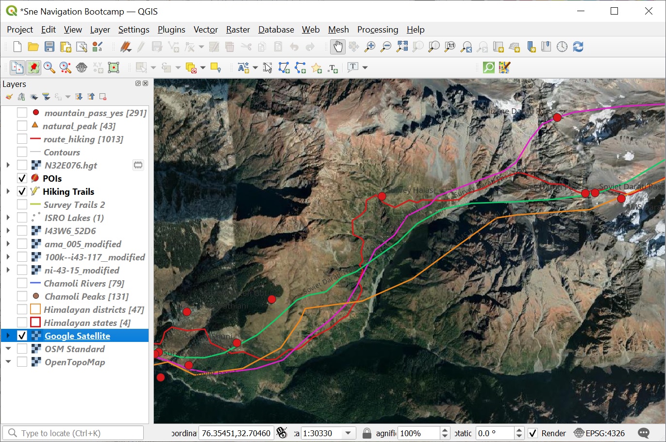
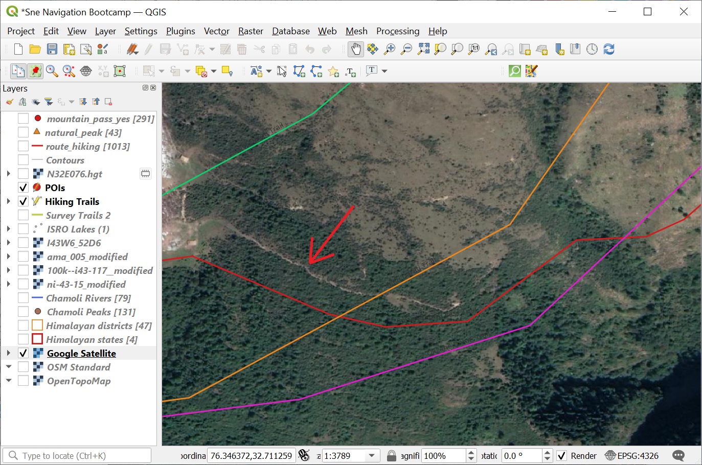
Zoom into the lower part of the valley until the actual trail and surrounding settlements appears on the Satellite map. Higher up, closer to the Pir Panjal ridgeline, scree, snow and moraines will fade out the trail. Check which of the 4 digitized trails matches closely to the actual trail. We can see the best match with the red Survey trail. Similar with the digitized settlements in the lower valley. See Images 1+2+3 below.
Darati pass
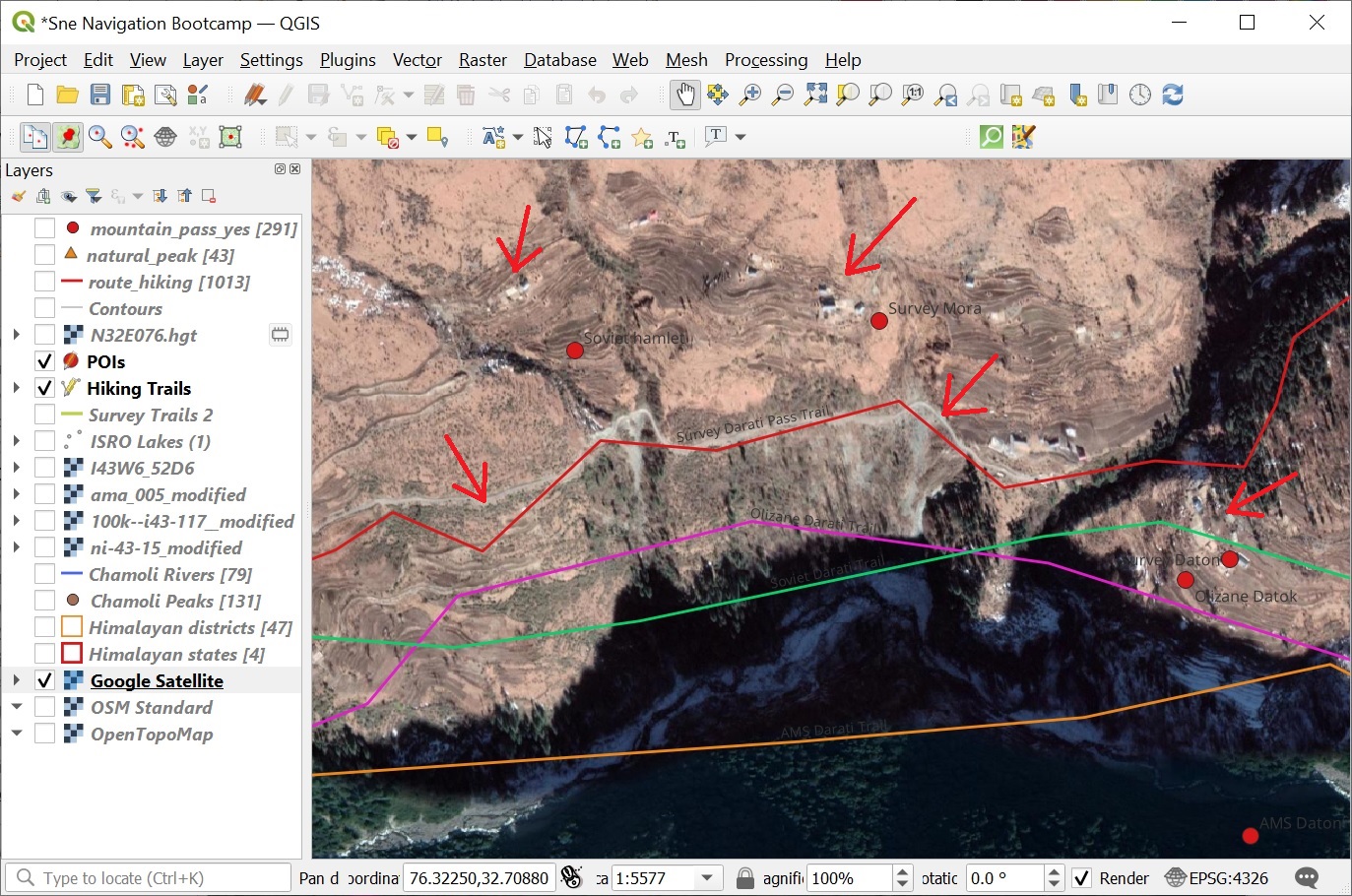
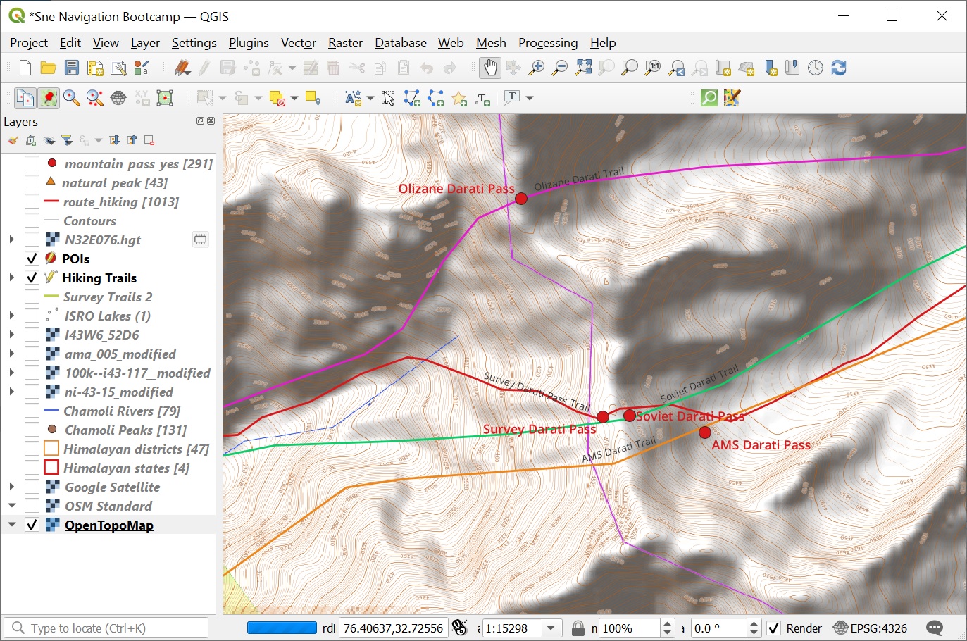
Higher up we see the digitized trails diverging: the Olizane map trail climbs up through a steep gully crossing over the Pir Panjal through another saddle and descending through a different side-valley. The Survey, Soviet and AMS trails climb up through different gullies but converge on the Pir Panjal ridge-line crossing over the same saddle and descending in the same side-valley. See Image 1 below.
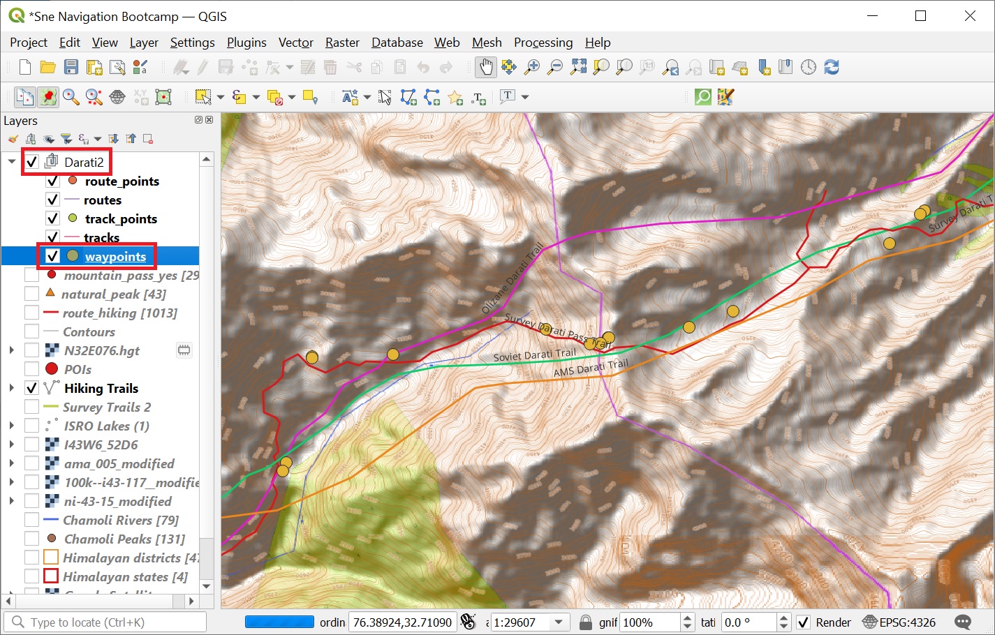
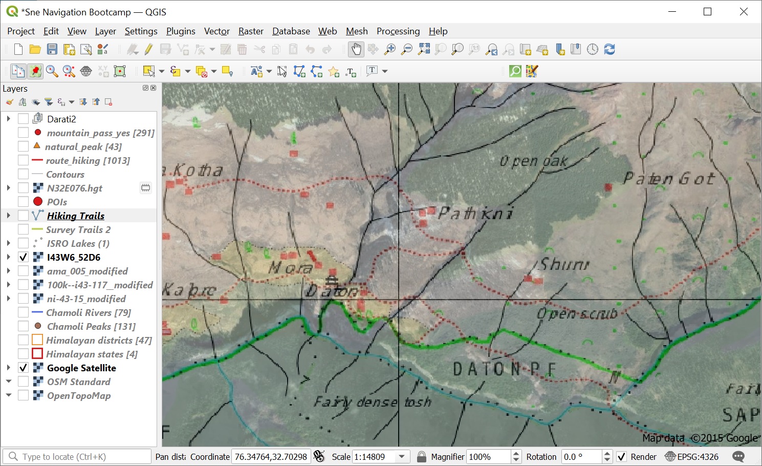
Now let’s try to identify the actual location of the pass. As this 5000m high ridge-line is permanently covered in snow we cannot identify the actual pass on the Satellite map. In 2019 I crossed over the Darati pass but unfortunately did not GPS record my route (battery concerns). Still I took many photos which fortunately were (auto) geo-tagged (latitude, longitude embedded). I extracted the geo-tags from the photos into a GPX file:
https://drive.google.com/file/d/1BgI-68xn68W82RRiYFphl970VZVGu_Mz/view?usp=sharing
Overlaying (drag-n-drop in QGIS) these geo-tags on the map clearly reveals the actual pass and trail across the Pir Panjral range. See Image 2 below (yellow points). We can see a pretty accurate match with the Survey trail.
Survey map
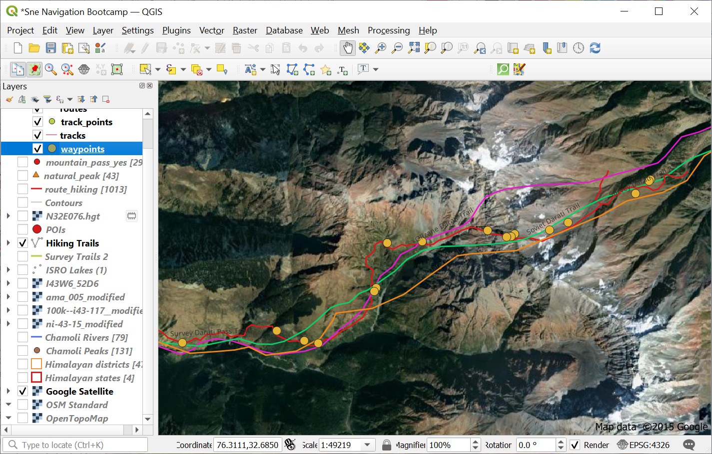
Another interesting way to verify the accuracy of the features on a map (without digitizing) is to transparently overlay it over a Satellite map. Below we overlay the Survey map with 50% transparency over a Google Satellite map. We can see a pretty accurate match of trails and surrounding settlements. See Images 2+3 below.
Assignment
Acknowledge your understanding of the concepts learned in this module by submitting the assignment below