
There are many Open Street Map viewers, both web based (planning on laptop) and mobile (offline navigation in mountains) based. All are visualizing the same OSM data set in different ways, suitable for different purposes. Let’s take a closer look at a very useful one – Waymarked Hiking Trails (WHT) – particularly suitable for planning hiking routes and longer traverses.
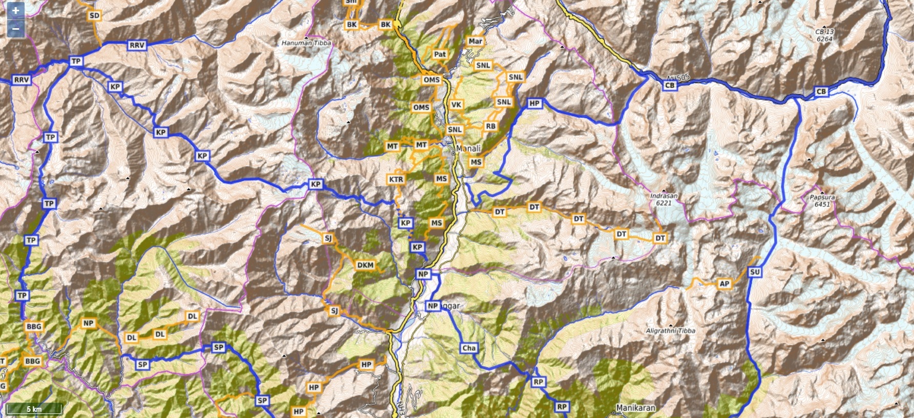
Where the standard OSM web site (osm.org) shows hiking trails only at high zoom level / low scale, WHT will present a comprehensive overview of available hiking trails in a given region at any scale. Let’s take a look around Manali:
https://hiking.waymarkedtrails.org/#?map=11!32.2082!77.1993
(open on mobile or laptop)
One can zoom in / out to show more / less hiking routes:
Hiking Networks
Hiking routes are categorized in 4 different networks / scales: local (purple), regional (orange), national (blue) or continental (red). At high scale / low zoom intercontinental & national networks are shown, at lower scale / high zoom regional & local trails are shown, preventing the map view from getting too congested at any scale. Similar like Google Maps shows national highways at country level and regional roads at neighborhood level. Let’s take a look at Western Europe which has many hiking routes in all 4 networks:
https://hiking.waymarkedtrails.org/#?map=6!48.3664!12.2358
(open on mobile or laptop)
Left view shows continental / national hiking routes at European level. Right view shows regional / local hiking routes in a specific region of Germany. Zoom in / out and pan around to show /hide more routes:

Hiking Routes
Click on any hiking route to show more details about that route. Let’s take a closer look at the Hampta pass. You can either Search (bottom left corner) or click on the “HP” route tag or click the “Routes” (bottom right corner) to list all routes in current map view and select “Hampta Pass”. For a given route key details are shown: total distance, elevation / altitude profile, total ascent (elevation gain) and descent (elevation drop). You can also download the GPX (GPS log) of the route which will be useful for offline navigation using your phone.
https://hiking.waymarkedtrails.org/#route?id=11230779&map=12!32.2636!77.3434
(open on mobile or laptop)

Planning Traverses
WMT is especially useful for planning longer traverses across entire mountain ranges / valleys / districts. Let’s identify a traverse (sequence of hiking routes) from Pangan in Kullu valley – Bara Bhanghal – Barot valley – Lug valley – back to Kullu valley. In this case we could put following sequence together across 5 passes / 6 valleys:
Pangan village (Beas river)
Kaliheni pass – 54km, 5300m gain
Bara Bhanghal (Ravi river)
Thamsar pass – 33km, 2975m gain
Bada Gran (Uhl river)
Nohru pass – 11km, 950m gain
Lohardi (Lumba Dug Khad)
Sari pass – 27km, 2700m gain
Gramang (Sarbari Khad)
Himri pass – 22km, 2700m gain
Himri village (Beas river)
=========
Total traverse – 147km, 14625m elevation gain
Review the entire traverse and all individual hiking routes on the WMT map below:
https://hiking.waymarkedtrails.org/#?map=11!32.166!77.0153
(open in mobile or laptop)


Assignment
Similar as above, plan a traverse from Sarchu in Lahaul to Lamayuru in Ladakh by identifying a sequence of connected hiking routes. There are multiple possibilities in this case, just pick any proper sequence. List the individual routes (distance, gain), river valleys and the overall traverse distance / elevation gain.
