
Kyrgyzstan spans a vast region of the Northern Himalayas over 11 longitudes (69-80 East) and 4 latitudes (39-43 North). It’s tucked between Kazakhstan (North), Tibet (East), Tajikistan (South) and Uzbekistan (West). In this post we present the overall geography of Kyrgyzstan including major ranges and valleys and how to use Soviet topo sheets to plan a Himalayan traverse across a vast trail network spanning 950 mountain passes inter-connecting hundreds of valleys.
- Northern Himalayas
- Geography
- Trans Kyrgyzstan
- Mapping Kyrgyzstan
- Planning a Traverse
- Offline Navigation
Northern Himalayas
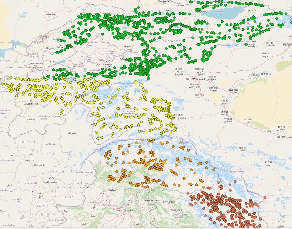
Comparing sizes and mountain passes of Kyrgyzstan (green) with Tajikistan (yellow), Karakoram (Pakistan, orange) and Ladakh (India, red)
| Region | Longitude | Latitude | Passes |
| Kyrgyzstan | 69-80E (11) | 39-43 (4) | 950 |
| Tajikistan | 68-75 (7) | 37-39 (2) | 360 |
| Karakoram (Pak) | 72-77 (5) | 35-37 (2) | 200 |
| Ladakh | 76-79 (3) | 32-35 (3) | 300 |
Geography
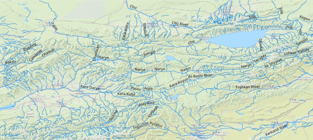
Kyrgyzstan spans a vast Himalayan region of 11 longitudes (1200km) and 4 latitudes (440km). There s a wide valley in the Southwest and a large lake in the Northeast, both surrounded by many high ranges. Above shows the major rivers / valleys which drain snow and glacial melt from the surrounding high ranges including the Talas, Chu, Naryn, Kyzylsu, Darya and Toshkan.

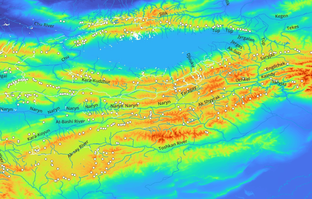
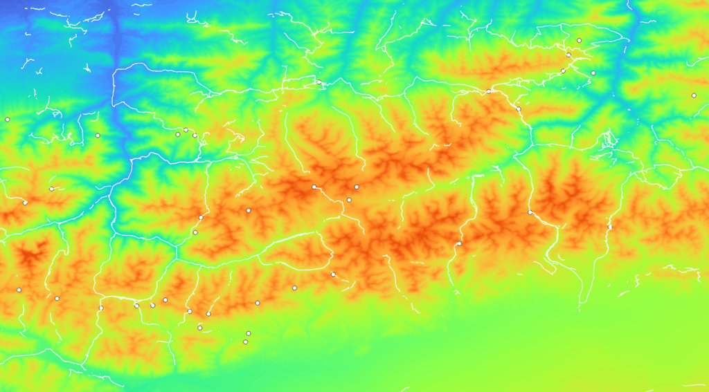
These elevation maps clearly show the high ranges (ridgelines) in yellow/orange/red and the valleys in blue/green. We overlay 950 mountain passes identified using Soviet topo sheets (white dots) which allow you to hop across the high ranges connecting neighboring valleys. Trails mapped in Open Street Maps (white lines) are also shown.
Trans Kyrgyzstan
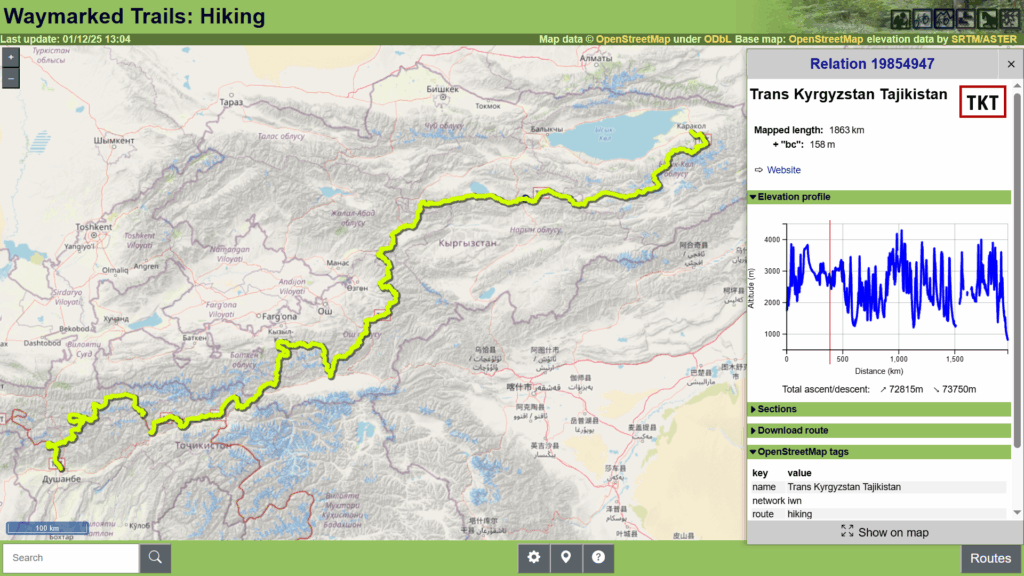
I recently mapped a 2000km long traverse across Tajikistan and Kyrgyzstan in OSM:
Mapping Kyrgyzstan
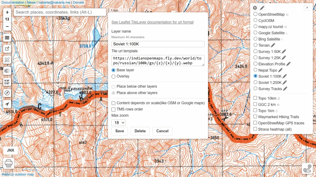
To map 950 mountain passes inter-connecting hundreds of valleys in Kyrgyzstan we used 1:100K and 1:200K Soviet topo sheets. You can add below custom layers to nakarte.me to view the same:
- Soviet 1:200K: https://indianopenmaps.fly.dev/world/topo/russian/200k/gs/{z}/{x}/{y}.webp
- Soviet 1:100K: https://indianopenmaps.fly.dev/world/topo/russian/100k/gs/{z}/{x}/{y}.webp
- Mountain passes


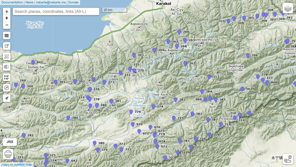
Trails are shown as black dashed lines on these Soviet maps. Mountain passes are marked as black crosses labeled as “nep.”
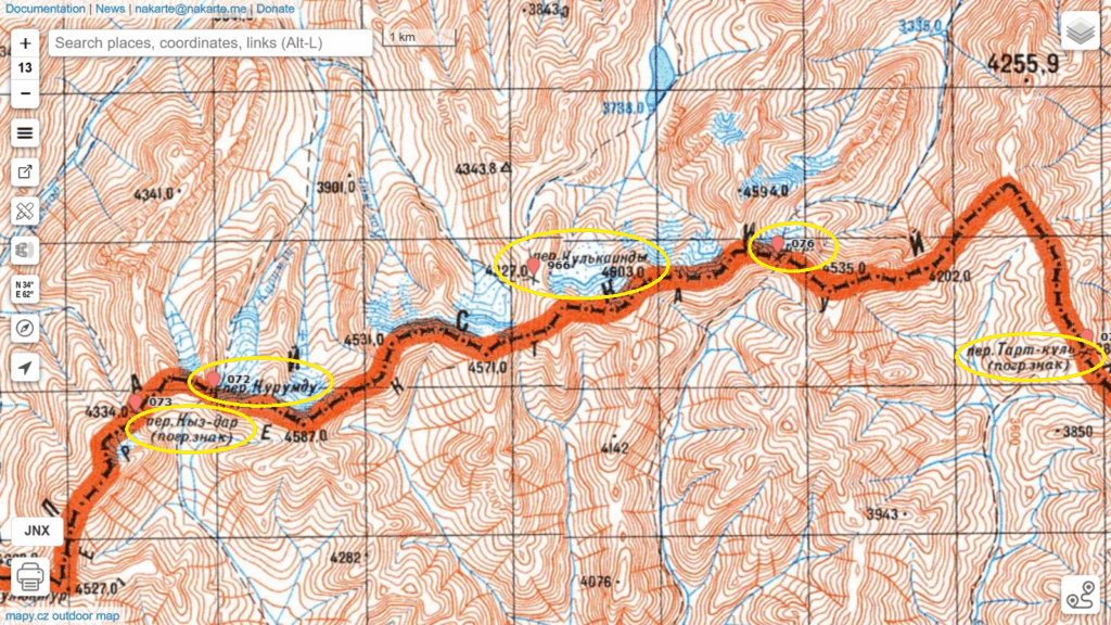
By mapping all mountain passes you create a blueprint for Himalayan traverse planning identifying which points you can hop across mountain ranges to interconnect neighboring valleys.
Planning a Traverse
Planning a Himalayan traverse across Kyrgyzstan is now a matter of “connecting the dots”. Mark a sequence of mountain passes that allow you to hop across mountain ranges and valleys in a continuous route. Say for example we wish hike from the Toshkan river valley in Tibet across the border through the Ak Shyyrak, Naryn, Djuuku river valleys to reach the Issyk Kul lake in Northeast Kyrgyzstan.
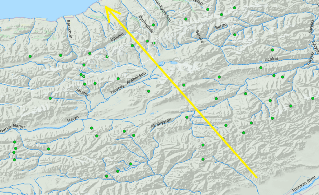
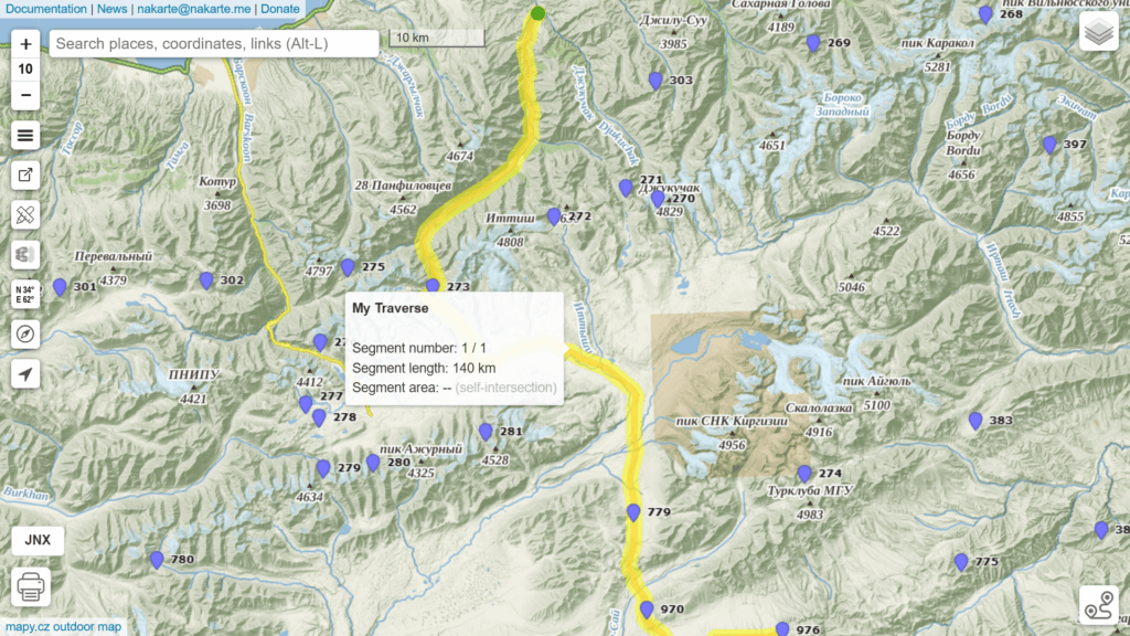
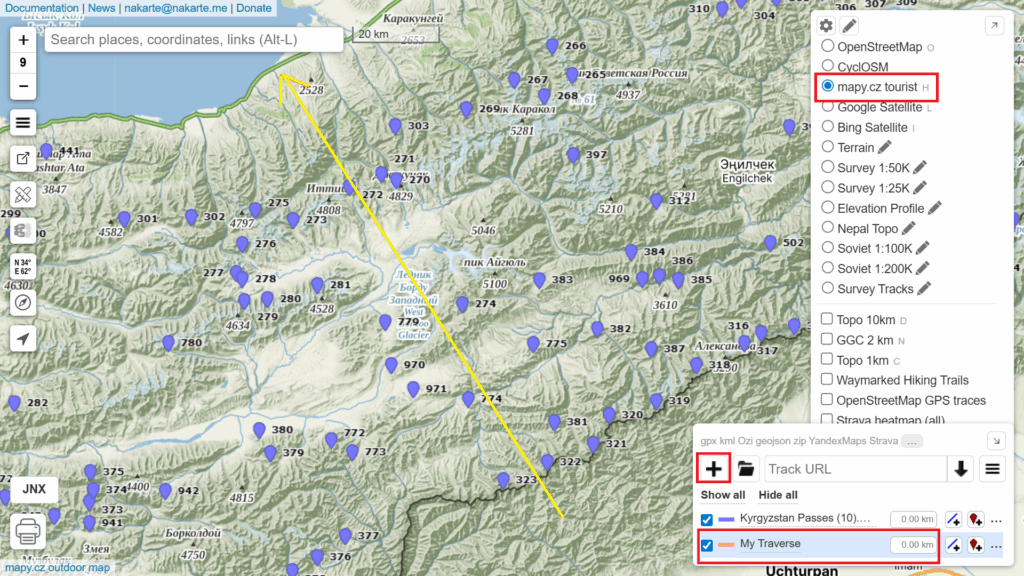
Open nakarte.me, select the “mapy.cx tourist” layer, load the Kyrgyzstan mountain passes and Create a New Track “My Traverse”. The yellow line shows the general direction of our planned route.
Zoom into 2-5km scale (better overview) Soviet 1:200K map layer or 1-2km scale (more accurate) Soviet 1:100K layer to mark the trails (black dashed lines) connecting the subsequent mountain passes. You can download the sample traverse over here to overlay on nakarte.me.
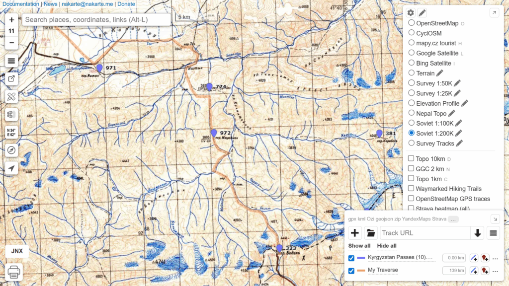
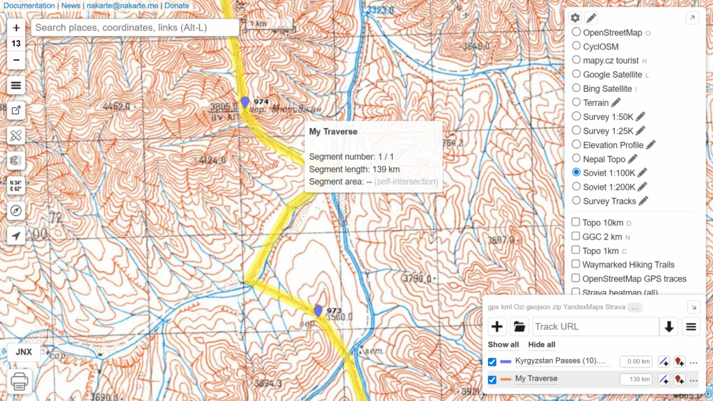
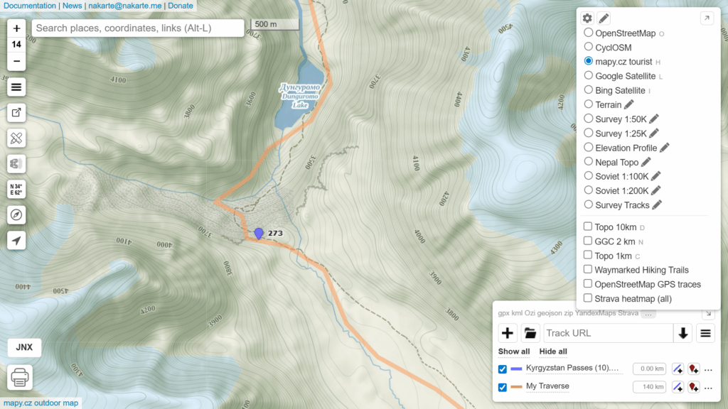
Once complete you can view the entire traverse on the “mapy.cz tourist” layer to get an overall idea of your route. View the Elevation Profile to get an idea of the vertical profile of your traverse including total distance (139km) and elevation gain (5150m).
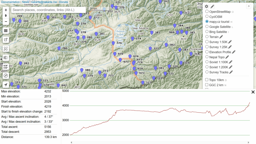
Limited routes across 950 mountain passes (10%) are mapped in Open Street Maps already providing more accurate (GPS recorded) routes than the less precise Soviet 1:100K trails. Still the Soviet maps should provide you with sufficient reference to explore any given route.
Offline Navigation
Once complete you can download the same traverse (GPX) on your phone and download the base map, hill shades and contours for Kyrgyzstan to start navigating the same offline. The Soviet 1:100K, 1:200K map layers above can be added to OSMAnd as online overlay map layer.
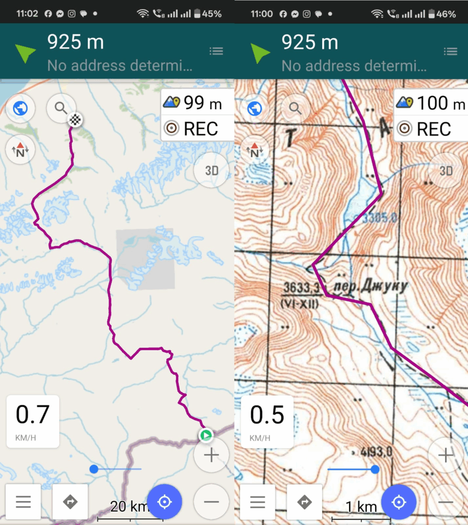
To create offline versions of the Soviet maps follow below steps in QGIS:
- Add XYZ layer with Soviet 1:100K webp URL
- In the QGIS Processing Toolbox use “Generate XYZ Tiles (MBTiles)” function to create offline map tiles in MBTiles format (Zoom levels 12-14, JPG 95%)
- Follow chapter 6.6 of my online alpine bootcamp to convert the MBTiles to SQLiteDb format which is supported by OSMAnd
- Download the SQLiteDb file on your phone and set as overlay map in OSMAnd