
Last couple of weeks I’ve been poring over Topographic maps, Satellite Imagery and Open Street Maps identifying thousands of kms of beautiful interior long distance cycle routes across 140 mountain passes and 40 major valleys in the foothills of Nepal Himalayas. Find below an overview of a true cycle touring treasure that takes us across the 5 mountain provinces spanning the entire width of Nepal from 1000 to 4000m altitude.
- Mountain Passes
- Provinces & Major Valleys
- Altitude Range
- Cycling vs Hiking
- Research
- Cycle Routes
Become a patreon to get access to thousands of kms of cycle routes
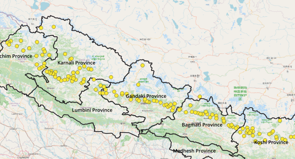
Mountain Passes
Around 140 cyclable mountain passes were identified using OSM mapped roads and dirt tracks as well as satellite imagery. We focused on the foothills of the Himalayas with heights ranging from 1300 to 4000m altitude providing significant elevation spread across these cyclable routes.
Provinces & Major Valleys
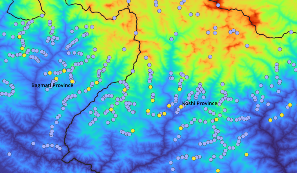
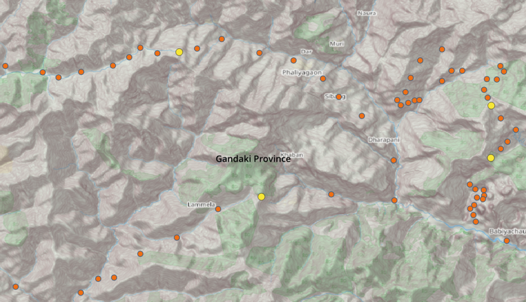
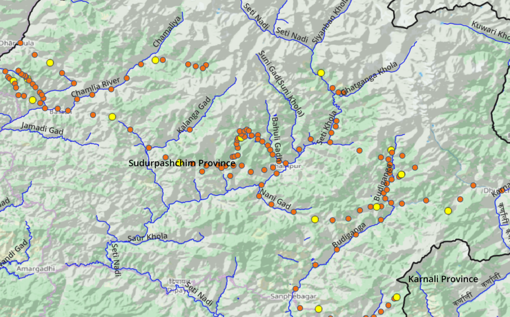
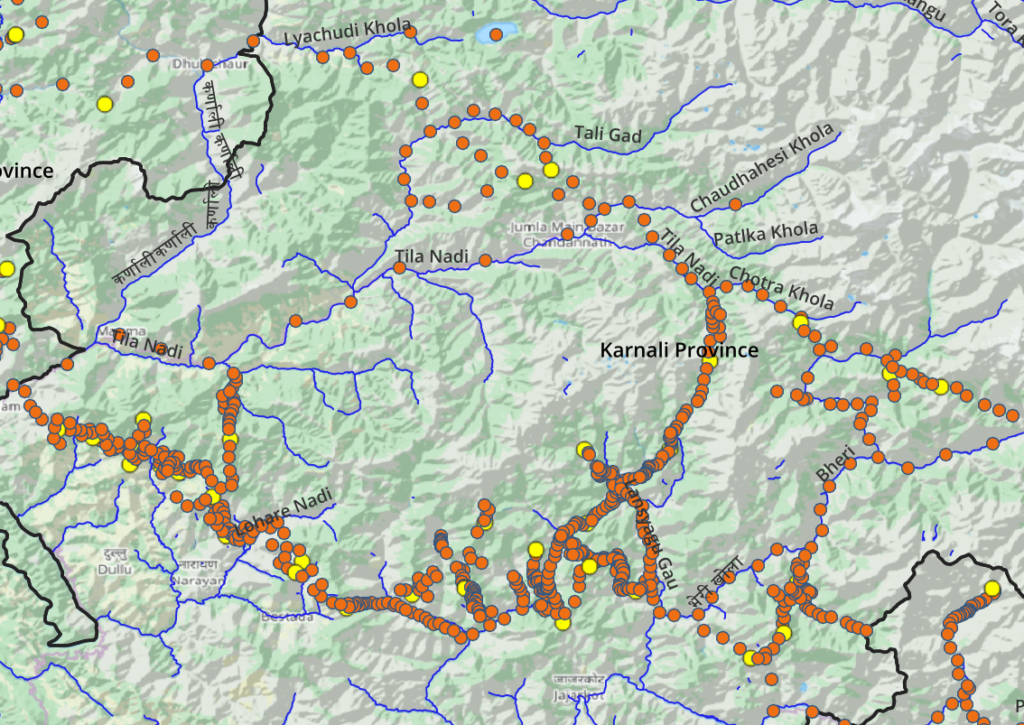
The cycle network spans the entire length of Nepal from West to East across 40 major river valleys. Mountain passes allow cyclists to cross over in-between ridgelines to quickly commute between neighboring valleys.
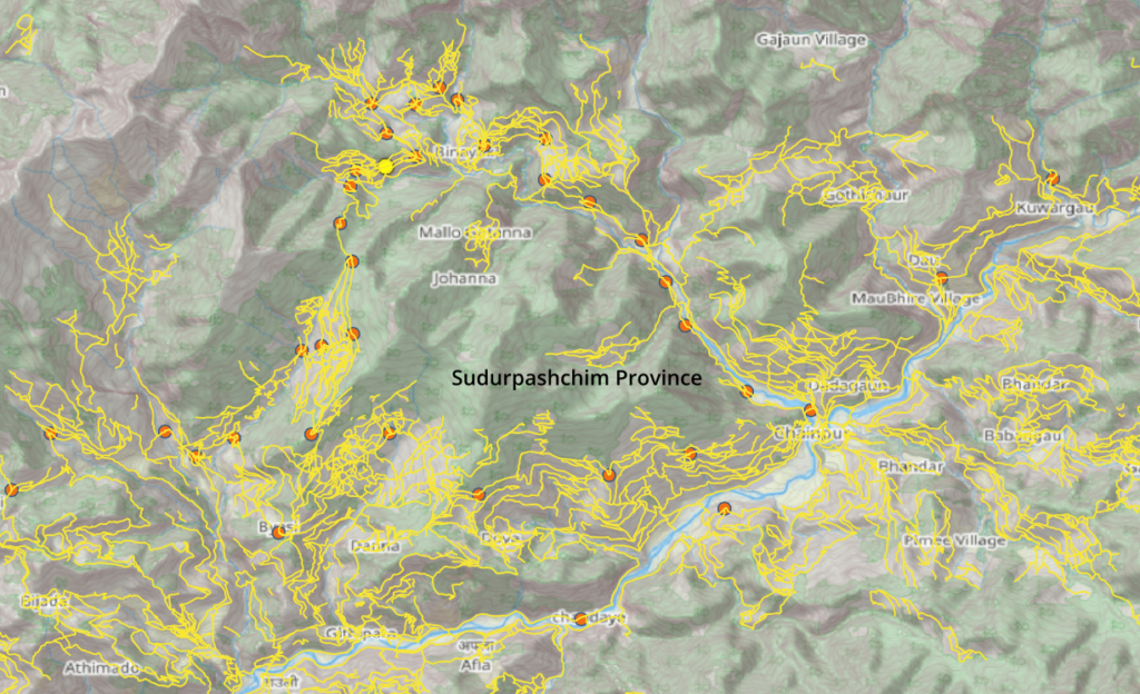
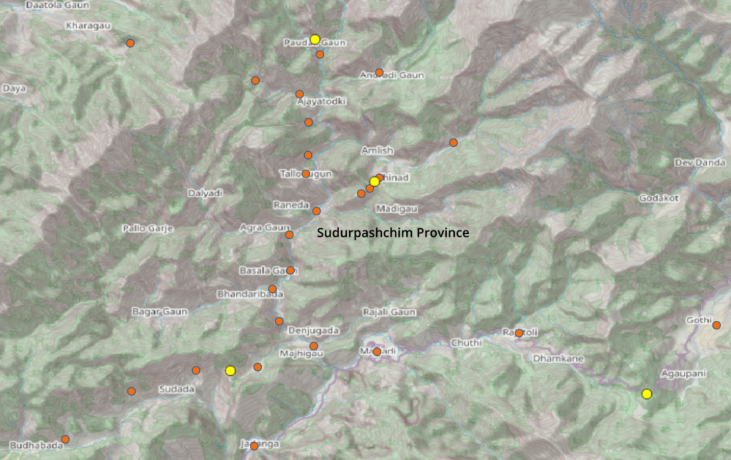
Sudurpashchim
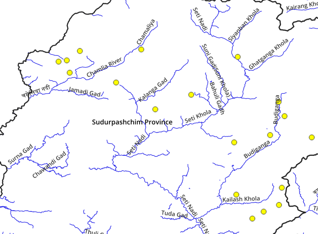
- Chamaliya
- Kalanga Gad
- Seti Khola
- Budi Ganga
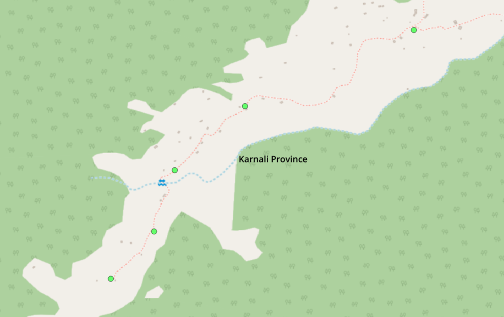
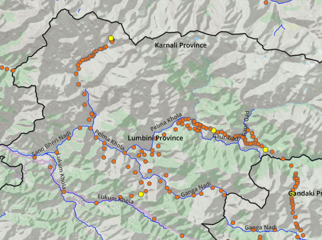
Karnali
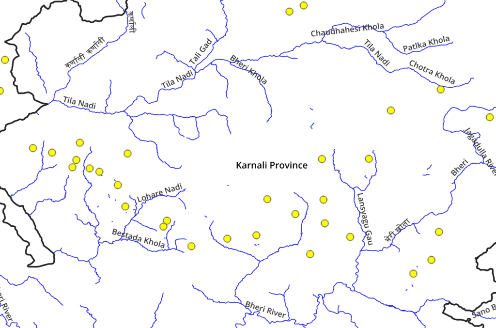
- Karnali river
- Tila Nadi
- Lohare Nadi
- Chheda Khola
- Lansyagu Gau
- Bheri Nadi
- Thuli Bheri
- Bheri river
Lumbini
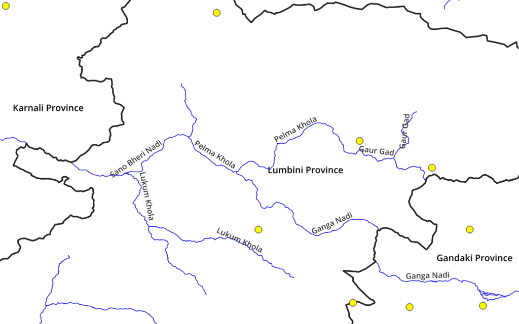
- Sani Bheri Nadi
- Pelma Khola
- Ganga Nadi
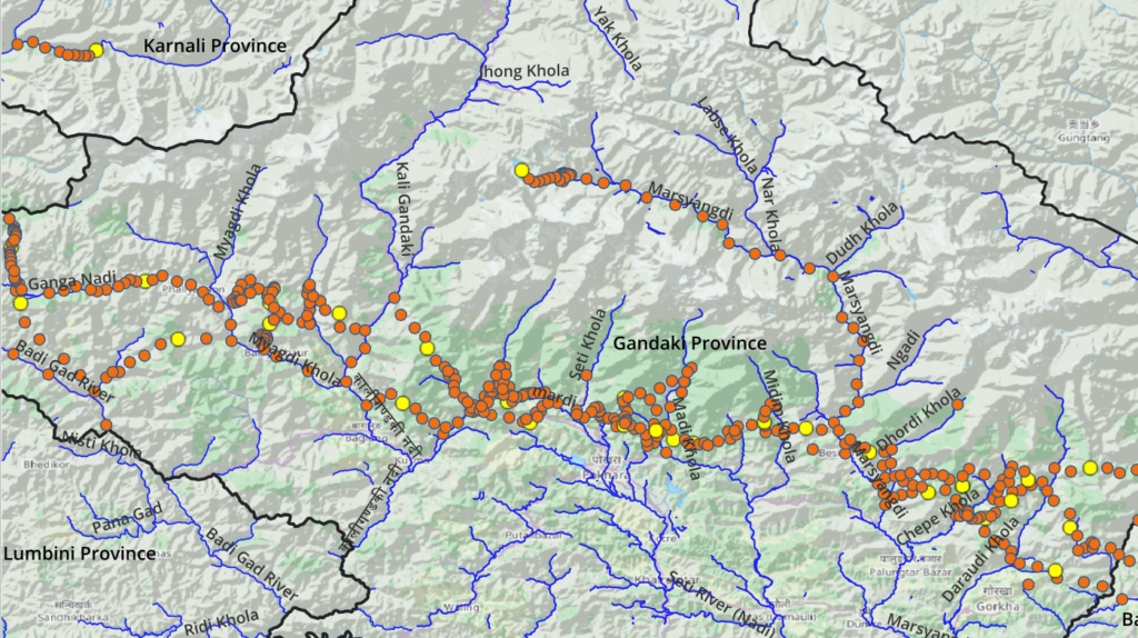
Gandaki
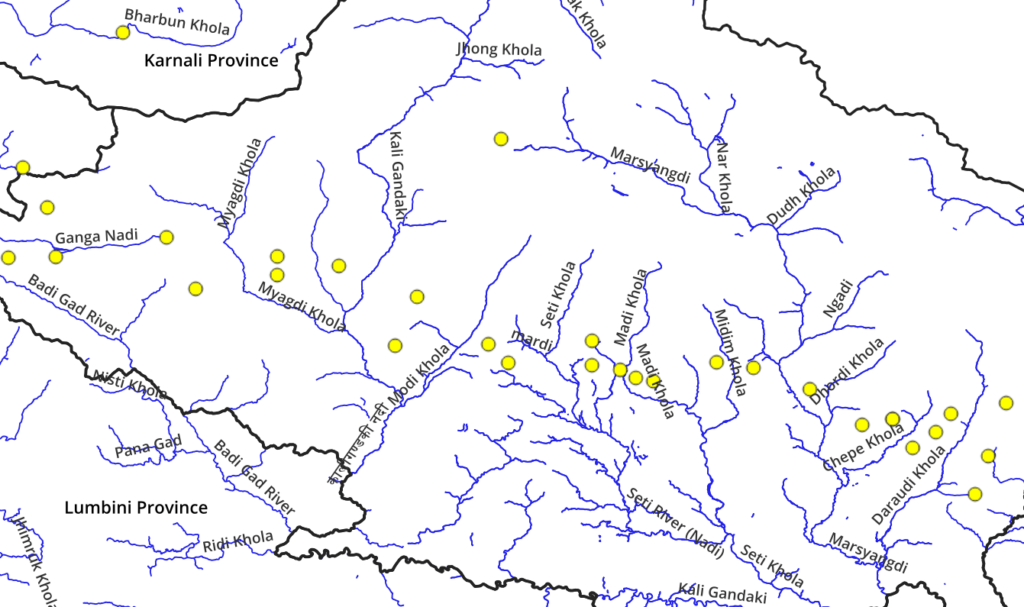
- Myagdi Khola
- Thula Khola
- Kali Gandaki
- Madi Khola
- Midin Khola
- Marsyangdi
- Dhordi Khola
- Daraudi Khola
- Budhi Gandaki
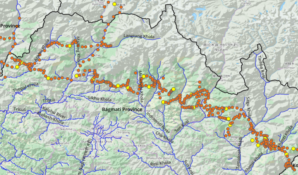
Bagmati
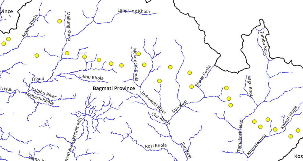
- Ankhu Khola
- Trishuli Ganga
- Tadi Khola
- Melamchi River
- Indrawati River
- Balephi Khola
- Sun Koshi
- Tama Koshi
- Khimti Khola
- Likhu Khola
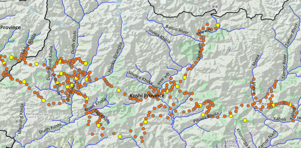
Koshi
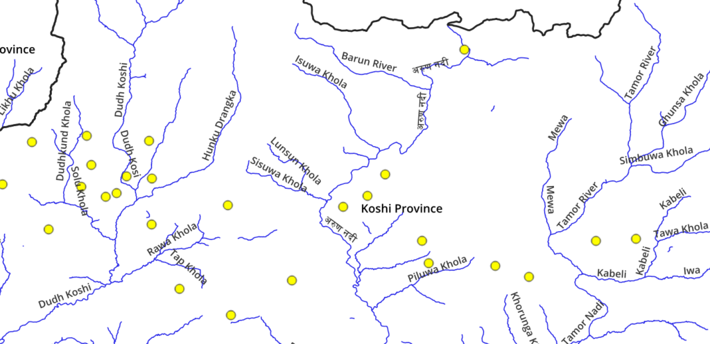
- Solu Khola
- Hunku Drangka
- Dudh Koshi
- Barun river
- Tamor river
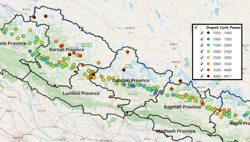
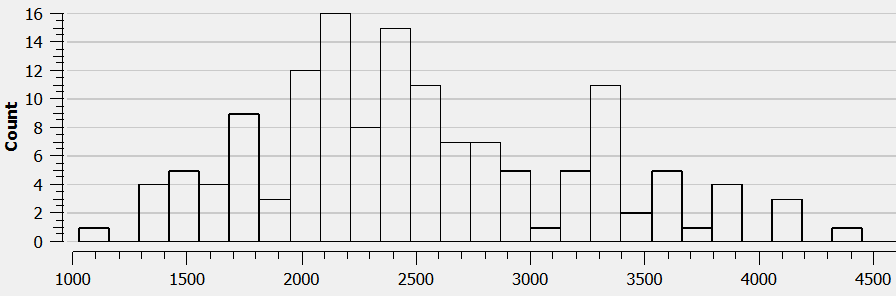
Altitude range
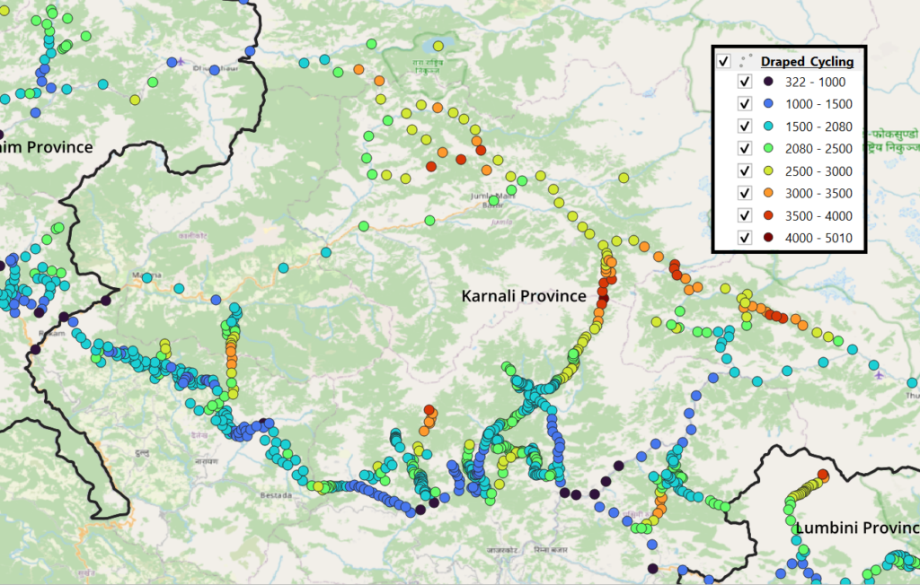
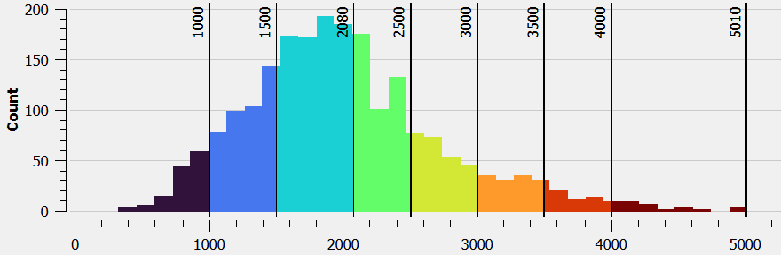
Cycle routes are marked every few hundred meters guiding cyclists through valleys, along slopes and across mountain passes connecting remote villages in the foothills which can be used for night halt and food supply. Proper acclimatization is required when going up to the higher routes. Below histogram gives an overview of the altitude range of the cycle routes ranging from all the way from 800m till 4000m.
Cycling vs Hiking
Comparing cyclable (yellow) and hike-able (blue) mountain passes of Nepal on the same map we observe that there is significant overlap between cycle and hiking routes although the latter of course takes you to higher and less accessible alpine altitudes.
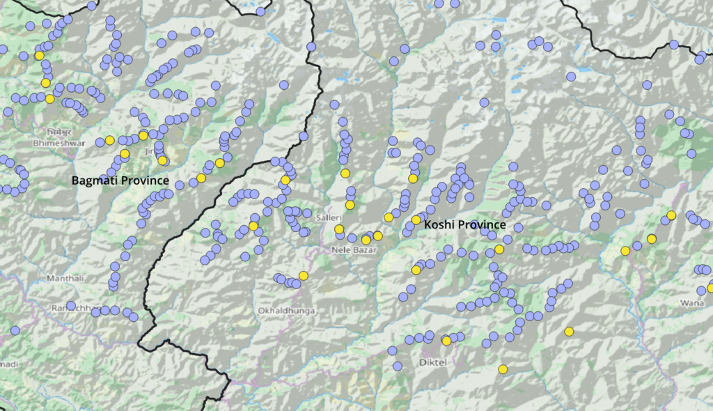
Cycling and hiking passing compared on an altitude map shows that cycle routes stay within the foothills of the Himalayas while hiking routes have a wider elevation span.
Research
Cyclable routes were identified as scenic smaller roads and dirt tracks connecting remote villages in the foothills and researched using three types of maps:
Open Street Maps
Different types of roads are mapped in OSM. We were mostly focused on smaller roads and dirt tracks between remote villages in the mountains which can be identified using below OSM key-value pairs. The same can be easily queried through the QuickOSM plugin in QGIS giving a birds-eye view on potential candidate routes that span across multiple valleys.
OSM key-value pairs suitable for cycle touring:
- highway=secondary
- highway=tertiary
- highway=minor
- highway=unclassified
- highway=track
Remote villages along these cycle routes are mostly mapped in Open Street Maps and cover both villages, hamlets and isolated dwellings. These are useful for food supply, night halt, guidance and recharging electronics along the way.
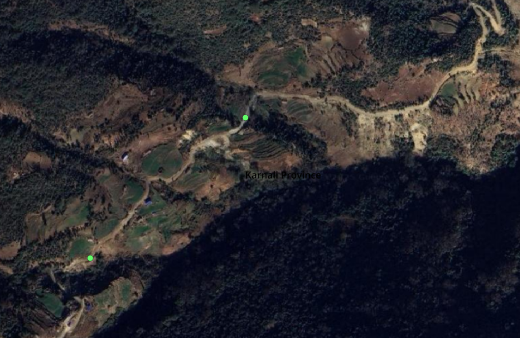
Satellite Imagery
Many remote and lesser known routes are not yet mapped in OSM. These can be identified using high resolution satellite imagery. Roads and dirt tracks are clearly visible outside the forested regions.
Topography
While identifying suitable continuous long distance cycle routes we use a shaded topographic map (here Thunderforest Landscape) to understand how neighboring valleys can be connected through mountain passes (yellow) enabling the cyclist to quickly hop across in-between ridgelines covering linear traverses.
Cycle Routes
Sudupashchim
Karnali
Lumbini
Gandaki
Bagmati
Koshi
Become a patreon to get access to thousands of kms of cycle routes