Skip to content
UltraJourneys

Author: Peter Van Geit

  • Home
  • Blog
  • About
    • Profile
    • Social Media
      • Instagram
      • YouTube
      • Whatsapp
      • Patreon
      • Substack
      • Facebook
    • Articles
      • Blogs
      • The Himalayan Club
      • ExplorersWeb
      • Outdoor Journal
      • IMF
    • Interviews
    • News
    • Talks
      • Colleges
      • Corporate
      • Public
      • TEDX
    • Awards
    • Relief
  • Courses
    • Field Bootcamp
    • Online Bootcamp
    • Alpine Webinar
    • Navigation Bootcamp
    • GIS
    • Minimalist Gears
    • Himalayan Regions
    • Sahyadri Regions
    • Self Supported Runs
    • Running in Vietnam
    • GIS Workshop
    • Social Media
  • Himalayas
    • Mapping the Himalayas
    • Guiding Hikers
    • Himalayan Regions
    • Gears
    • Traverse Planning
    • Nepal
    • Alpine Lakes
    • Cycle Touring
    • Ultra Running
  • Maps
    • Himalayan Maps
    • Himalayan Traverses
    • Open Street Maps
    • Journey Maps
    • Survey of India
    • Navigation
    • Topography
  • Journeys
    • J&K 2022
    • Himachal 2021
    • Uttarakhand 2021
    • Trans Sahyadri 2019
    • Trans Himalaya 2019
    • Trans Sahyadri 2018
    • Trans Himachal 2018
    • Vietnam 2018
    • Spiti-Pangi 2017
    • Ultras 2017
    • Pangi-Zanskar 2016
    • Vietnam 2016
    • Pangi 2015
    • Spiti 2015
    • Srilanka 2015
    • Shimla-Leh 2013
  • Sitemap

Alpine Hiking 10E – Hiking Routes

February 9, 2022 Peter Van Geit

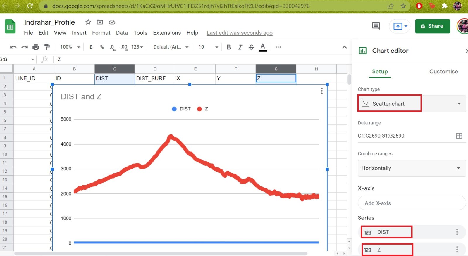
In this module we will play around with various metrics for Hiking Routes downloaded from Open Street Maps. Distance, route…

Continue Reading →

Posted in: 9B Geometrics of Himalayas, Alpine Bootcamp DIY, Courses Filed under: GIS

Alpine Hiking 10D – Settlements (Part 2)

February 7, 2022 Peter Van Geit

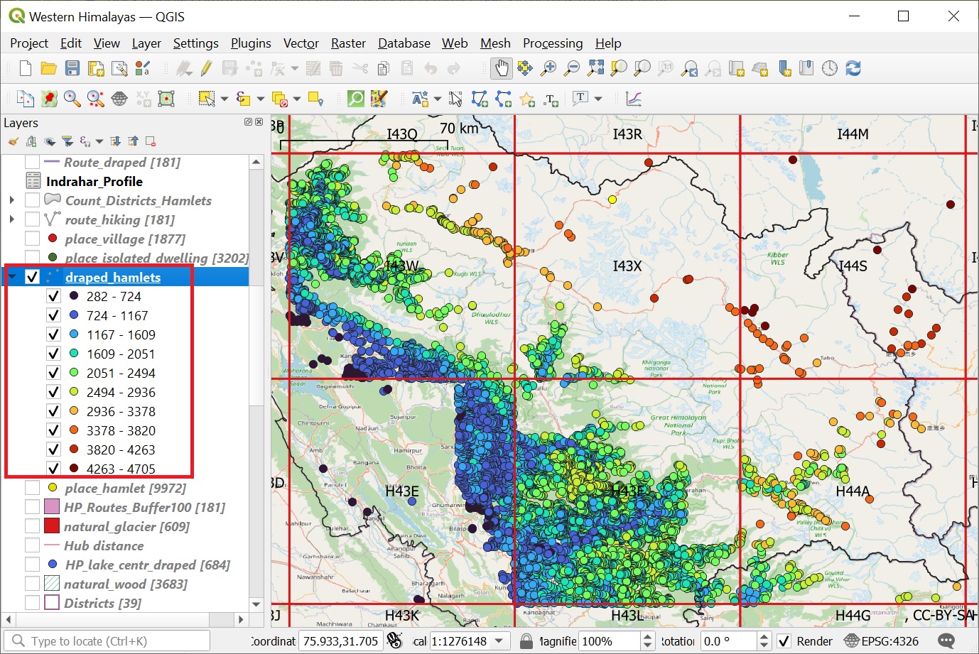
Let’s take a closer on the distribution / proximity of settlements with respect to forest regions. Download “natural” = “wood”…

Continue Reading →

Posted in: 9B Geometrics of Himalayas, Alpine Bootcamp DIY, Courses Filed under: GIS

Alpine Hiking 10C – Settlements

February 5, 2022 Peter Van Geit

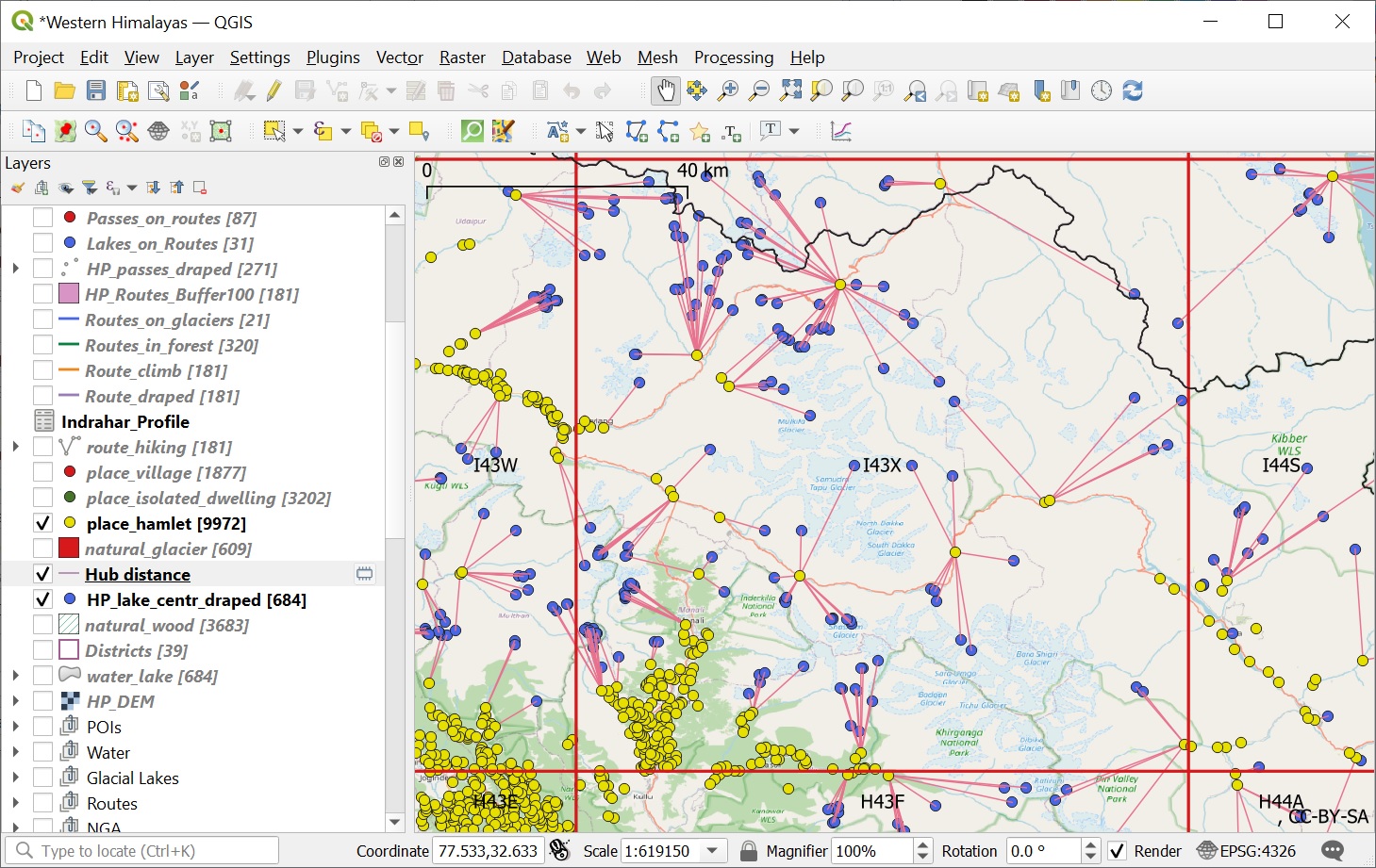
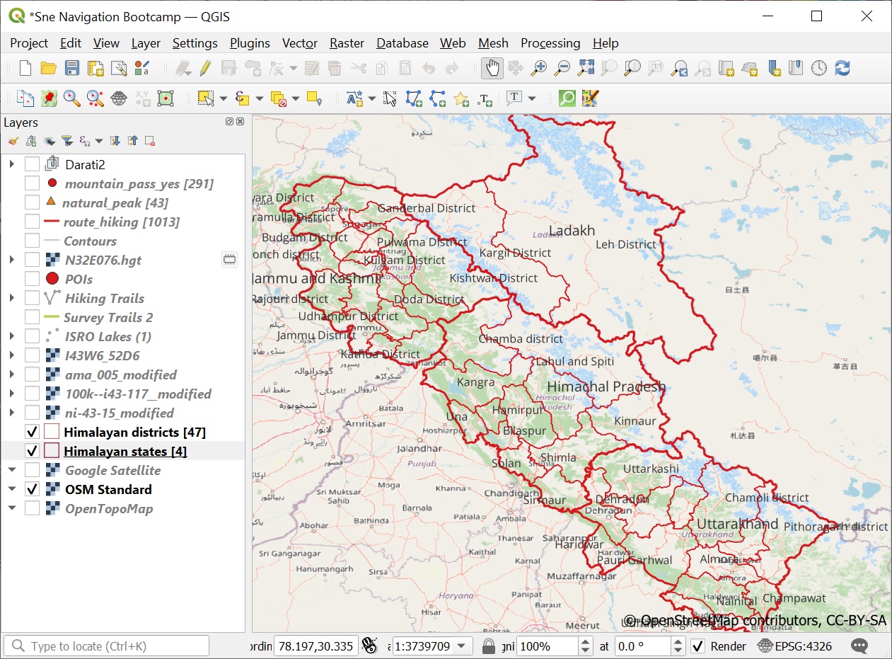
In this module we will download human settlements for the Himachal region from Open Street Maps and play around with…

Continue Reading →

Posted in: 9B Geometrics of Himalayas, Alpine Bootcamp DIY, Courses Filed under: GIS

Alpine Hiking 10B – Lakes & Glaciers

February 3, 2022 Peter Van Geit

In this module we will play around with visualizations of Himalayan lakes and glaciers downloaded from Open Street Maps. Lakes…

Continue Reading →

Posted in: 9B Geometrics of Himalayas, Alpine Bootcamp DIY, Courses, Lakes Filed under: GIS, Lakes

Alpine Hiking 10A – Mountain passes

February 1, 2022 Peter Van Geit

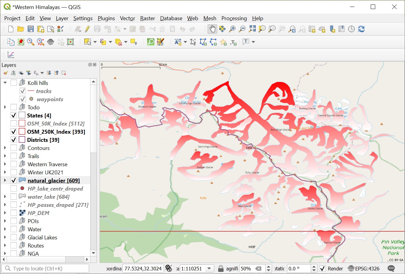
In this chapter we will explore the powerful geometry processing capabilities of QGIS on various Himalayan features. These capabilities will…

Continue Reading →

Posted in: 9B Geometrics of Himalayas, Alpine Bootcamp DIY, Courses Filed under: GIS

Alpine Hiking 9D – Atlas

January 4, 2022 Peter Van Geit

We are now able to visualize all mountain peaks (1958), passes (1393) and alpine lakes (1900) located in the Western…

Continue Reading →

Posted in: 9 Atlas of the Himalayas, Alpine Bootcamp DIY Filed under: Atlas, GIS

Alpine Hiking 9C – Alpine Lakes

January 3, 2022 Peter Van Geit

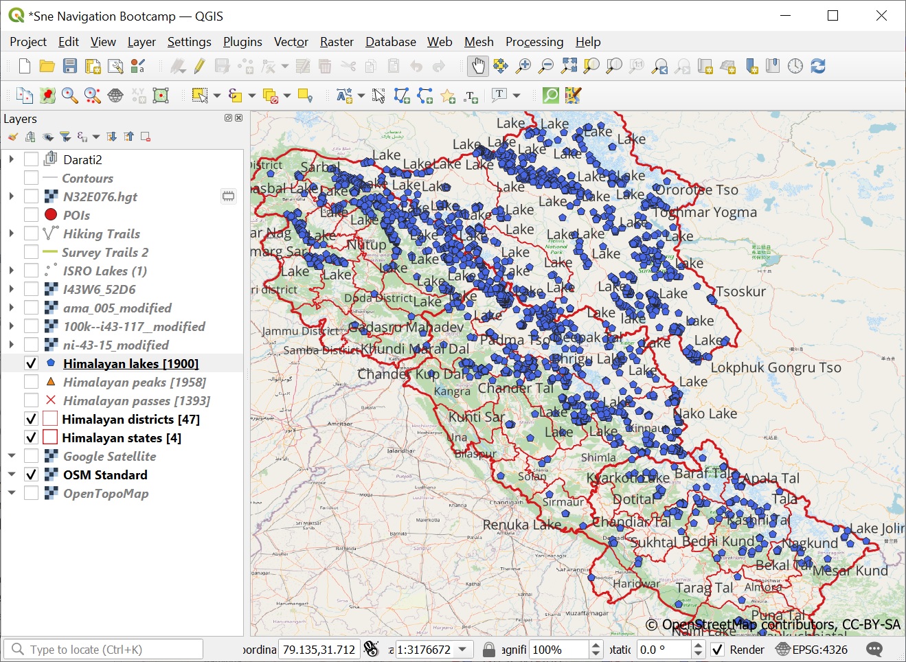
In this module we will query and visualize Alpine lakes from Open Street Maps in QGIS. Lakes are defined in…

Continue Reading →

Posted in: 9 Atlas of the Himalayas, Alpine Bootcamp DIY, Lakes Filed under: Atlas, GIS, Lakes

Alpine Hiking 9B – Passes & Peaks

January 2, 2022 Peter Van Geit

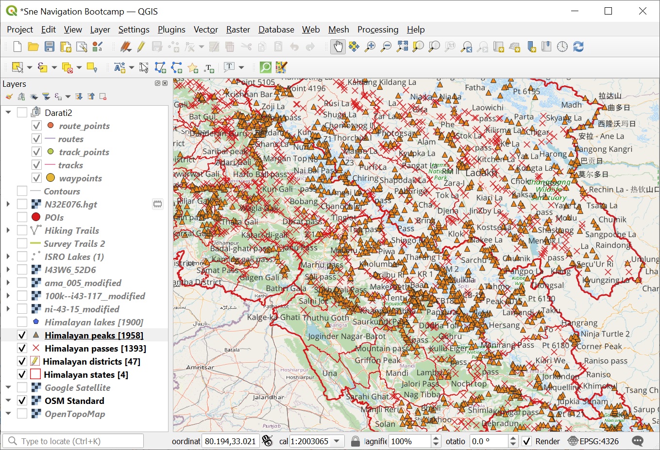
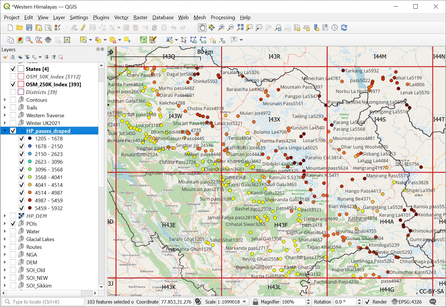
In this module we will retrieve all Himalayan passes and peaks from Open Street Maps and visualize them appropriately in…

Continue Reading →

Posted in: 9 Atlas of the Himalayas, Alpine Bootcamp DIY Filed under: Atlas, GIS

Alpine Hiking 9A – Boundaries

January 1, 2022 Peter Van Geit

QGIS is a powerful GIS software. In Chapter 6 we learned how to import and visualize geo-tagged alpine lakes, query…

Continue Reading →

Posted in: 9 Atlas of the Himalayas, Alpine Bootcamp DIY Filed under: Atlas, GIS

Alpine Hiking 8E – Analysis

December 31, 2021 Peter Van Geit

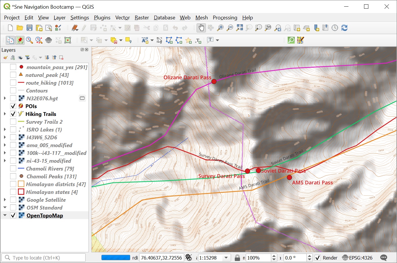
In this final module we ll be cross referencing the digitized features of Survey, Olizane, Soviet and US AMS maps…

Continue Reading →

Posted in: 8 Maps of the Himalayas, Alpine Bootcamp DIY

Post navigation

Page 18 of 92
← Previous 1 … 17 18 19 … 92 Next →
  • Home
  • Blog
  • About
  • Courses
  • Himalayas
  • Maps
  • Journeys
  • Sitemap
  • Home
  • Blog
  • About
  • Courses
  • Himalayas
  • Maps
  • Journeys
  • Sitemap
Copyright © 2019 UltraJourneys - Supported by dreams