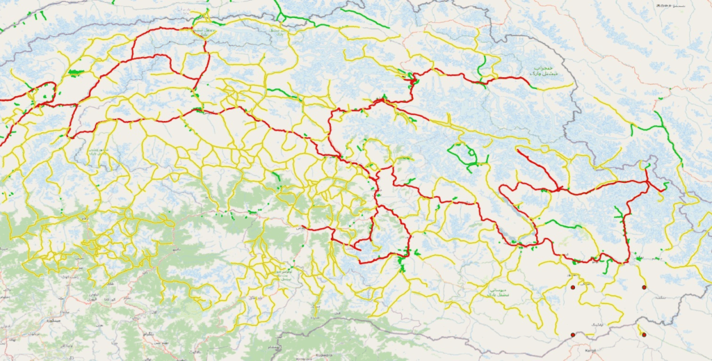
Recently I was contacted by Anne, a hiker from Belgium who did a few individual glacial hikes (connected by roads) in the Karakoram in Pakistan a few years ago. She was interested to know if it would be possible to hike a more continuous traverse in the same region. Unable to find any public available topo sheets for Pakistan I had to fall back on 1:100K Soviet maps which revealed an extensive trail network totaling 8000km across 200 mountain passes. Above shown in red (hikes / roads done by Anne), green (trails mapped in OSM) and yellow (trails digitized from Soviet maps).
- Soviet Topo Sheets
- Mapping the Karakoram
- Topography of the Karakoram
- Traverse Planning
- Map Layers
- Navigation
Soviet Topo Sheets
Soviet topo sheets for many countries are available on mapstor. 1980 dated 1:100K scale Soviet maps for Pakistan can be downloaded here:
https://archive.org/details/pakistan–gs–100k–1980-1980
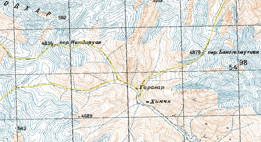
Individual topo sheets are named as per latitude and longitude each covering an area of 30×20 minutes (55x37km). The Karakoram in Pakistan lies between 34.5 and 37 degrees North and 72 and 77 degrees East. You ll have to download around 50 sheets to cover the entire region.
Mapping the Karakoram
I used QGIS to geo-reference 50 individual Soviet topo sheets and digitize 8000km of trails across 200 mountain passes in the region. An elaborate effort which took several days and nights.
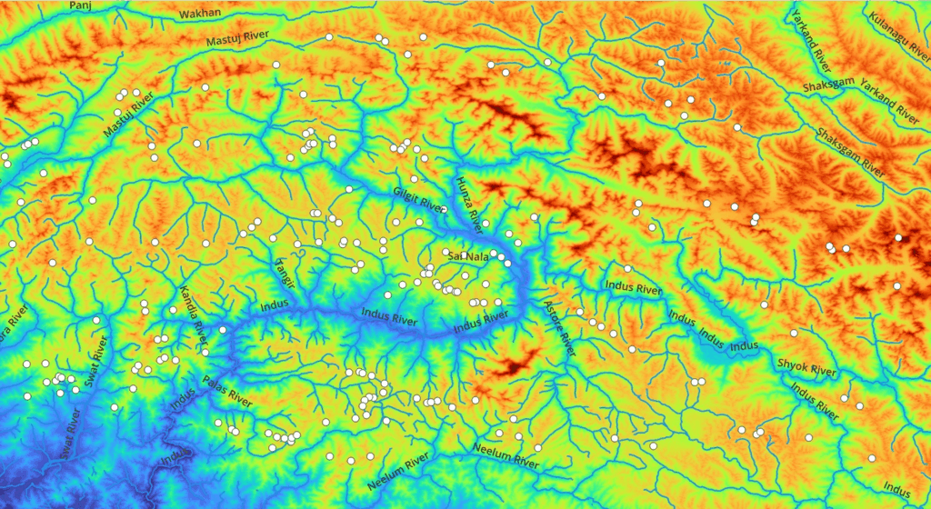
Topography of the Karakoram
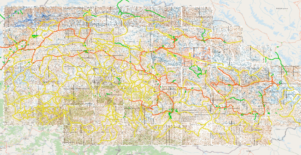
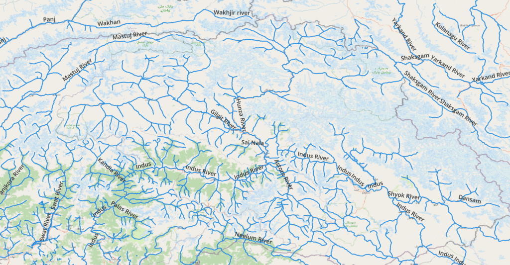
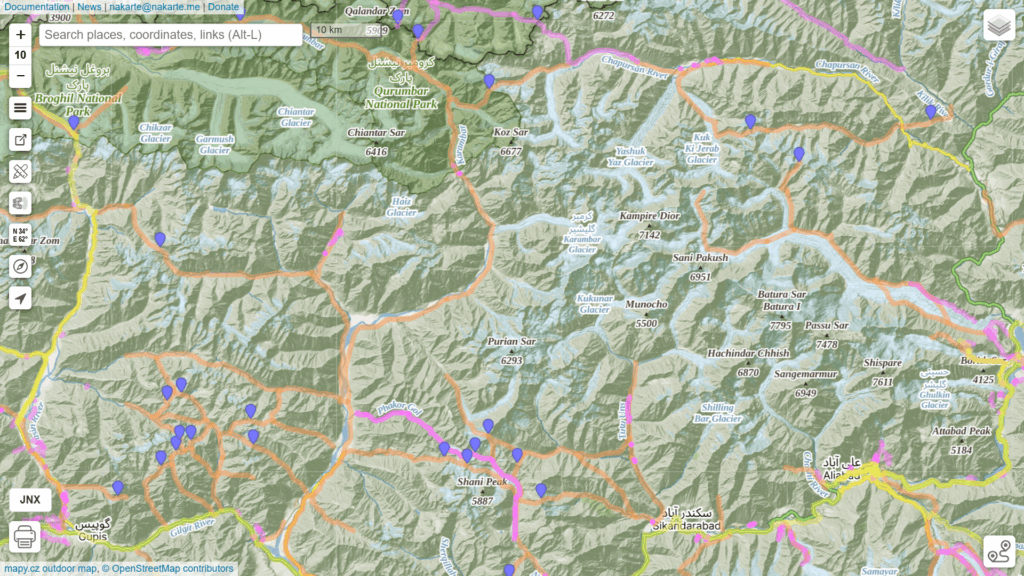
Using the STRM-Downloader plug-in one can download DEM (Digital Elevation Model) satellite data for the region to visualize the topography (elevation spectrum). Using the QuickOSM plugin one can download major rivers from Open Street Maps. Both layers together visualize the overall topography or geography of the Karakoram. Snow and glacial melt water from the red colored high ranges is drained by the Indus, Gilgit, Neelum, Shaksgam and Mastuj rivers. Passes identified on Soviet sheets in white.
Traverse Planning
Planning a traverse through this digitized 8000km trail network of the Karakoram is straightforward. Download below GPX files in nakarte.me to plan your traverse:
- Pakistan GHT (glacial hikes and interconnecting roads from Anne, still to be mapped in OSM)
- Pakistan OSM (trails mapped in Open Street Maps)
- Pakistan Soviet (trails digitized from 1:100K Soviet topo sheets)
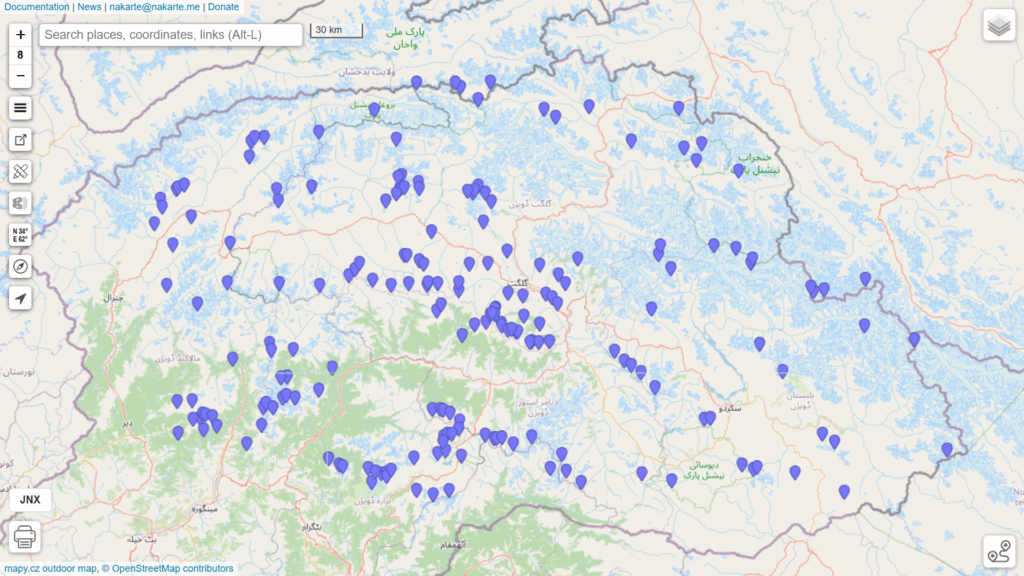
- Pakistan Passes (200 passes digitized from Soviet sheets)
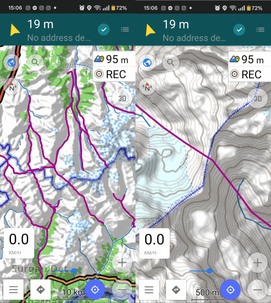
Map Layers
Traverses can be planned on different map layers:
- Standard OSM (above)
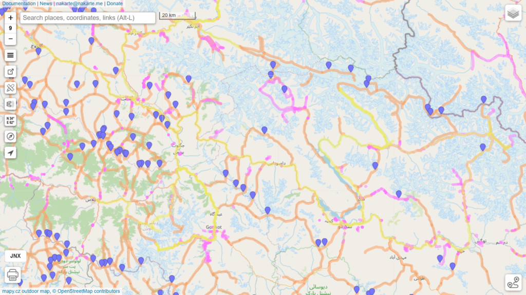
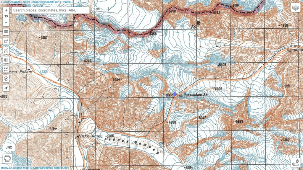
- Mapy.cz topographic layer (below)
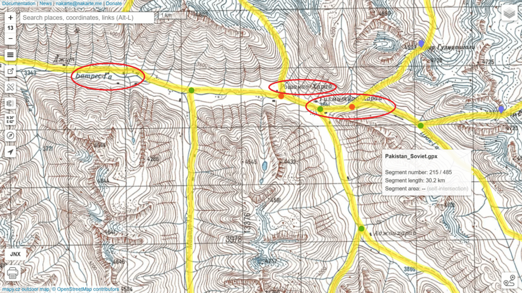
- Soviet maps (2nd below)
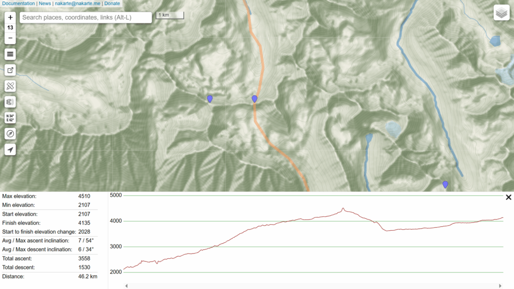
Create a “New Track” in nakarte.me to create a contiguous traverse across multiple mountain passes. Nakarte can generate an Elevation Profile of the planned traverse showing distance and elevation gain.
Villages and hamlets (food supply, charging electronics, night halt) within the traverse can be identified in both OSM and Soviet topo maps. More remote settlements would be present on the Soviet maps.
Navigation
Once a traverse is planned you can download above GPX files on your mobile to navigate the same