Skip to content
UltraJourneys

Tag: Open Street Maps

  • Home
  • Blog
  • About
    • Profile
    • Social Media
      • Instagram
      • YouTube
      • Whatsapp
      • Patreon
      • Substack
      • Facebook
    • Articles
      • Blogs
      • The Himalayan Club
      • ExplorersWeb
      • Outdoor Journal
      • IMF
    • Interviews
    • News
    • Talks
      • Colleges
      • Corporate
      • Public
      • TEDX
    • Awards
    • Relief
  • Courses
    • Field Bootcamp
    • Online Bootcamp
    • Alpine Webinar
    • Navigation Bootcamp
    • GIS
    • Minimalist Gears
    • Himalayan Regions
    • Sahyadri Regions
    • Self Supported Runs
    • Running in Vietnam
    • GIS Workshop
    • Social Media
  • Himalayas
    • Mapping the Himalayas
    • Guiding Hikers
    • Himalayan Regions
    • Gears
    • Traverse Planning
    • Nepal
    • Alpine Lakes
    • Cycle Touring
    • Ultra Running
  • Maps
    • Himalayan Maps
    • Himalayan Traverses
    • Open Street Maps
    • Journey Maps
    • Survey of India
    • Navigation
    • Topography
  • Journeys
    • J&K 2022
    • Himachal 2021
    • Uttarakhand 2021
    • Trans Sahyadri 2019
    • Trans Himalaya 2019
    • Trans Sahyadri 2018
    • Trans Himachal 2018
    • Vietnam 2018
    • Spiti-Pangi 2017
    • Ultras 2017
    • Pangi-Zanskar 2016
    • Vietnam 2016
    • Pangi 2015
    • Spiti 2015
    • Srilanka 2015
    • Shimla-Leh 2013
  • Sitemap

Mapping Glacial Lakes in OSM

May 28, 2021 Peter Van Geit

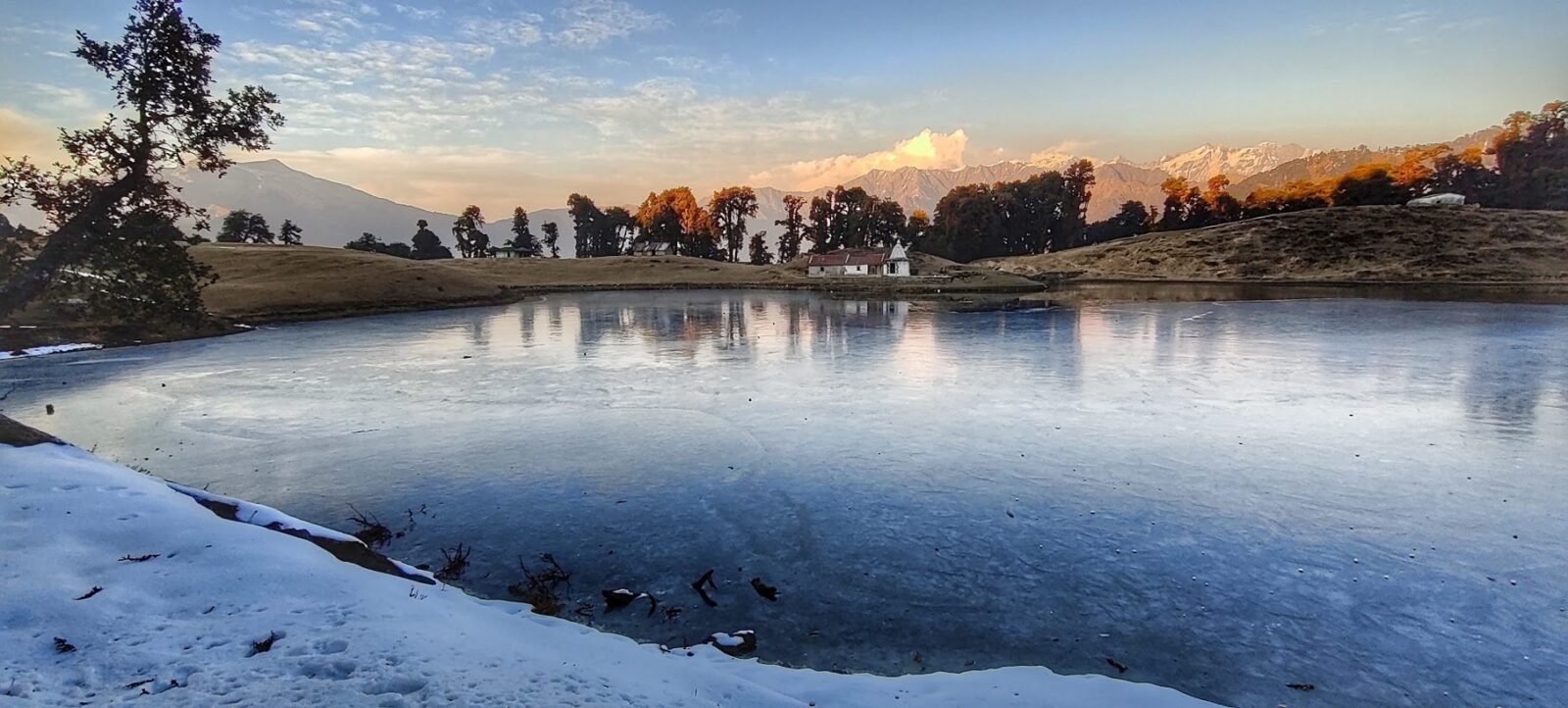
Introduction There are thousands of beautiful high altitude glacial lakes in the Indian Western Himalayas. Some are destinations of beautiful…

Continue Reading →

Posted in: Lakes, Mapping Himalayas Filed under: Lakes, Mapping Himalayas, Open Street Maps

Mapping Hamlets in Open Street Maps

April 8, 2021 Peter Van Geit

Continue Reading →

Posted in: Mapping Himalayas Filed under: Mapping Himalayas, Open Street Maps

Navigation for dummies

March 15, 2021 Peter Van Geit 1 Comment

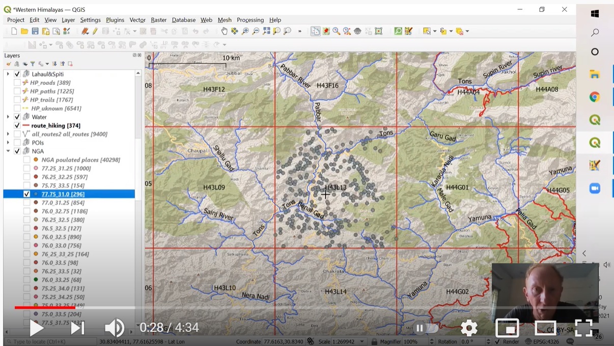
Open Street Maps based exploration of the Himalayas

Continue Reading →

Posted in: Navigation, Open Street Maps Filed under: Navigation, Open Street Maps

Mapping Himalayan Settlements

February 16, 2021 Peter Van Geit

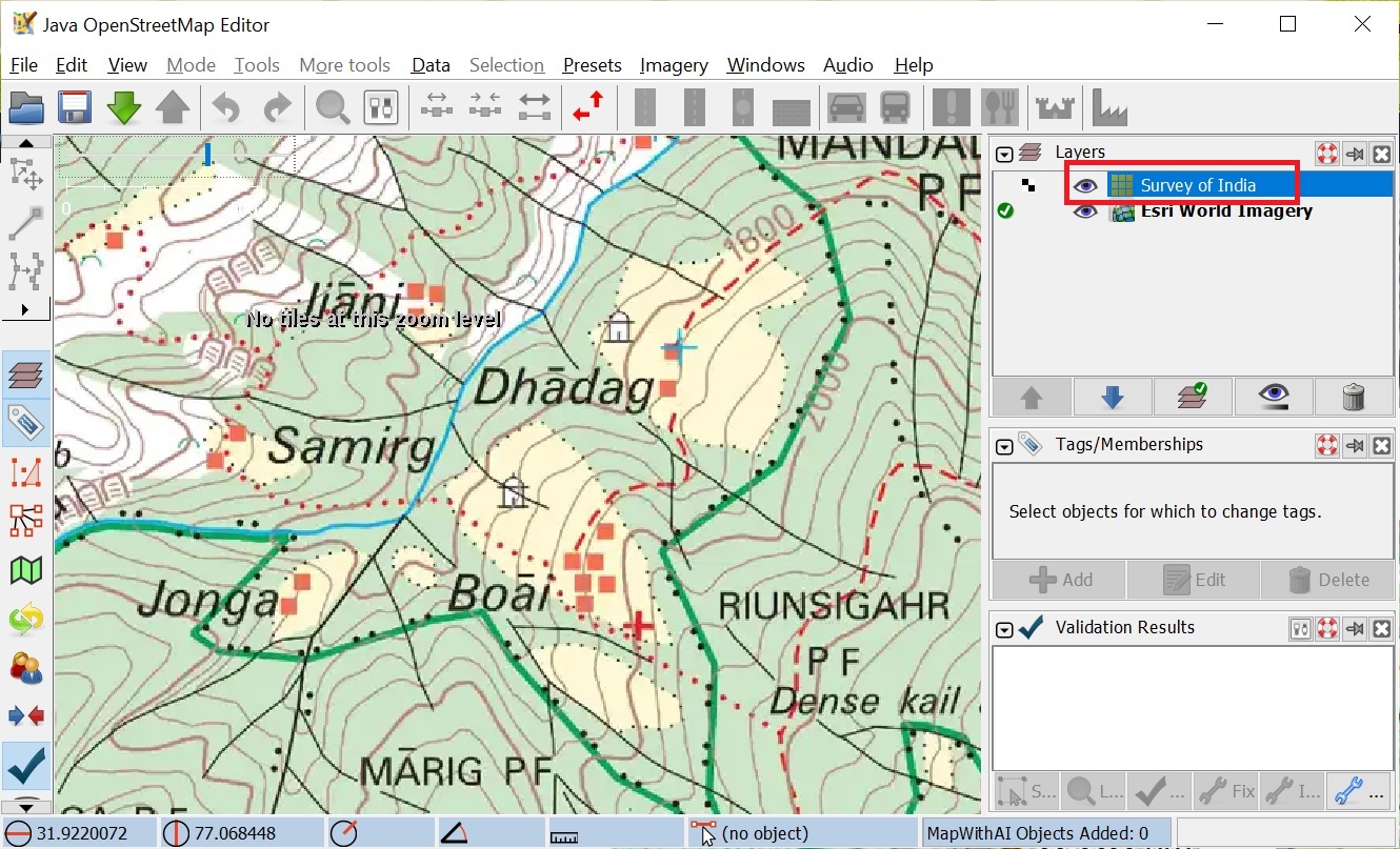
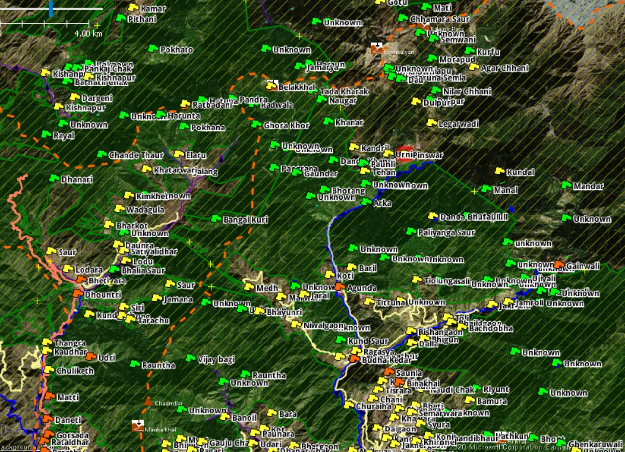
In this step-by-step tutorial I provide a quick overview on how to map human settlements in Open Street Maps. Settlements…

Continue Reading →

Posted in: Mapping Himalayas Filed under: Mapping Himalayas, Open Street Maps

Mapping Hiking Routes in OSM

November 6, 2020 Peter Van Geit

See also Part 1 – Using JOSM and adding Hamlets This short tutorial illustrates the steps to create a new…

Continue Reading →

Posted in: Mapping Himalayas, Open Street Maps Filed under: Mapping Himalayas, Open Street Maps

Mapping Hamlets in OSM

August 24, 2020 Peter Van Geit

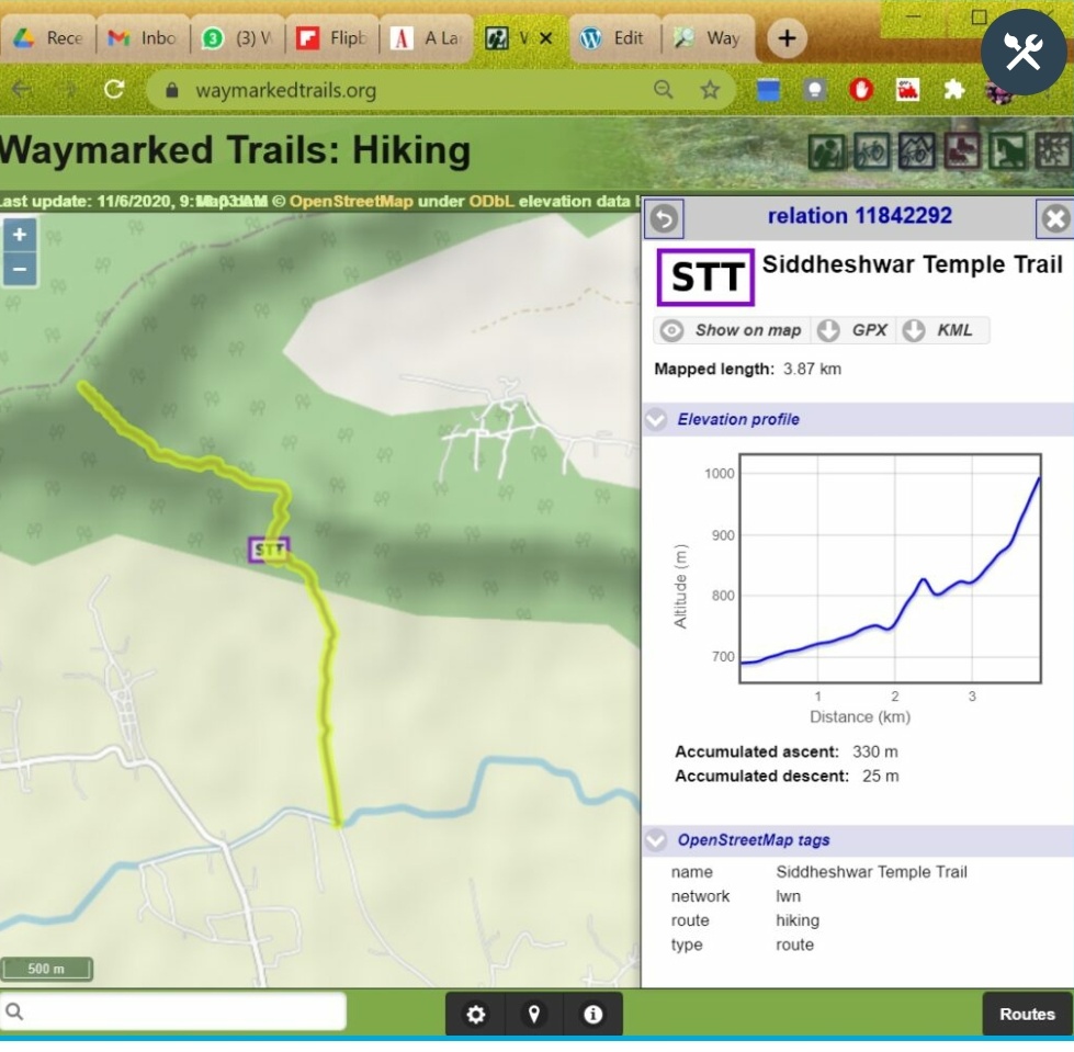
See also Part 2 – Mapping Hiking Routes The Western Indian Himalayas are a true hiking paradise. Unfortunately they are…

Continue Reading →

Posted in: Mapping Himalayas Filed under: Mapping Himalayas, Open Street Maps

Navigation Bootcamp (2) – Open Street Maps

January 30, 2020 Peter Van Geit

Continue Reading →

Posted in: Courses, Navigation Bootcamp Filed under: Open Street Maps

Alpine style hiking – mobile navigation

May 1, 2019 Peter Van Geit

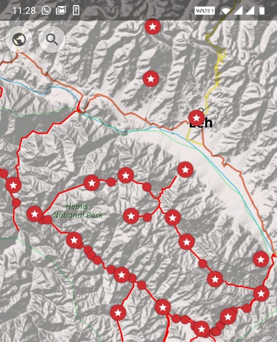
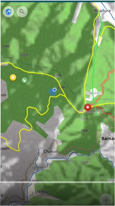
We will be using the OSMAnd mobile app for offline maps and navigation during the journey. It is a mobile viewer for…

Continue Reading →

Posted in: Courses, Navigation, Open Street Maps Filed under: Navigation, Open Street Maps

Post navigation

Page 2 of 2
← Previous 1 2
  • Home
  • Blog
  • About
  • Courses
  • Himalayas
  • Maps
  • Journeys
  • Sitemap
  • Home
  • Blog
  • About
  • Courses
  • Himalayas
  • Maps
  • Journeys
  • Sitemap
Copyright © 2019 UltraJourneys - Supported by dreams