I woke up by 6am on an open platform next to the Udaipur temple. A chill breeze was blowing at 2600m but Huzefa’s bluebolt quilt had kept me comfortably warm during the night. I walked to the bus stop where they confirmed the first bus to Miyar valley departs only by 12pm. I packed up a few aloo parottas for the journey ahead and start walking along the road hoping to hitch a ride. Khanjar, the last village, was a good 30km away.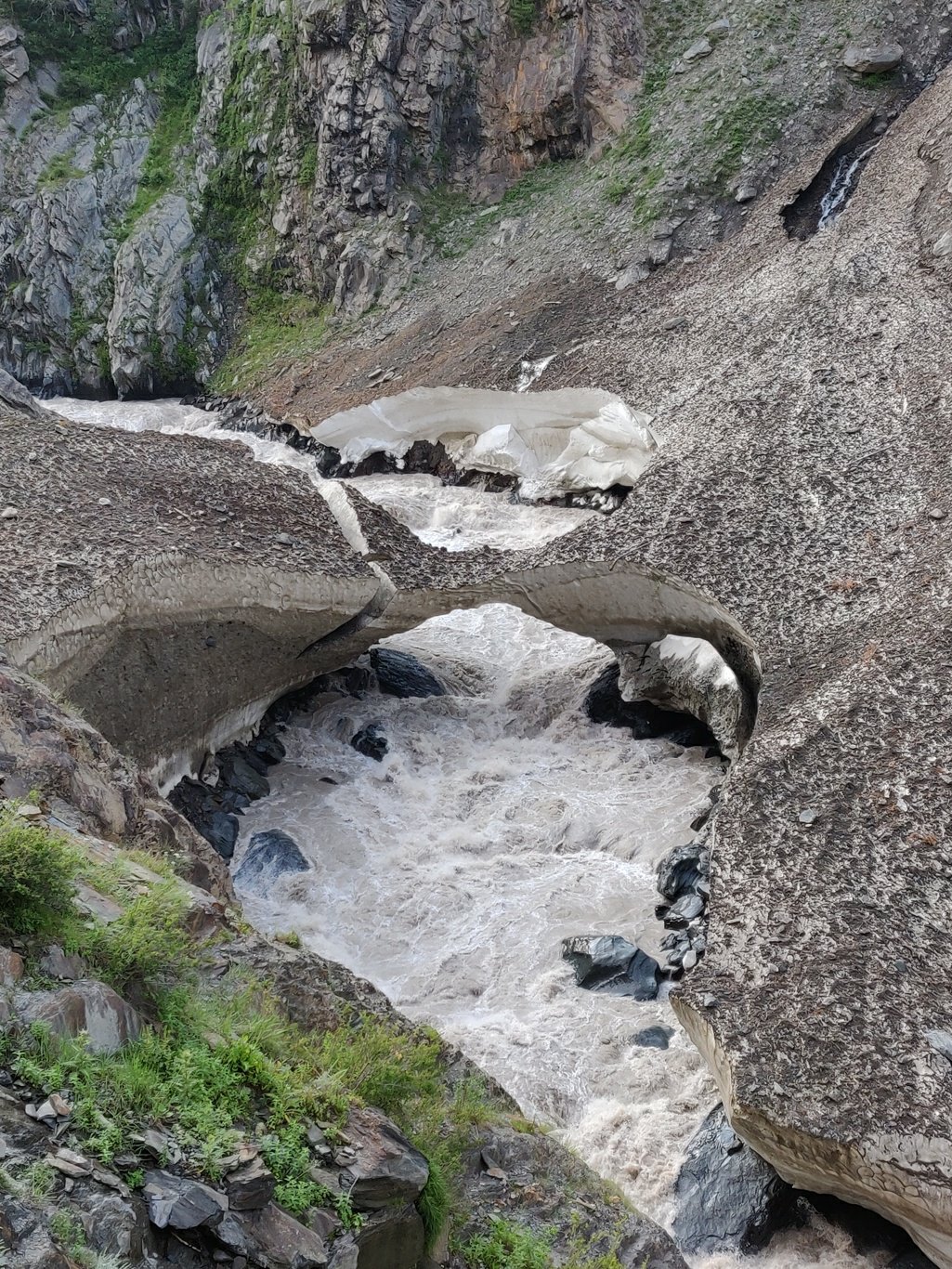 Several vehicles were coming from the opposite direction towards Udaipur but no one seemed to travel towards Miyar early morning. The Miyar Nala was still covered by snow bridges here and there. The road sides and plantations were dotted with colourful flowers some giving an intense scent. Irrigation had made this barren valley furtile.
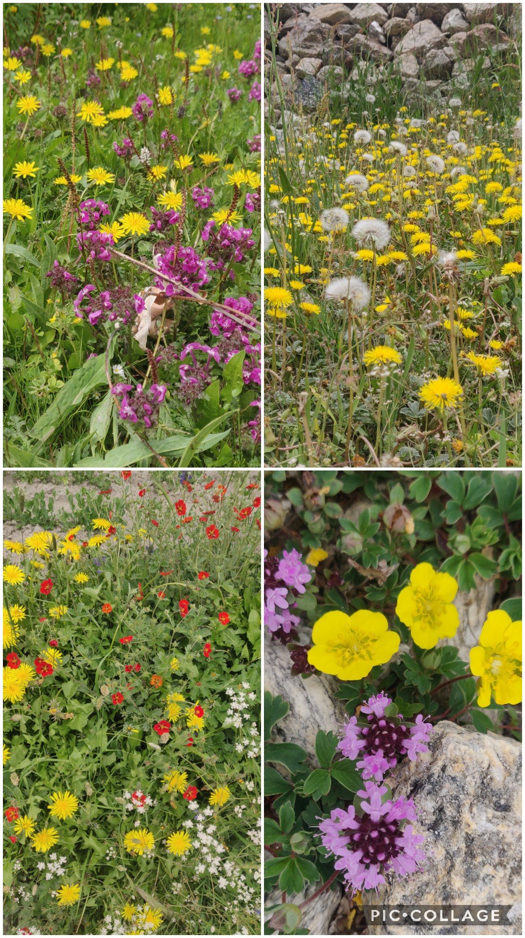 Mid way I was lucky to get a short 6K ride by a kind gentleman in a Maruti who was visiting his inlaws in Karpat. That probably saved me one hour of walking time. At Tingrat there is a police checkpost as many foreigners use this route to enter Ladakh.
 I grabbed some Maggie’s and eggs in the next village of Urgus. Beautiful farmlands surround the villages in Miyar valley. I could see lot of cauliflower being cultivated. The road ends at Shinto where you cross the turbulent Nala to Khanjar from where the trail starts on the right side of the valley.
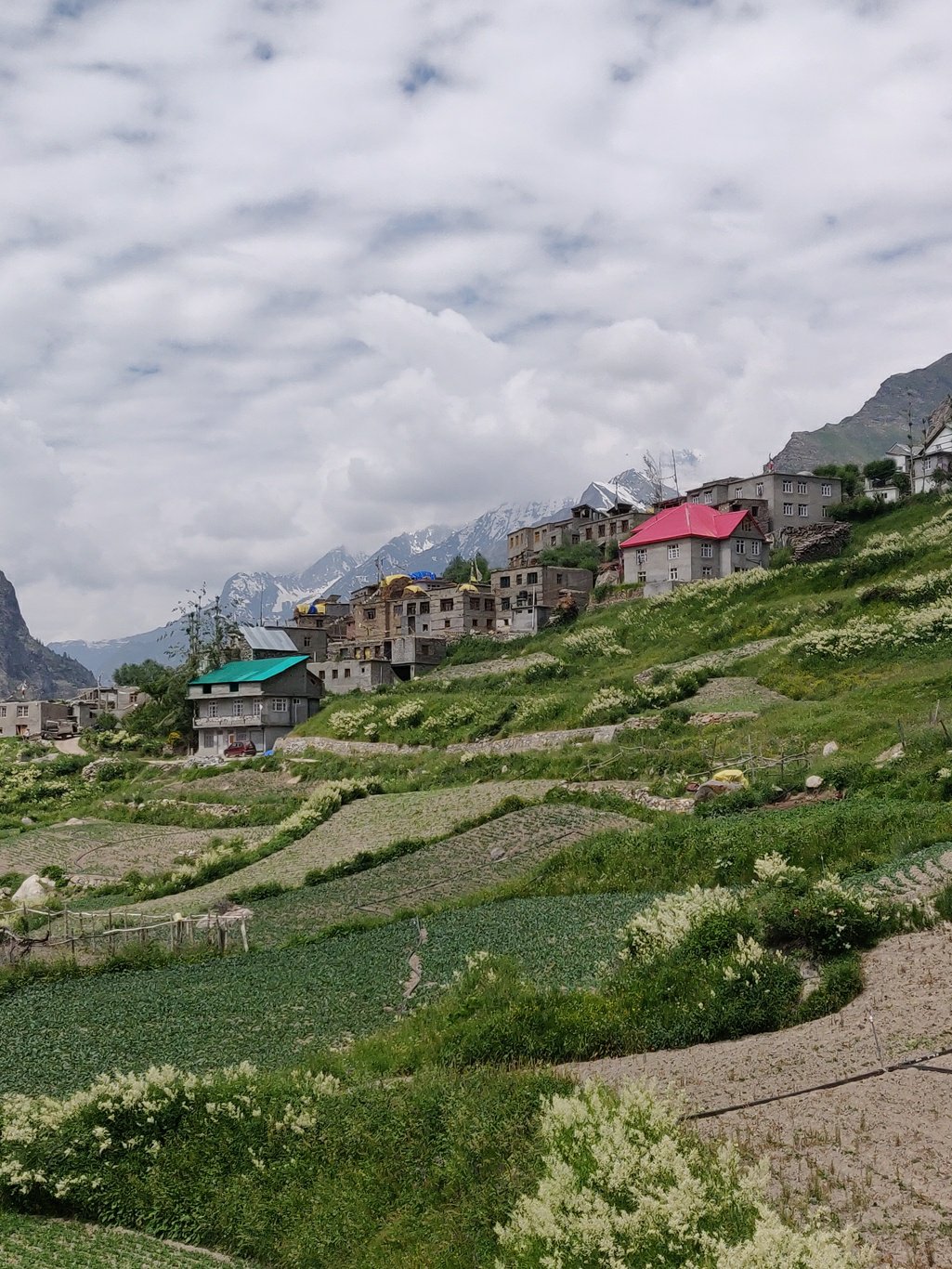 The Miyar valley is pretty flat and open. A clear sandy trail gradually ascends through lush green meadows across rolling hills. One can see shepherds on both side of the stream grazing their herds. Regular rock shelters are present along the way used by the gaddis.
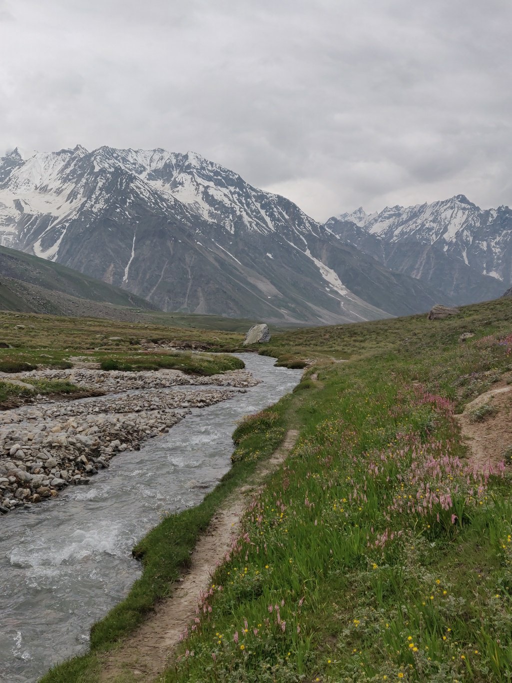 Beautiful alpine flowers of all shades brighten up the meadows of Miyar. You also see cows and horses grazing freely along the way. There are no trees or bushes at this 4000m+ altitude which makes me wonder how the shepherds cook their daily food.
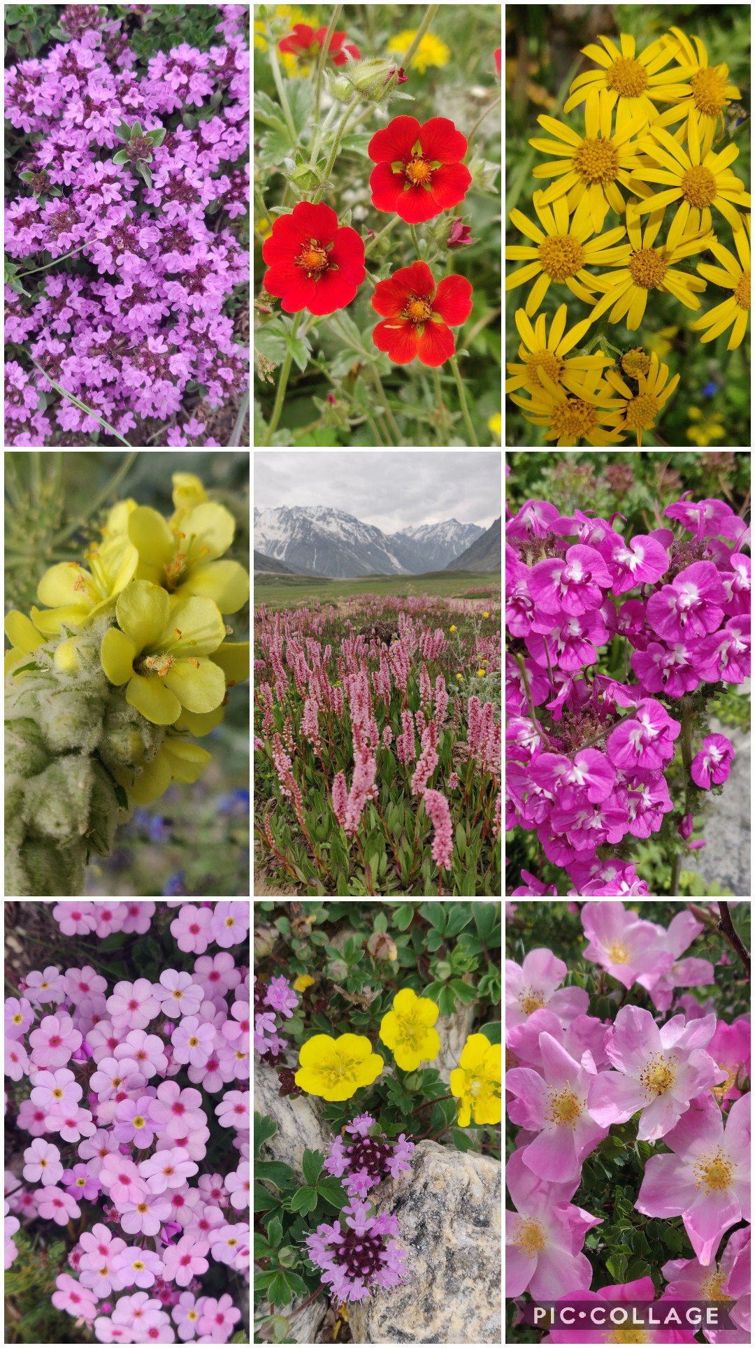 I meet a group of enthu locals along the way just carrying a day pack who have walked to the end of the valley and were returning back towards Khanjar. On route one has to cross several turbulent side streams, lucky there are bridges to cross the same.
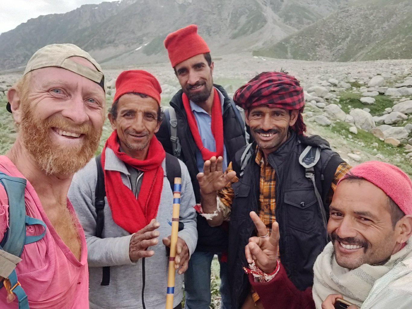 I keep up a good walking pace hoping to set up camp deep inside the valley so I have a good headstart to traverse the moraines and glacier tomorrow and cross the pass the day after. I meet a few porters who inform me a 5 member hiking party is camping ahead giving me hope to get some company tomorrow.
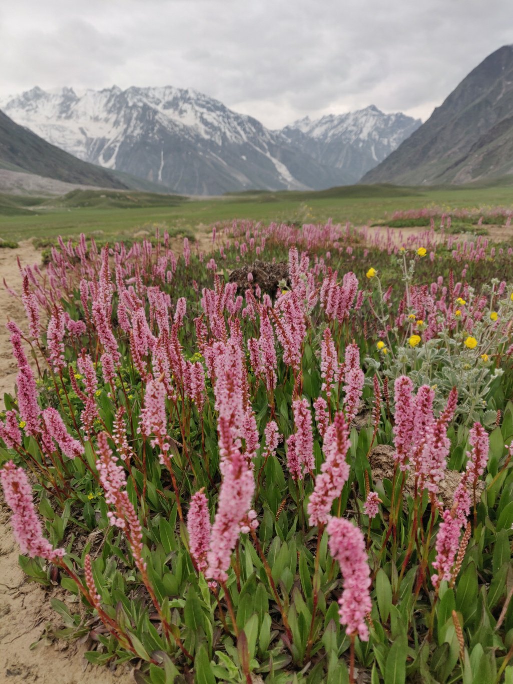 I finally settle down around 6pm after an intense 12 hour 50K hike from Udaipur in the same rock shelter where I stayed last year after descending from the Pratap Jot crossing over from the neighbouring Saichu valley, around 8K from the tip of the galcier. Comfy place out of the cold wind at 3900m.
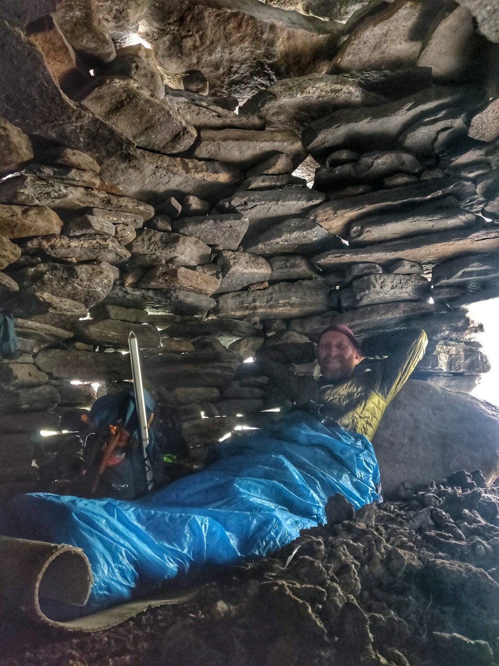 The next morning I wake up to a bright blue sky and resume my way through the final meadows towards the glacier. Wild horses are grazing freely withthe snow peaks of the Pir Panjal in the backdrop. An idillyc sight in a fairytale location.
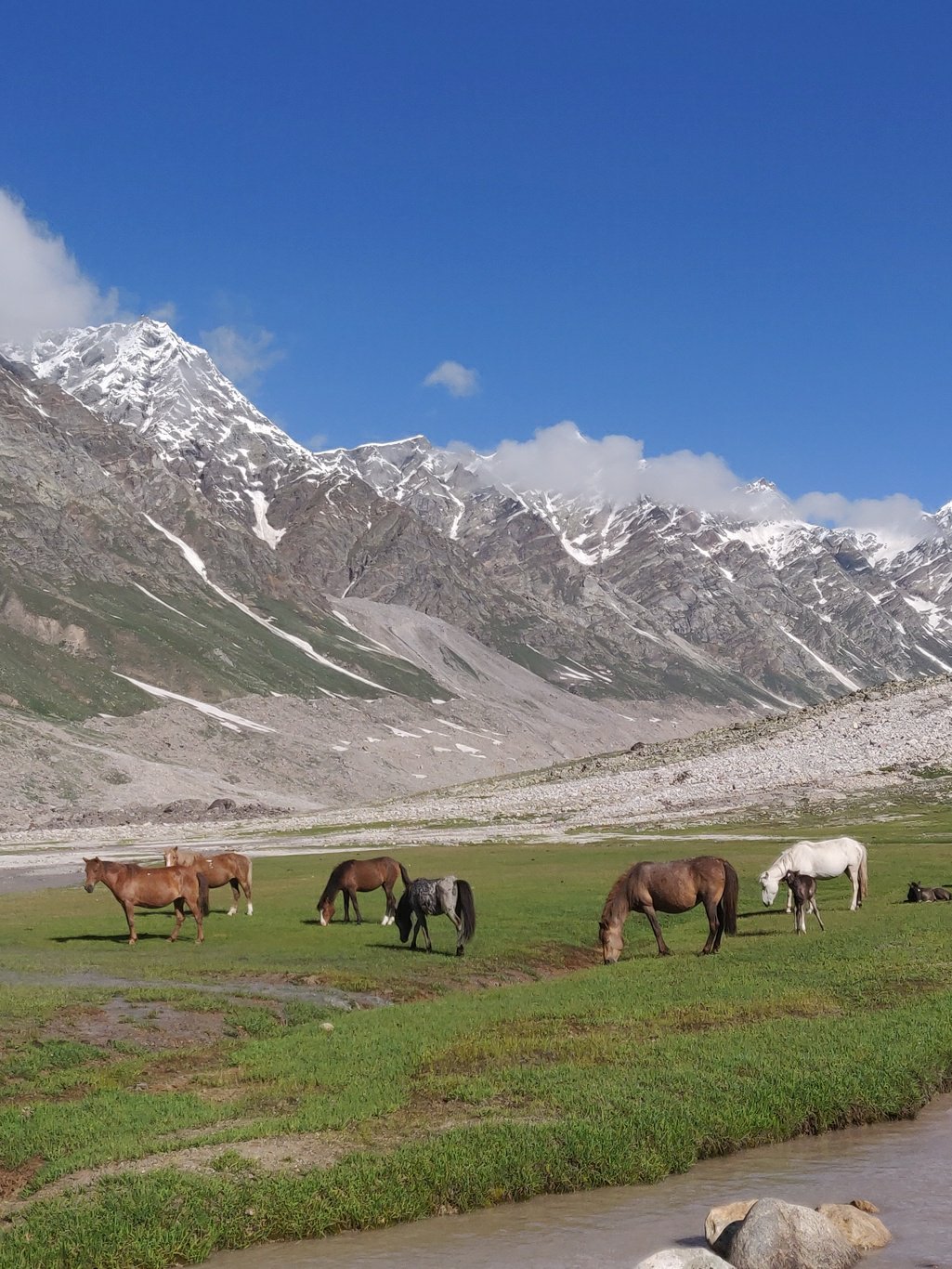 I finally reach the end of the meadows where the Miyar Nala flows down in full force from the moraines beneath the glacier. Even at this place where it surfaces its force and volume are intimidating. In the early morning itself the river carries lots of glacial meltwater.
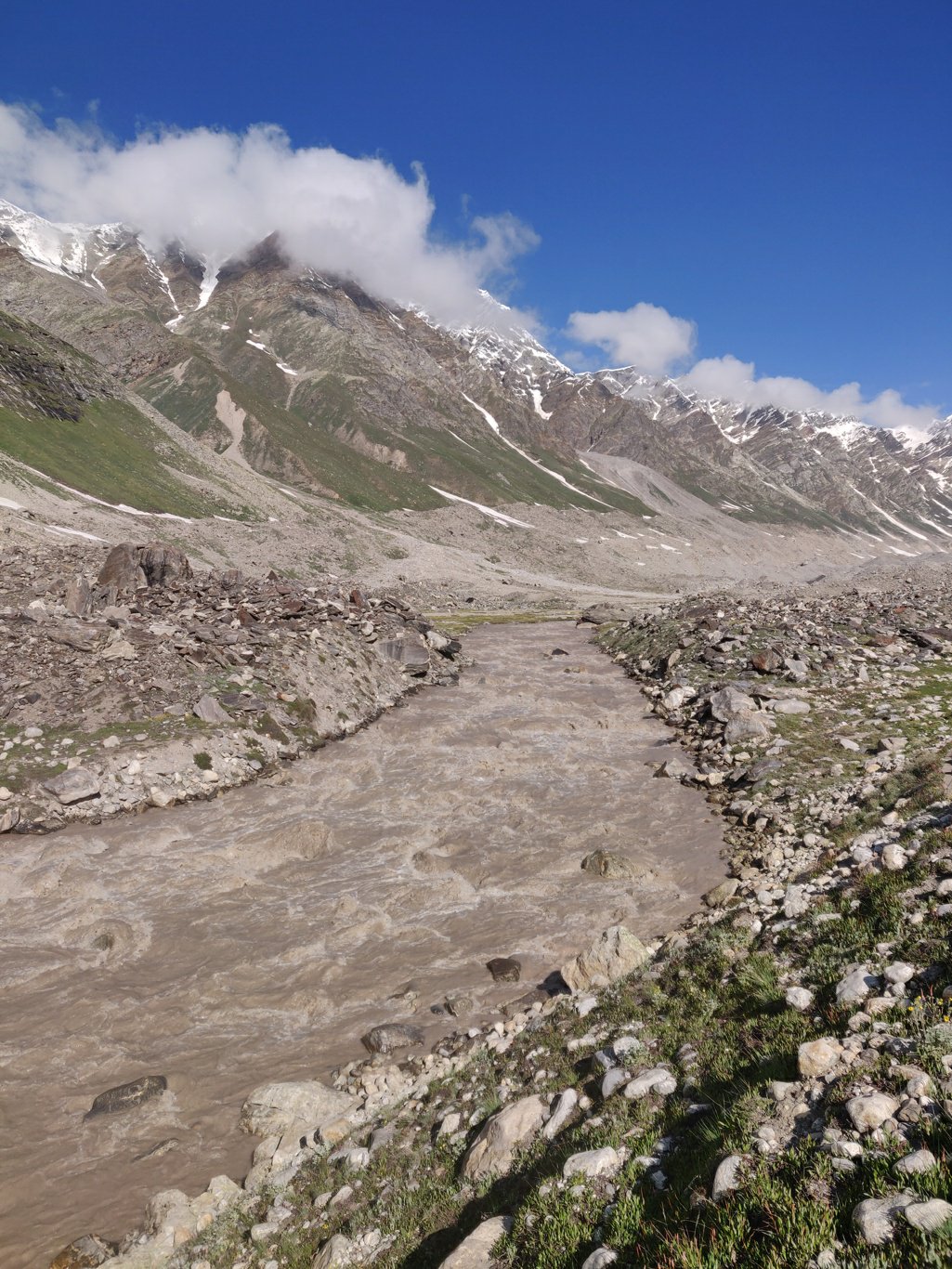 The trail climbs up on the right above the moraines and contours along the green valley slope above the rocks below. Regular cairns mark the route. This trail is much easier to traverse than the original OSM marked trail which runs straight across the moraines below.
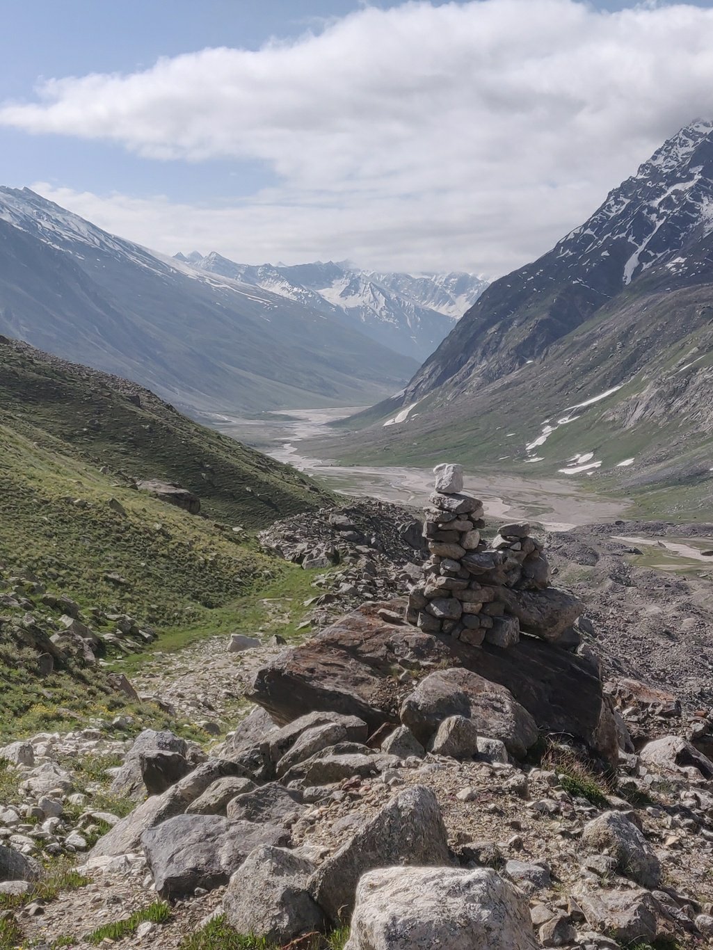 From above one gets a bird’s eye view on the vast moraines of the Kang La below which cave in at various places where the glacier is melting. One can hear rubble and boulders falling as the ice melts away. On the opposite side the Pir Panjal rises steeply till 5000m+ and a number of passes are used by the shepherds to cross over into the Saichu valley of neighbouring Pangi.
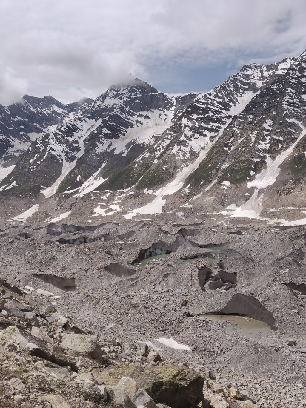 After a while a glacier from a right side valley joins and the trail forcibly descends into the moraines making progress slower and the effort goes up considerably. Cairns continue to mark the route through this vast landscape of moving boulders and rocks on top of the melting glacier.
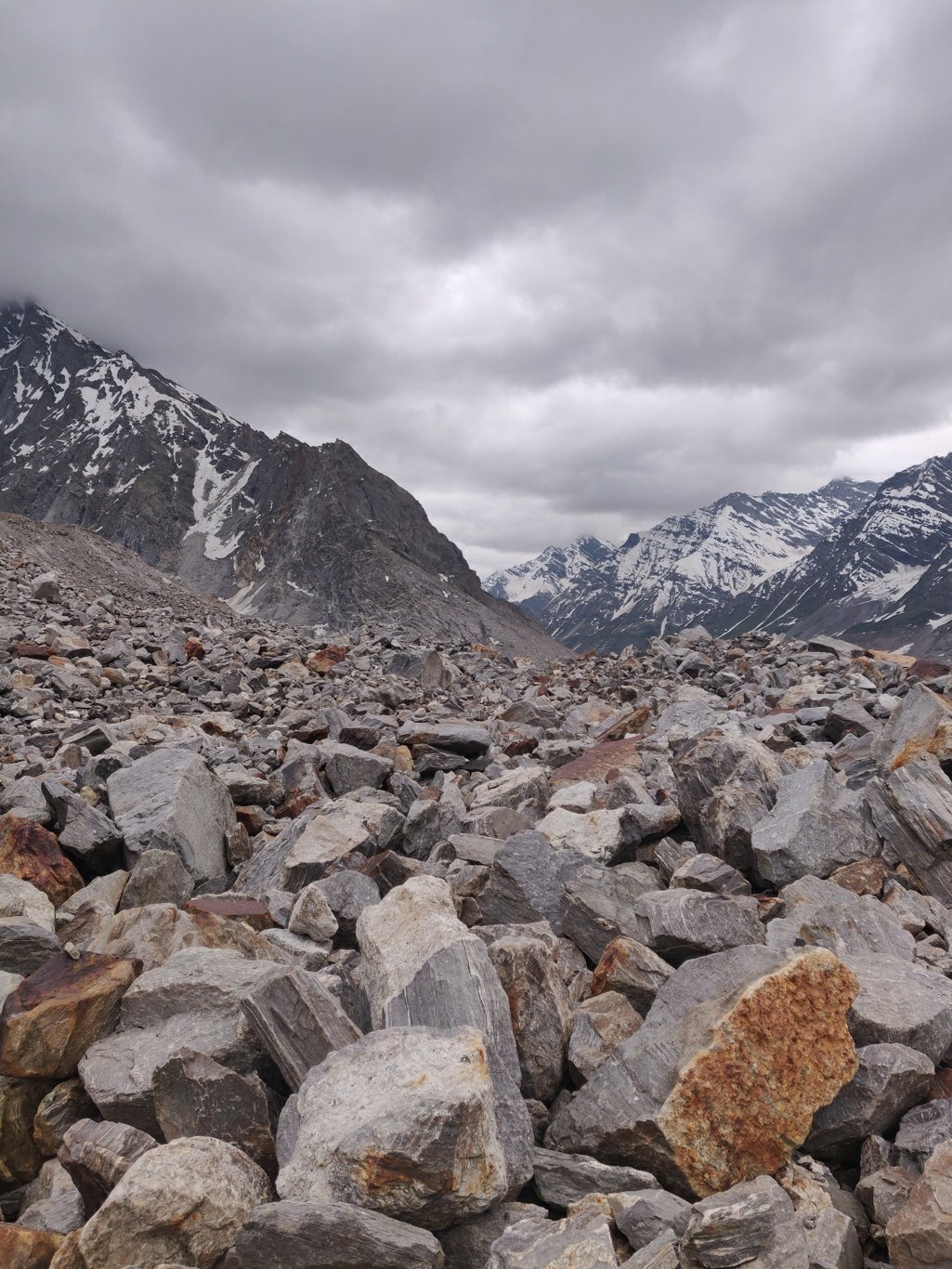 Finally the glacier appears from underneath the rocks and one can now proceed more easily on top of the rough ice providing firm ground for the hiker. Melt water canals are running down from the exposed glacier.
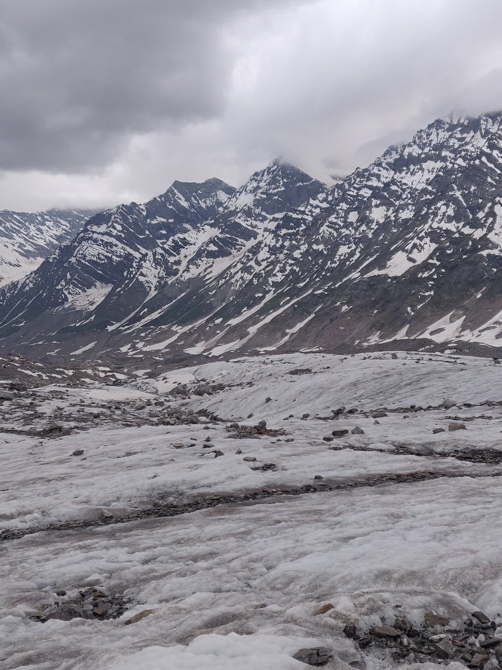 Still higher up snow still covers the glacier and the pace drops again as we sink into the soft snow. I m now trying to navigate the best path through a mix of partly exposed rubble, frozen snow and in between soft snow where I sink hip deep inside.
 On both sides of the vast snow covered valley there are huge glaciers hanging from above which merge into the snow covered Kang La glacier. Around 5pm dark rainy skies appear from behind and I hurry up to find a shelter for the night. At 4900m you don t want to get drenched and suffer in this cold ice world.
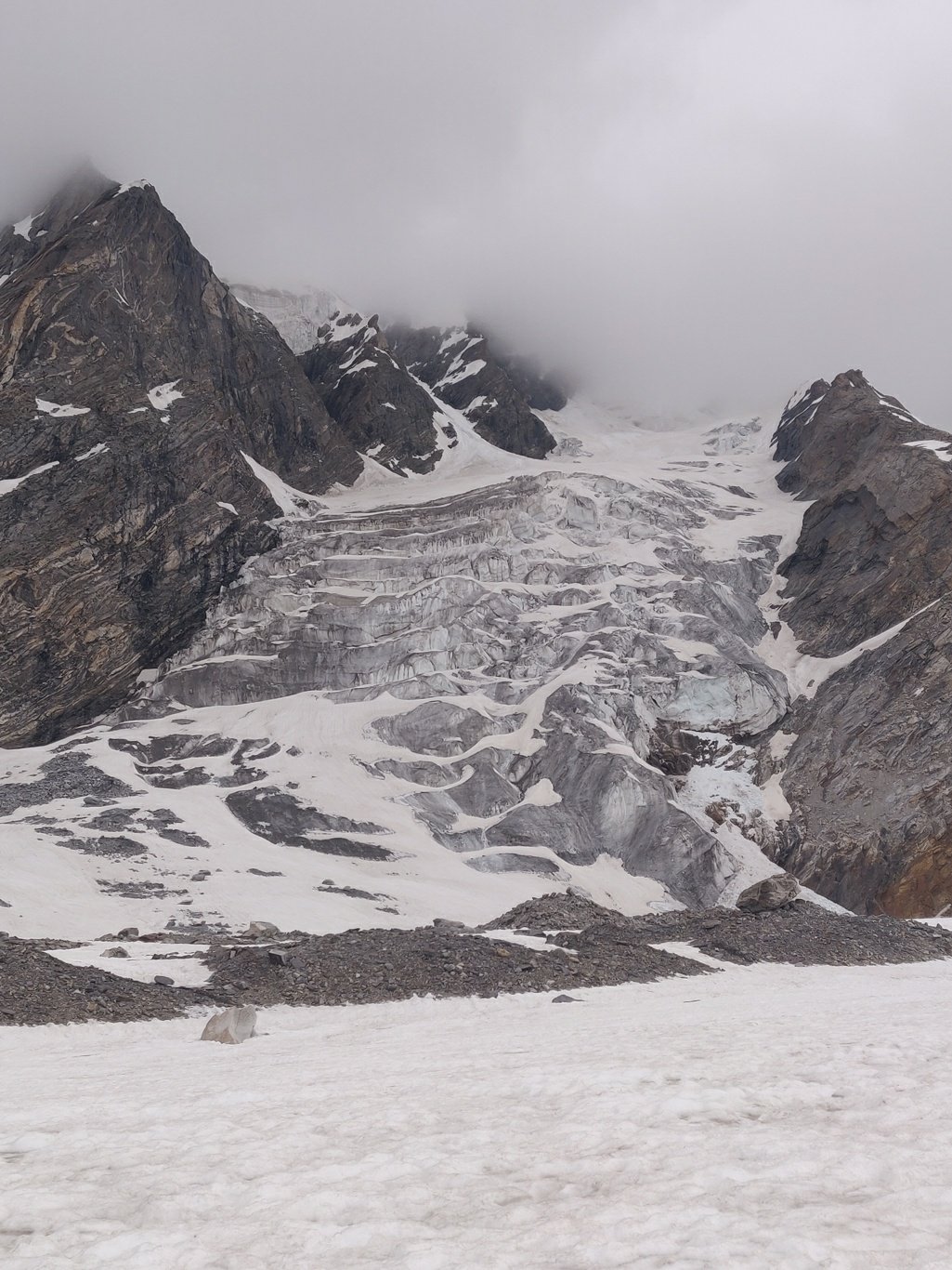 The valley is now a vast expanse of (firmer) snow with little else left to find shelter. I spot a small area of still exposed moraines on the left side and head in the same direction hoping to find a suitable place for the night. As luck would have it, there is a big overhanging boulder with a space below covered from the cold rain.
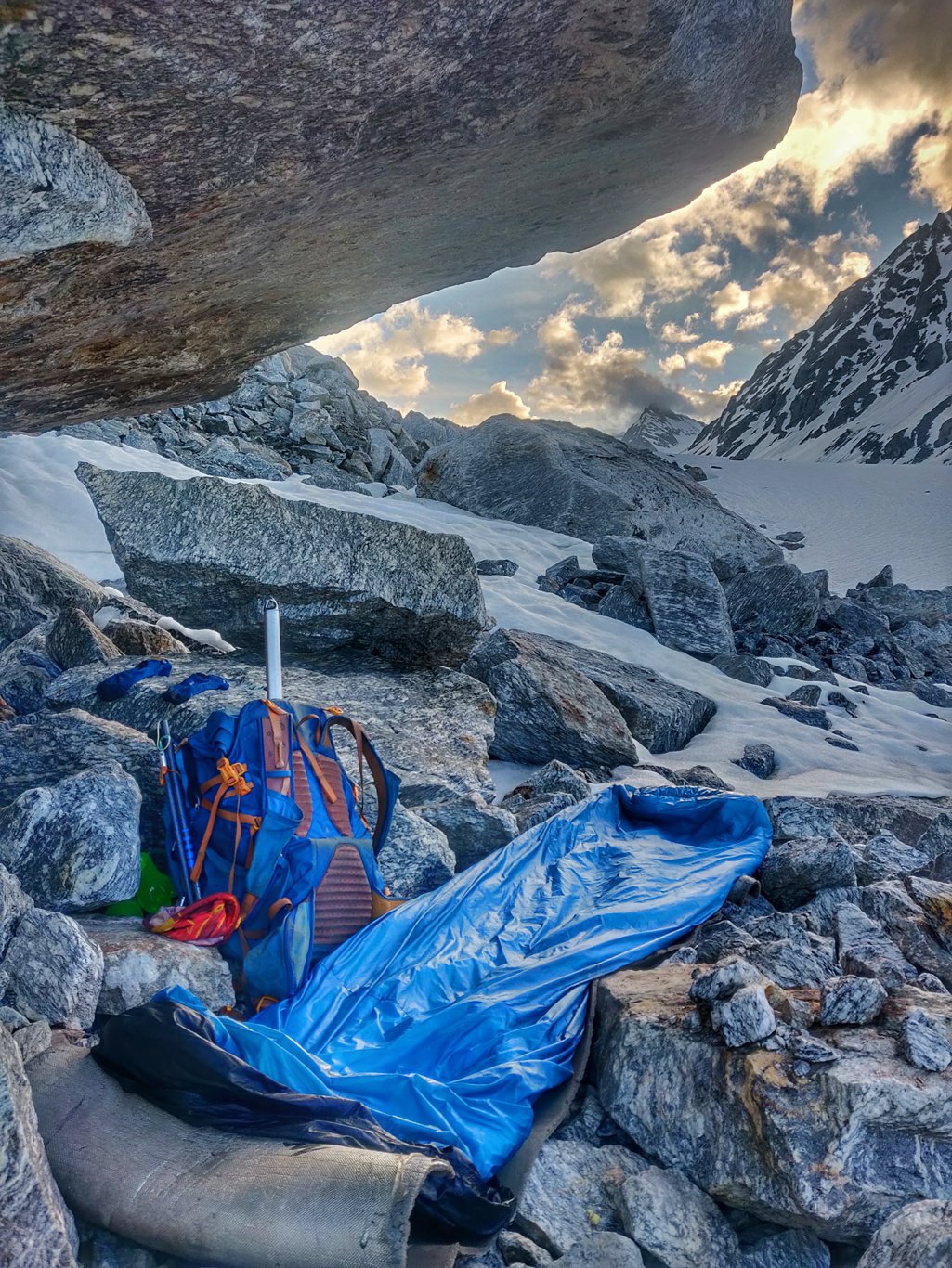 I level the rocks beneath the boulder to create a flat space, spread out my mat and quickly get inside my quilt as the temperature drops. I am glad to be out of the ice, snow and rain. I covered a solid 10 hour, 35K hike today over challenging terrain ending up just 8K from the pass. Perfect position for an early morning crossing in hopefully good weather.
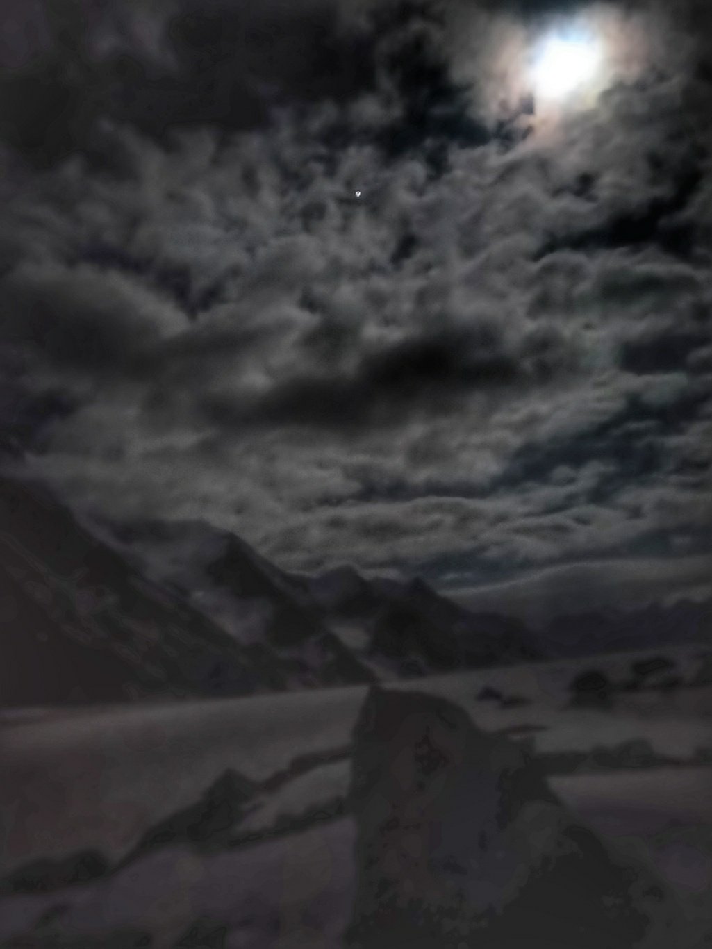 In the night the weather clears up and the moon lights up the snow covered valley. I hear rocks falling from the steep slopes above as the ice melts. I wake up early to another clear, blue sky and get moving by 6am to stay ahead of the usual afternoon weather change.
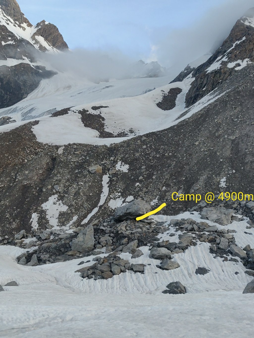 I hike up a very gentle slope towards the pass walking on firm overnight frozen snow. The Miyar valley is huge, 1km wide and appears endless in length. As we cross 5000m in altitude the surrounding peaks appear smaller now. Further up blue canals of glacial meltwater appear inside the snow.
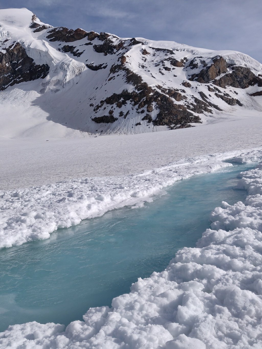 Around 1km from the pass the final 250m steeper ascent starts. As usual the approach is from the side to reduce the gradient of the climb. I take out my ice axe and climb up along a small ridge on the left side and contour up right towards the pass. While climbing up I look back at the beautiful snow covered Miyar valley below.
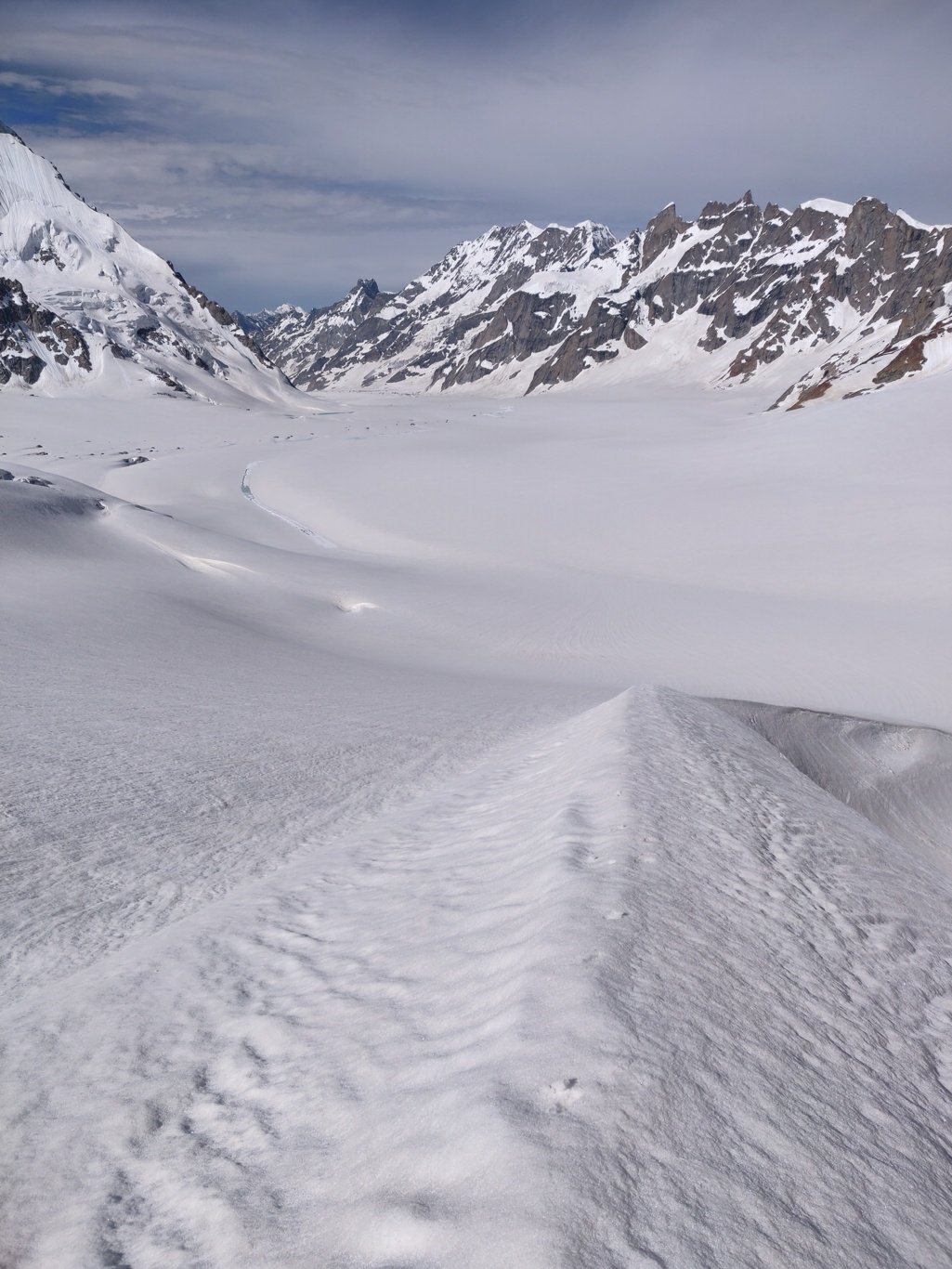 I finally reach the Kang La pass 5450m at 9am, 3 hours after I started, and get the first glimpse on the high ranges of Zanskar, Ladakh. I take a short break for breakfast to refill the burned calories while climbing up.
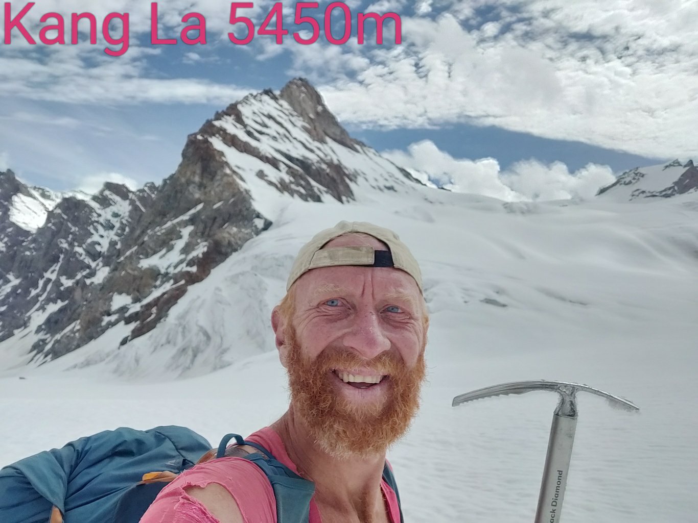 I now descend left into another snow covered valley with glaciers hanging on both sides. The slope is gradual and the snow is soft as my feet sink a few inches with every step so I can maintain a good pace.
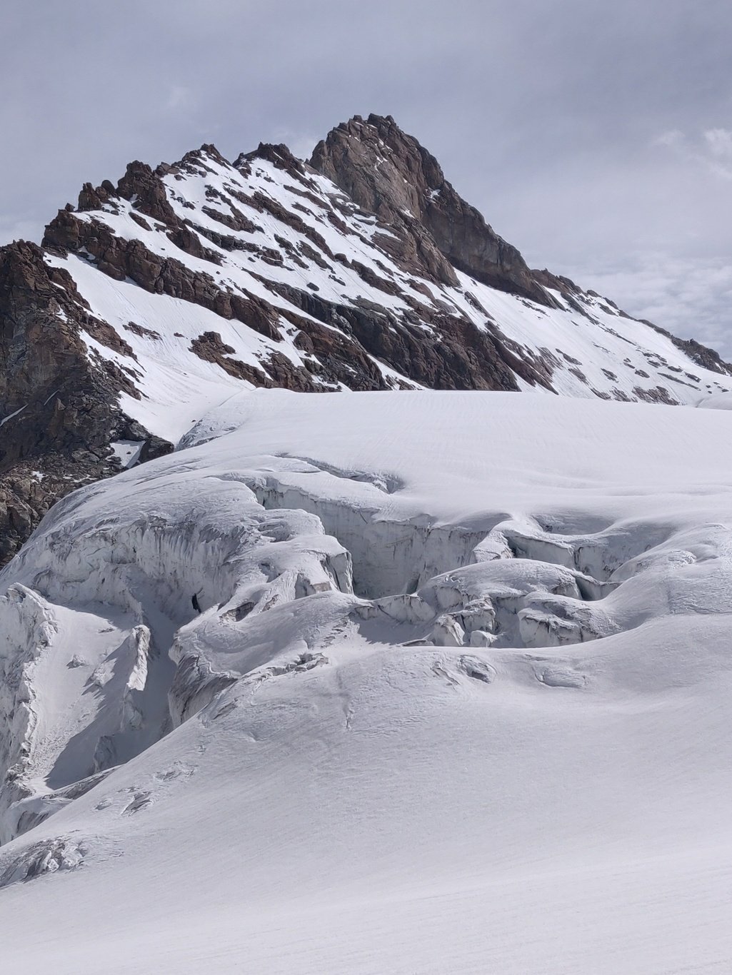 Further down the glacier appears from underneath the snow and a glacial stream is born. The valley turns right and another valley (Poat La) joins from the left. We step out of the snow into the moraines, although much shorter then the Miyar side
 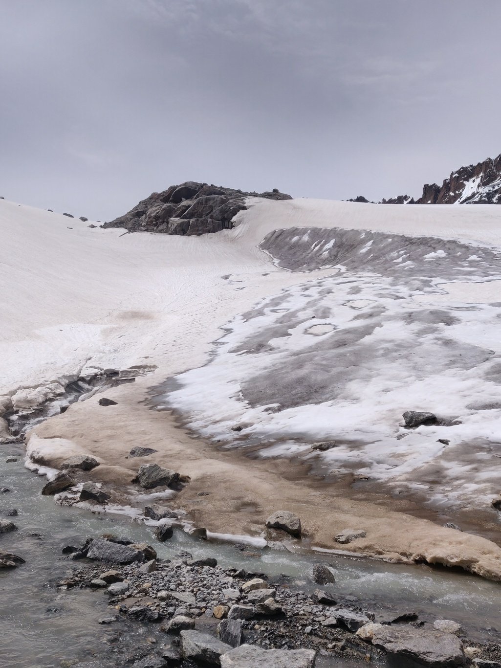 Soon a clear trail forms on the right of the stream and we walk through patches of grass land interspersed with rocks. Far down below we can see the Lugnak river valley. As we enter Zanskar the mountains turn a different hue, darker brown-red.
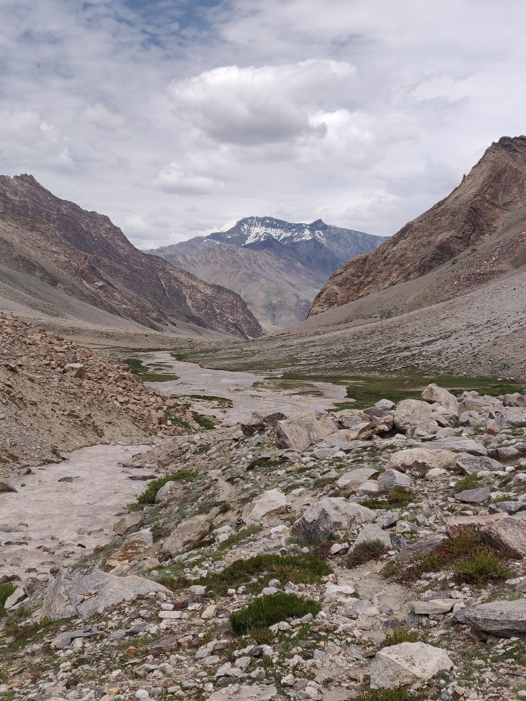 I am surprised to see that in the barren high altitude desert of Zanskar this valley is naturally green with grasslands, bushes and various high altitude flowers. Quite a stark contrast with the barren Lugnak, Tsarap or Zanskar valleys further below.
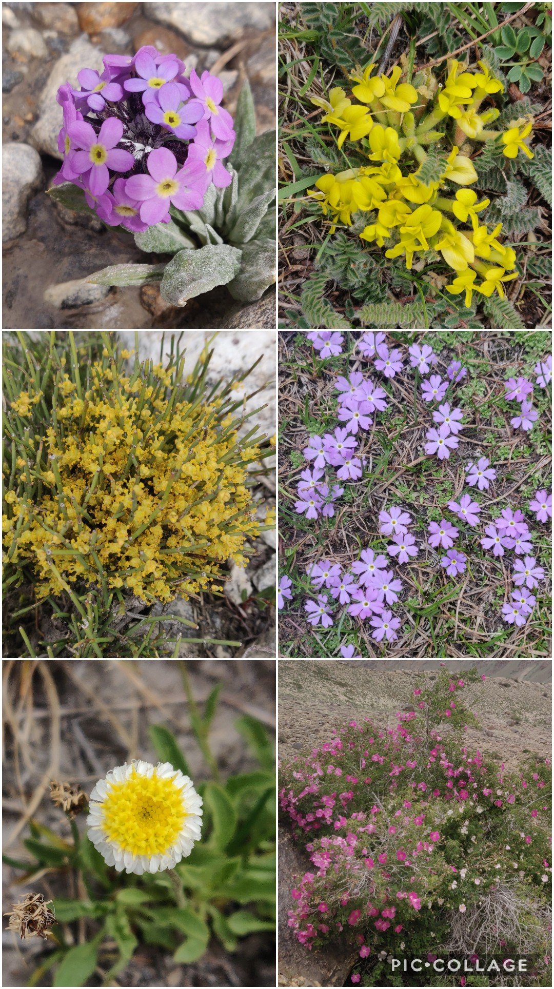 On both sides of the stream wild yaks are grazing the meadows undisturbed by this lonely passer by. I look for any human signs or settlements but this beautiful valley appears uninhabited.
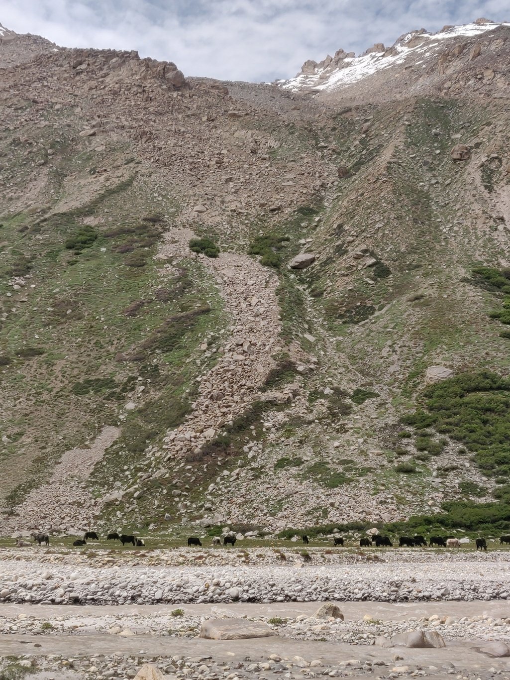 I finally climb down into the Lugnak valley where both streams join. To my surprise the BRO (border roads organisation) is building a two lane highway in this remote valley that hardly sees any traffic. They re also putting up power lines to electrify the Lugnak valley.
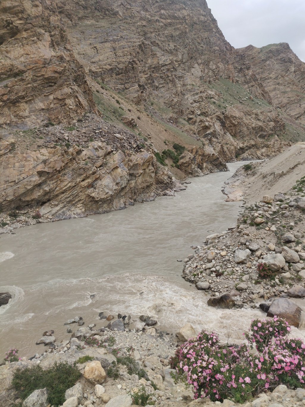 My guess is that they want to make Zanskar more accessible through a road being built across the Shingo La. Once mass tourism flows in, it ll loose it’s remote beauty and original soul. I m lucky to get a ride in the back of a BRO truck towards Padum saving me 12km of walking.
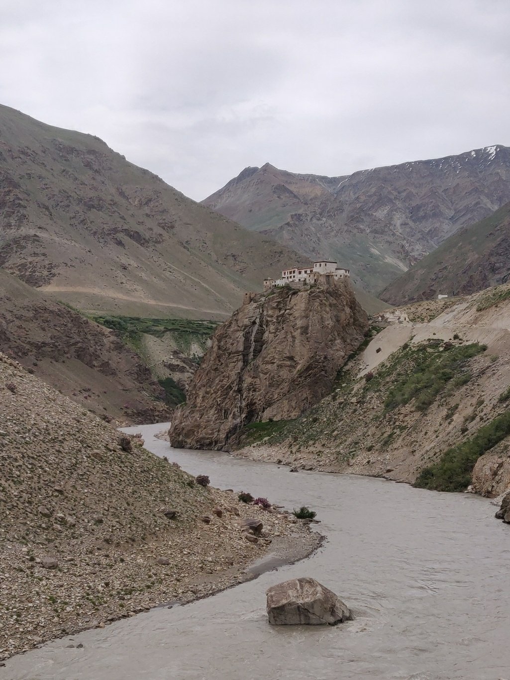 After a 3 day, 100k+ traverse from Lahaul into Zanskar across the Kang La I indulge in some of my favourite cuisine in the touristic town of Padum and stock up my ration for my next target: Umasi La 5300m from Zanskar into the Chenab river valley of J&K.
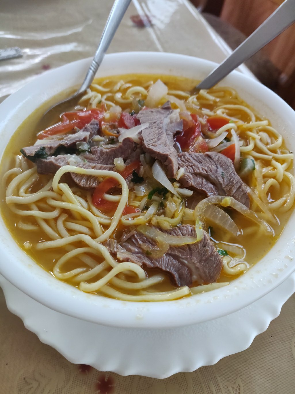

Posts
Copyright © 2019 UltraJourneys - Supported by dreams