
My name is Peter Van Geit, born in Belgium and settled in India for the past 2 decades. I love spending time in nature through long endurance journeys. It’s my way of meditation in remote, virgin locations and experiencing lost humanity. I am a bit of a unique intersection of an explorer, ultra runner (minimalist) and alpinist. Last year I ran 2000km solo through the remote mountains of Northeast Vietnam near the border with China. This year I sat down to plan a new challenge – spent the entire summer in the Indian Himalayas exploring as many high passes as possible. Eventually I ended up crossing 120 passes over 3000+km and 175 thousand meters of elevation gain passing through 341 remote hamlets where I experienced true humanity. Highest pass covered was 6150m altitude.
The journey – mostly solo – was done in exploration style – myself (and a friend Maniraj) spent weeks analyzing various maps and blogs to locate and identify lesser known passes connected through a 3000 km trans-Himalayan route covering Uttarakhand, Himachal and Ladakh. The journey was executed alpine style without any support, self-planned and self-navigated finding my way through virgin jungles, alpine meadows, moraines, glaciers, snow sections and wild streams. In several places I lost my way trying to get back on track using topographic maps and modern navigation. Being an ultra runner I also went minimalist carrying minimal gears – just 5kg – to complete the journey in an ultra pace, power hiking 12 hours each day, crossing 120 passes in 4 months (or roughly 1 per day).
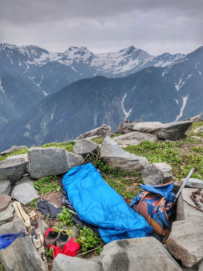
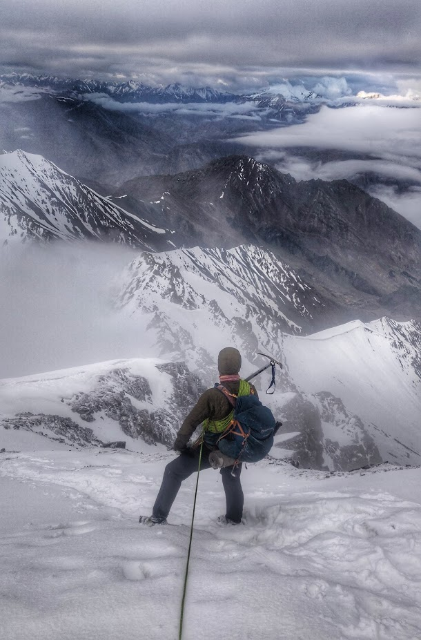
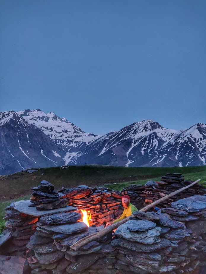
I carry a basic shelter – mostly sleeping in the open with a lightweight sleeping bag, carrying a 500 gram bivy to protect against rain and cold wind. No stove or fuel was carried (to reduce weight) as most passes were crossed in 1-2 days resupplying fresh food in remote hamlets in between. In the vast high altitude desert of Ladakh I collected bushes and yak dung sprinkled in kerosene to cook food for longer 5-6 day sections in between villages. No technical gears are carried (minimizing weight) except for an ice axe to cut through numerous frozen snow gullies while opening passes in early summer. I wear trail running shoes and light breathable clothing to climb up fast and for comfort in wet and hot weather and crossing streams. A lightweight puff and rain jacket are used to layer up and stay warm in cold and rainy conditions.
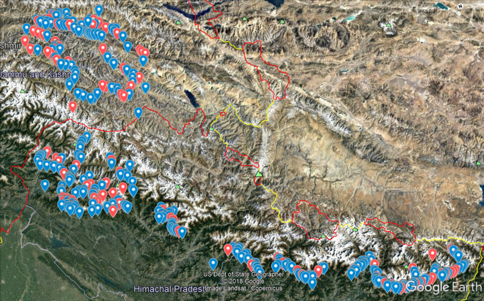
Navigation is done using off-line contour maps on my phone carrying an extra power bank giving me 5-6 days action radius before recharging. I use Open Street Maps (OSM) as a base layer (has numerous trails, villages, campsites…) overlaid with my own GPS routes for lesser known passes taken from Himalayan hiking blogs and self-marked using satellite maps. The exact location of all 120 passes and 341 hamlets passes were marked in OSM and documented using geo-tagged photos, daily blogs and maps on my blog ultrajourneys.org in an effort to create a central repository on passes in the Indian Himalayas which is currently absent.
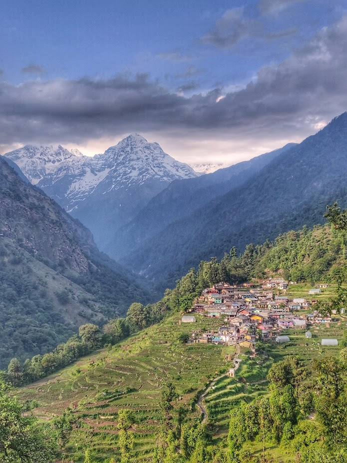
Putting together a realistic 4 months multi-season, 3000km long trans-Himalayan route had to take into account various key factors: altitude (high passes closed in spring), seasons (July monsoon in lower Himalayas), glacial meltwater (unpassable streams, dangerous currents) and shepherd migration (open snow-covered passes). All 120 passes were looped together minimizing in-between travel. The journey started with crossing the entire length of Uttarakhand through 30 sub-4000m passes in May, exploring several deeper valleys (ancient trade routes) near the border with Tibet like Dharma, Milam and Pindari. The state has many beautiful undocumented cobbled and dirt paths connecting remote, tribal hamlets (some taken straight out of a fairytale book) through virgin forests and passes connecting neighboring valleys. I experienced unseen hospitality in most villages minimizing the need to carry food or even shelter.
With the snow line retreating early June, I moved on to the Great Himalayan National Park (GHNP) a wildlife sanctuary and protected biosphere in Kullu, Himachal tucked between the high ranges of the Pin National Park and Kinnaur. I explored the valleys of Tirthan, Sainj and Jiwa Nala rivers connected by 4000m high passes. With little info available online on trails in GHNP I navigated using a rough schematic diagram downloaded from the tourism web-site. The park has some of the steepest and most inaccessible rock cliffs I encountered. Losing the less used trail here meant getting stuck in near-vertical cliffs. I encountered tribals collecting “jungli nalla” – a highly valued medicinal root smuggled to China and large, beautiful quartz rock crystals found in these high ranges.
Mid June I moved on to 4000+m passes across the Dhauladhar range separating the Kangra plains and the Chamba valley. I opened several passes above Dharamsala with my ice axe cutting through numerous frozen snow gullies. These mountains rise up sharply from the plains and gradually descend into Chamba leading to holy pilgrim lakes which were still covered below ice and snow due to unprecedented snowfall last winter. On the Palampur / Eastern side of the Dhauladhar several lesser known passes (like Waru) are used by shepherds to migrate from the plains to Chamba. Several times I lost track of these unmarked trails dropping steeply into the Kangra plains and partly covered by snow ending up in free solo moments trying to climb down near-vertical rock faces before setting firm foothold again in the frozen snow gullies below.
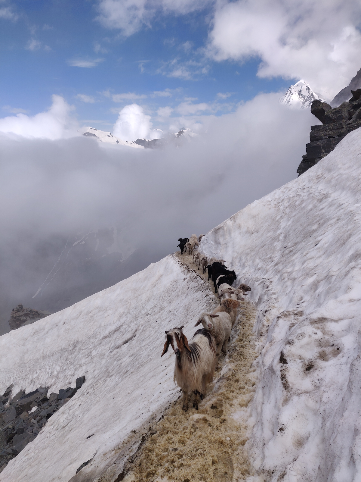
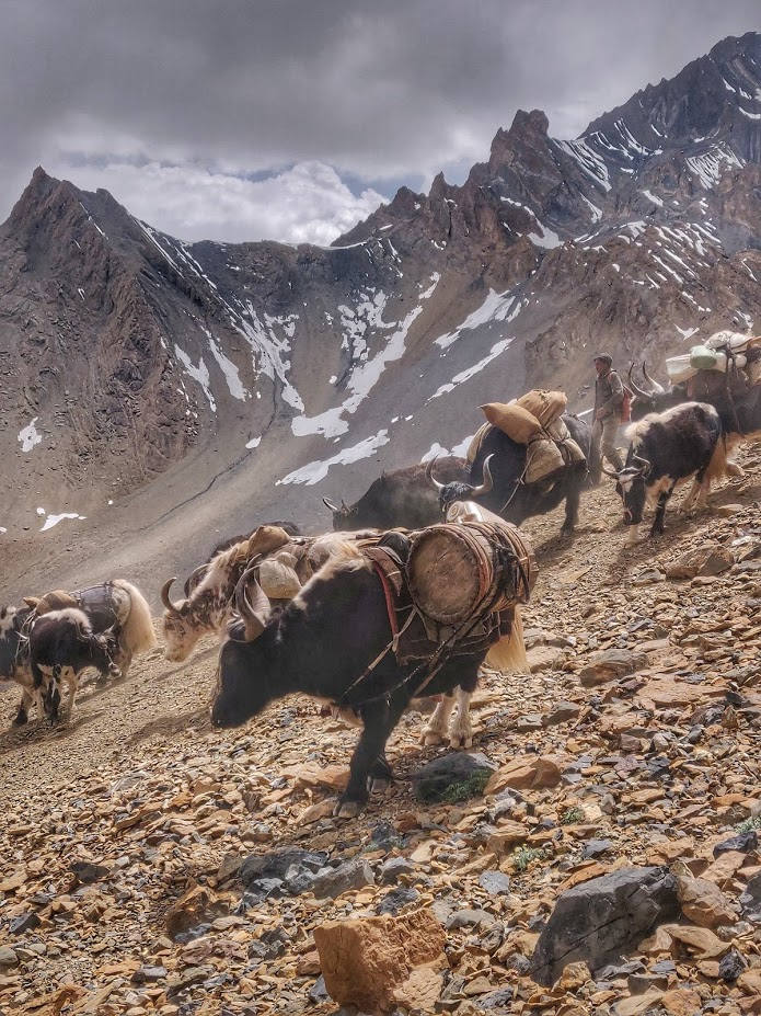
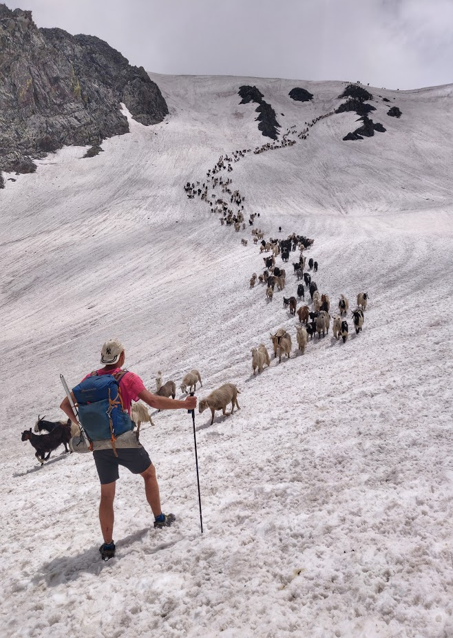
End June I followed the footsteps of the gaddis in their annual migration from the Chamba valley across the 5000+m Pir Panjal ranges to the high ranges of Lahaul and Pangi. Their herds graze the alpine meadows during the entire summer to produce better quality milk and meat. Many of these high passes like Darati, Marhu, Kalichu are gradual on one side but very steep (some 1000+m near vertical drops) climbing through a labyrinth of narrow passages up these steep rock faces. Combined with land-slide prone slopes, large moraines on melting ice and crevassed glaciers several of the animals do not survive the journey. The experience of crossing these undocumented, virgin passes along with near kilometer long herds of thousand+ sheep and goats is life memorable experience.
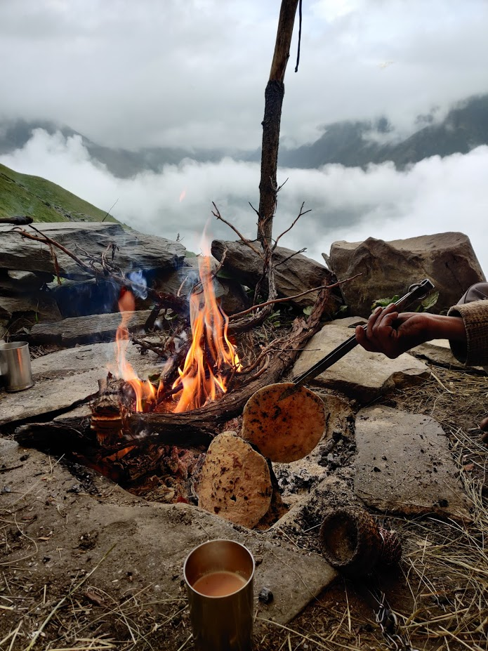
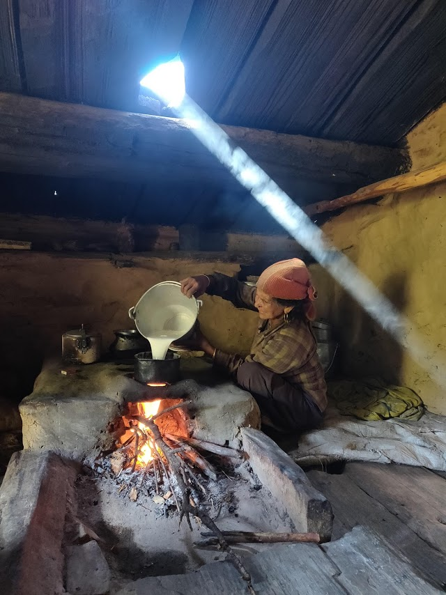
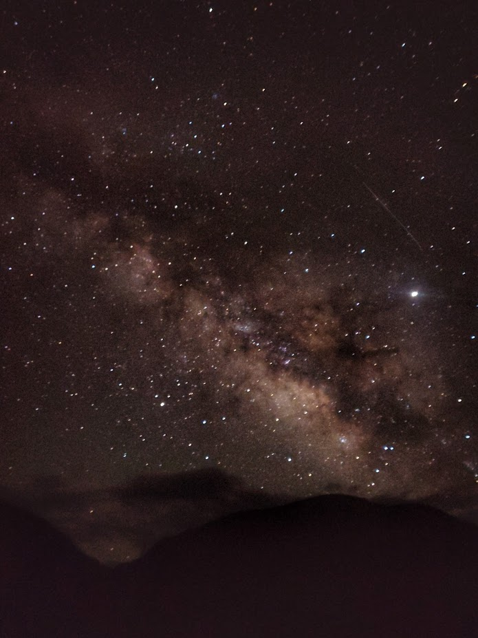
Hospitality in these remote and inaccessible corners of the Himalayas is beyond words. Completely disconnected from modern society, living self sustained and in harmony with nature one encounters the gujjars (mountain tribes) in the virgin forests of Chamba which treat you as a royal guest, especially when traveling solo in these untouched places. A friendly face, a cup of fresh buffalo milk is followed by a sumptuous dinner of fluffy rotties over a wood fire and fresh ghee poured over dal sabji mixed with sheep milk before dreaming off beneath the stardust of milky way in the dark night skies above on a warm goat skin in a mud home with the soothing sound of the neary stream. A similar heart-warming hospitality is standard procedure with the semi-nomadic shepherds which will offer you – without expectation – fresh food and shelter for the night. True humanity can be found in these places of untouched natural beauty which we lost in our modern societies selling our souls to money and greed.
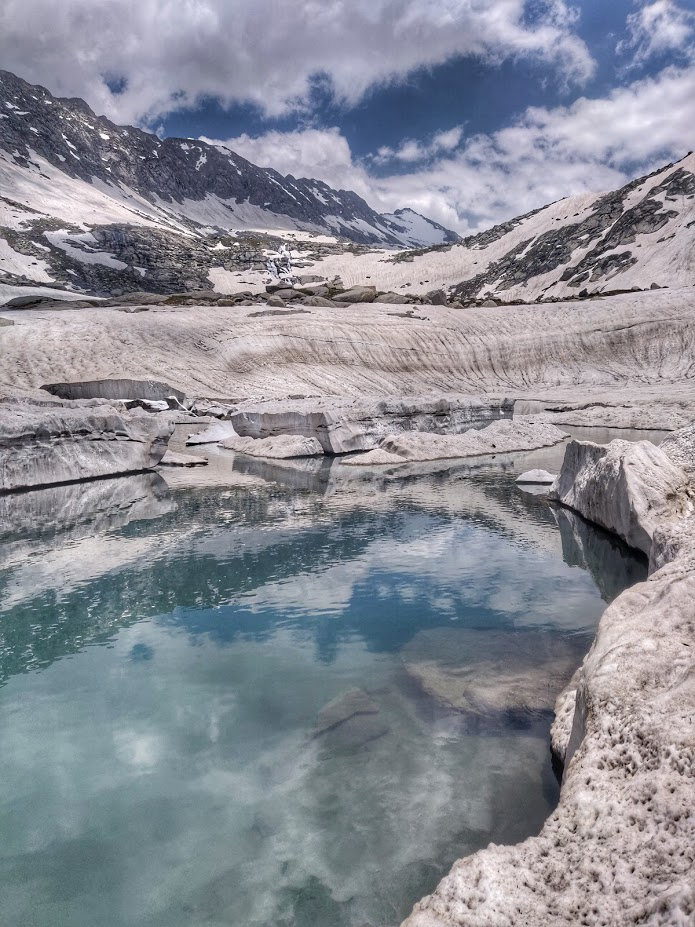
With the onset of the Northwest monsoon in July I cross the Kang La, one of the largest glaciers in Himachal, moving on from Lahaul to the high altitude desert of Zanskar and Ladakh. Here one enters an entirely different world – a vast, desolate unearthly landscape of highly eroded mountains and glacial streams cutting deep canyons through rocks of unusual gradients and textures. One encounters many remote settlements which have been deserted by once vibrant farming settlements due to (probably) climate change and younger generations leaving the hardship of this remote existence for the comforts of the cities. With the monsoon rains pouring down in the lower Himalayas I crossed around 30 high passes between Zanskar and Ladakh around the Hemis National park. Changing weather patterns have also in frequent rains in Ladakh not seen before in the last 2 decades and given birth to bustling green eco systems in some of the interior valleys of this barren desert.
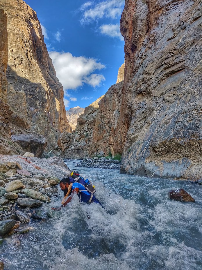
One encounters many hikers from all corners of Europe in the more touristic regions of Ladakh, most of them carrying loads of gears and comfort on horses, accompanied by horsemen, guide and cook. Only few of them go in alpine style but no one really goes minimalist. All seem surprised while I run past them with my 5kg pack covering trice the distance of the average hiker. Navigation is straightforward with trails clearly marked by horse dung, cairns and footsteps. As soon as I step into the lesser known passes I am on my own again with no living soul around me except for herds of wild yaks, ibex (wild mountain goats) and snow leopards. Mid August unprecedented rains flood the lower Himalayas and cover the high ranges of Ladakh with a white blanket above 4000 meters. The interior passes and canyons which I planned to explore in Hemis are out of bounds again due to dangerous stream currents.
I hitch a ride along the Manali-Leh highway which had been closed for 5 days due to massive landslides and continue exploring some of the lesser known passes around Bara Bangal, a remote corner on the border of Kullu, Kangra and Lahaul. Ancient trails are destroyed in many places by fresh landslides and crossing turbulent streams remains a challenge. We manage to short cut valleys, streams and landslides using frozen snow bridges which are still in tact due to unprecedented snowfall in winter. Our hosts and guardian angels of the Himalayas, the shepherds, are returning home early this year expecting winter to set in soon and facing an uncertain future with challenges unseen in previous generations in a fast changing high altitude world due to climate change caused by unsustainable living in the cities and plains. Mid September I wrap up my 120th pass and decide it’s time for a short break before heading out to my next destination…
Trans Himalaya 2019 was a journey of mesmerizing natural beauty discovering unseen humanity in the remotest corners of the Indian Himalayas. The entire journey is documented through photos, videos, daily blog posts and maps on ultrajourneys.org. Special thanks to Bluebolt (bluebolt.in) minimalist gears.
More on:
Couldn’t take my eyes of this article. This journey of yours is beyond amazing.
I took my first trek to the Himalayas this June, and I felt I had achieved a great deal. But after reading this, it feels so miniscule in front of it.
Been following your posts on Instagram and I still can’t believe how minimalist can you live on such high altitudes. That is commendable.
Thanks for sharing your journey.
Wonderful to read your story of exploring the remote parts of Himalayas … Kudos