This 105km long multi-day traverse proceeds North-South along the Deccan ridge hopping across 5700 meters of elevation gain while passing through 12 forts, ghat sections, valleys including Sudhagad fort, Taila-Baila pinnacles, Mulsi lake, Ghangad fort, Ghondand, Tahmini valley, Kal river valley, Kurdugad fort, Telyachinaal – Thipthipyaghat, Konkan Diva fort, Kaal river valley and Raigad

- Sudhagad fort (Bhorapgad) – 7km / 480m+ we start this traverse near Pachchapur in the Kundalikar river valley in the Konkan plains where we climb up North to Sudhagad fort (574m) located on a big plateau. Dated from 2nd century BC and of same age as the nearby Thanale Caves and Khadsamble caves. We descend North back into the Konkan plains via the Walki Nadi valley
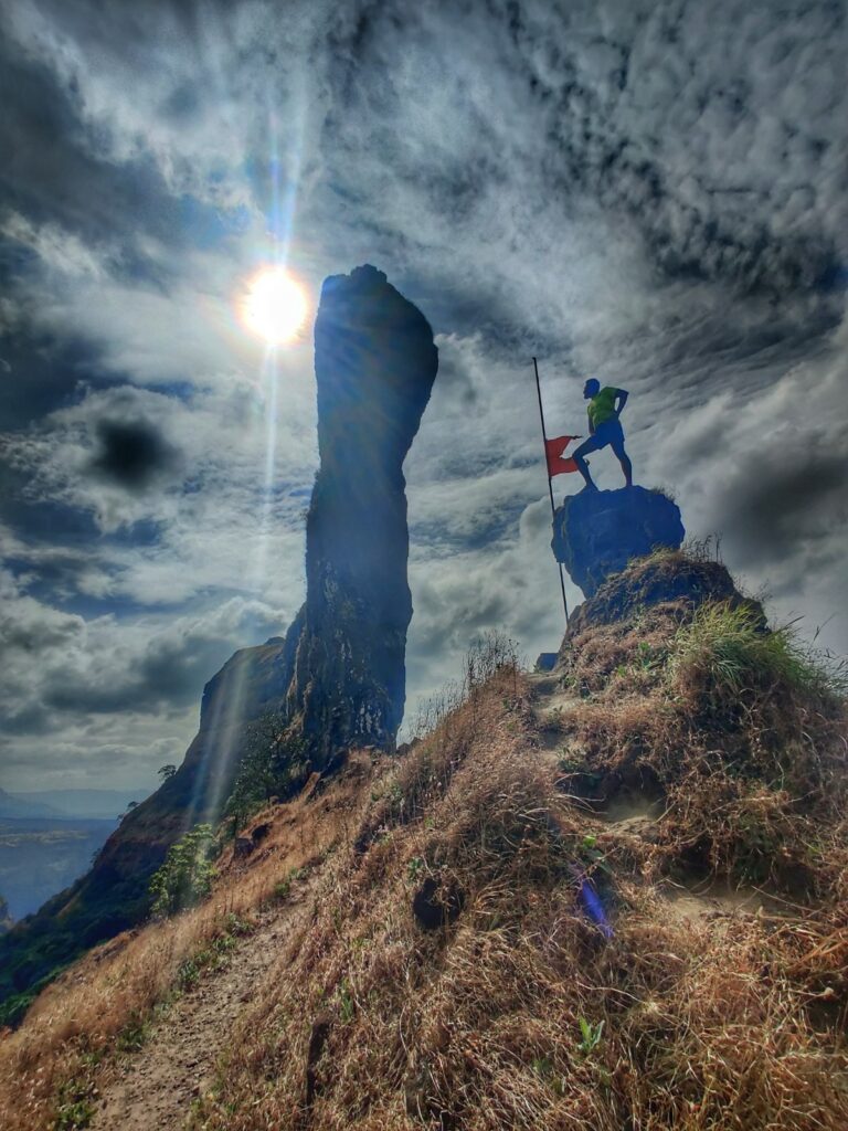
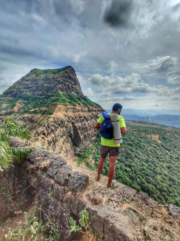
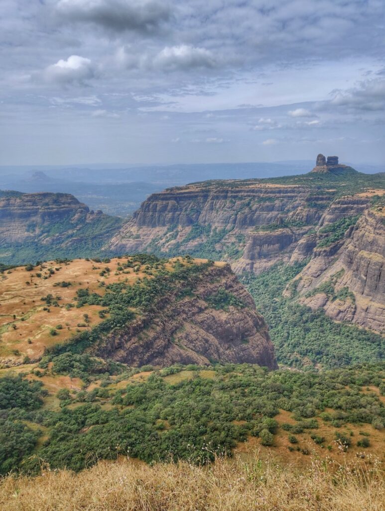
- Taila-Baila – 5.6km / 660m+ we immediately climb up East across the Savasni pass (600m) to the twin pinnacle of Taila-Baila (1012m) on the edge of the Deccan plateau providing birds eye views on the surroundings
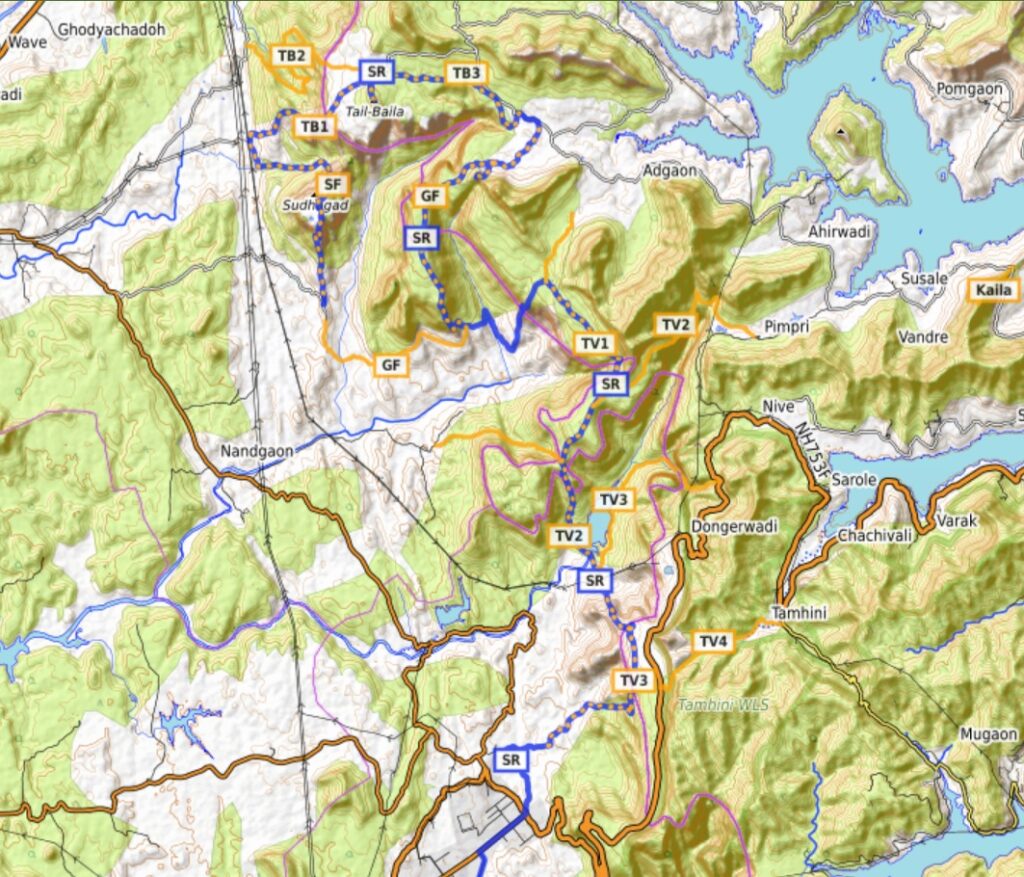
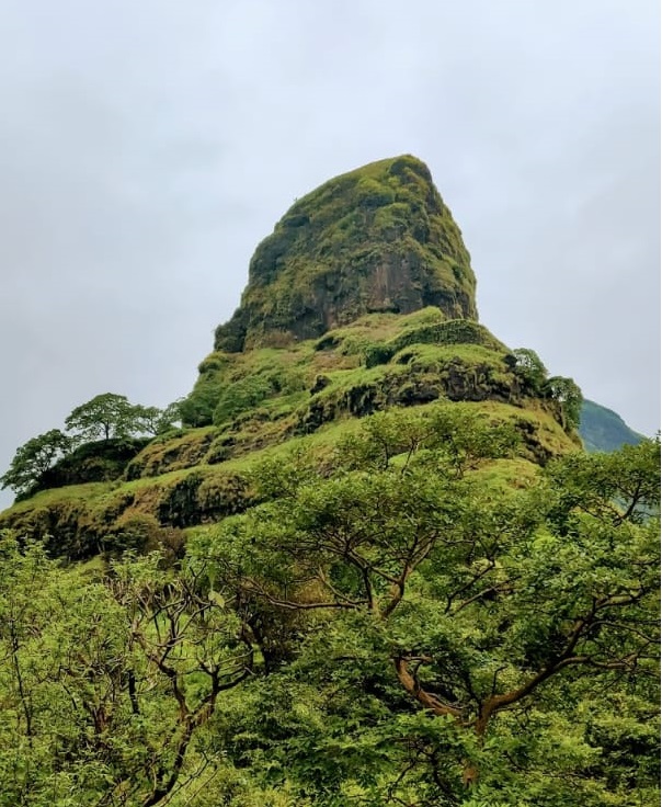
- Ghangad fort – 15km / 780m- from Taila-Baila we proceed East on the Deccan plateau towards Mulshi lake where we turn Northwest towards Ghangad fort (810m) on overlooking the Borapdara Nala valley opposite Sudhagad
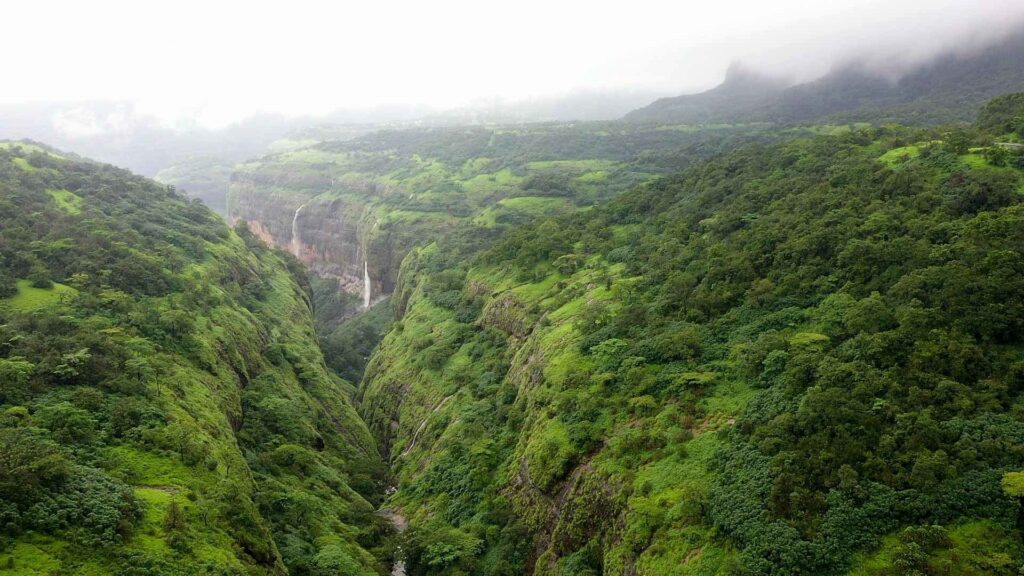
- Tamhini valley – 12km / 750m+ from Ghangad we proceed South via Ghondand descending into the Kundalikar river valley where we contour SouthEast towards the Tamhini ghat. We descend South crossing a dam / reservoir in the Tamhini valley (Kundalika river) to the Konkan plains near Vile Bhagad in the Kal river valley
- Vile Bhagad / Kal river valley – we now traverse the Konkan plains via roads South from Vile Bhagad at the base of Tamhini ghat road (NH753F) East towards the base of Kurdugag fort
- Kurdugad fort – 5.6km / 400m+ we climb out of the Kal river valley North up to Kurdugad fort (800m) on the edge of the Deccan plateau overlooking the Konkan plains to the West
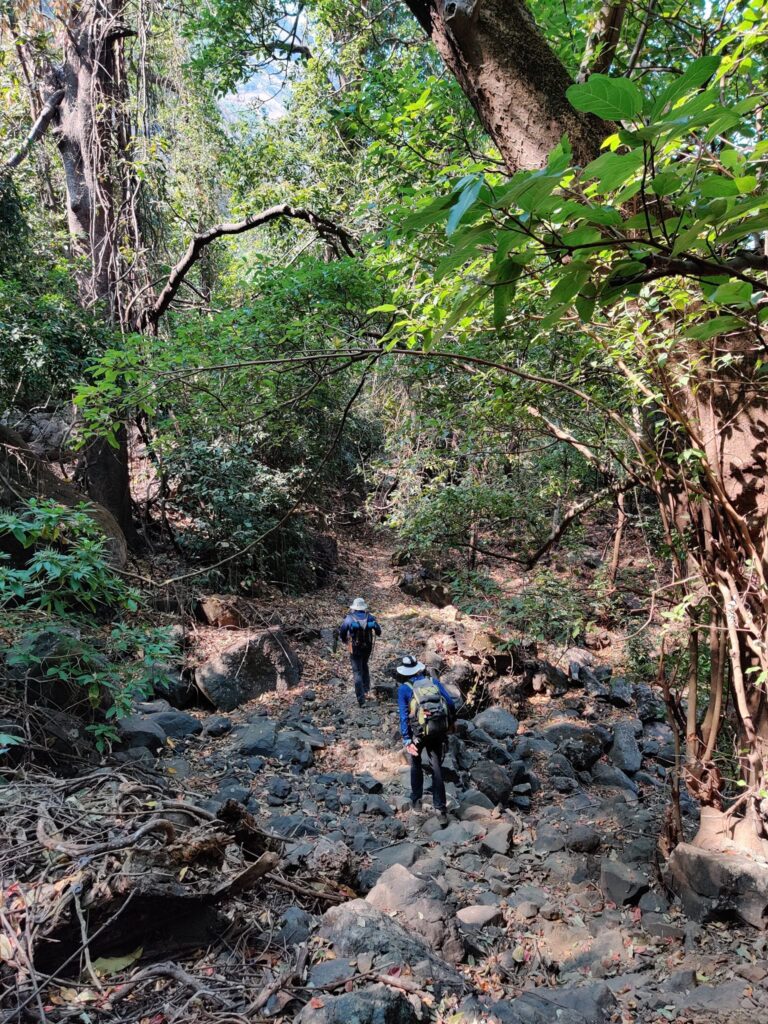
- Telyachinaal – Thipthipyaghat – 16km / 620m+ we descend back South from Kurdugad fort to the Kal river valley and climb up Southeast to Kumbermachi where we contour mid-way (450m) the Deccan plateau slope West – South – East via Bormachi – Badadermachi – Yelonwadi – Ghol into the origin of the Kaal river valley
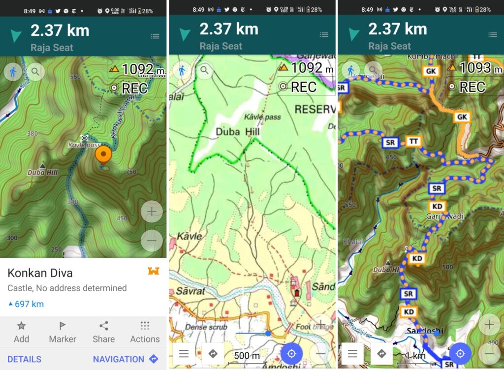
- Konkan Diva – 9km / 700m- from Ghol we proceed South high above the Kaal river valley towards Konkan Diva fort (800m) overlooking the valley below
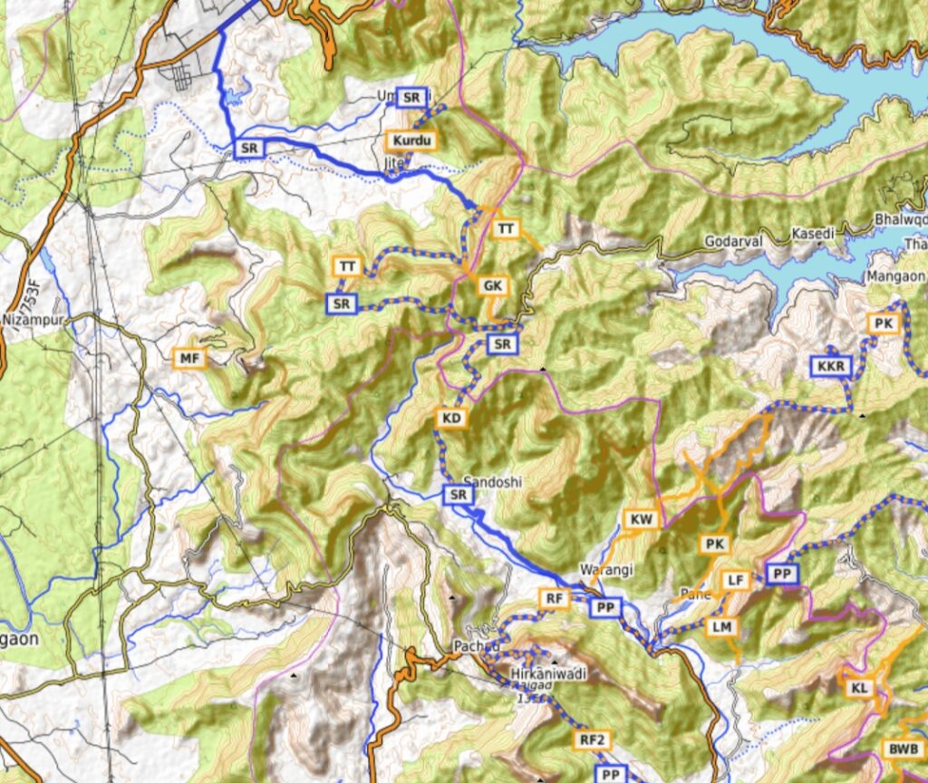
- Kaal valley – from Konkan Diva we descend South via the Kavle pass (620m) just East of the Duba hill into the Kaal river valley and follow a road on the left bank of the river Southeast towards Warangi
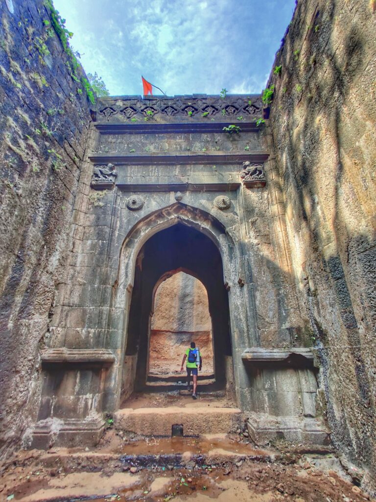
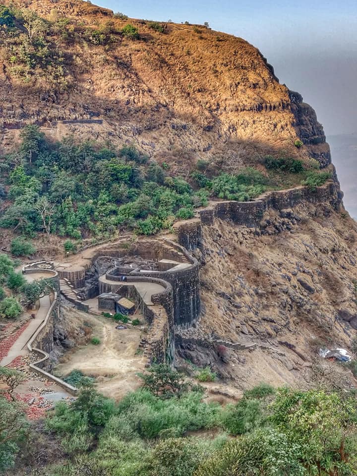
- Raigad fort – 13km / 780m+ near Warangi we cross the Kaal river and gradually climb up East to Raigad fort, the capital of Chhatrapati Shivaji Maharaj’s kingdom where we end this beautiful 105km long traverse starting from Sudhagad, also once considered as a possible choice for the capital
Navigation
Above traverses can be easily navigated using most mobile mapping apps – most use Open Street Maps as base maps which include tens of thousands of kilometers of trails in Himalayas, Sahyadri, etc. OSM maps can be downloaded on the phone for offline exploration of the mountains without mobile network. Contours can be added to understand the topography of the terrain. My favorite app is OSMAnd.

References