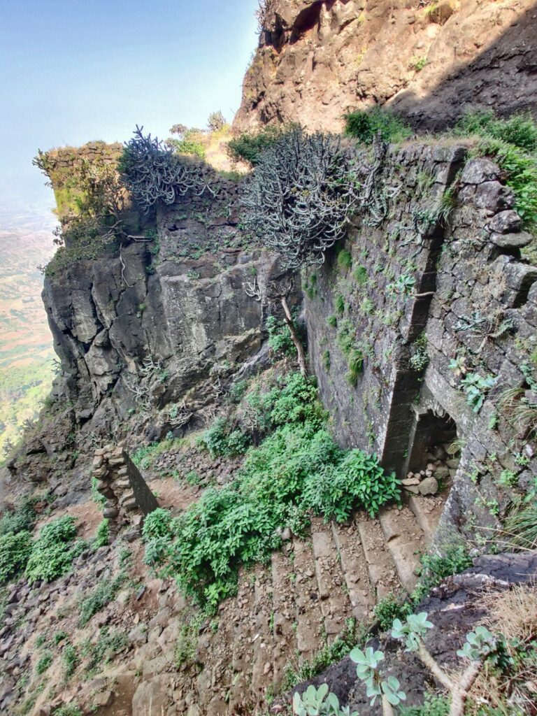
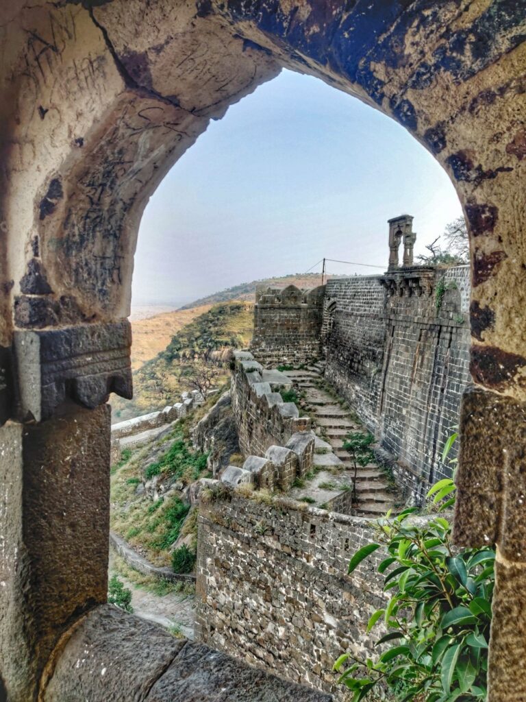
Selbari-Dolbari is a mountain range located in Nashik District in Maharashtra, India. Spanning East-West the hills form the Northernmost extent of the Sahyadri’s and serve as a natural boundary between Nashik and Dhule district. The range is gifted with a number of peaks including the only two-pinnacled peak of Mangi-Tungi rising to a considerable height of up to 1,331 meters. There are 14 forts and peaks located in this range (disconnected by road) with a total elevation gain of 4500 meters. Details on the individual forts (clock-wise) below.
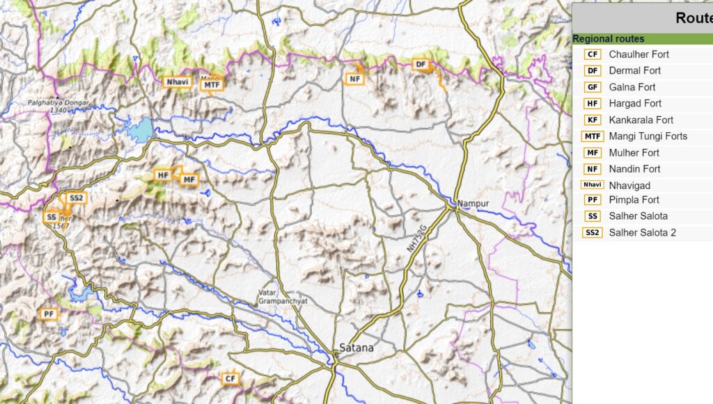
- Chauler Fort 2.2km / 400m+ Chaular Fort (1070m) is located West of Satana on the Western edge of the Selbari range overlooking the Aram Nadi river (North) and Girna river (South) valleys.
- Pimpla Fort (Karhan Fort) 2.6km/ 300m+ further West on the Selbari range Northwest of the reservoir from which the Aran Nadi river originates we come across Pimpla fort overlooking the Punad Nadi river valley (South).
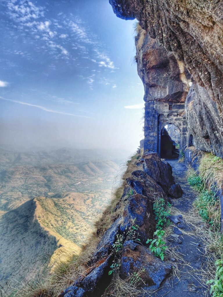
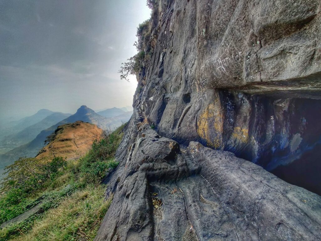
- Salher-Salota forts 10km / 850m+ Salher is the highest fort in the Sahyadri mountains and the second highest peak at 1,567 metres after Kalsubai. Salota (1430m) is a twin fort on a neighboring peak separated by a small saddle. The Selbari range here separates the Mosam river valley (North) and Aram Nadi river valley (South). There are various trails leading up to both forts from the North, West and South offering birds eye views on the surrounding plains.
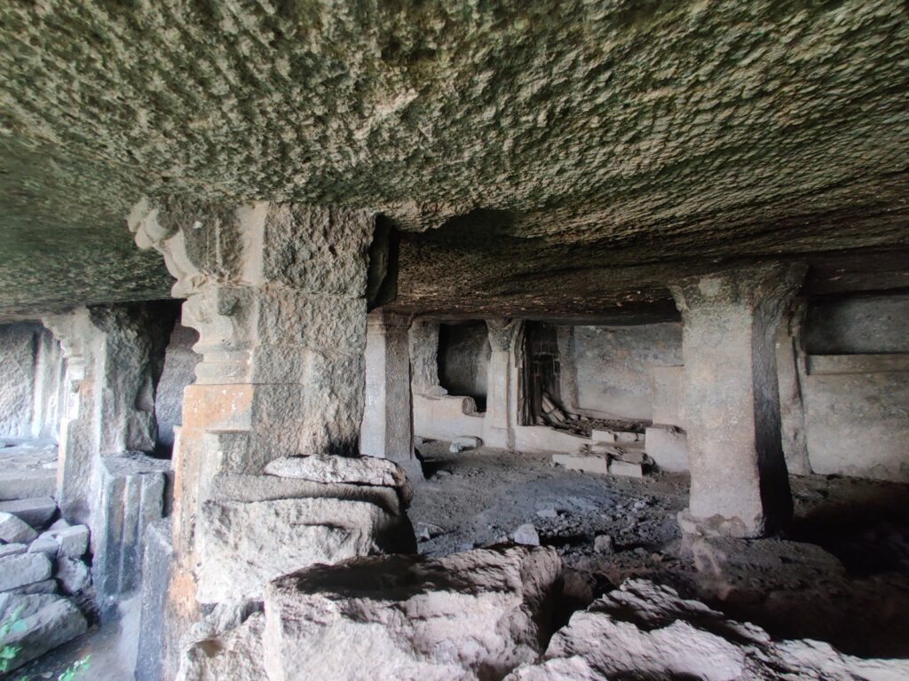
- Mulher, Moragad and Hargad Fort 5km / 600m+ further East on the Selbari range we come across three nearby forts: Mulher (1270m) , Moragad (1280m) and Hargad (1320m) interconnected through common trails. From the top of the forts one gets mesmerizing views on the surrounding ranges and valleys of Mosam river (North) and Karanjadi Nadi river (South).
- Nhavigad 3.5km / 300m+ a bit further North we come across Nhavigad (Ratangad) Fort at 1120m overlooking the Mosam river valley (South) and Panzara river valley (North)
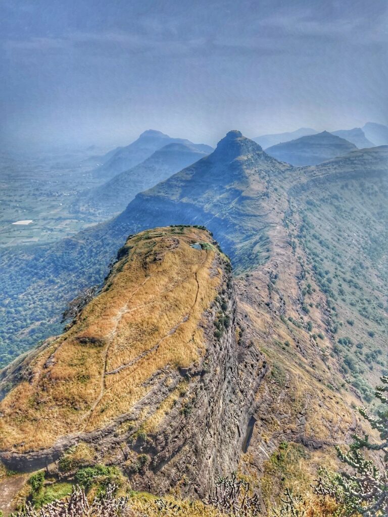
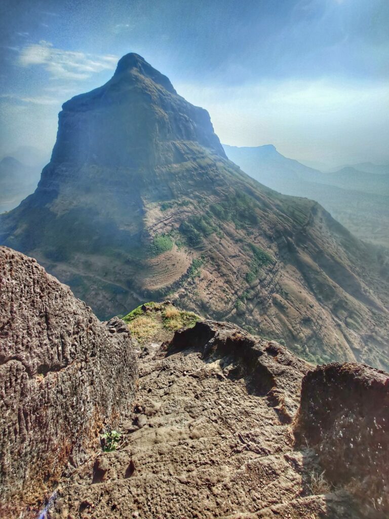
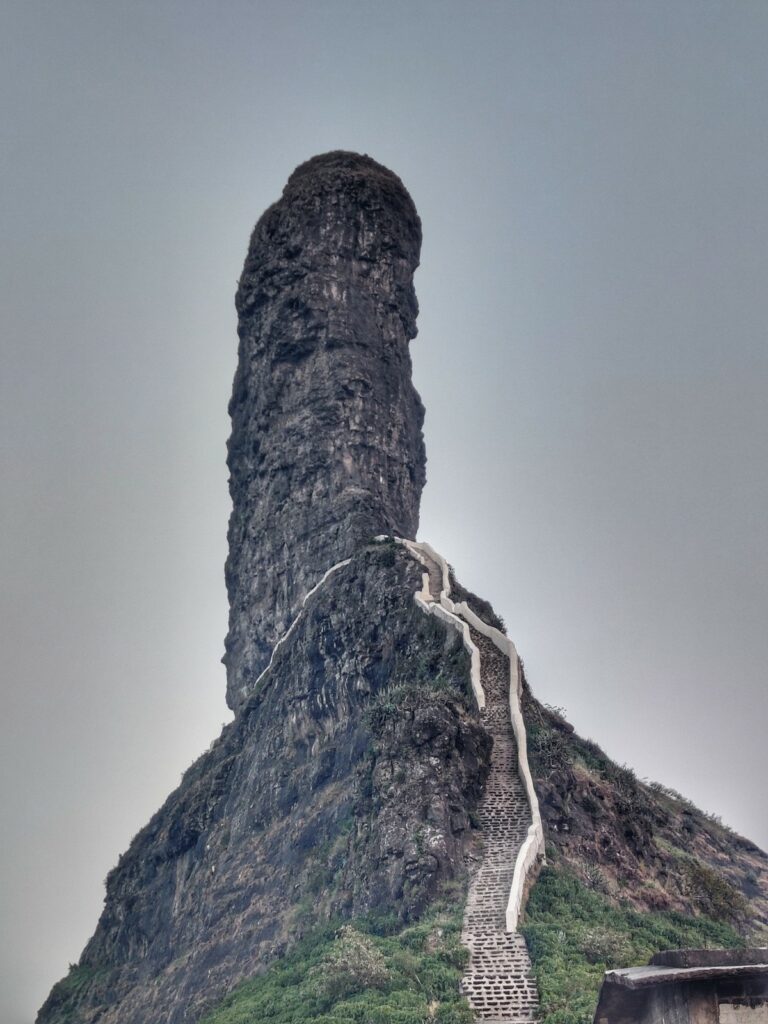
- Mangi-Tungi forts 4.5km / 475m+ located nearby is the prominent twin-pinnacled peak of Mangi (West, 1324m) and Tungi (East, 1331m) with plateau in between. There are several temples considered sacred in Janism. A huge rock stair case leads up to both pinnacles offering mesmerizing views on the surrounding plains.
- Nandin (Pisol) Fort 5km / 360m+ and Dermal Fort 8km / 500m+ further East on the Selbari range separating the Masam and Panzar river valleys we come across the less visited Nandin or Pisol (1050m) and Dermal (1060m) forts located in each others vicinity and approached through separate trails from the South.
- Galna Fort 1km / 90m+ further East located on a small hillock near the village of Galna we find the Galna fort (700m) overlooking the Bori river valley (South). On the Burhanpur-Surat trade route this fort has bastion and entrance in good condition.
- Kankrala Fort 2km / 90m+ South of Galna fort we come across the little known fort of Kankrala (690m) located on a small range separating Bori (North) and Mosam (South) river valleys.
Navigation
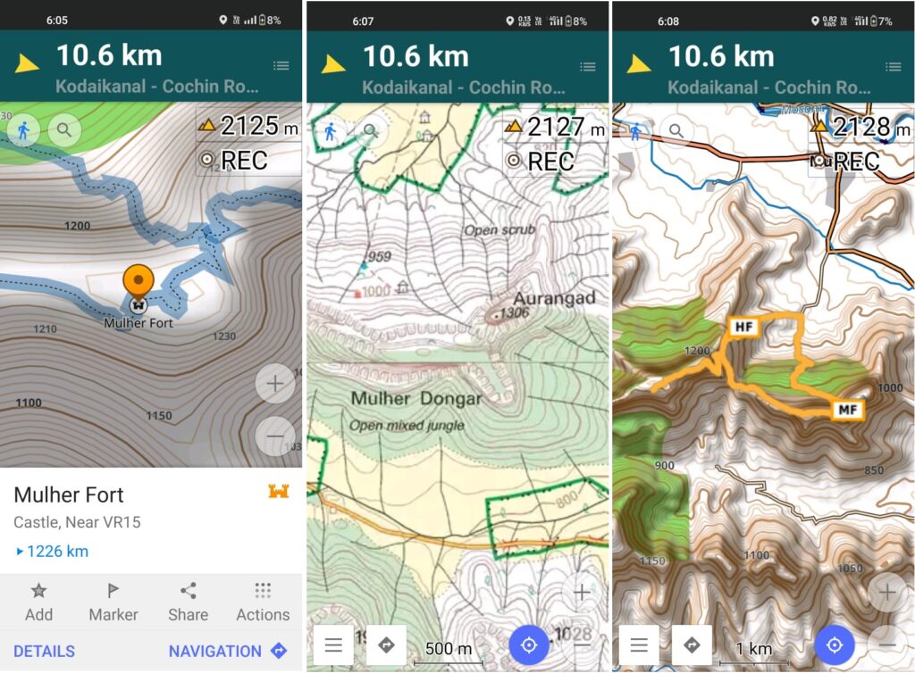
Above traverses can be easily navigated using most mobile mapping apps – most use Open Street Maps as base maps which include tens of thousands of kilometers of trails in Himalayas, Sahyadri, etc. OSM maps can be downloaded on the phone for offline exploration of the mountains without mobile network. Contours can be added to understand the topography of the terrain. My favorite app is OSMAnd.
References