
2. Mountain Passes
Mountain passes are gateways to cross over high ranges or ridgelines connecting neighboring valleys. Shepherds cross through passes during their annual migration from the plain to the high meadows to graze their cattle. Pilgrims cross over passes on their way to holy lakes and sacred peaks
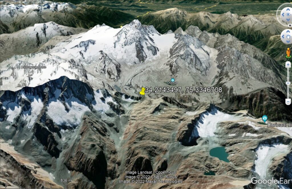
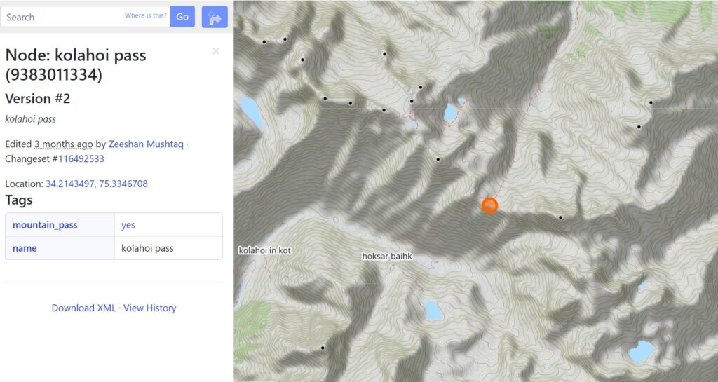
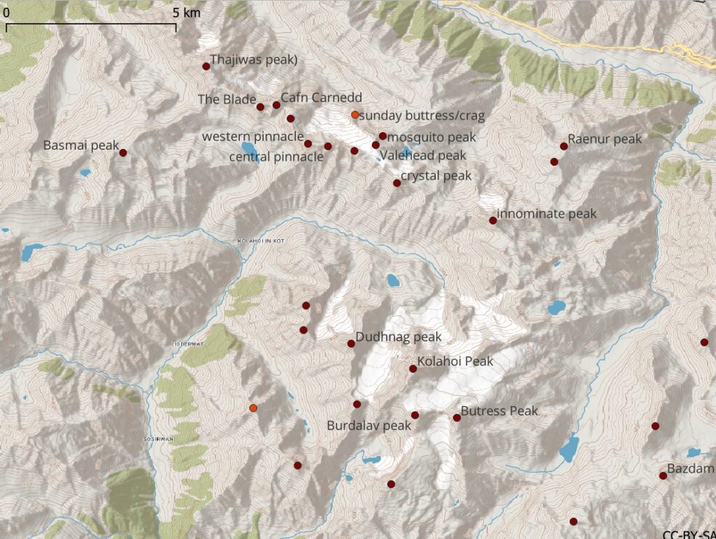
Mountain passes usually correspond to saddles – e.g. lowest point to cross over a ridgeline. Above / below the Kolahoi pass at 4380m altitude to cross over from Sind river valley to base of Kolahoi peak.
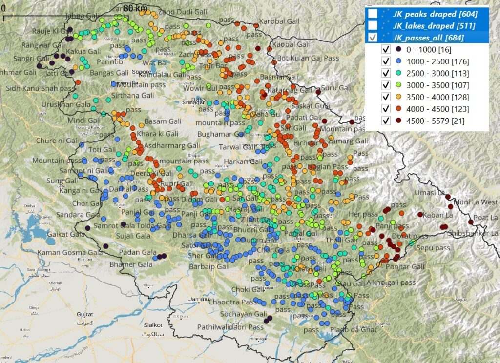
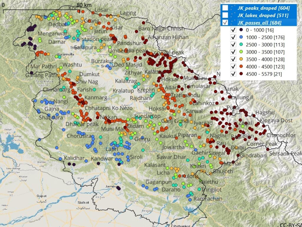
Jammu and Kashmir has more than 700 mountain passes varying from 500 meters to 5580m altitude as shown below. Lower altitude passes (blue) dot the Southern foothills of the Himalayas. Higher altitude passes (red) are located mostly on the Northern side bordering Ladakh and Pakistan, as well as a narrow range Southwest of the Kashmir valley.
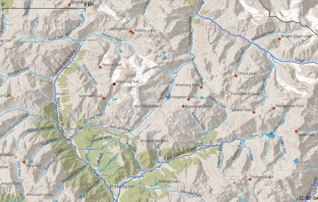
Zooming in we can see individual passes appearing as gateways between neighboring rivers valleys offering shortcuts for the alpine hiker to quickly move across the landscape. Using a sequence of mountain passes one can create a linear or circular traverse covering an entire state while hopping across multiple valleys.
A closer look at the distribution of passes (altitude histogram) of J&K reveals that most passes are located between 2000 and 4500 meters altitude, offering all-season, around the year hiking opportunities while staying below the snow line.
Below is a list of all 700+ mountain passes (and geo-location) in Jammu & Kashmir sorted by elevation.
3. Mountain Peaks
Where mountain passes appeal to hikers, mountain peaks attract mountaineers as these are usually more technical to ascent. Peaks, being the highest points in the landscape have always appealed to people’s imagination.
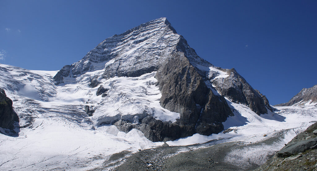
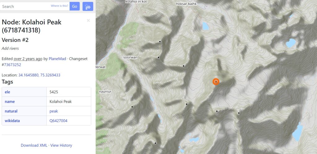
Above / below is the Kolahoi peak standing tall at 5425m, the highest mountain in the Kashmir division and locally called ‘Gashe-braer’ meaning the goddess of light. The peak is located in the Anantnag district between the East and West Lidder valleys.
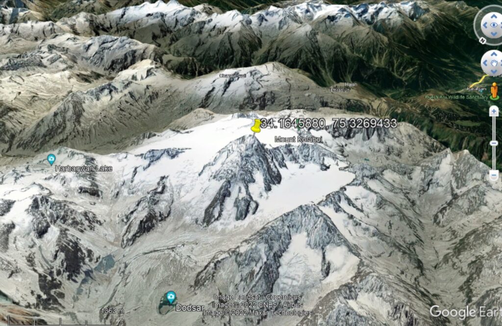
Mountain peaks are easy to identify on topographic maps (inner circles = highest contours) and are marked clearly in Open Street Maps. Peaks are a useful high altitude reference point for identifying your approximate location using compass as we saw in Chapter 2 of the Alpine bootcamp.
600+ (named and unnamed) mountain peaks have been mapped in Open Street Maps for the state of Jammu & Kashmir offering challenging technical & non-technical targets for mountaineers. The map below is similar to that of the mountain passes above as peaks (high points) and passes (low points) located on the same high ranges / ridgelines.
Zooming in to a lower scale we see individual peaks appearing. Prominent peaks appeal to people’s imagination have been given appropriate names. Many peaks are considered sacred and considered as the adobe of the Gods. Lesser known peaks have no name and can be identified by their elevation.
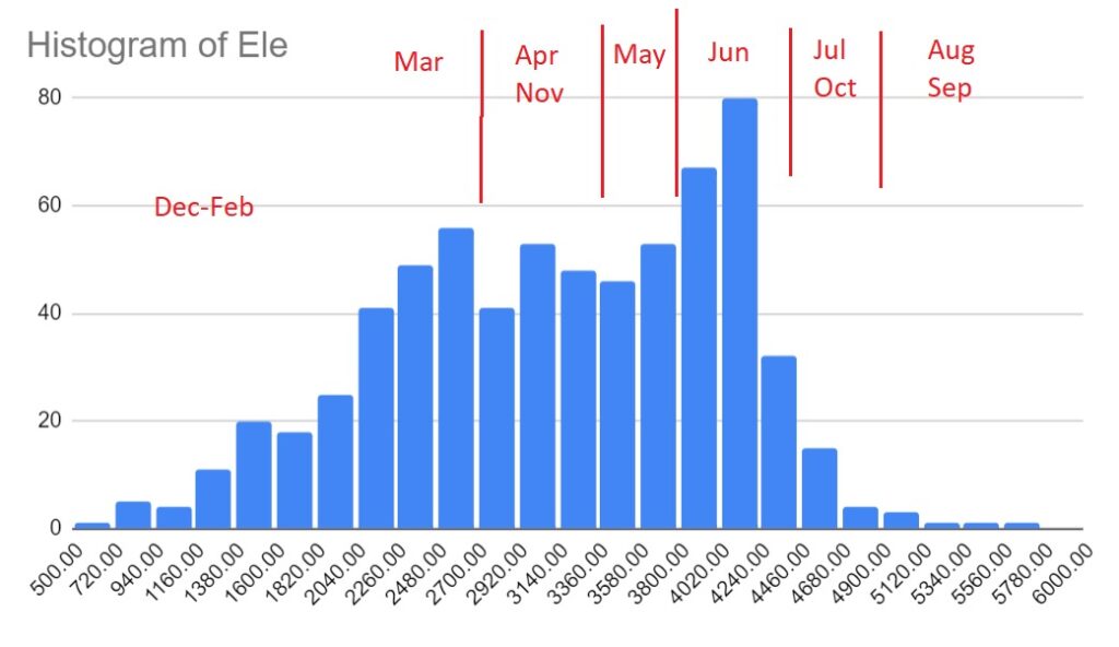
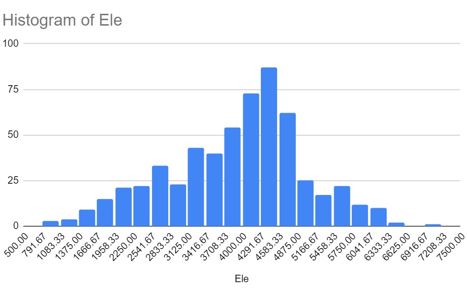
Looking at the distribution of peaks (histogram of elevations) in Jammu & Kashmir we see a wide spread from 500 to 6520 (Nun) meters in altitude with a larger number between 4000-4900 meter range.
Below is a tabular overview of peaks (and geo-location) in J&K sorted by elevation. Many more unnamed peaks can be identified on topographic maps which are not yet mapped in OSM.