
(Unpublished) interview with Explorers Web magazine on my planned Trans Himalaya 2020 ultra journey just before Himachal closed its borders early March
– How do you find/choose your trails and the villages you pass through?
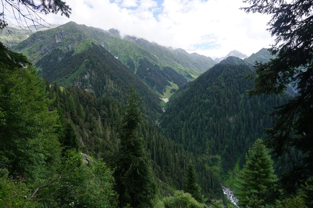
My favorite destinations are beyond the borders of modern human civilization – remote mountain ranges, virgin forests, inhospitable terrain where one finds inner peacefulness and experiences natural beauty untouched by human hand as well as true humanity – mountain tribes living in harmony with nature not yet lost (or should I say sold) their soul to the global money driven economy. These are mostly unexplored regions far beyond the last road head or touristic / documented destinations. Contour lines on topographic maps help me in understanding the steepness of an unknown region and allow me to identify key terrain features like peaks, valleys, ridges and saddles to plan my route. Satellite maps containing hires imagery allow me to understand vegetation density and zoom into and spot remote tribal settlements, seasonal high-altitude shelters, makeshift bridges across wild streams and identify 2 feet wide trails not documented elsewhere. Human settlements are useful for night stay and resupply of food ration during my long exploration journeys. I usually scan an entire unexplored wilderness region of say 2500 square kilometer at high zoom level to identify key terrain features, hamlets, trails and finally try connecting these into continuous thousand kilometer long routes for my ultra journeys. 60% of the journey is planned in advance through maps, 40% of the dots need to be connected on the ground as both topographic and sat maps do not reveal all the details in advance. Public available contour lines are usually generated from elevation data with a 1 arc-second (30 meters) resolution leaving smaller terrain features waiting to be discovered and many trails / hamlets are invisible on satellite maps in regions with dense vegetation making on the ground trail finding an important skill for the explorer.
– As none of these are well known routes how do you plan these routes? How long does this take you and what resources do you use?
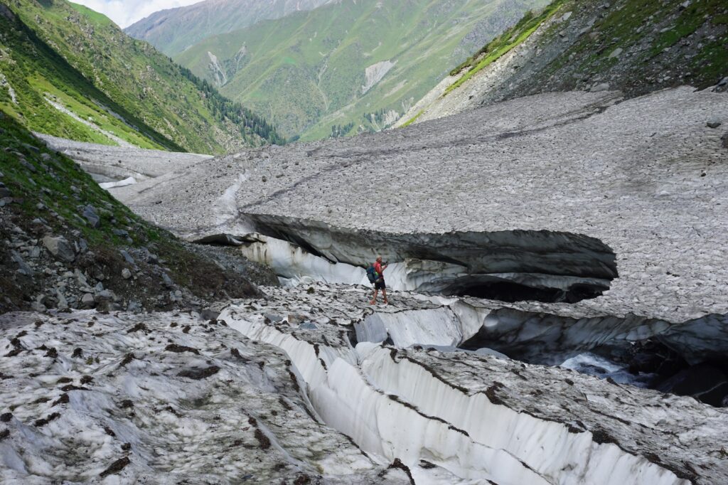
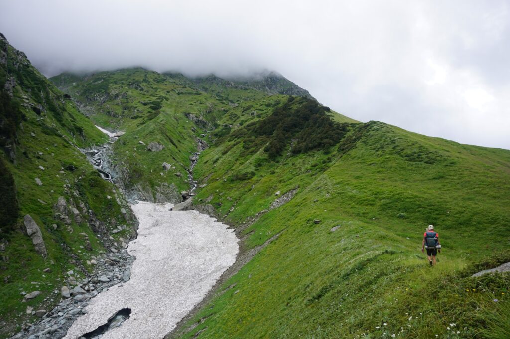
In addition to the identifying important features on terrain maps I take into account three other key factors for planning my routes: annual seasons, Southeast Asia monsoon and glacial melt. During winter / early summer migratory routes across high passes are still covered by heavy winter snowfall so I usually explore sub 4000 meter regions and valleys in spring until the snow starts melting at higher altitudes in mid June. The Southeast Asia monsoon hits the lower Himalayas in July-Aug flooding streams and causing landslides in the lower Himalayas so I migrate towards the high altitude deserts of Kashmir, Ladakh and Zanskar which are rain shadow regions behind the 5000+ meter Pir Panjal high ranges. During mid summer (July-Aug) meltwater peaks as glaciers of 10-25 square kilometers in size trigger dangerous stream currents in narrow gorges and canyons making some routes off limits till end of the summer. Then there is also the daily melt-cycle – peaceful streams in the morning turn into deadly rivers in the late afternoon as the sun sets high above the glaciers above – so timing of stream crossings becomes critical. Another very useful resource is the old 1:50K scale Survey of India maps which contain many lesser known remote trails through the Himalayas. Less easy to get by – partly due to the security concerns along the geo-political boundaries of India, China and Pakistan which are not on good terms – these maps are treasures of terrain details. Contour lines – being of strategic military importance – are generally absent on these maps so I usually download DEM (Digital Elevation Model) data to generate and overlay contours on the same which give me the best possible maps for navigating the Indian Himalayas. Finally one also needs to plan for obtaining the necessary permits before entering the inner border line areas.
– How do you prepare for any change in route once you have set off? i.e if your planned route has unexpected errors
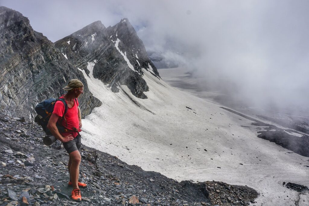
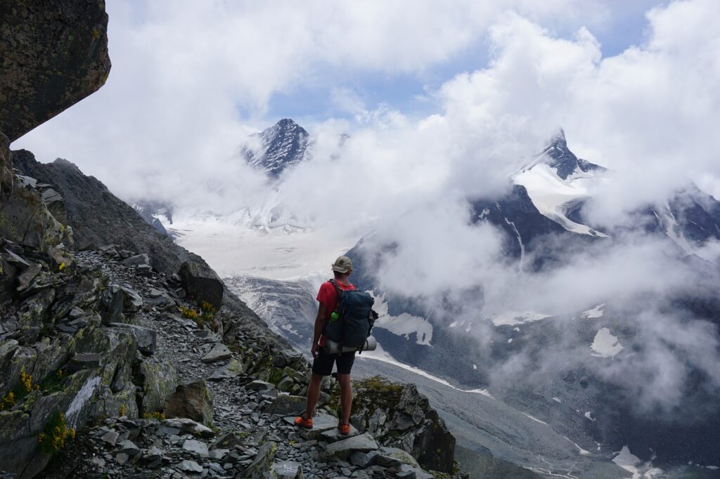
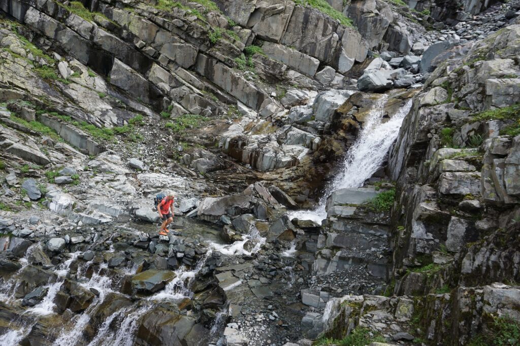
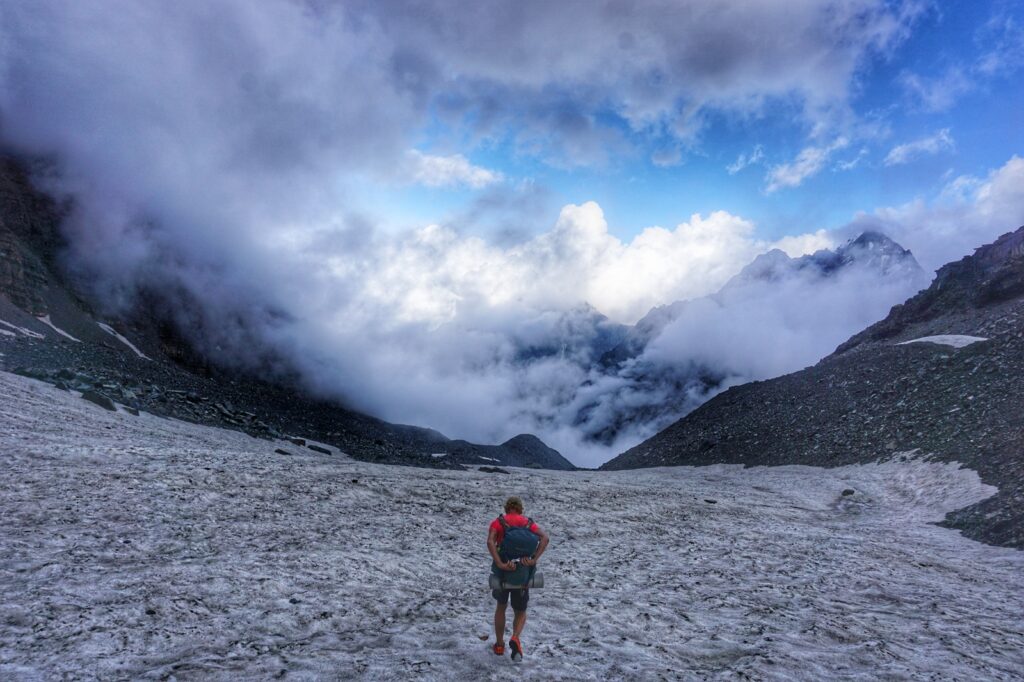
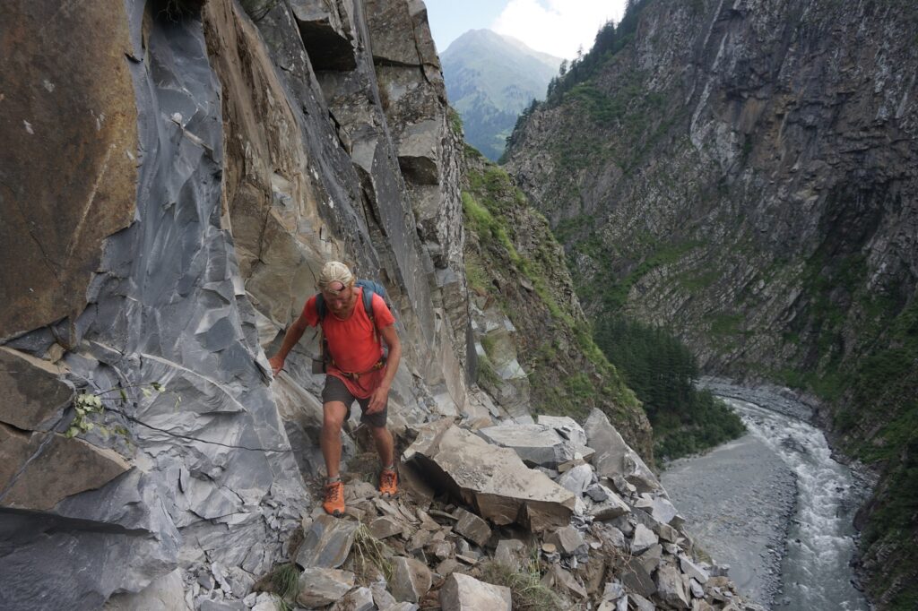
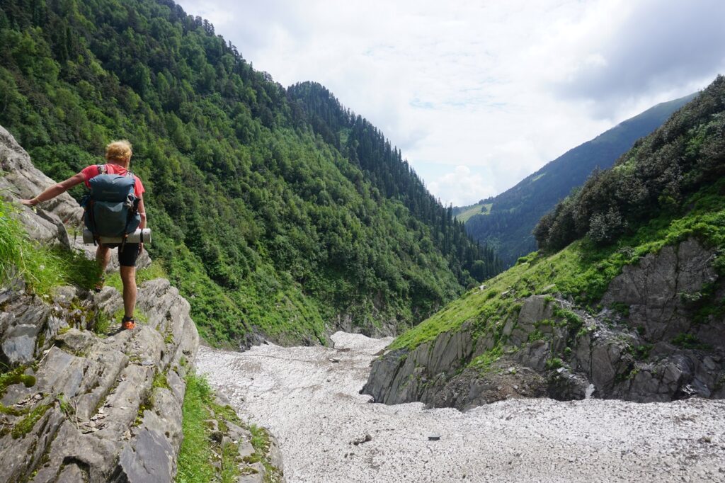
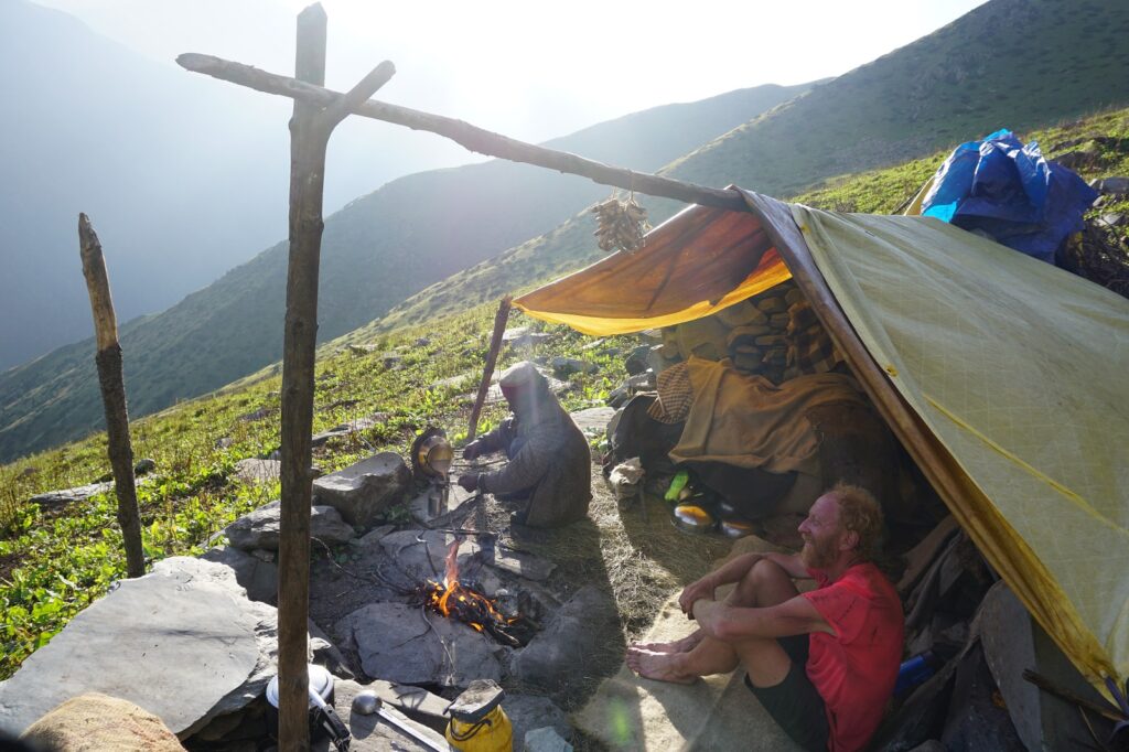
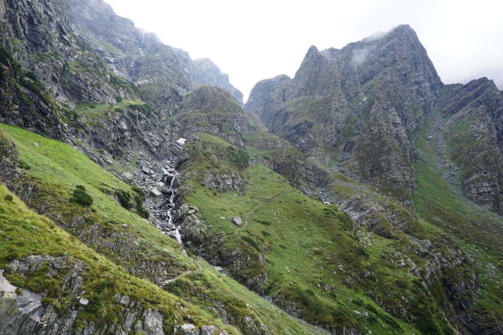
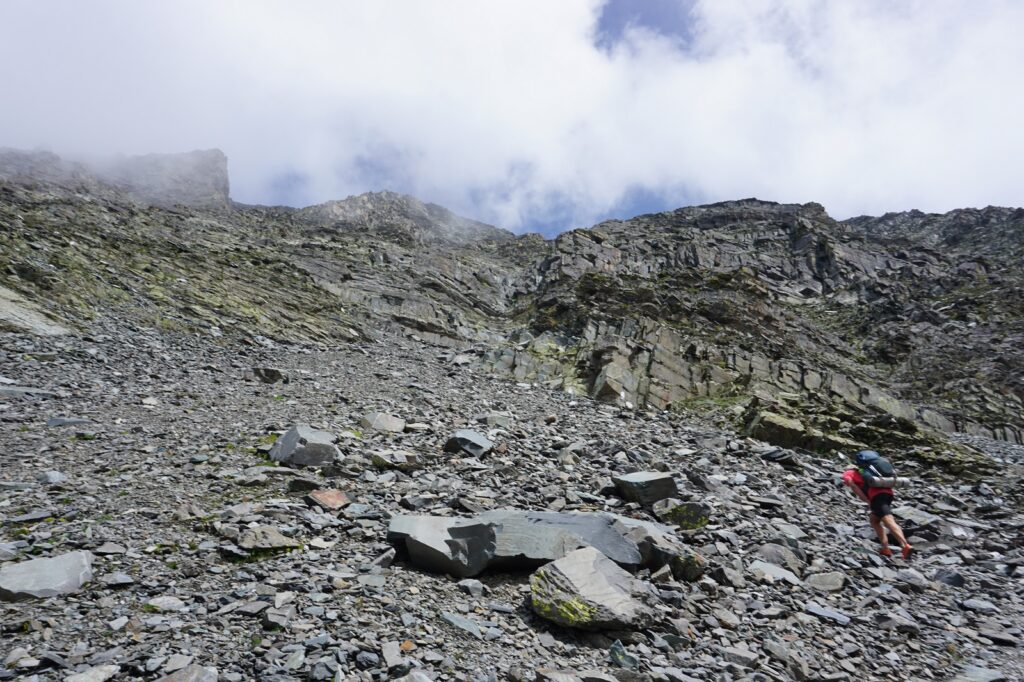
Being aware of single point failures like makeshift bridges washed away by flash floods, impassable stream currents, landslided trail sections, technical climbing sections near high passes, steep (frozen) snow gullies, losing the trail near steep sections, sudden weather changes, etc I usually plan backup routes. In general I never start off with planning a linear traverse but always analyze (feasible trails in) an entire region and sequentialize a linear route after I finish a complete review of the available maps. Sometimes I reroute a planned traverse based on the on-ground conditions or info obtained from the locals or nomadic shepherds. A few examples: last year I got stuck at the Kaliheni Nala where several sections of a generations old shepherd trail got destroyed by landslides. Thanks to the heavy snowfall during the previous winter I could traverse the ferocious stream in the valley by using several frozen snow bridges even at the end of summer. Kalicho, one of the most treacherous passes across the 5000m high Pir Panjal range could easily be crossed early summer last year by contouring a trail through the snow rather than scrambling on steep landslide prone trails on barren rock and scree. Yet another time I completely lost the shepherd trail near the Chobia pass due to a sudden whiteout in the later afternoon getting completely stuck on near vertical drops on all sides. Only solution was to set up an improvised camp at 4100m in my minimalist shelter and brave the cold rains that night waiting for the weather to clear the next morning and sip a hot cup of fresh tea 1 hour later at a shepherd camp 500m below my location.
– Last year you had issues with the monsoon season/snow, do you think you will have similar issues this year? If so how will you combat these?
During the winter of 2018-19 snowfall was unprecedented in the Himalayas so that many high passes opened only later in the following summer as the snow line retreated. Routes to many passes could only be traversed by cutting steps through steep, frozen snow gullies with an ice axe. Snow also made it easier to contour up steep valley slopes covering otherwise landslide prone trails on loose scree. Finally frozen snow bridges allowed us to cross otherwise impassable wild streams through narrow valleys. The monsoon is an annual weather pattern which affects the lower Himalayas causing dangerous stream currents and potential landslides so you cross the 5000m high mid ranges which cannot be passed by the rain clouds. Last year however – probably due to climate change – there was unexpected rainfall beyond these high ranges causing tremendous floods and landslides in this fragile high altitude barren landscape. This year also there is unusual high winter snowfall in the Himalayas and the impact of climate change is likely to get more intense so we’ll need to be better prepared. Staying abreast of the weather forecast, respecting the seasons and carrying the necessary technical gears like poles (4 points of contact help a lot in crossing steep snow and wild streams) and a lightweight ice axe (cutting a pathway through steep frozen snow) will be my most important companions again. Additionally I have analyzed 5000 square kilometers of sub 4000m unexplored regions on topographic and satellite maps in Chamba and Uttarakhand to explore in the months of April and May before heading up to higher altitudes.
– How many passes/trails do you plan to cover in the 6 months? How many settlements will you pass through?
As of now I have 5000 sq kms of lower Himalayas ready for spring and 150 high passes lined up for summer which should easily add up to 5000 kilometers of trails passing through 500 remote settlements. Maps have been analyzed in sufficient detail to succeed in minimizing route loss or dead ends in the field. Now starts the tricky part to connect all of these in one continuous 5000 km long linear traverse (with minimal in between road travel) as per the seasons, monsoon and glacial melt to maximize the success of not getting stuck (streams, snow…) anywhere en route.
– What distance do you plan to cover each day?
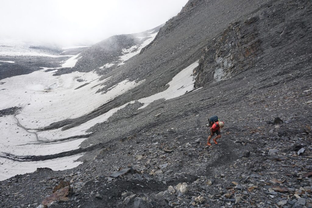
I usually fast-hike 12 hours a day with minimal breaks in between from sunrise till sunset allowing me to cover 40+km with a proper trail independent of the elevation gain. Mileage will drop to 25-30km as we walk across moraines, crevassed glaciers, landslide prone valley slopes, difficult stream crossings, losing the trail or bad weather conditions in between. Distance varies but effort or calories burned remains constant each day. Sometimes if you cross hardly a few hundreds meters in one hour walking through waist deep snow or finding your way climbing down thousand meters along a near vertical labyrinth of non existing trail used by shepherds. An ultra-runner by heart you try to keep up the pace and maximize daily mileage but in some moments priority tends to shift to holding on to your life while negotiating the challenges of the steep terrain and volatile weather patterns.
– Have you covered any of these passes in your previous trips or are they all new?
Nothing beats the thrill and adrenaline while exploring the unknown, not knowing what’s laying ahead of you at the next turn of the valley or after the next pass crossing. The constant doubt whether you will miss or lose the trail or end up stuck in a challenging section or unexpected obstacle. The sudden discovery of unseen natural beauty or some hidden fairy-tale hamlet deep inside the forest. Losing your complete sense of direction in a white out weather condition, unsure whether you ll find a proper shelter or campsite before the night settles and the temperature starts dropping steeply. Ignoring your dry throat while walking for endless hours in a high altitude desert unsure when you ll find the next water source. Seeing loose rocks tumbling down hundreds of meters into the raging stream below as you negotiate a landslide prone trail high above the valley floor. Running low on food ration due to under-planning the duration of an unexplored traverse not knowing when you ll find your next meal. Ending up around the warm campfire of shepherds at the end of the day indulging in a sumptuous meal when you have burned all the energy left in your body during the day. Those experiences are incomparable to following the footsteps of a guide or repeating a known trail which holds little excitement for me. It’s only the fear for the unknown that keeps our heart racing and adrenaline rushing through our veins which makes us feel more alive with a heightened sense of the primal senses as survival mode kicks in to handle unexpected challenges thrown by unknown terrain and ever changing weather. Sometimes you feel like a tiny gladiator in the vast overwhelming arena of the Himalayas unsure of finding your way out.
– What is the route? (where will you start and finish?)
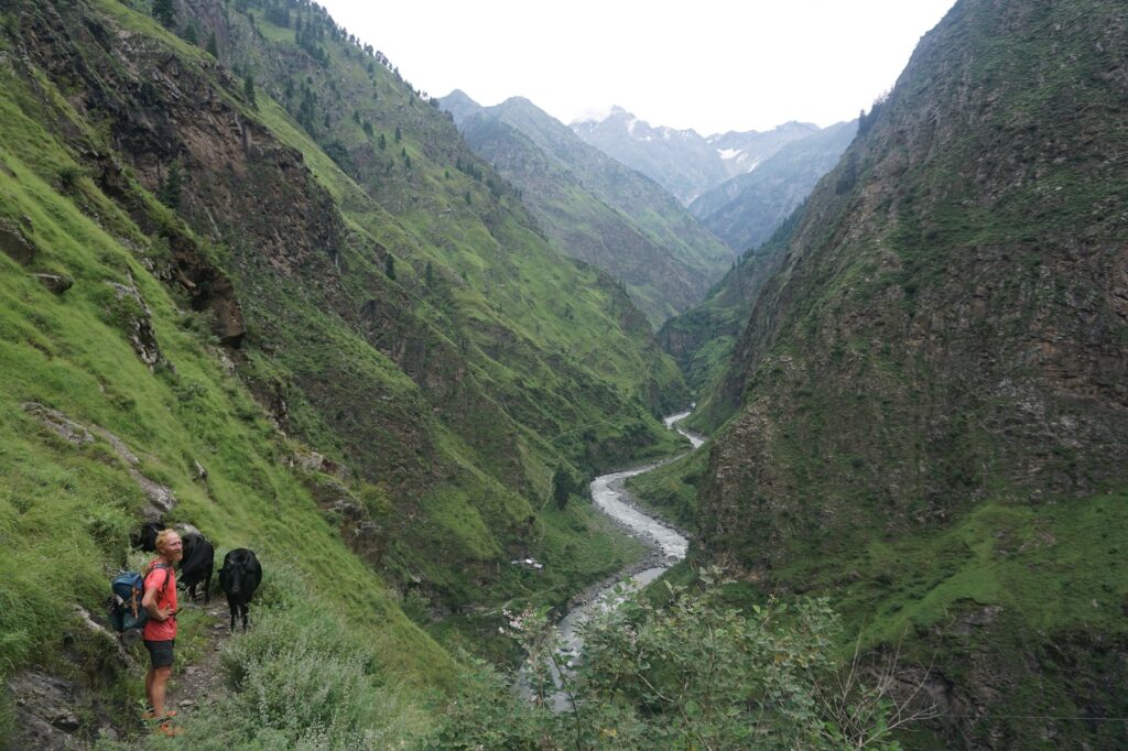
Similar to last year, the route will again span the entire Western Indian Himalayas from the border of Nepal all the way to Jammu & Kashmir covering several high ranges across Uttarakhand, Himachal Pradesh, Zanskar and Ladakh. I traversed 160 high passes and 500 hamlets in the last 2 summers. This year I hope to bring up that number to 300 unique passes and 1000 remote settlements which is more than anyone would have ever explored in 10 human lifetimes. At the same time I keep documenting both my planned routes / maps and blogging my actual journey and experiences on ultrajourneys.org hoping to inspire more youngsters and adventurers in the lesser explored Himalayas.
– How long will the overall route be in km?
Even though I measure my journey in terms of experiences or encounters with beautiful unseen nature and humanity as well as challenges overcome, the overall linear distance would easily be 30K x 180 days or 5000+ kms. More than distance the main challenge will be the elevation gain – I expect to touch 200 hundred thousand meters of vertical elevation gain or 23 times the height of mountain Everest.
– Will there be any climbing involved?
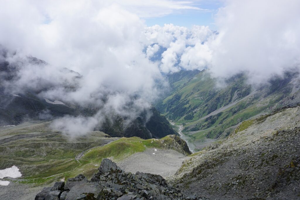
Although I will not be carrying any technical climbing gears (due to weight constraints over these long journeys), there will definitely be certain sections – especially those closer to the high passes – where skillful climbing is required. The main challenge in the Himalayas is the fragile terrain with mostly loose rocks and scree making it difficult to find a proper foothold. Even with 4 points of contact, the mortality rate of mountain sheep and goats crossing the high passes in the Himalayas along the migratory shepherd routes can be as high as 20 out of 500 or nearly 5%. This of course includes not only steepness of the terrain but also extreme weather conditions and nocturnal predators like snow leopards. Another typical scenario where you sometimes end up climbing near vertical rock sections is when you lose the trail and end up negotiating steep valley slopes trying to get back on track towards your destination but blocked by gullies steeply cut into the valleys. Still, based on my experience though the main adversary or challenge remains (unpredictable) weather more than (assessable) terrain.
– Is there a pass that you think will be most challenging? If so why?
There are quite a few on the list this year: Poat La, Alipattan, Tarsalamu, Manirang, etc. As you initially cover the more known passes in previous years, what remains now are the lesser known / used ones. Some of these have been in disuse for several years with trails partly been destroyed by landslides. Crossing these sections can be difficult and dangerous. Further down the valleys the stream currents become very strong and nearly impossible to cross if the makeshift bridges are washed away and not restored by shepherds during their annual migration across the passes.
– Why do you keep coming back to the Himalaya? What draws you to them?
The Himalayas are overwhelming on the senses. Their sheer magnitude and natural beauty leaves an ever lasting imprint on you. The innocence and hospitality of the people in the mountains is a heartwarming experience. The mountain tribes which live (survive) in harmony with nature like our ancestors have been living for hundreds of thousands of years before materialism and comfort drew us to cities where we sold our souls to money. Self sufficient and sustainable living with food, clothing, housing and basic needs. The more remote inhospitable regions (due to extreme weather and lack of vegetation at high altitudes) where you can experience a deep sense of inner peacefulness in a completely desolate landscape far away from human presence. The overwhelming magnitude of the landscape which makes you feel very tiny. The ability to run and fast-hike for thousands of kilometers through stunning natural beauty and live for months in an environment which is so pristine and naturally pure, free from pollution. Experiencing the life of a nomad traveling across a wide variety of unique landscapes, waking up in a beautiful new place each day is the opposite of the daily routine which is a mental killer. The constant thrill of surviving unexpected challenges in the extreme terrain and weather at higher altitudes makes life many fold more intense. Traveling through the highly eroded desolate landscape of Zanskar and Ladakh with its unearthly gradients and rock formations is like time traveling to another planet. The first time you go to the Himalayas you lose your heart.
– What is the most important thing you learnt from previous expeditions in the Himalaya?
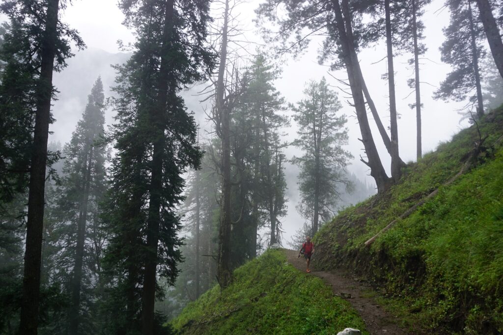
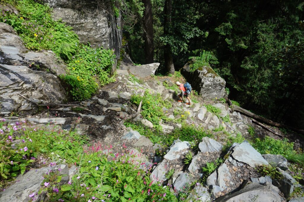
We are living on a beautiful but extremely fragile planet. Seeing the birth of glacial streams that drastically shape the landscape and planet below. Watching the birth of beautiful ecosystems full of green and live as you descend from barren terrain into hospitable lower altitudes. Experiencing fast changing and extreme (inhospitable) weather near the high passes. Walking through pristine forests in the valleys which provide for human kind and larger animals. Seeing colorful flowers bloom from beneath the winter ice as it melts after nearly 8 months. Discovering a small hidden oasis of green and life in a barren high altitude landscape with the right presence of water. Seeing entire nomadic villages and their life stock move up and down along with the seasons. We are living in a small corner of an infinite universe where the constants of physics are magically tuned to give birth to an ecosystem in which life can thrive. The slightest changes in weather, climate have enormous impact which is first experienced in the higher barren altitudes. Our non sustainable living in past decades in the cities in the plains has drastic changes on the fragile high altitude terrain. Many picturesque, once-thriving farming settlements are now abandoned ruins as their lifelines have dried up and as a new generation has migrated to cities erasing our beautiful past heritage and sustainable existence.
– Will this be a solo trip?
Yes. A long journey is the best (most intense) experienced solo. Being just by yourself you are much closer with your surroundings. You have a heightened sense of what is happening around you. Camping alone in the night below the stardust of the milky way with no one around for days makes you feel close with the universe. Going solo gives total freedom on the chosen path and timeline at any moment of the day. It builds extreme confidence in finding your way and facing the elements by yourself. Wandering alone in an overwhelming landscape makes you feel very small and humble. Negotiating potential life threatening challenges becomes a magnitude more intense as there is no one around to get help if things go wrong. Sitting alone on top of a pass overlooking an entire mountain range below hearing nothing but the sound of the wind instills a deep sense of inner peacefulness. Residents of a small, remote hamlet will shower a lone traveler with overwhelming hospitality as one of their own. I might take one or two friends along with me in between but it will remain a challenge in terms of physical and mental preparedness.
– Will this be done in the same minimalist style as your last trip?
Very much. Being an ultra runner by heart, I like to move fast. And fast means light. Light means enjoyable. Fast means more experiences in a shorter time frame. I see too many hikers in Ladakh struggling beneath their 60 liter / 25 kg backpack carrying all kinds of unnecessary comforts with them. There are so many ways in which you can optimize / minimize your baggage. Going light and fast I can cover the distances between subsequent villages much quicker and therefore carry less food. Going fast means I can camp at lower / warmer altitudes before / after the pass and manage with lighter shelter. I always find a proper campsite out of the cold night wind allowing me to manage with a minimalist shelter. It’s meaningless to carry a heavy tent and then pitch it up in the open exposed to the weather elements. I carry mostly lightweight gears (carbon poles, aluminium ice axe, 500gr bivy, 600 gr zero degree quilt, etc.). Every 100 gram counts if you plan on scaling the equivalent height of Mt. Everest multiple times. Going fast I never carry water as I always hit the next water stream within a few hours. I carry just sufficient food ration to reach the next hamlet and if I run out of food, know which edible plants to eat. I don’t carry a stove or fuel – instead I cook my food using dry horse and yak dung sprinkled with a little kerosene in barren regions of Ladakh and Zanskar where no firewood is available. It usually takes less than half an hour to catch up with a 60L backpacker which appears on the horizon in front of me and the same amount of time to make him disappear behind me.
– How will this differ from the first ultra-Himalayan run we covered, just a different route, or more?
Things have changed a lot since my first foray into the high passes in the summer of 2018. More experienced, more confident after having crossed 160 passes in the last two years. Still as an explorer there is always the same intense feeling of nervousness for the unknown that’s waiting out there for you, not knowing which passes you will cross vs. get stuck, not knowing when you ll lose the lesser used trail and end up scrambling your way through dense forest and steep rock faces trying to get back on track, not knowing where you’ll sleep at the end of the day or whether you’ll run out of food before reaching the next village. With every challenge you overcome you become more confident and look for bigger challenges out there. At the same time you become more aware of the constant rate of life threatening situations which are thrown at you and the fine balance between pushing ahead or realizing that a situation is simply too dangerous / risky and making a sometimes tough call to retreat.
– Why are you doing so many of these projects all of a sudden?
Since I quit my corporate job 2 years ago breaking out of the daily routine of commuting in traffic, locked up in a 5×5 ft cubicle, feeling suffocated in infinite corporate meetings surrounded by people who are mostly not alive, I am a free man now who just started living my life. I realized that life is very short on this beautiful planet and decided I will die with memories instead of dreams. To travel is to life. To explore is to feel alive. I think there can be no sadder realization that you have sold your entire life to money and materialistic things when you’re old and unable to go back in time. Life is more than living the ordinary cycle of reproduction in society and being a small gear or bolt in the global consumer economy. Life is so much more intense when stepping out of your comfort zone. Being close to nature one can feel the primal energy of the environment in which you were born and thrived for millions of years ago. Nothing kills your mind and soul like the daily routine of modern artificial life. Last summer I met a 78 year old humble gentleman from Colorado, US who had traveled most of his life and was just heading out to cross the Umasi La, one of the most challenging passes on my list. At that moment I realized that I still have 3 decades to live my life after sitting 2 decades in my corporate cubicle. That time I decided to live each remaining day of my life as if it was my last one.
I am following him since his 2018-19 journey..His feats are amazing, that’s the right way of hiking to explore the unexplored places. I wish to meet him in future . Thanks ?? . If he comes to punjab meet me any time. My contact:98555-40615
Nice Interview.I met peter at Nashik during one Programme. LIKE HIS PASSION.