We will be using the OSMAnd mobile app for offline maps and navigation during the journey. It is a mobile viewer for “Open Street Maps” (OSM) which contain lot of detail on terrain, villages, routes, trails, shelters, etc. Install this free app from the Google Play or App Store.
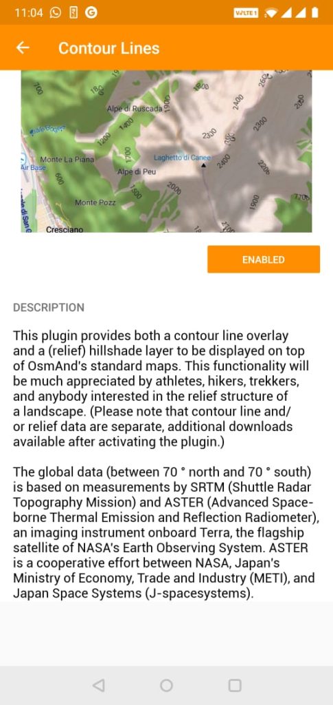
Once installed, go to the Plug-ins menu and enable the “Contour Lines”. Contours are essential for navigation in the mountains clearly showing the overall topography of the terrain. You ll be directed to Google Play or App Store to pay approx 200Rs for this life saving plugin
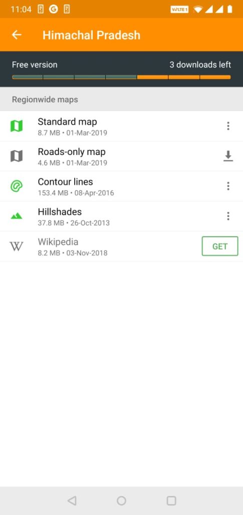
Next go to the “Download Maps” menu, Asia – India and download Standard map, Contour Lines and Hillshades for three states: Himachal Pradesh, J&K and Uttarakhand
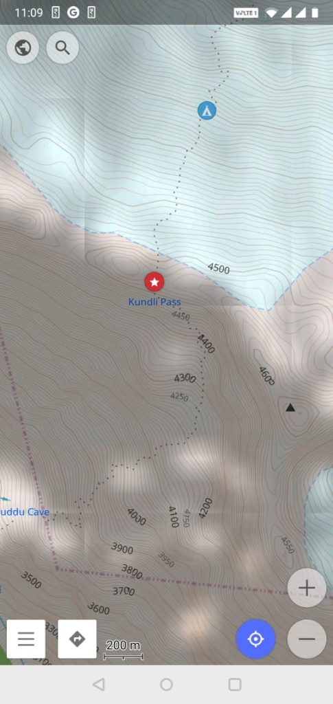
After downloading all maps and data you should now we able to see contours for any region within the three states. If not, close and reopen the app or restart the phone.
Finally, open the Himalayas 2019 map from this web site, chose “Export to KML/KMZ”, open “GpsVisualizer.com” to convert the KML to GPX file, copy the GPX file onto your phone. In OSMAnd – Configure Maps – GPX files, import the GPX file.
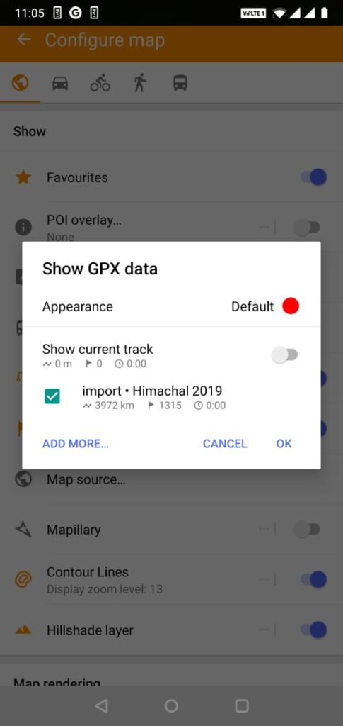
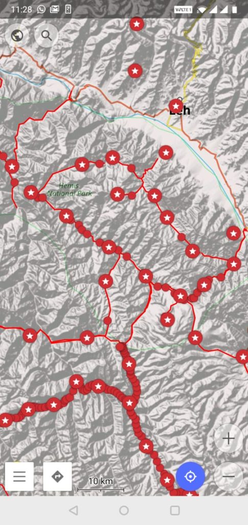
You now have the entire 2019 route + offline OSM maps + offline contours on your phone, ready to navigate, disconnected from the mobile network
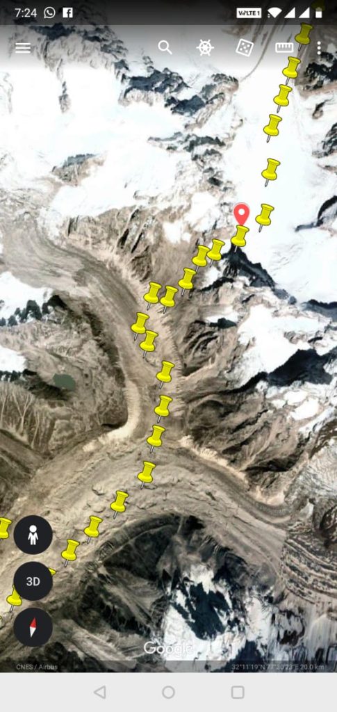
A second useful application for navigation is Google Earth, available on both Android and iOS. GE mobile gives access to satellite maps and clearly shows the terrain including forests, alpine meadows, moraines and glaciers. Export the KMZ file from the 2019 route map and open in GE to see the entire journey. Zoom and pan across the planned route to cache the satellite images you wish to view offline during the journey.