
Geography
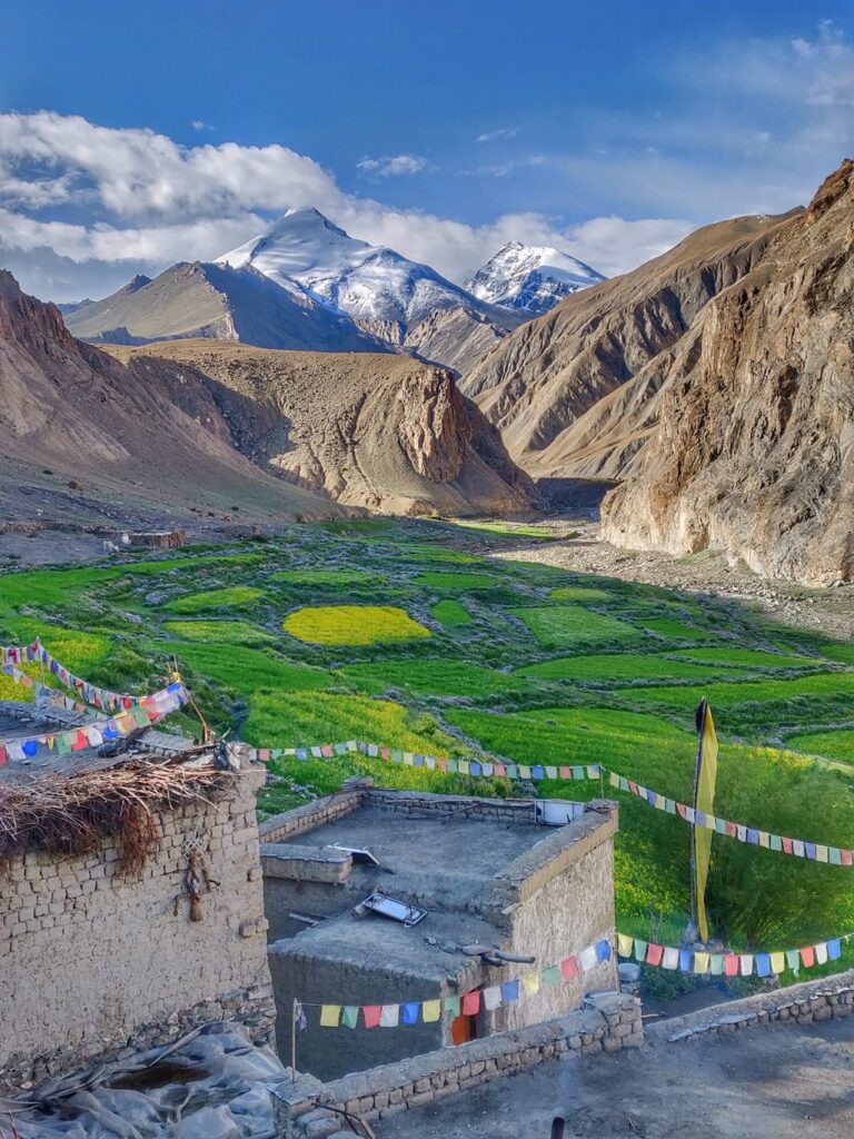
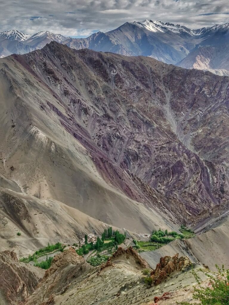
Leh (3000m) in a well known is international travel destination in the high altitude desert of Ladakh. Explored over decades by the international hiking community has given birth to a vast network of beautiful hiking routes across hundreds of high altitude passes connecting several major valleys: Indus valley, Shyok (Nubra valley), Zanskar and Markha valleys through umpteen tributaries / side-valleys.
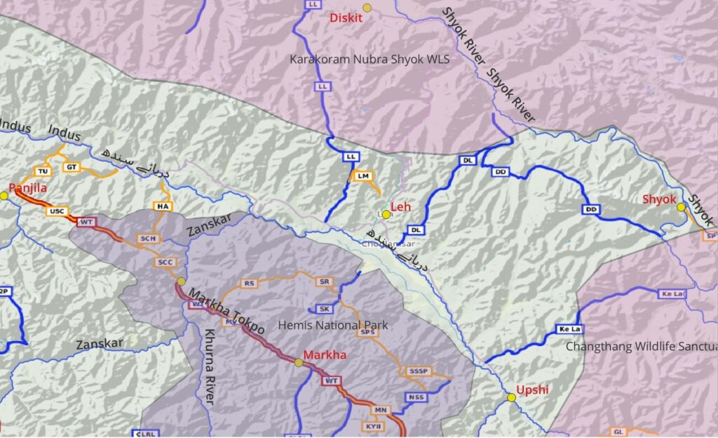
A few known reference towns / villages: Leh, Upshi (Indus valley), Diskit (Nubra valley), Shyok (Shyo valley), Chilling (Zanskar valley) and Panjila (Wanla Tokpo valley). The region is part of Hemis National Park in South, Karakoram Nubra Shyok Wildlife Sanctuary in the North and Changthang WLS in the the West.
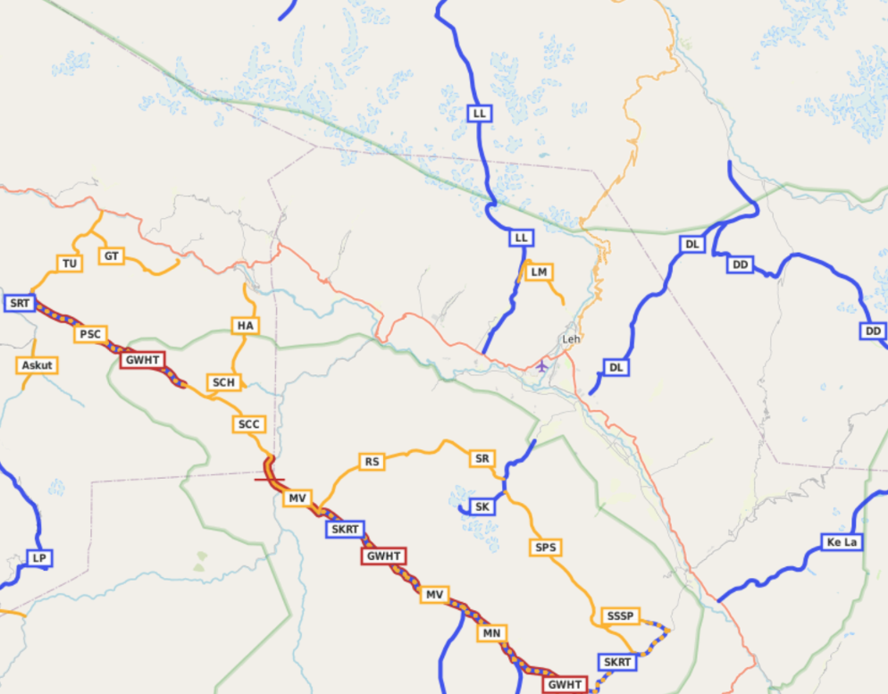
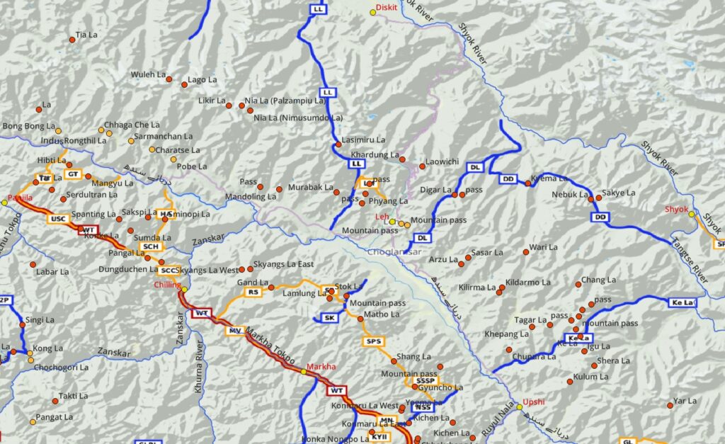
There are hundreds of high altitude passes in Ladakh (see below) which are well documented in the Olizane maps (1:150K scale). These 2 decade old maps are very popular and have attracted a vibrant international hiking community to Ladakh. Recently also the Survey of India published detailed maps (1:50K scale) for Ladakh to the public. In this post we will cover 40 beautiful hiking routes which have been GPS recorded and accurately mapped into Open Street Maps (any scale). OSM are base maps used in many popular hiking apps like Maps.Me and OSMAnd (my personal favorite) which can be downloaded offline and used for easy navigation of these routes. Many of these routes are documented in detail on my blog.
Hiking Networks
OSM categorizes hiking routes in 4 different networks:
- Local hiking routes (purple) – short hikes with limited elevation gain useful for beginners. Day (or sub-day) hikes with no overnight camping requirement.
- Regional hiking routes (orange) – medium distance hikes with more elevation gain connecting neighboring valleys for intermediate hikers. Many of these can be connected in larger multi-day traverses
- National hiking routes (blue) – longer multi-day hikes with significant elevation gain across major high ranges for experienced hikers.
- Continental hiking routes (red) – long distance traverses across states
15 Local Hikes
Short day hikes perfect for beginners with lightweight packing / no need for overnight stay or camping:
- Murabak La (ML) – 3.3km / 670m+ steep uphill from Murabak along the Standong Nal to Murabak la pass (4550m) offering birds eye view on the Phyang Fu valley
- Leh to Choma (LC) – 3.7km / 650m+ steep uphill from Northeast Leh to Choma ridgeline (4250m) offering mesmerizing views above the Leh surroundings
- Leh to Saboo (LS) – 6.6km / 200m+ short hike from Old Leh across an unnamed pass (3950m) to Saboo in the Sabu Nala valley. Short side-trail to unnamed peak (4200m) offering mesmerizing views on the Indus river valley below
- Leh to Saboo 2 (LS2) – 5.8km / 330m+ alternative hike from Old Leh across an unnamed pass (3800m) to Saboo in the Sabu Nala valley. Alternative steep descend from the pass into the valley
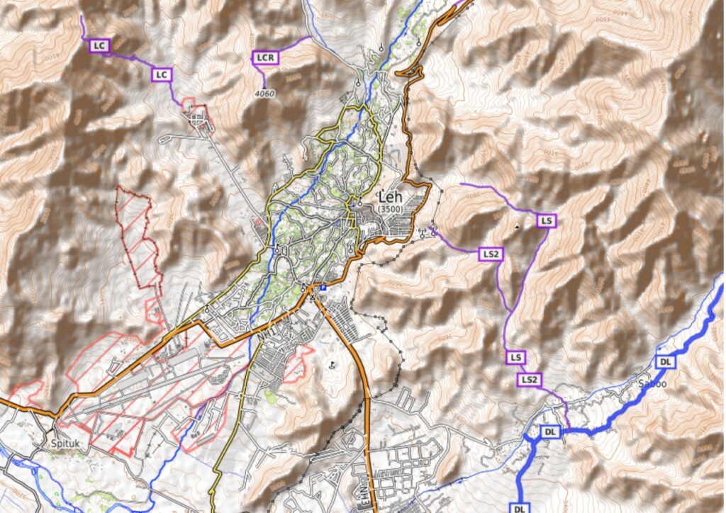
- Lingtse to Chhamkang Ri (LCR) – 1.9km / 280m+ steep short, gradual climb from Lingtse (Leh) to the Chhamkang Ri peak (4060m) offering birds eye view on Sangto Topo valley around Leh
- Stok Gompa (SG) – 11km / 700m+ circuit hike from Stok village to Stok Gompa (3850m) offering stunning views on the Indus valley to the North
- Hemis Gotsang Gompa (HGG) – 5.3km / 630m+ uphill hike from Martselang to Hemis (3700m) and Gotsang Gompa (4000m) above the Himis Tokpo valley
- South Pullu (SP) – 8.6km / 1150m+ uphill hike from Choskar (Leh) along a trail to the South Pullu (4800m) on the way to Kardung La
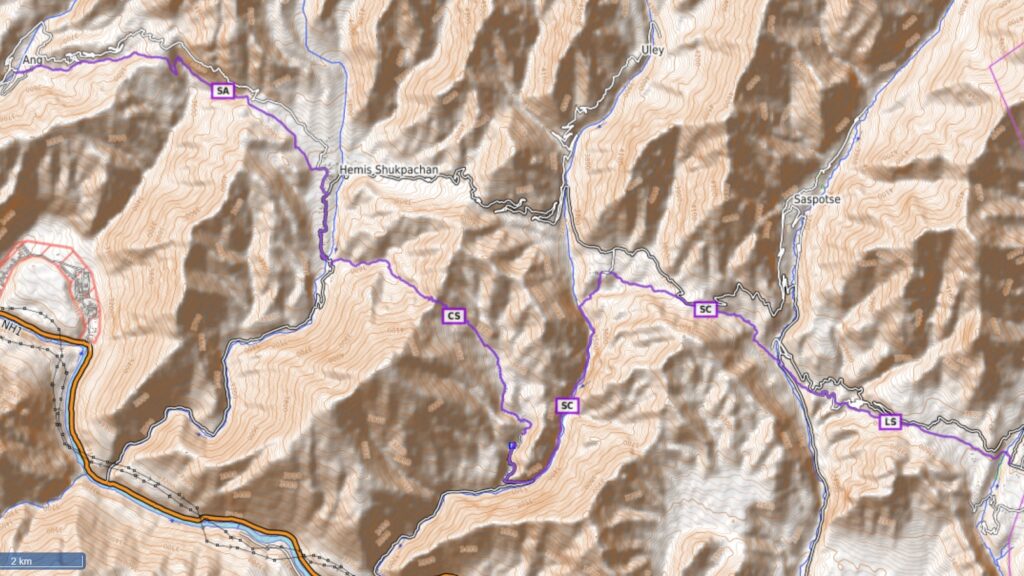
- LS+SC+CS+SA can be combined as one continuous regional traverse:
- Lingstut to Sumdo (LS) – 5km / 170m+ small hike from Lingstut in the Likir Tokpo valley across the Pobe La pass (3550m) to Sumdo in the Saspul Tokpo valley
- Sumdo to Chulichan (SC) – 9km / 720m+ short hike from Sumdo in the Saspul Tokpo valley across the Charatse la pass (3750m) to Chulichan in the Wuleh Topkpo valley
- Chulichan to Shushut (CS) – 6km / 480m+ short hike from Chulichan in the Wuleh Topkpo valley across the Saramanchan La pass (2000m) to Shushut in the Akheur Tokpo valley
- Shushut to Ang (SA) – 6.8km / 350m+ short hike from Shushut in the Akheur Tokpo valley across the Rongthil La (3800m) and Chhaga Che La pass (3850m)to Ang in the Dangdong Tokpo valley
- Lamayuru to Shilla Kong (LSK) – 9km / 460m+ short hike from Lamayuru (famous monastery) in the Yuru Rong valley across the Prinkti La pass ( 3700m) to Shilla Kong village in the Shillakong Tokpo valley near Wanlah. Blog post Blog post 2
- Achirik (Achir) – 3.5km / 700m+ steep hike from Hagso village in Sumdah Tokpo valley to Achirik village (4000m)
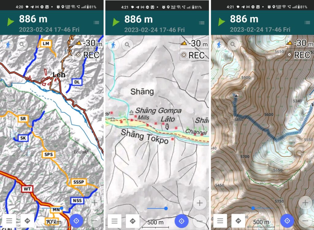
- Shang Upper (SU) – 4.2km / 600m+ steep hike from Shang village in the Shang Tokpo valley on the Northern slope to 4450m
19 Regional Hikes
Day and multi-day hikes across high passes connecting adjacent valleys suitable for the intermediate hiker. Night stay along popular routes is possible in villages / homestays passed or one can carry his own overnight camping gears. Once you feel comfortable with the local hiking routes and gained basic experience you can consider some of these regional routes.
- Leh to Murabak (LM) – 12km / 1000m+ hike from Guyamche in the Gomachi Chu valley near Leh across an unnamed pass (4800m) to Murabak village in the Phyang Fu valley
- Shushut to Ang (SA) – 29km / 2000m+ traverse combining LS+SC+CS+SA local hikes from Shushut to Ang across 5 passes in the Indus river valley
- Kang Yatse II (KYII) – 7.2km / 1300m+ non technical ascent from Niamaling in the Jungchhutta Lungpa valley to Kang Yatse II peak (6185m) offering mesmerizing views on the surrounding Hemis National Park
- Hagso to Alchi (HA) – 17km / 1860m+ steep uphill hike from Hagso village in the Sumdah Topko valley across the Sminopi La (5150m) to Alchi through the Alchi Lungpa valley. Mesmerizing views on the Indus river valley North of the Sminopi La. Blog post Blog post 2
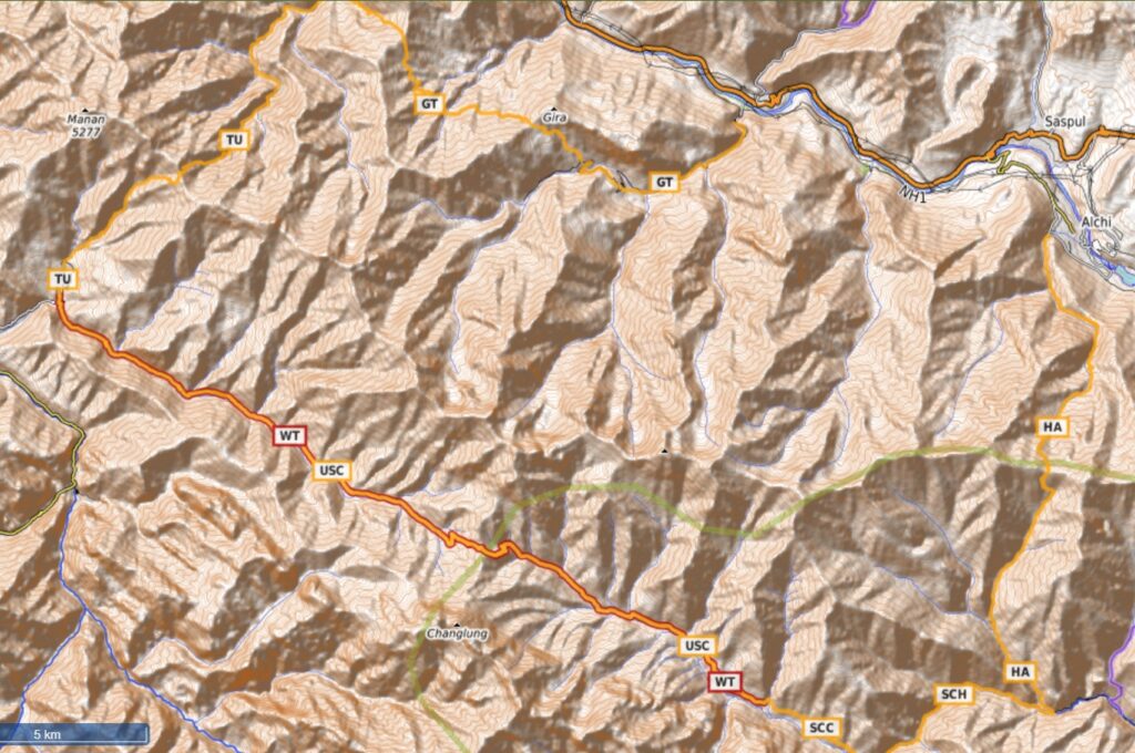
- Gira to Tar (GT) – 17km / 1400m+ hike along on Southern slopes of the Indus river valley from Gira across the Mangyu La (4150m) and Hibti la (4150m) passes to Tar village in the Brok Lungpa valley. Birds eye views on the Indus river valley from both passes. Blog post Blog post 2
- Tar to Ursi (TU) – 17km / 1450m+ steep hike from Tar village in the Brok Lungpa valley across the Tar La pass (4900m) to Ursi village in the Hinju Tokpo valley. Blog post
- Ursi to Sumda Chenmo (USC) – 25km / 1700m+ beautiful gradual hike in the Hinu Tokpo valley across the Konke La pass (4850m) to the remote hamlet of Sumdah Chenmo in the Chenmo Tokpo valley. Mesmerizing views on the snow covered high ranges to the South of the pass. Blog post
- Sumda Chenmo to Chilling (SCC) – 19km / 1300m+ hike from Sumdah Chenmo in the Chenmo Tokpo valley across the Dungduchen La pass (4600m) to Chilling in the Zanskar river valley. Birds eye views on the Indus and Zanskar river valleys. Blog post
- Sumda Chemno to Hagso (SCH) – 10km / 220m+ alternative route from Sumdah Chenmo in the Chenmo Tokpo valley to Sumdahdo in the Zanskar river valley
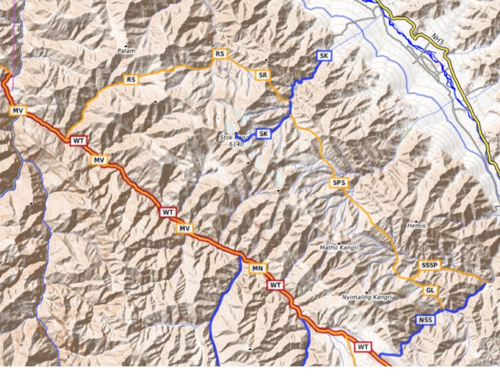
- Markha Valley (MV) – 32km / 1540m+ a popular touristic hike in the Markha valley from Chilling to Markha village. Very gradual ascent along the Markha Topko river through many villages with lots of homestays and cafe’s. Blog post
- Markha to Niamaling (MN) – 22km / 1320m+ uphill hike in the upper Markha valley to Niamaling (4850m) in the Jungchhutta Lungpa valley, base for the Kang Yatse II and Kongmaru La pass ascents
- Niamaling to Shang Sumdo (NSS) – 17km / 580m+ from Niamaling in the Jungchhutta Lungpa valley across the Konmaru La (5200m) into the Chushkurma Tokpo valley to Shang Sumdo in the Hemis National Park
- Shang Sumdo to Shang Phu (SDSS) – 14km / 1300m+ hike from Shang Sumdo near Shang village across the Gyuncho La (4950m) to Shang Phu in the upper Shang Tokpo river valley. Blog post
- Shang Phu to Stok (SPS) – 20km / 1200m+ hike from Shang Phu in the Shang Tokpo valley across the Shang La pass (4950m) traversing the remote Chhurtenchen Tokpo and Chhaskang Tokpo valleys and across the Martho la pass (4950m) to Mankarmo (Stok Kangri base camp) in the Stok Tokpo river valley. Blog post
- Stok to Rumbak (SR) – 9km / 900m+ hike from Mankarmo (Stok Kangri base camp) in the Stok Tokpo valley across the Stok La pass (4950m) to Rumbak in the Rumbak Tokpo river valley. Mesmerizing views from near the pass on the Indus valley to the North. Blog post
- Rumbak to Skyu (RS) – 21km / 1400m+ hike from Yurutse village in the Maseku Tokpo valley across the Gand La pass (4950m) to Skyu in the Markha valley. Blog post
- Niamaling to Lato (NL) – 24km / 1560m+ hike from Niamaling in the Jungchhutta Lungpa valley across the Pobe La pass (5600m) to Lato in the Mundar Tokpo valley along the Manali-Leh highway
- Likche to Gongma La base (GL) – 17km / 1400m+ hike from Likche in the Indus river valley to the base (4700m) of the Gongma La pass in the Dung Khur Lungpa valley
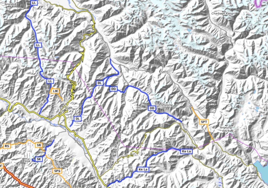
- Shyok to Pangong Tso (SPT) – 16km / 1670m+ hike from Shyok village in the Shyok river valley across the Horlam La pass (5100m) to Bugzin hamlet in the Tangtse river valley flwoing from Pangong Tso lake
7 National Hikes
National hikes are longer distance multi-day hikes across major mountain ranges between major valleys for experienced hikers. Once you are comfortable and gained sufficient hiking experience in several regional hikes you can consider doing some of these national hikes.
- Spangting Range Traverse (SRT) – 94km / 8200m+ combines regional hikes HA+GT+TU+USC+SCH in a circular traverse around the Spangting peak (5700m) range partly in the Hemis national park
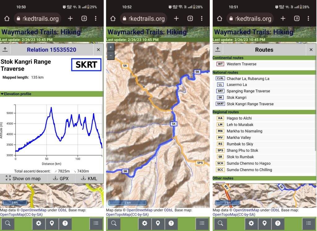
- Stok Kangri Range Traverse (SKRT) – 135km / 7625m combines regional hikes MV+MN+NSS+SDSS+SPS+SR+RS in a circular traverse around the Stok Kangri, Matho Kangri and Nyimaling Kangri peaks in the Hemis National Park
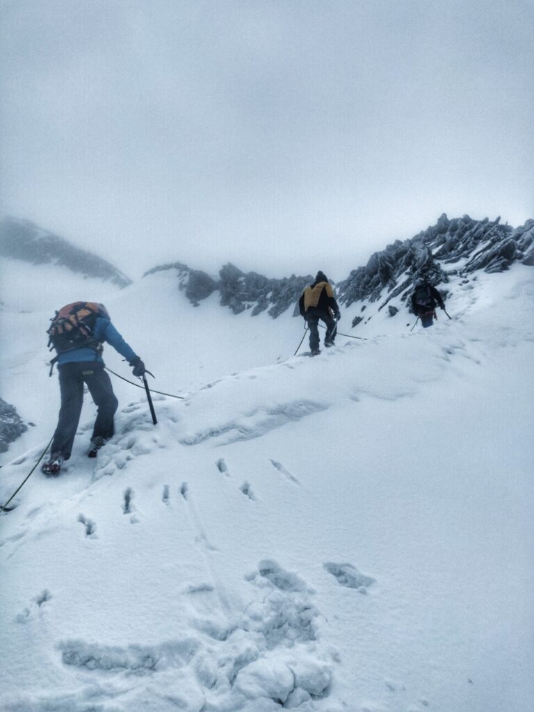
- Stok Kangri – 17km / 2400m+ non technical climb from Stok village in the Indus river valley to Stok Kangri (5185m) peak offering mesmerizing views on the surrounding Hemis National Park. Blog post
- Lasermo La – 64km / 3150m+ hike from the Indus valley across the high ranges in the North to the Nubra valley. Starts from Phyang and climbs up through the Phyang Fu valley across the Lasermo La pass (5450m) into the Thanglasgo Nala valley to Hundar in the Nubra valley
- Digar La – 42km / 2070m+ hike from the Indus valley across the high ranges in the North to the Shyok valley. Starts from Choglamsar through the Sabu Nala valley across the Digar la pass (5450m) into the Lungtung Phu valley to Digar in the Shyok river valley.
- Digar to Darbuk – 48km / 3050m+ hike from Digar in the Shyok river valley across the Kilkar La pass (4550m) into the Lazun Lungpa valley and across the Nebuk La pass (5350m) into the Iching Lungpa valley to Nemgo village in the Tangtse river valley
- Ke La – 46km / 1760m+ hike from the Indus valley across the high ranges in the North to the Tangtse valley. Starts from Arpa along the Indus river through the Igur Tokpo valley across the Ke La (5650m) into the Tarung Lungpa valley along the Ke Tso lake to Taruk village near Tangtse
Really very important and nicely written article. Thanks Peter for your efforts.
Highly informative and stunning photos . Thank you Peter.